Activity: Day Hike, Scenic Views, Chasing Waterfalls
4.2 miles, 758’ elevation gain, 2.5 hour duration, rated Moderate
Date: September 18, 2025
As part of my “Epic Road Trip” where I traveled from SoCal exploring many exciting and beautiful places in California, Oregon and Washington I found myself ‘Pursuing Balance Through Adventure’ in Central Oregon.
Once again I had a yearning to chase waterfalls and Oregon has some of the best.
(Checkout my trip to Silver Falls which has so many fabulous falls and all accessible if you are willing to hike a little… well, maybe a more than a little.)
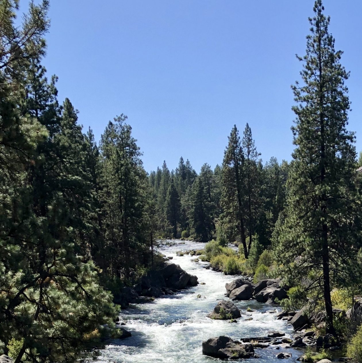
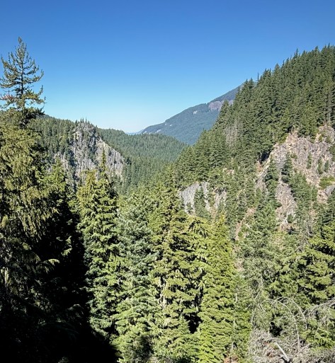
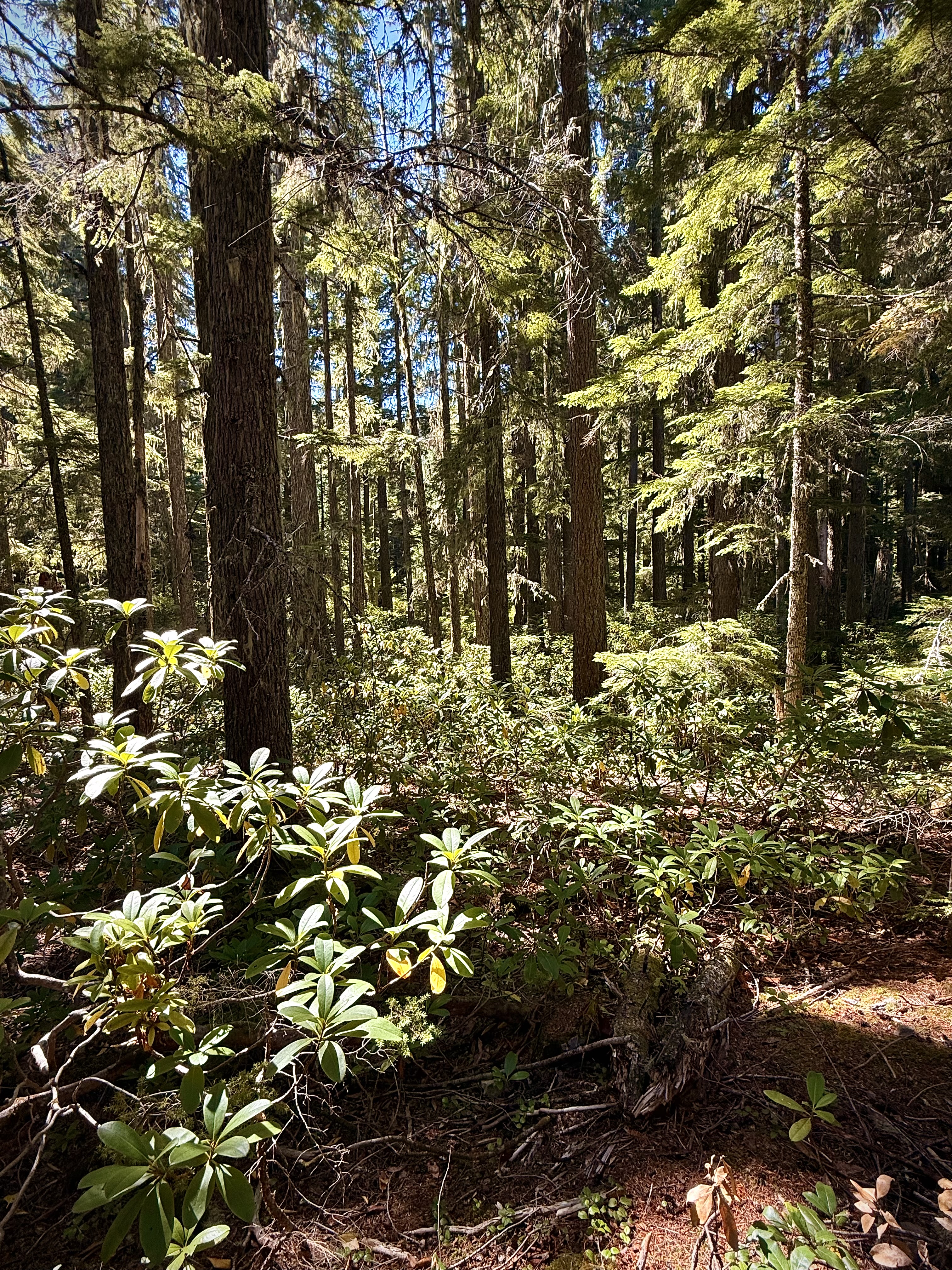
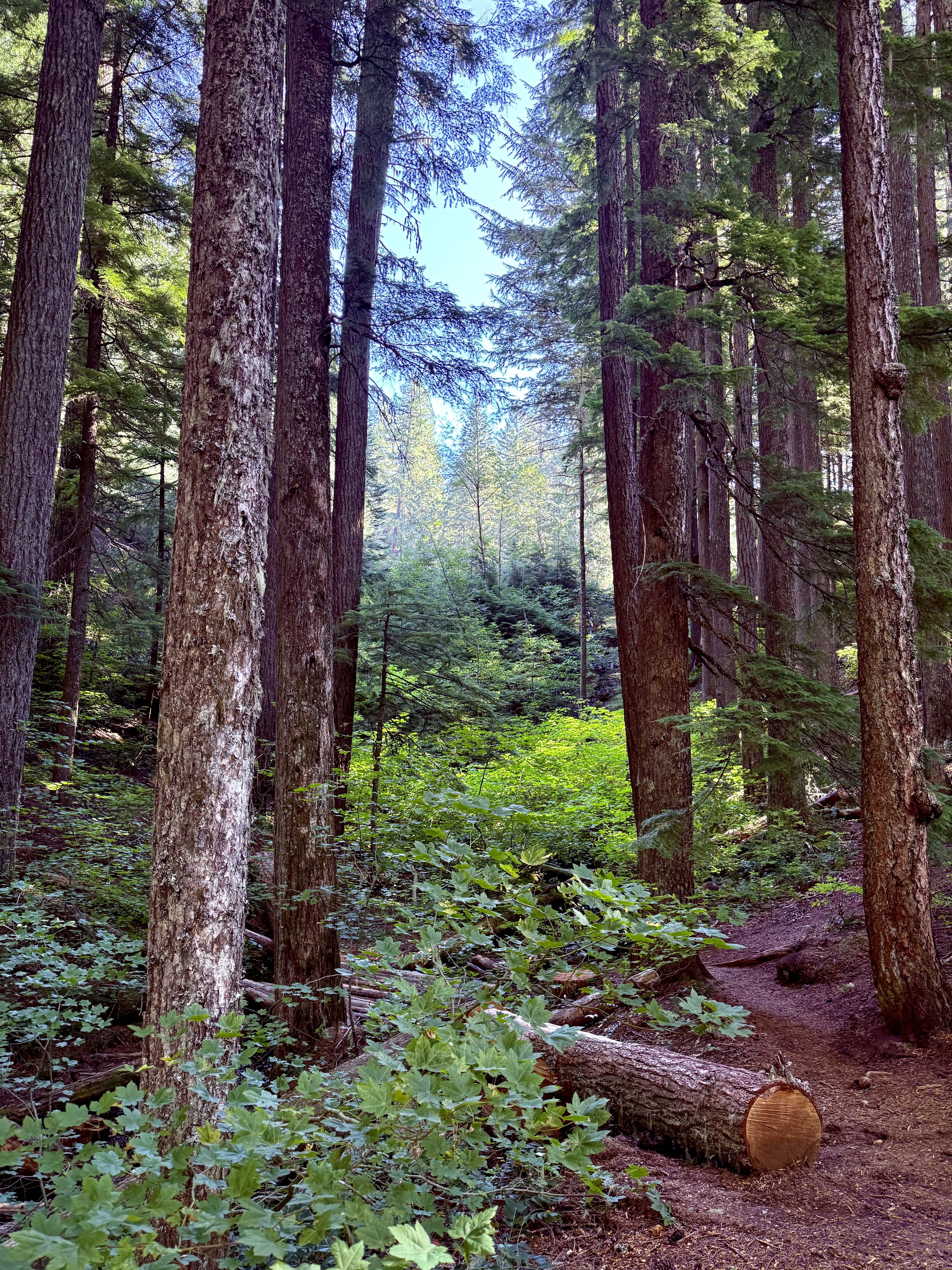
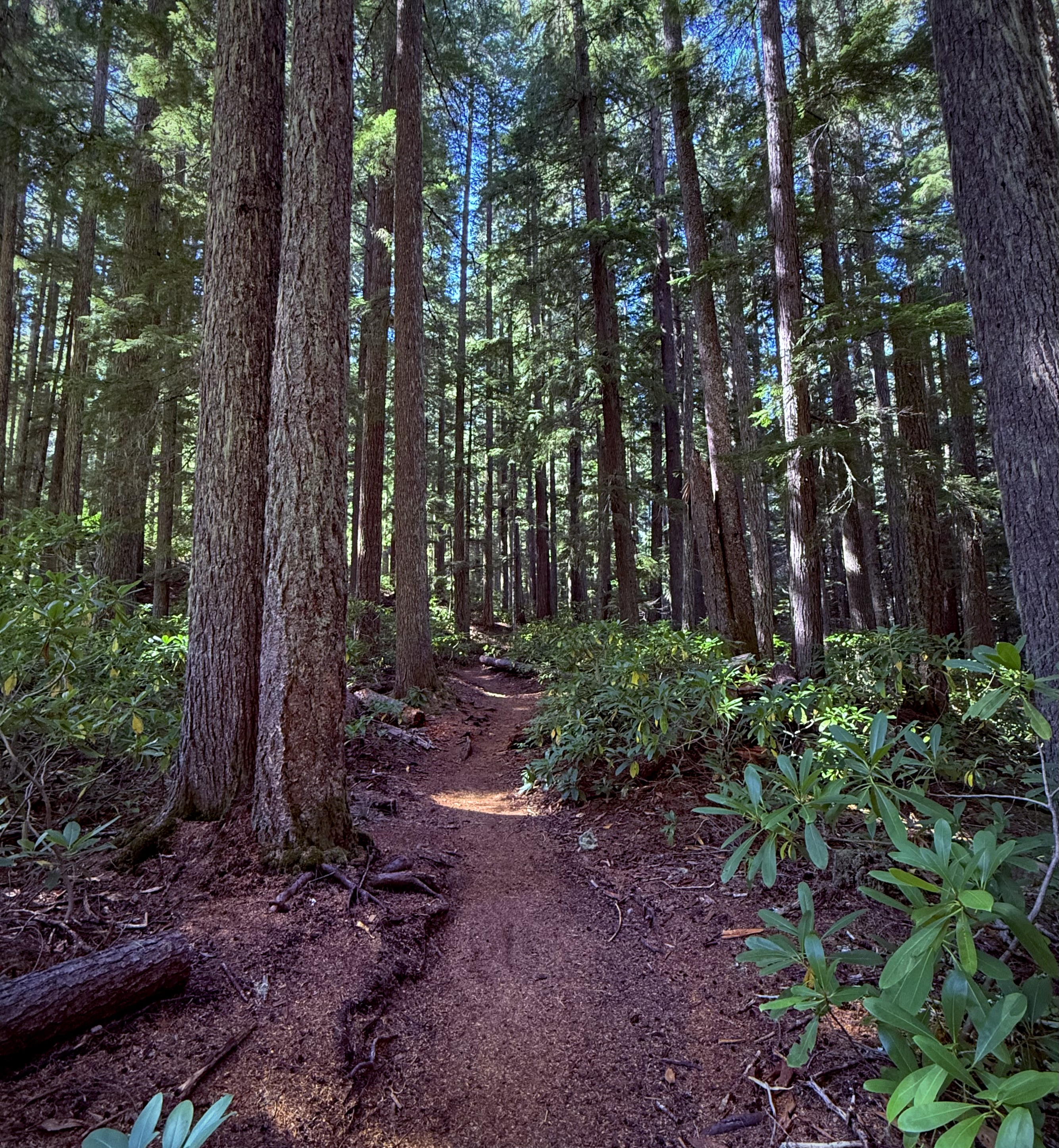
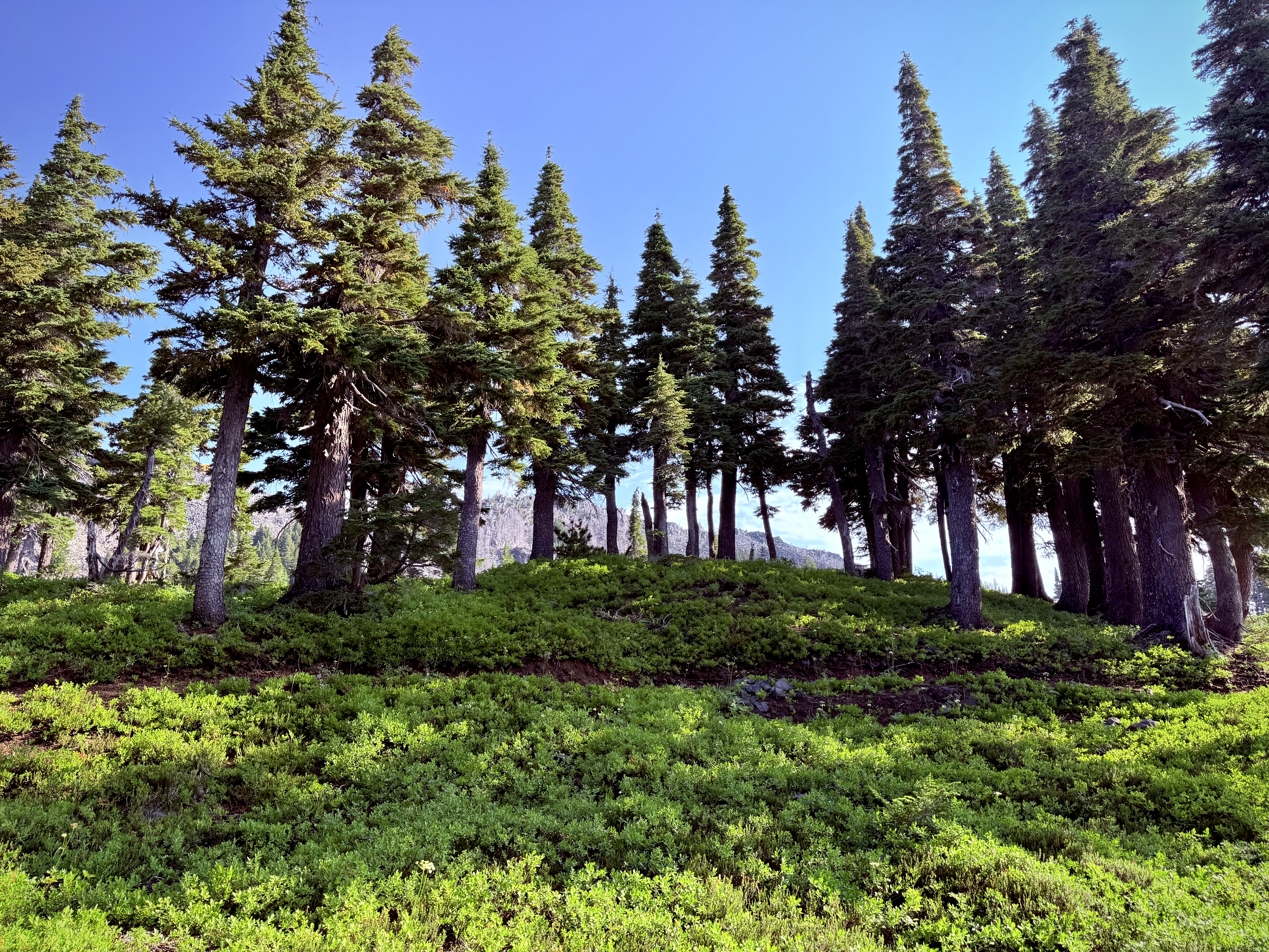
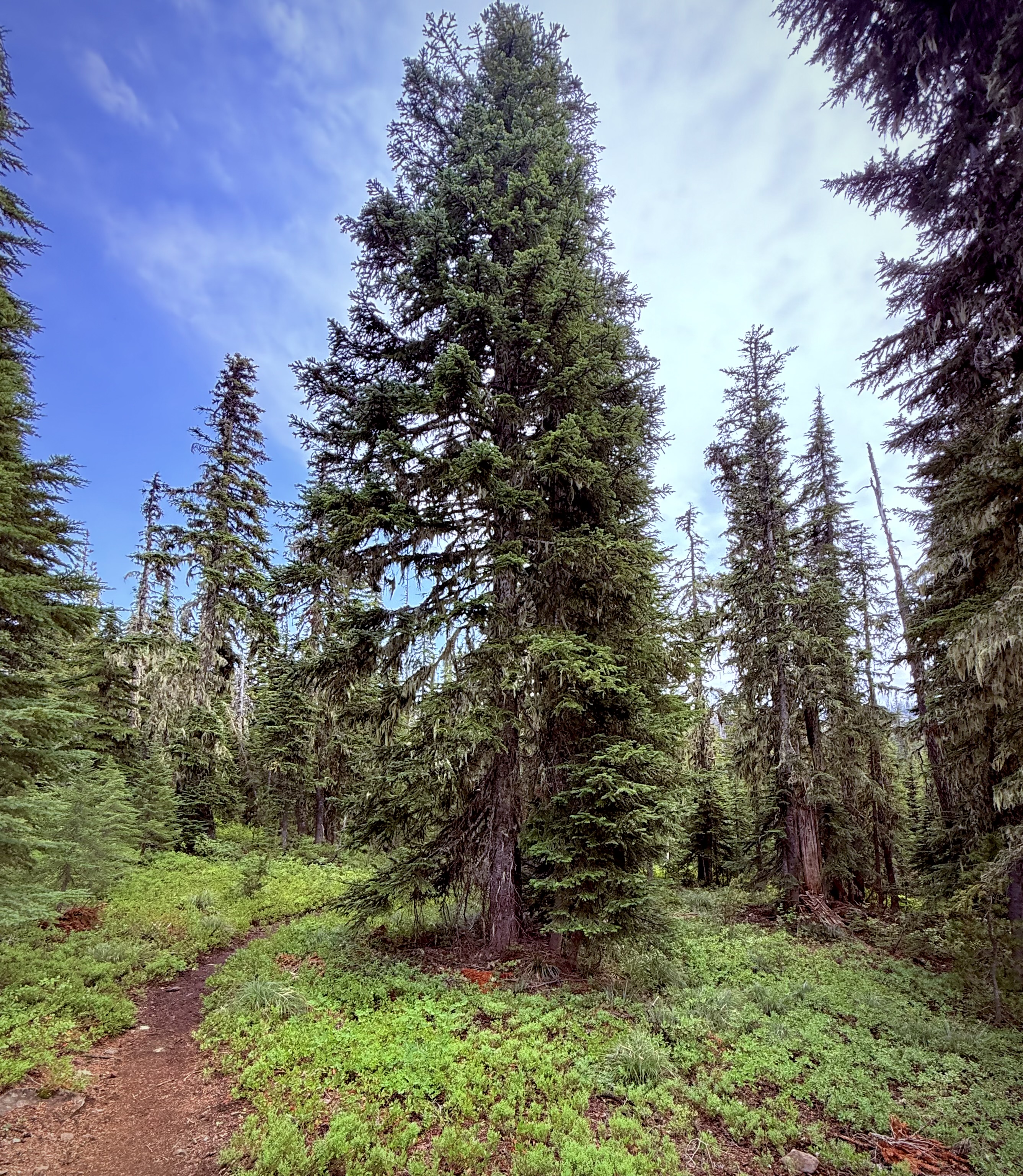
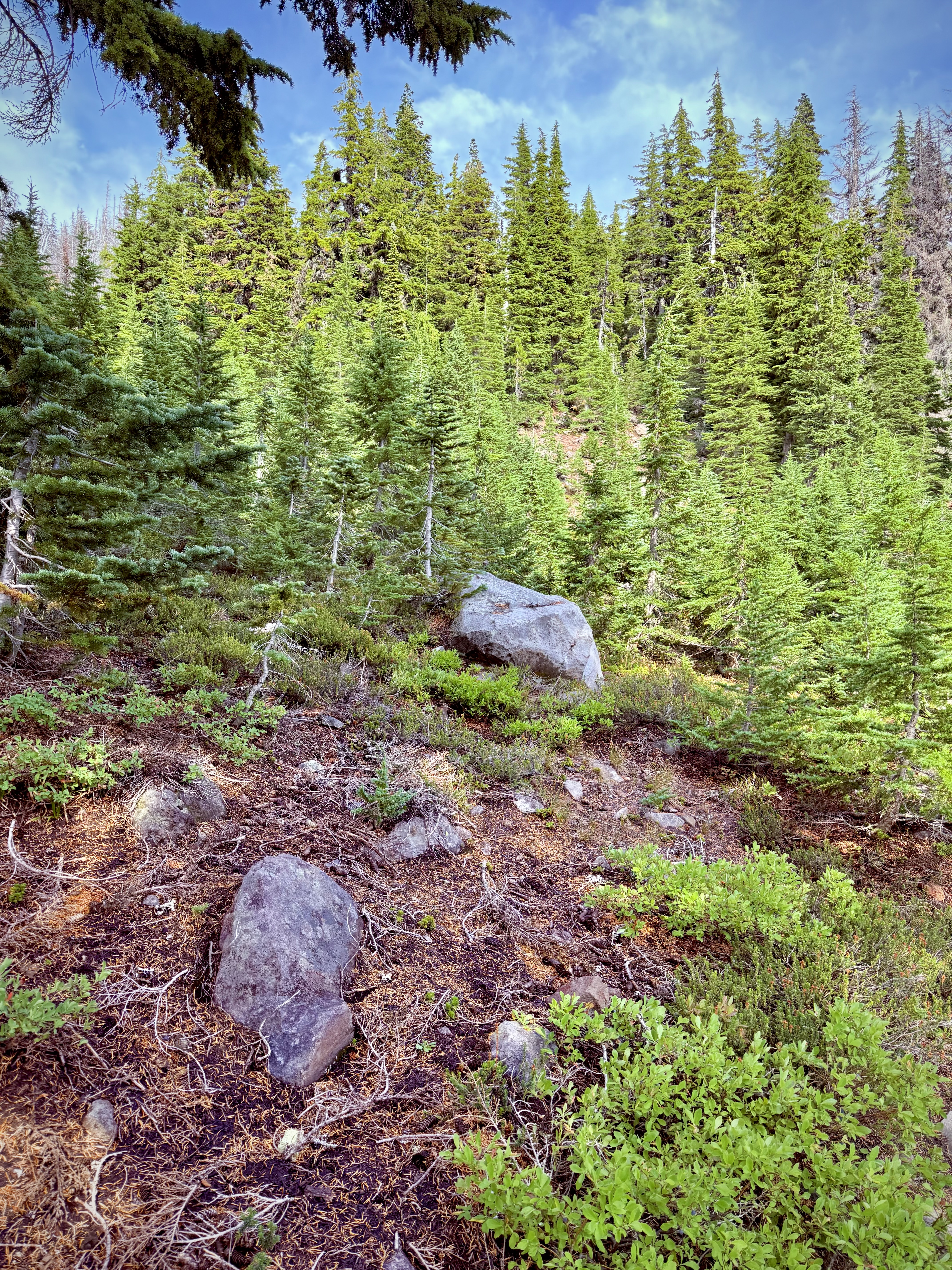
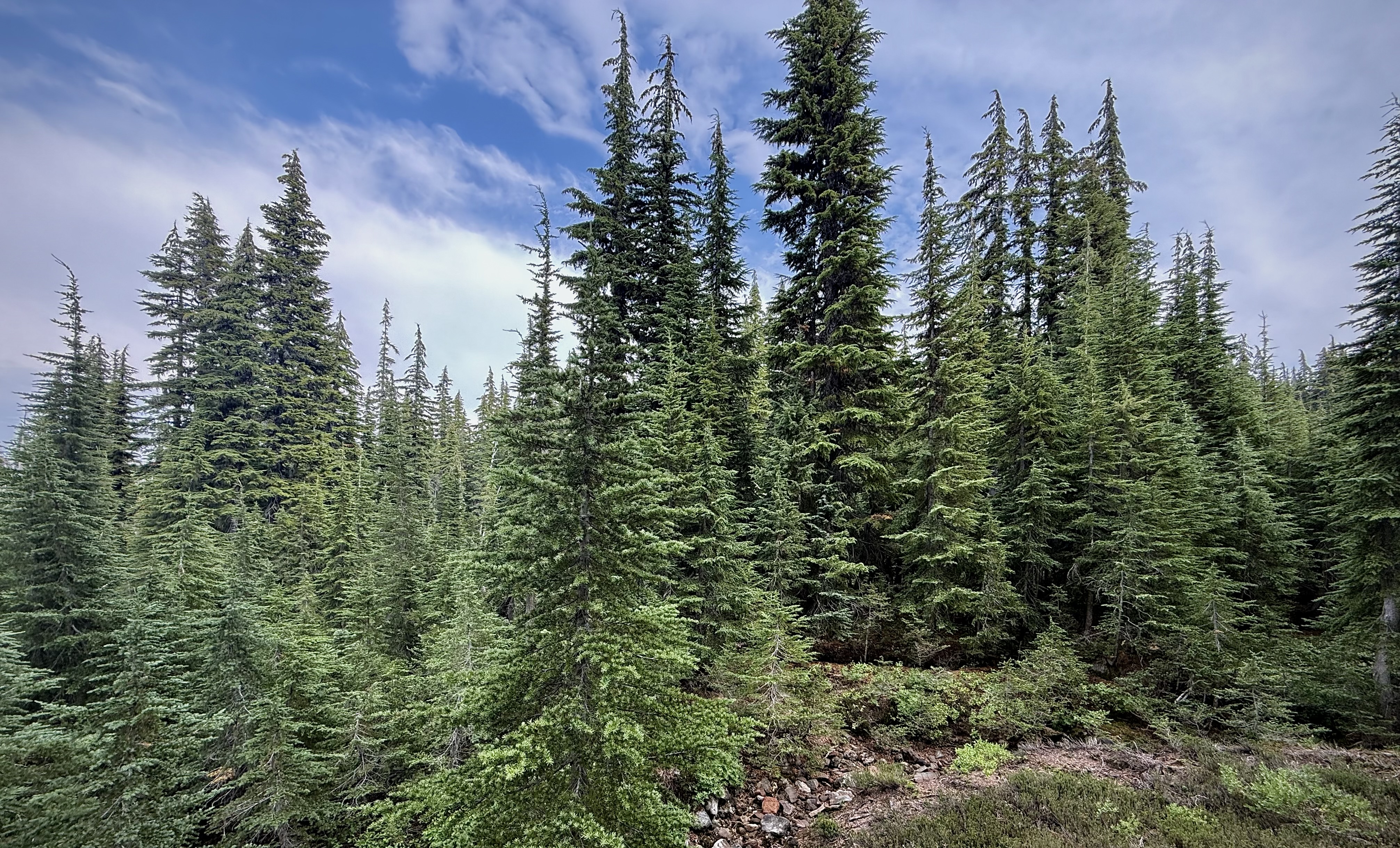
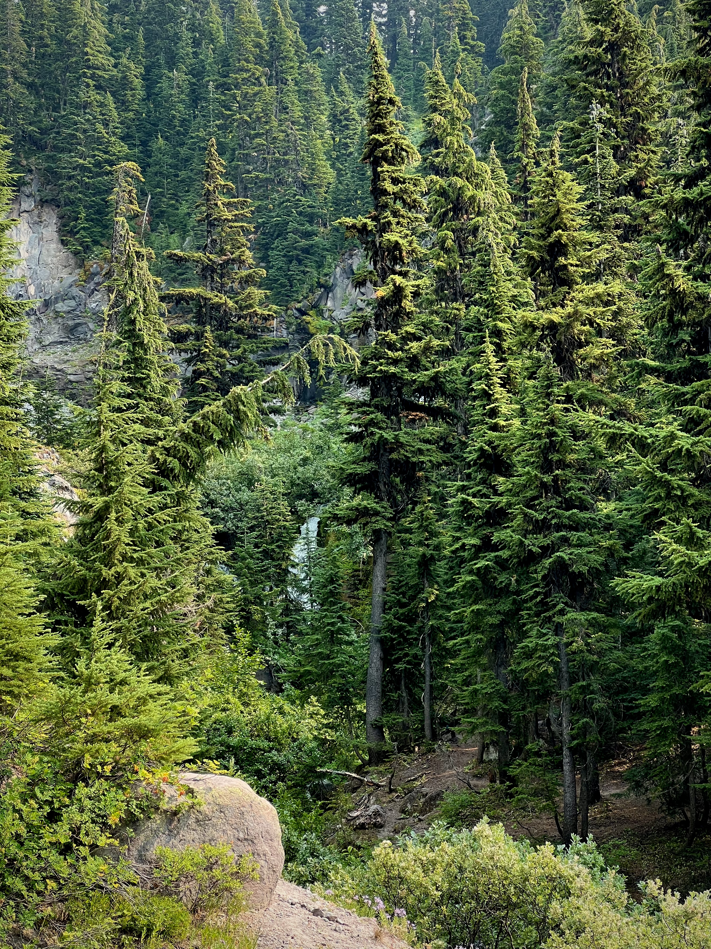
The hike I chose on this day encompassed two stunning waterfalls. It was a lovely hike through verdant forest, beside a still lake and along cliffs presenting sweeping views overlooking a breathtaking rugged gorge.
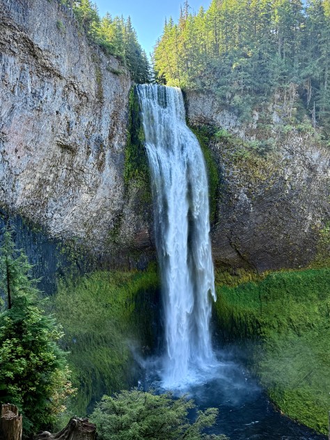
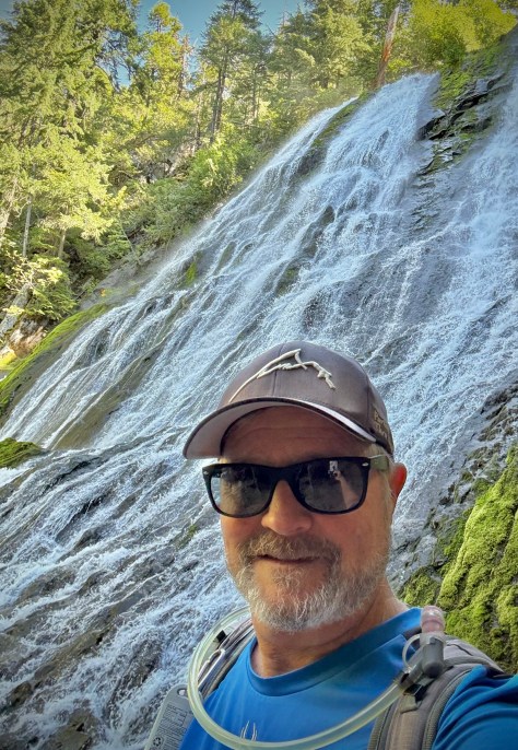
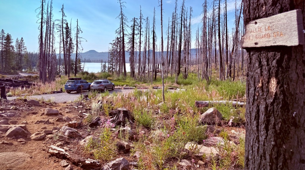
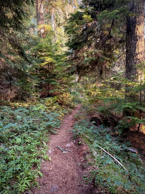
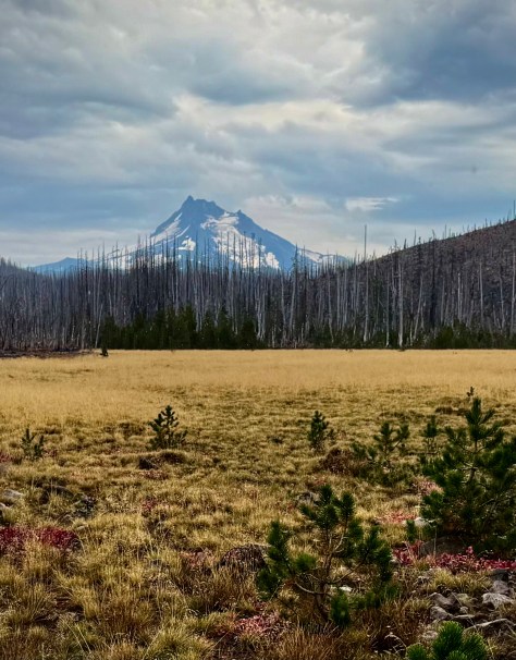
Salt Creek Falls
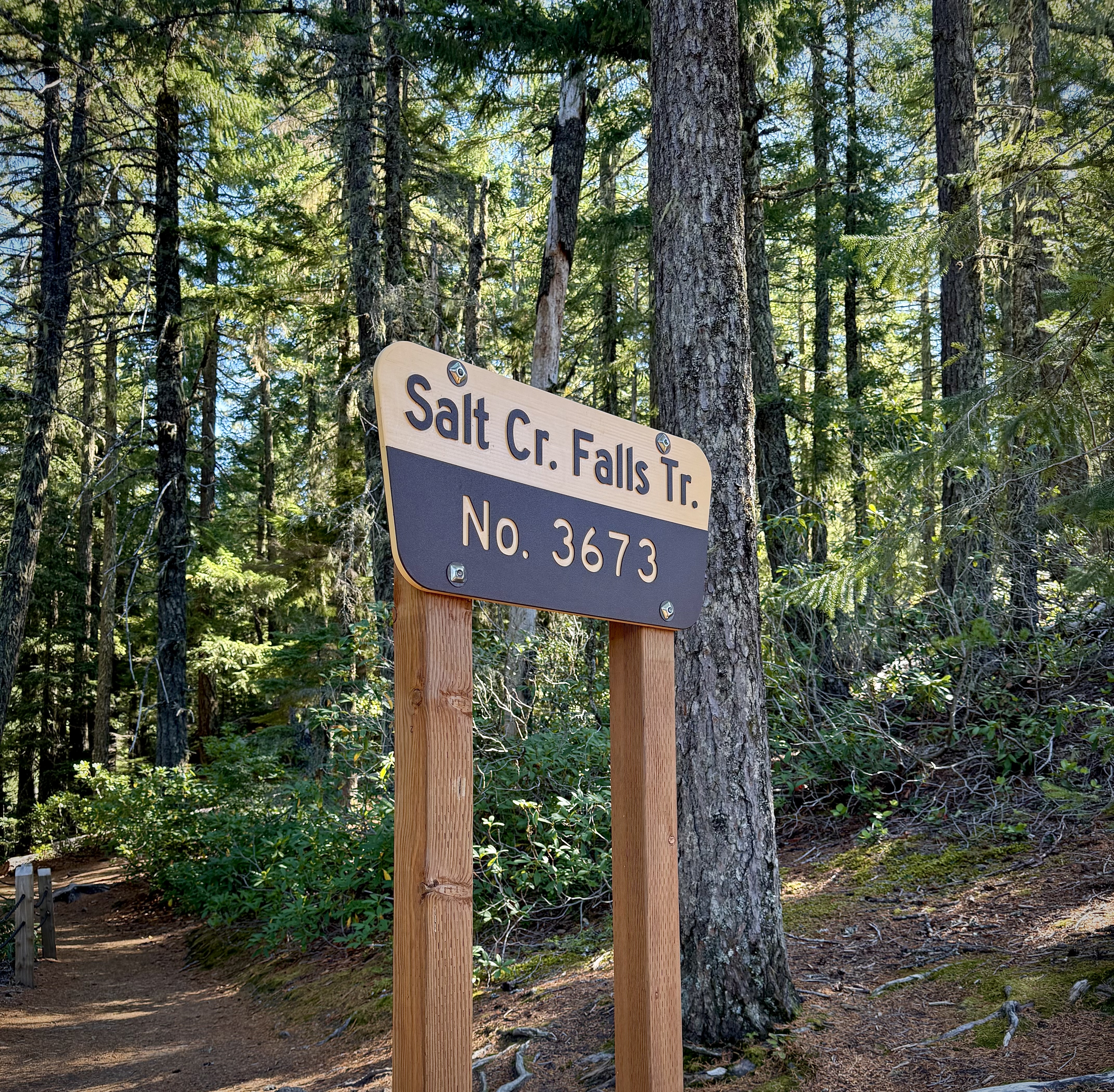
From the parking area I took Salt Creek Falls Trail. The magnificence of Salt Creek Falls is only a hop and a skip away for those in a hurry or perhaps less mobile. But- the way to experience this treat of nature, these extraordinary waterfalls, is to hike them.
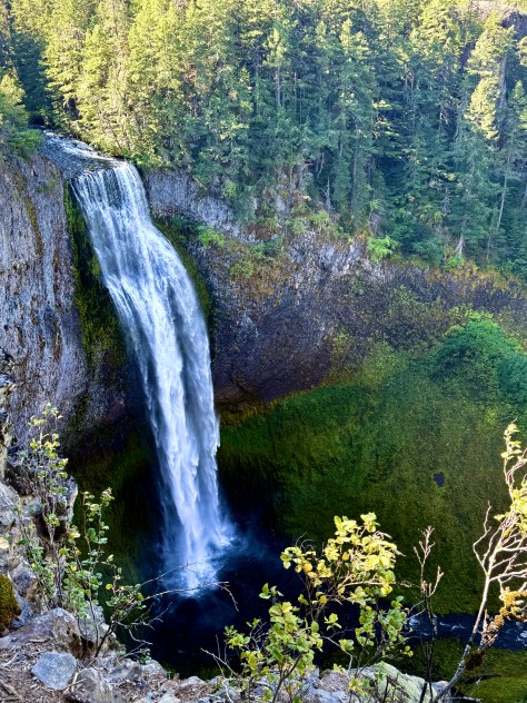
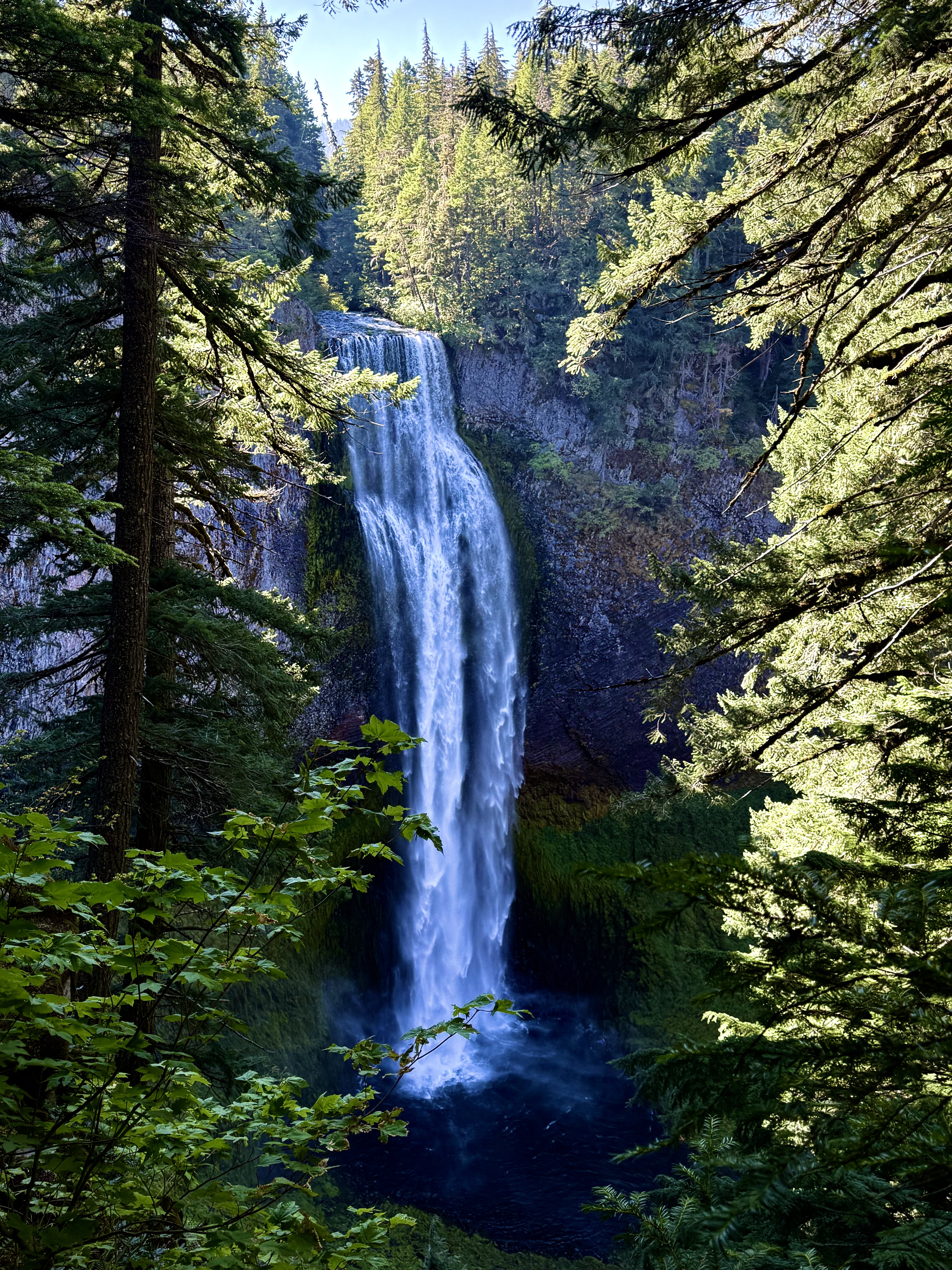
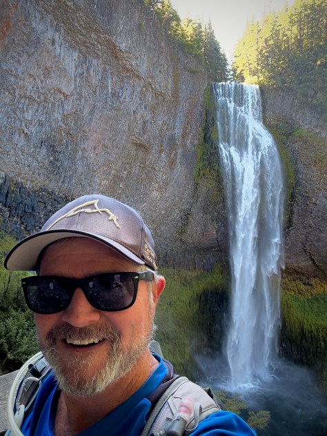
I stuck my head over the side to take in the view and indeed it was spectacular. It is easy to become mesmerized by the tumbling water as it flings its flow over the cliff, falling 286′ to the turbulent dark pool below. (Second highest waterfall in the State, the first is Multnomah Falls.)
I had to break myself of its spell and follow the trail down down down to an observation spot to see its wonders from a different angle and as you might imagine it did not disappoint.
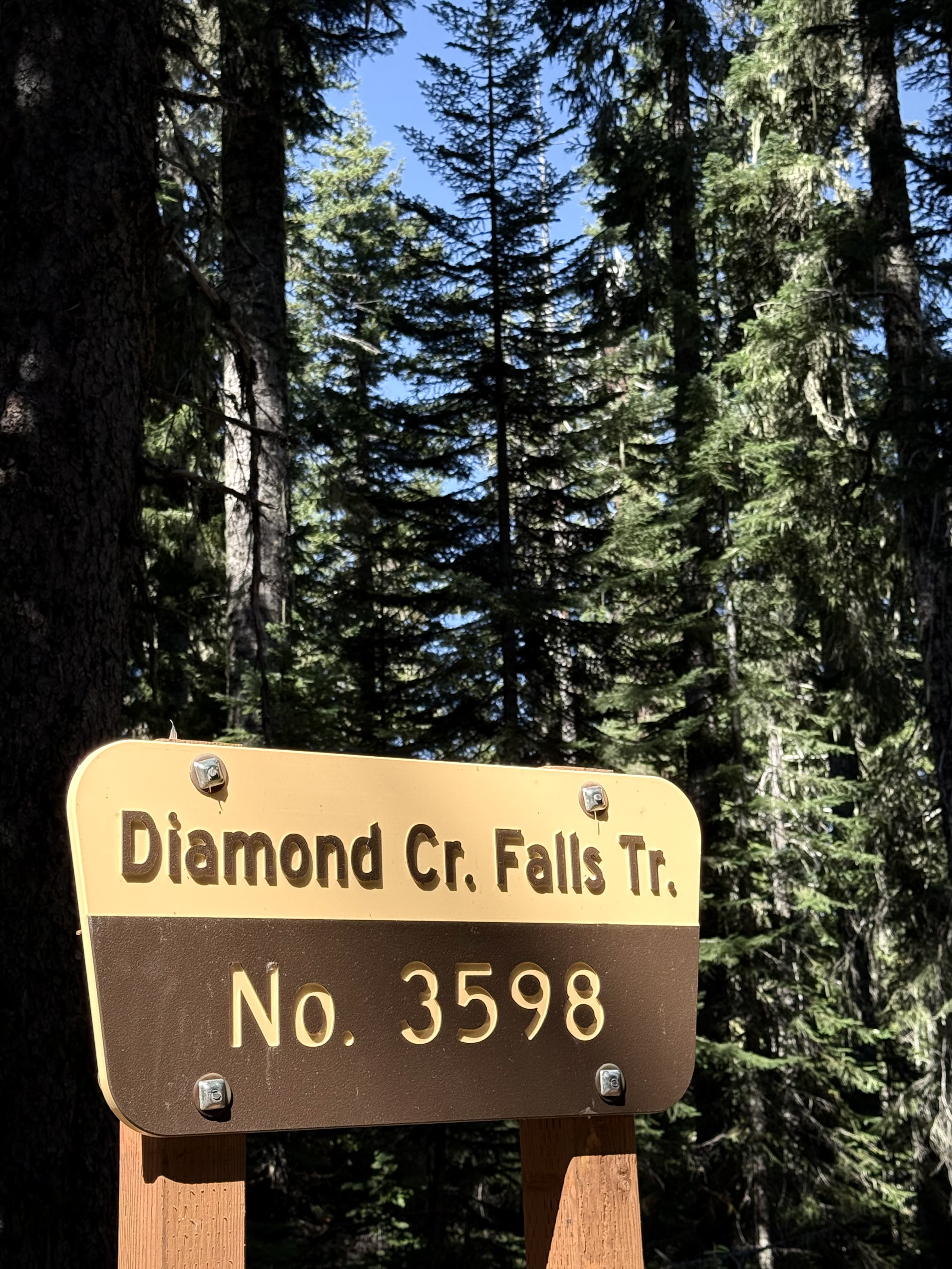
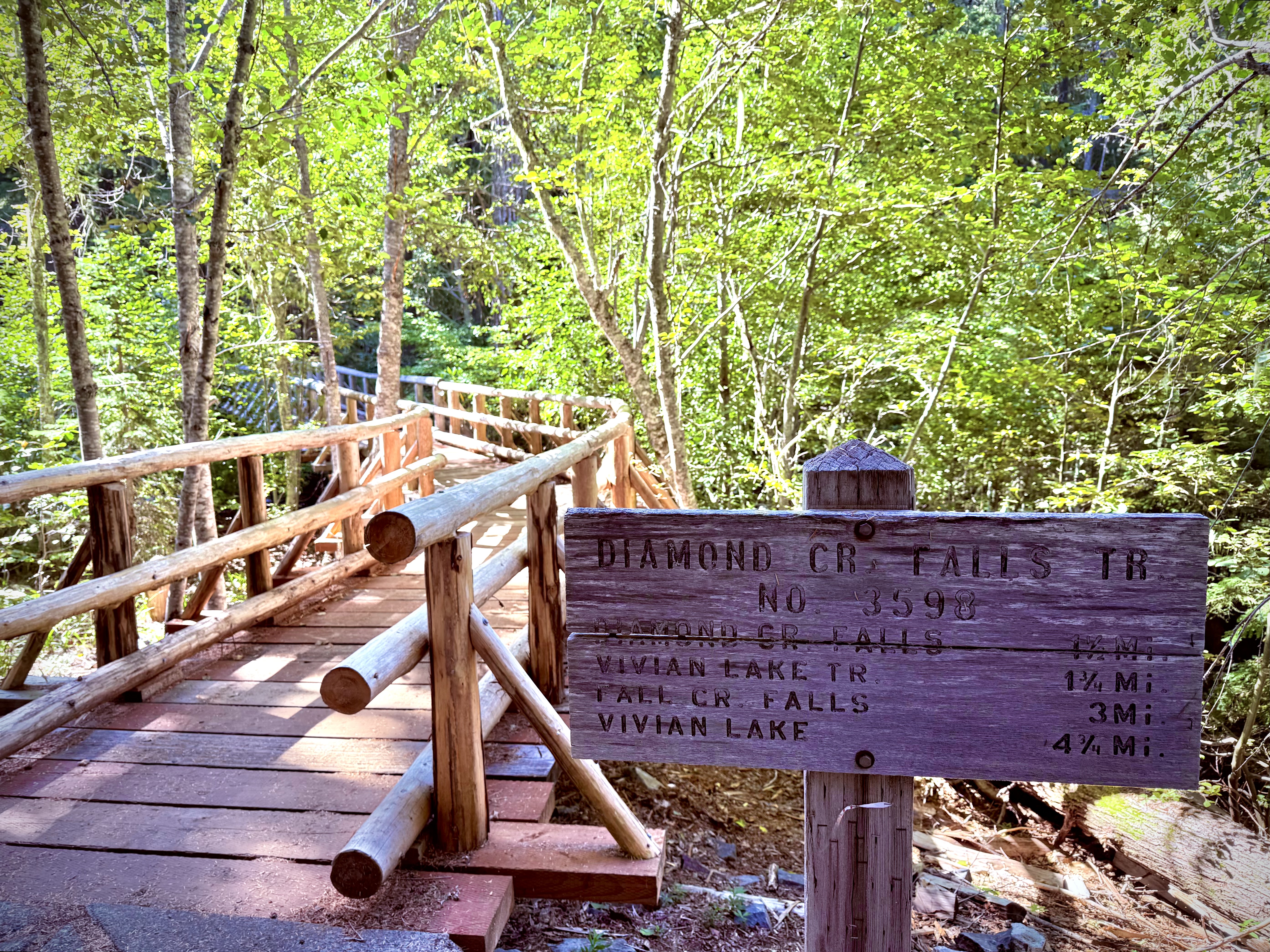
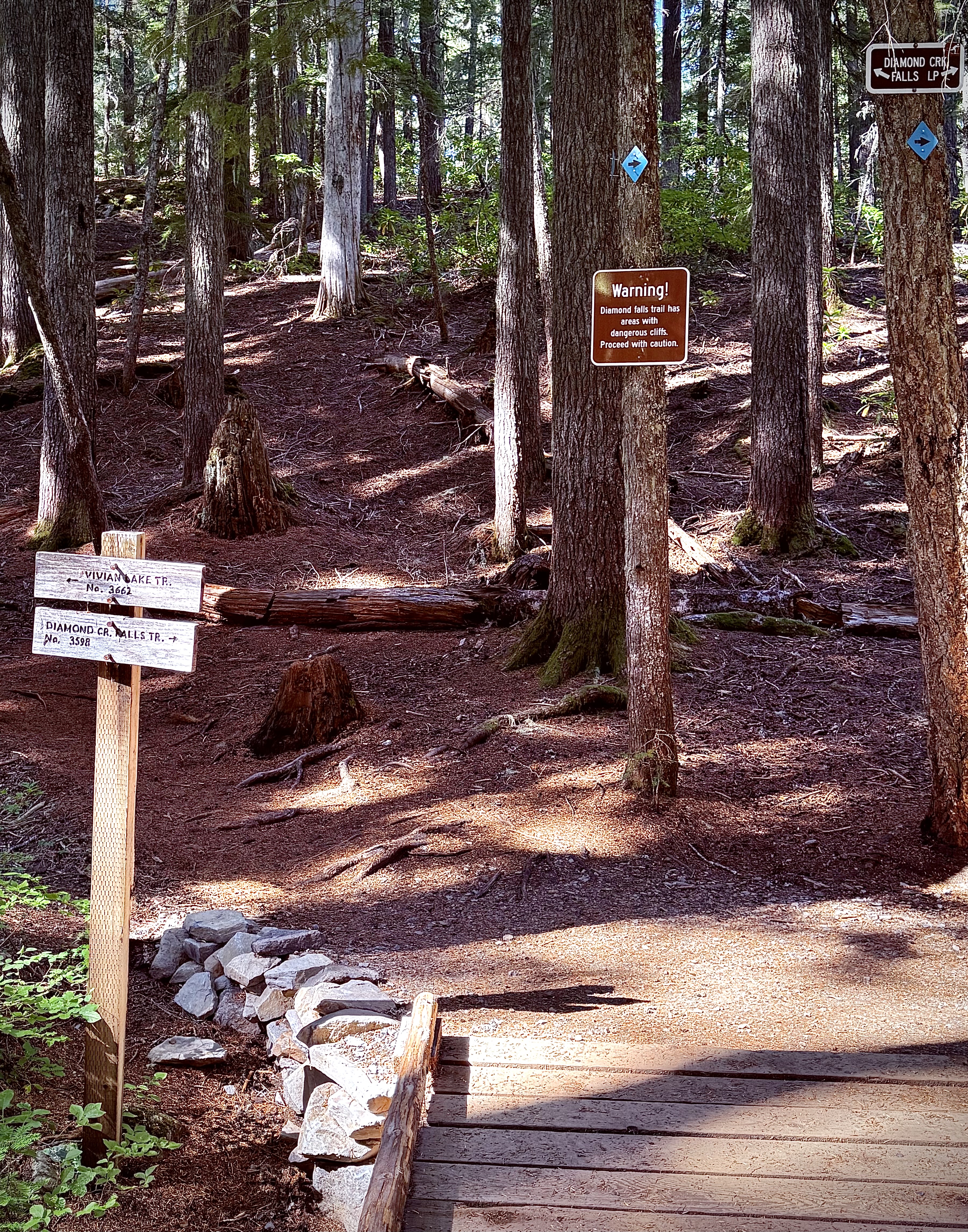
Then I retraced my steps back up to the top never missing an opportunity for another glimpse even if I had just seen it on the way down. Once on top I had to tear myself away again and ramble on down the trail connecting with Diamond Creek Falls Trail.
My trek was a delight with one final view up close and personal of Salt Creek Falls just before it goes airborne. I passed ‘Too Much Bear Lake’, which I am sure was named that for a good reason, but on this day I did not see any bear.
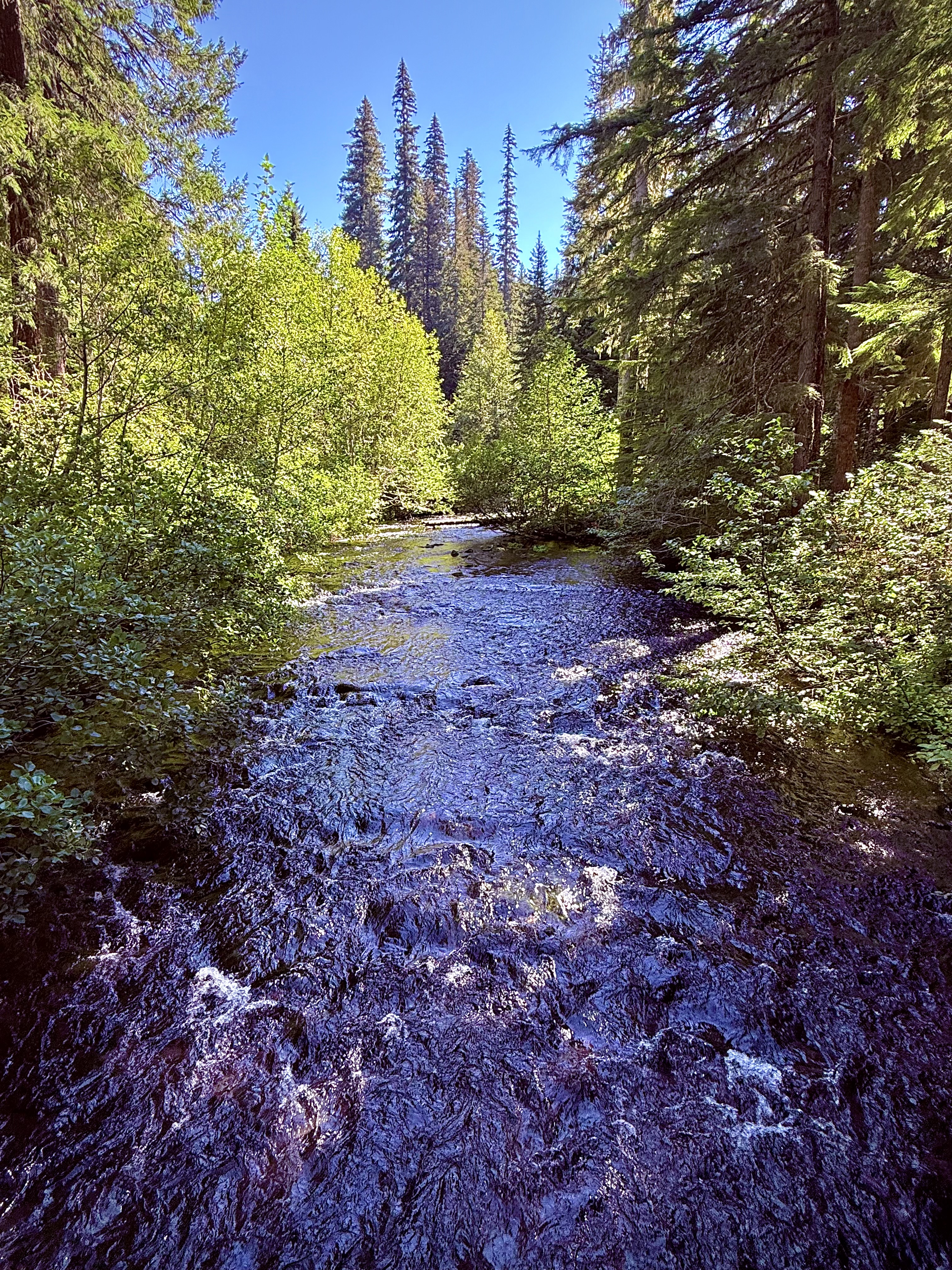
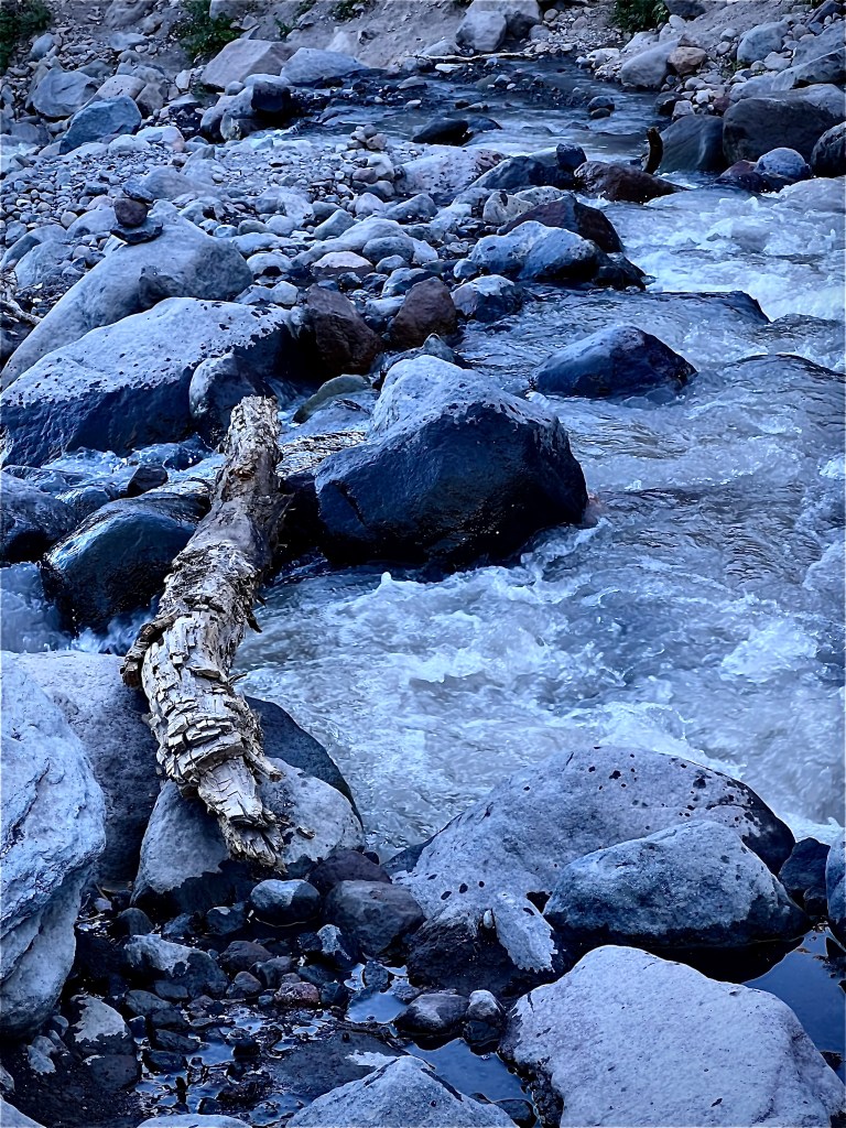
I would cross the stream a couple times and carefully creep up to the side of the cliff, which warning signs hand mentioned beforehand.
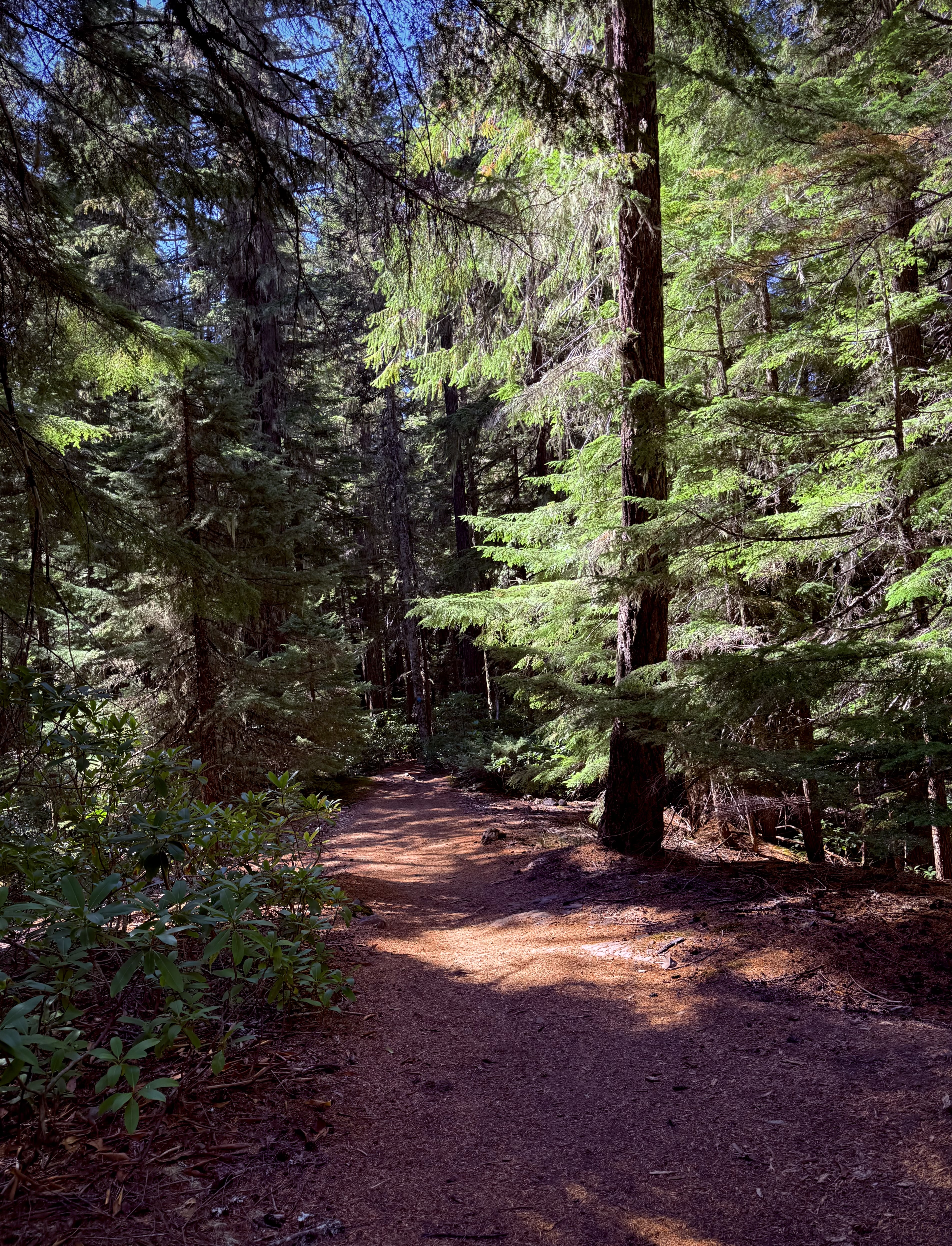
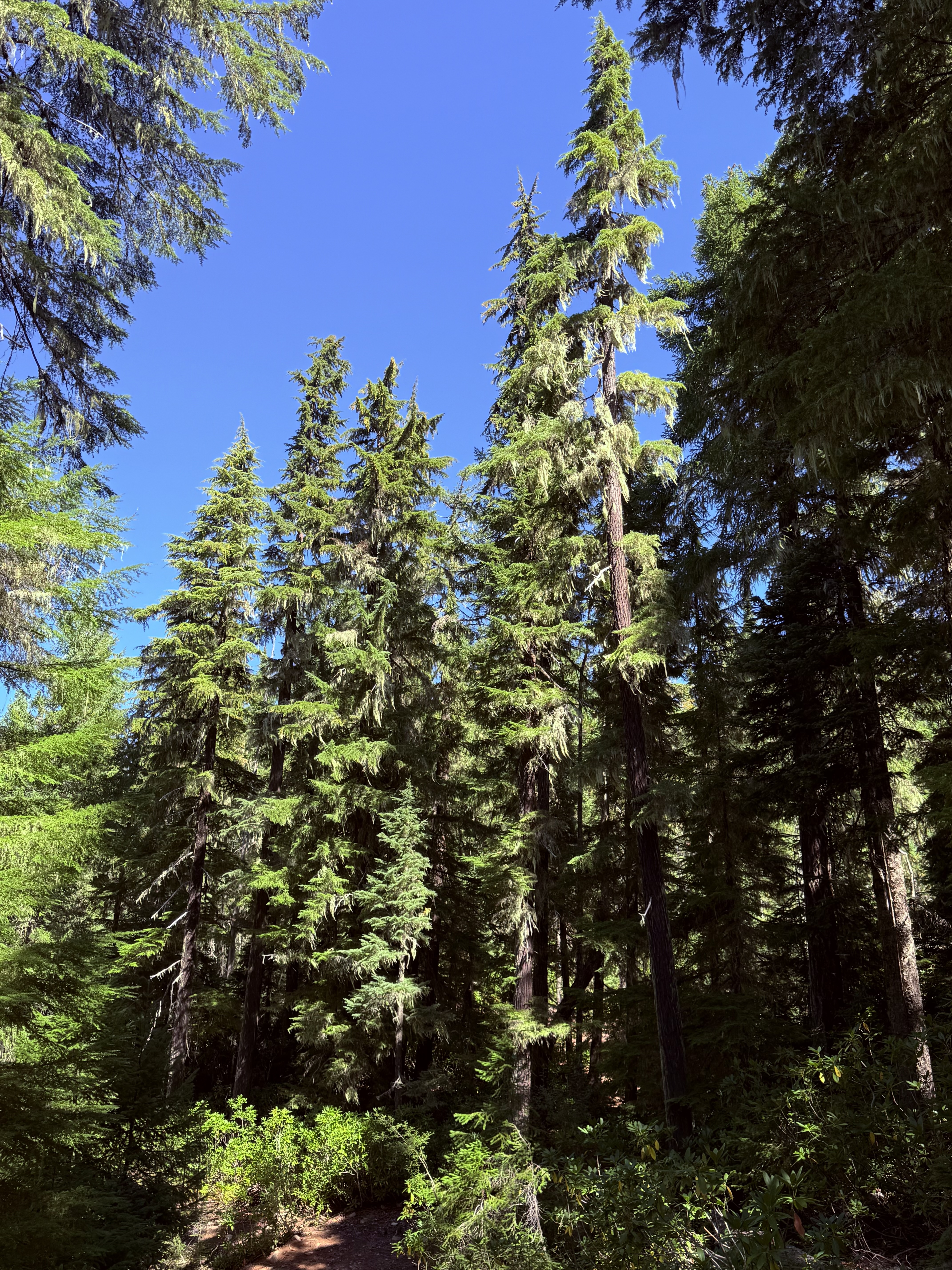
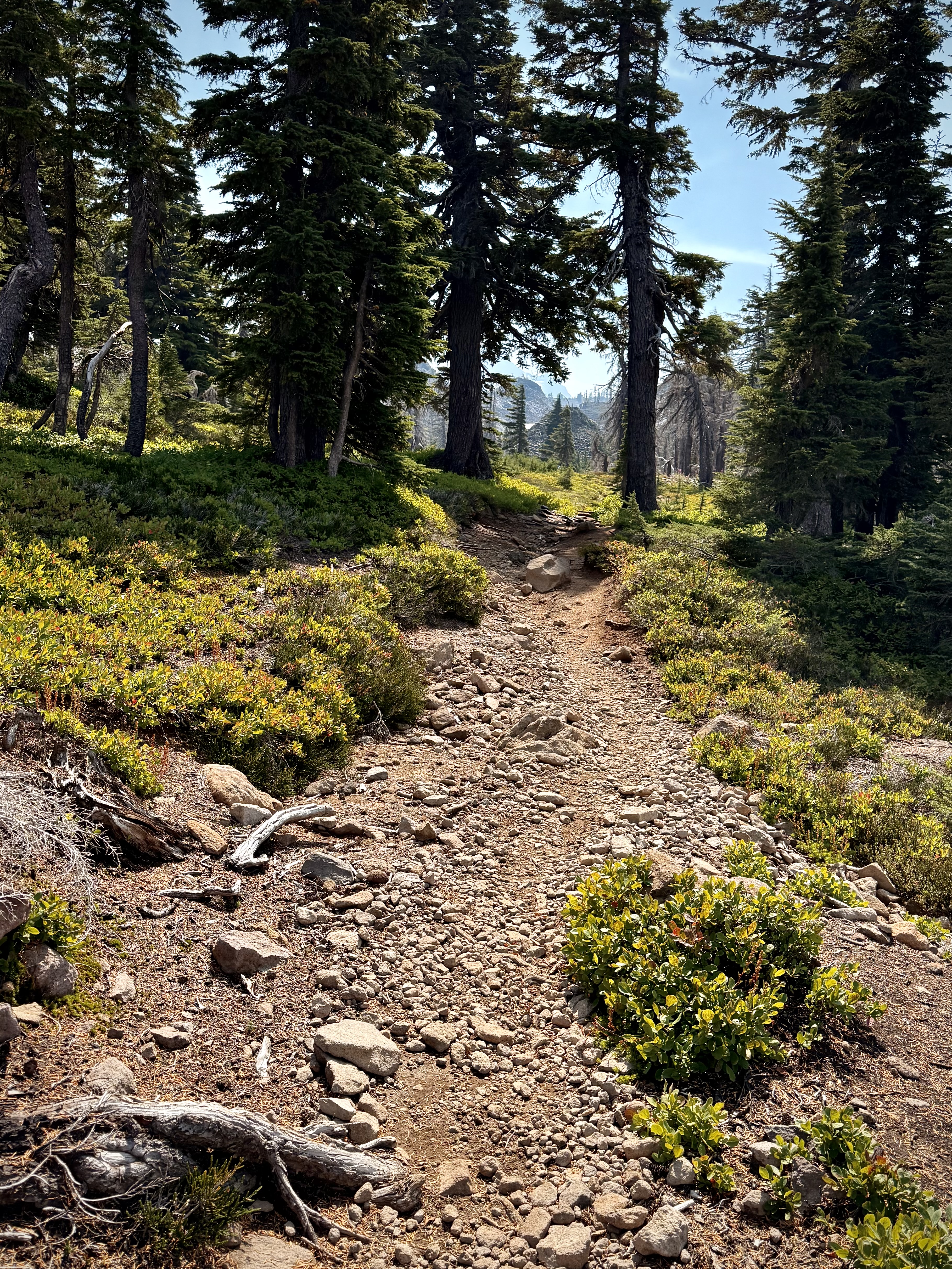
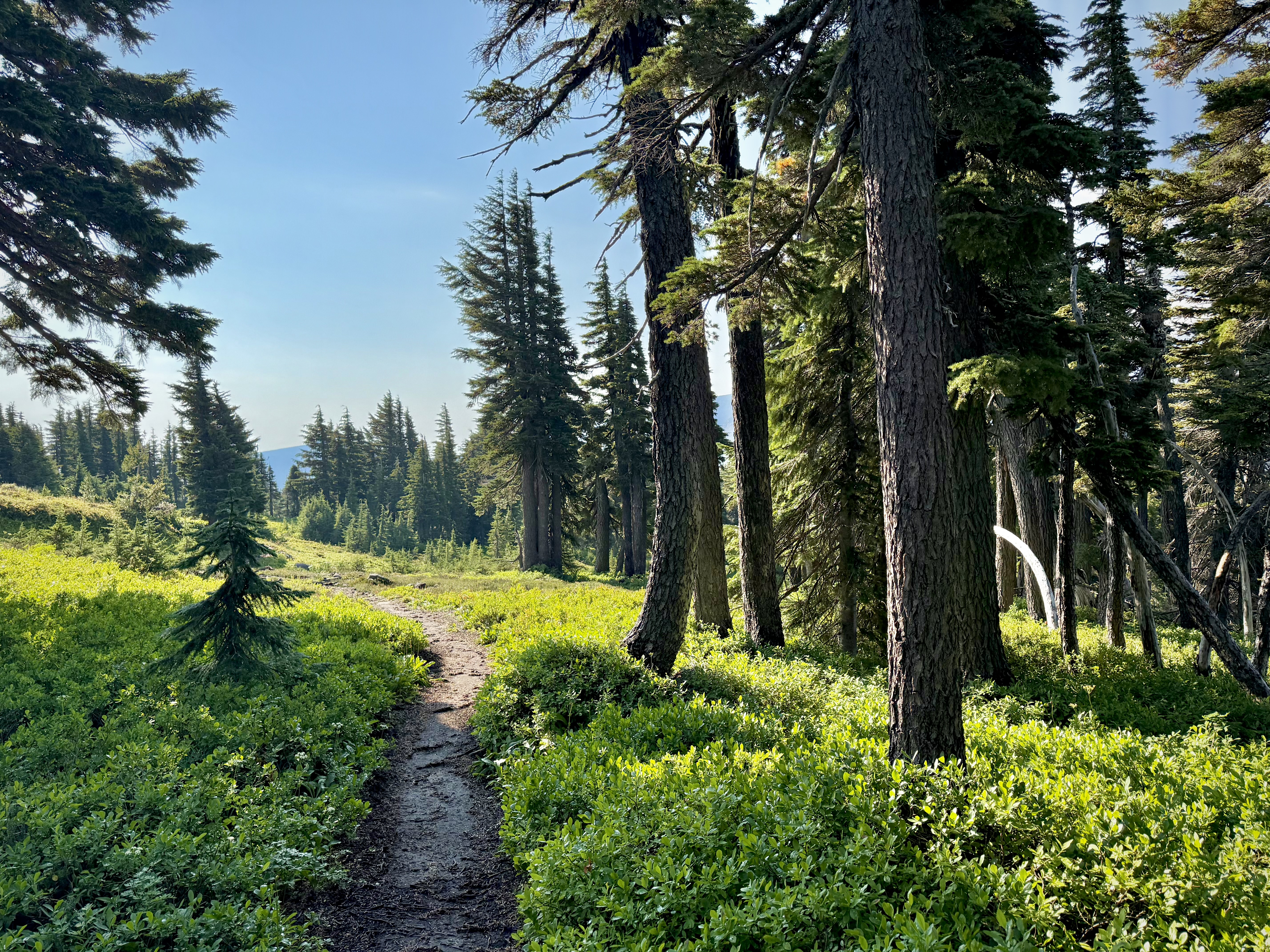
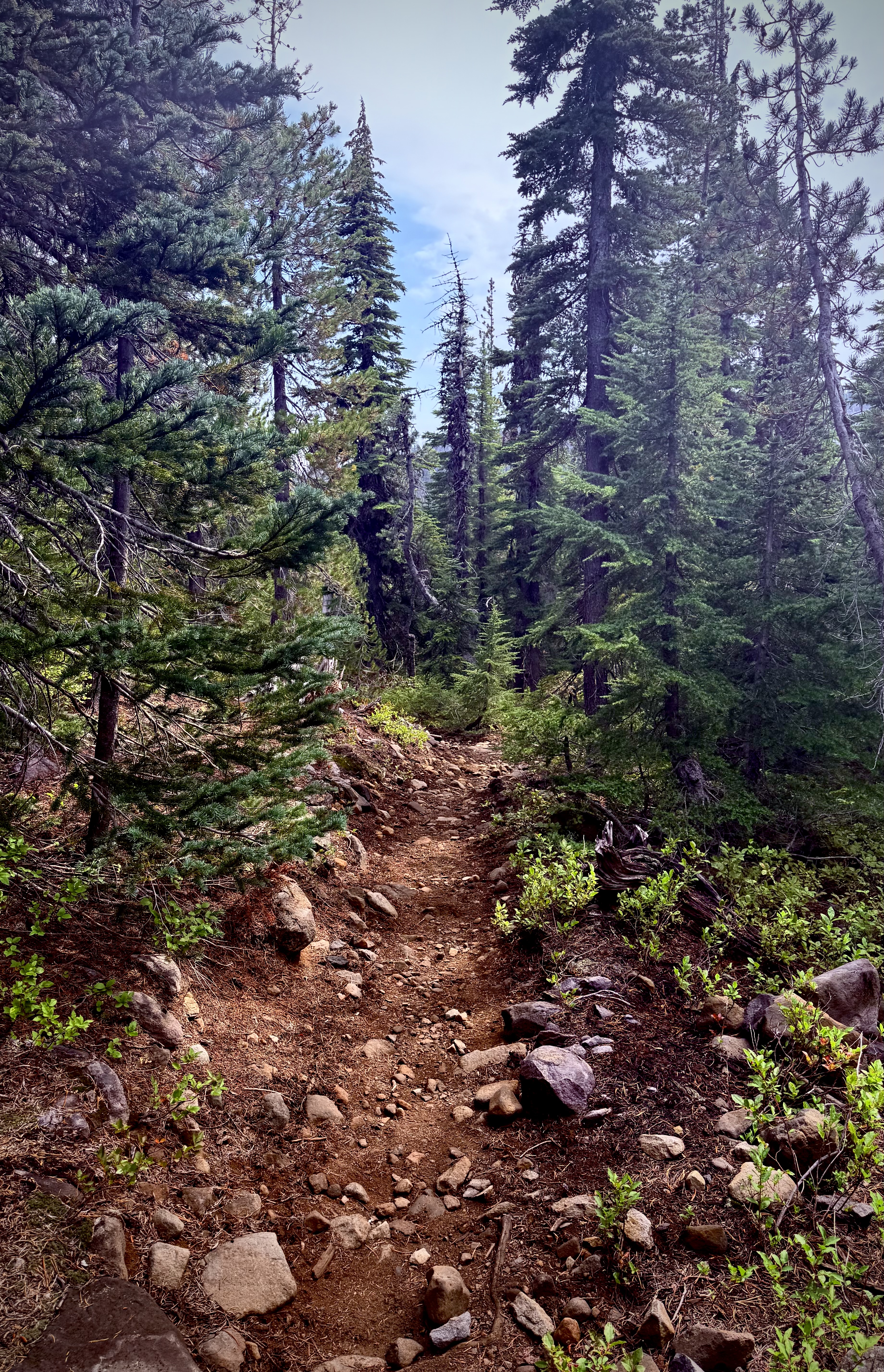
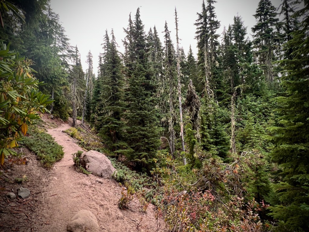
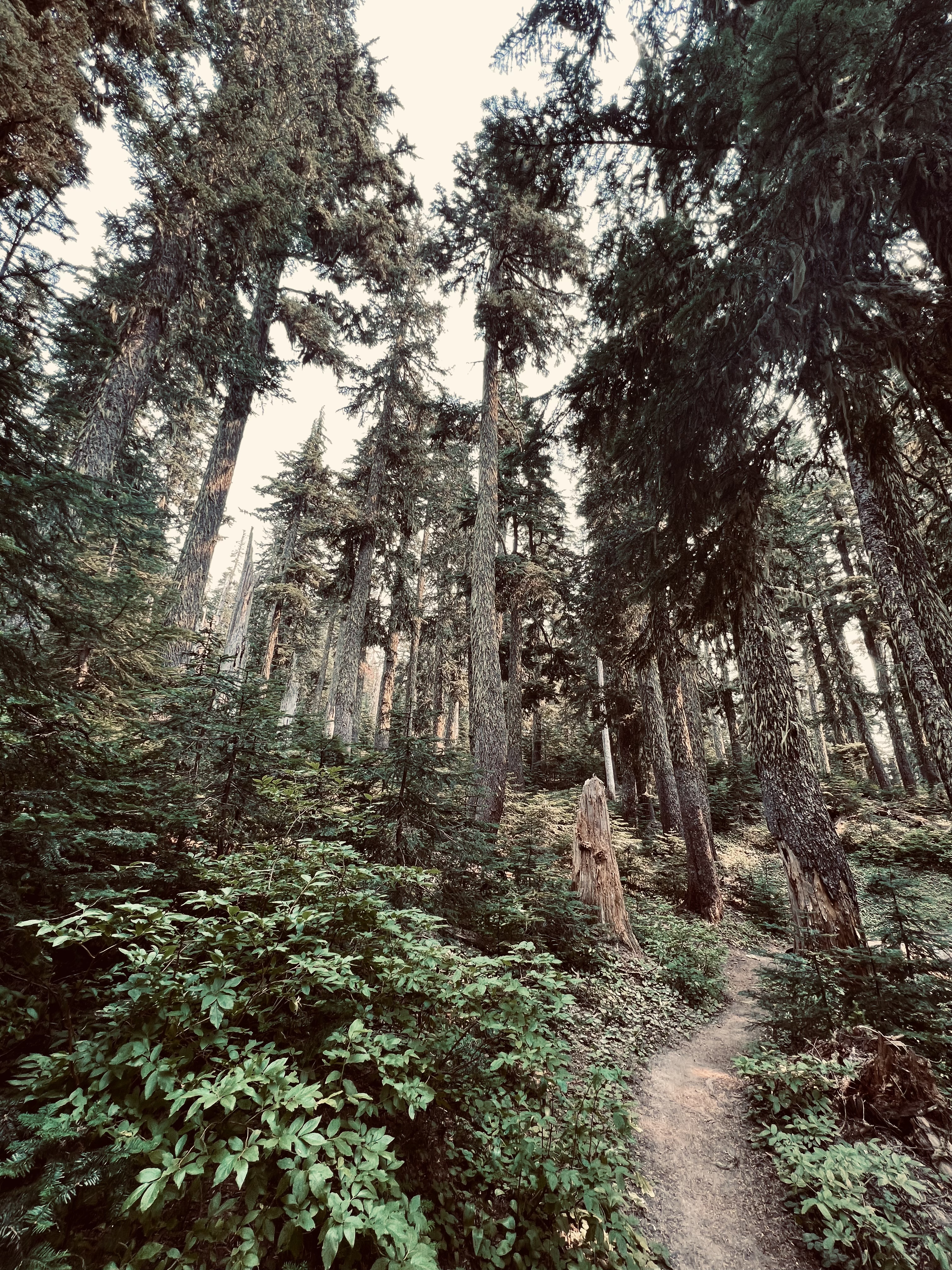
The trail led through an enchanting forest, pine scent and all. The sound of the flowing stream was a constant companion, but as I drew closer to my next objective the welcome sound of crashing water beckoned me onward.
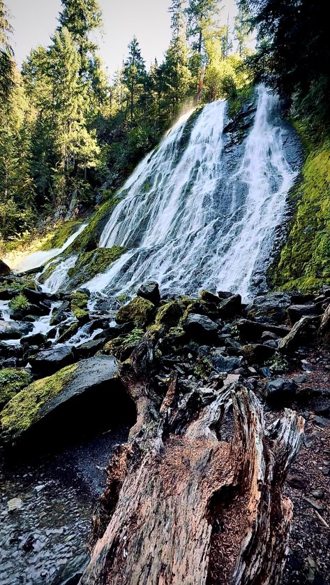
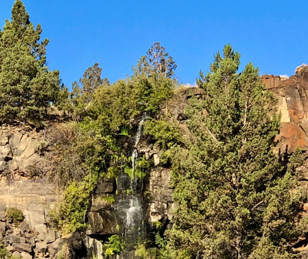
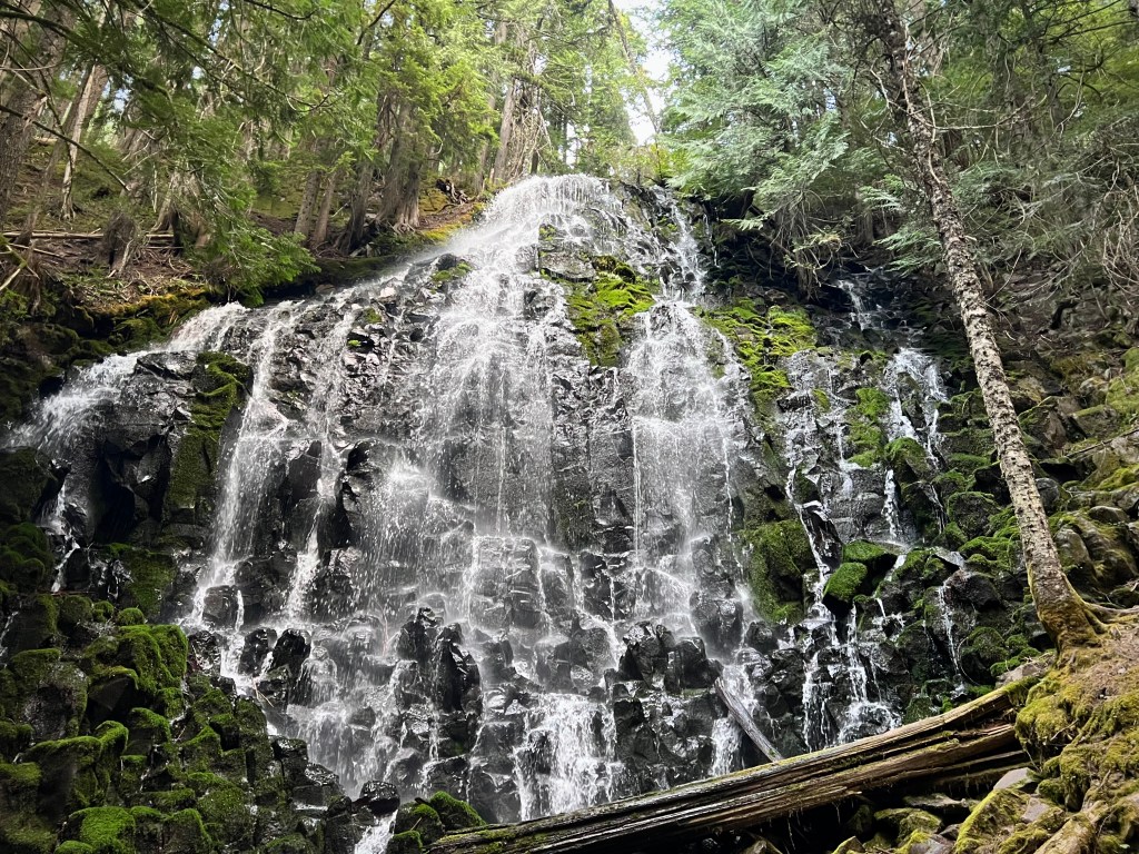
Diamond Creek Falls was much different than Salt Creek Falls both incredible in their own way. The water coming down Diamond Creek Falls fanned out, tumbling down the slanted face of the moss covered rock to the shallow pool below, perfectly framed by lush forest.
Diamond Creek Falls
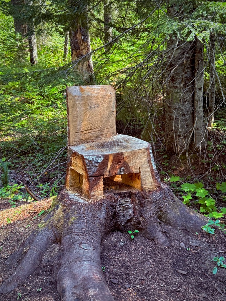
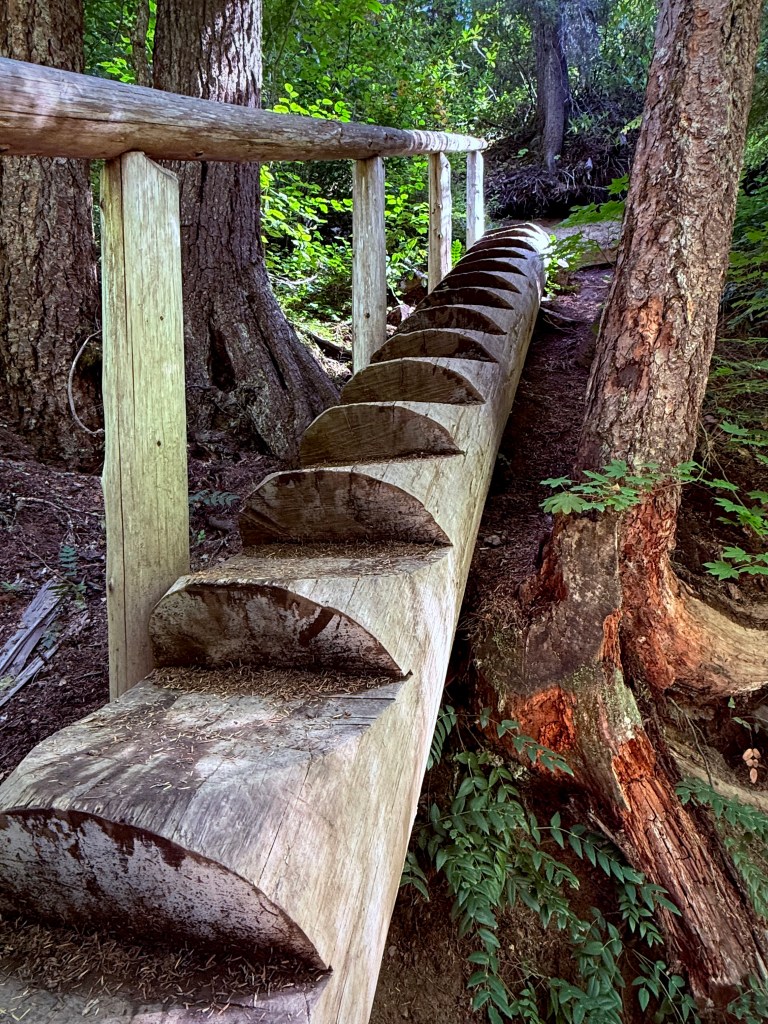
How about this chair carved from a stump?How cool is this log stair case?
Pursuing Balance Through Adventure YouTube Channel Salt Creek Falls and Diamond Creek Falls CLICK THE PIC!
“Moving through lush forest vegetation to reveal a stunning waterfall pouring gracefully over a rocky grotto deep in the woods. The sound of rushing water thunders through the canyon – a perfect moment of peace surrounded by nature’s beauty.” – Matt Swack
Thanks for joining me on my epic Road Trip from SoCal through Pinnacles National Park and then Mount Shasta in NoCal. I traveled on to my main event, Backpacking the Mount Jefferson Wilderness in Oregon. Afterwards I journeyed to the Northern parts of Washington. During my return I visited Mount Rainier National Park and outlying areas. I then set my sights on the Highway of Waterfalls. How intriguing does that sound? My tour would encompass many waterfalls in close proximity such that I could do it justice and complete this endeavor in just a couple days of hiking. This undertaking would leave me enchanted, spellbound and my soul full. There are many waterfalls to come so I wholeheartedly suggest that you LIKE, COMMENT, FOLLOW and SHARE. If you like the hat I have on in the pictures then I invite you to go to SHOP APPARELfor all of your Adventure Wear needs. PBTA travels extensively throughout the West if you go to the menu above you will see that the areas are categorized by area or activity. I am sure that this will fuel ideas when planning your next adventure.
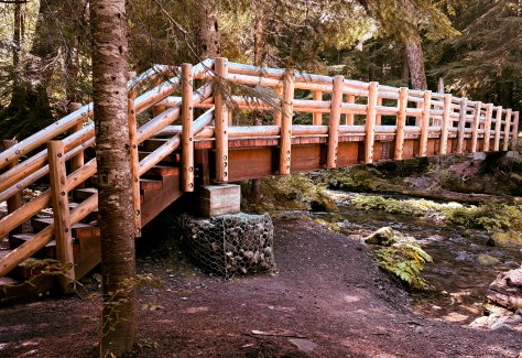
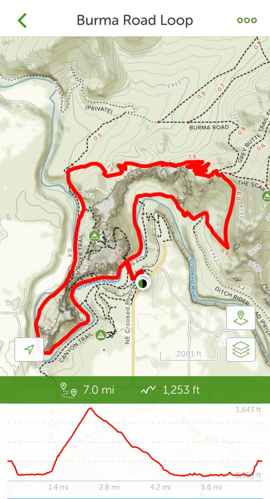
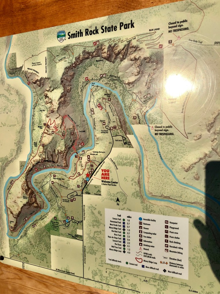
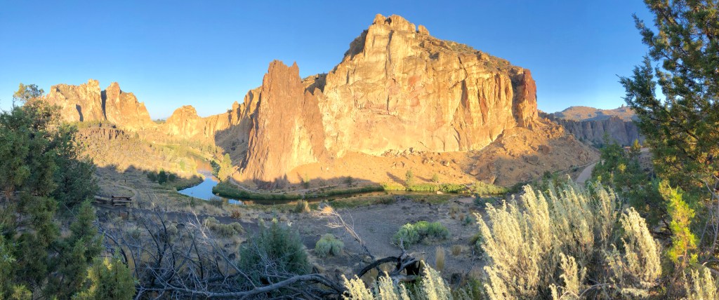
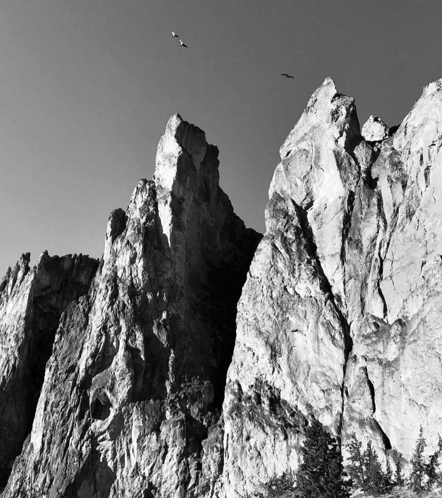
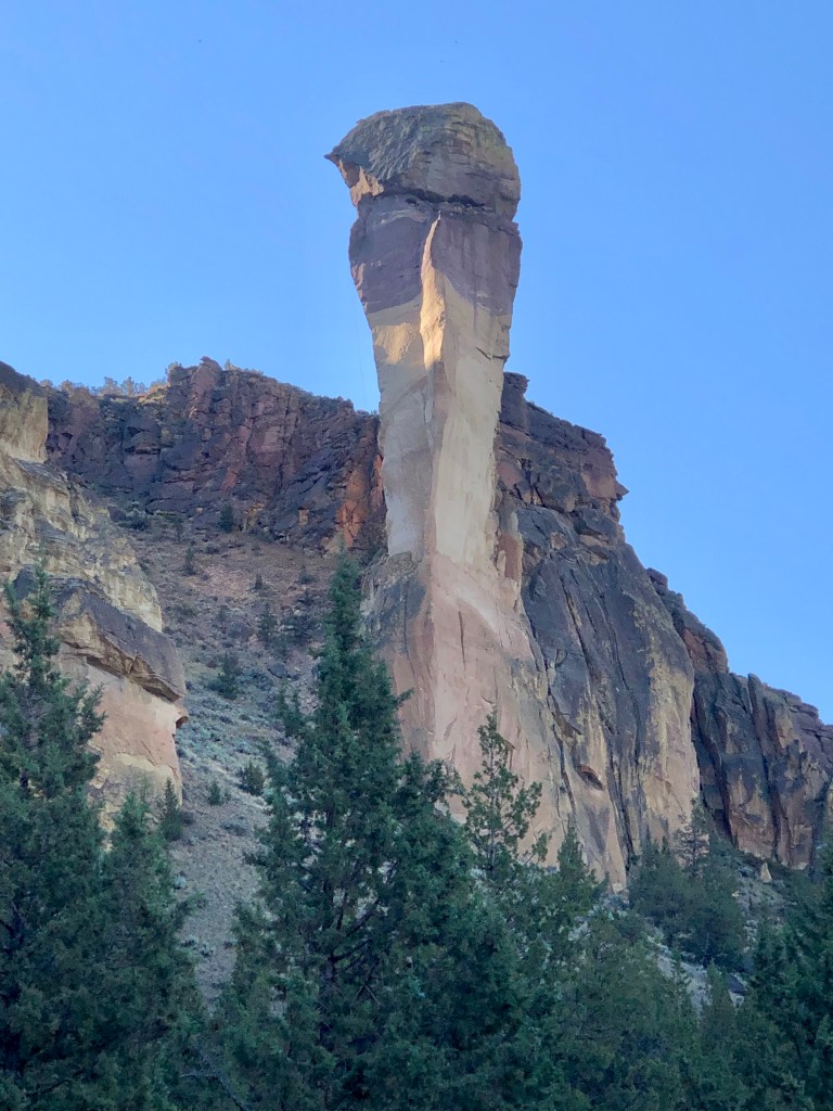
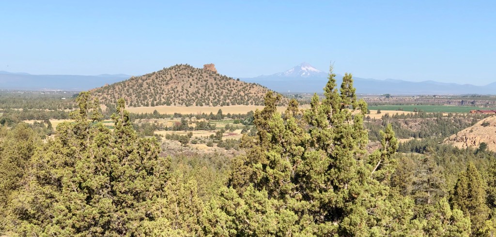
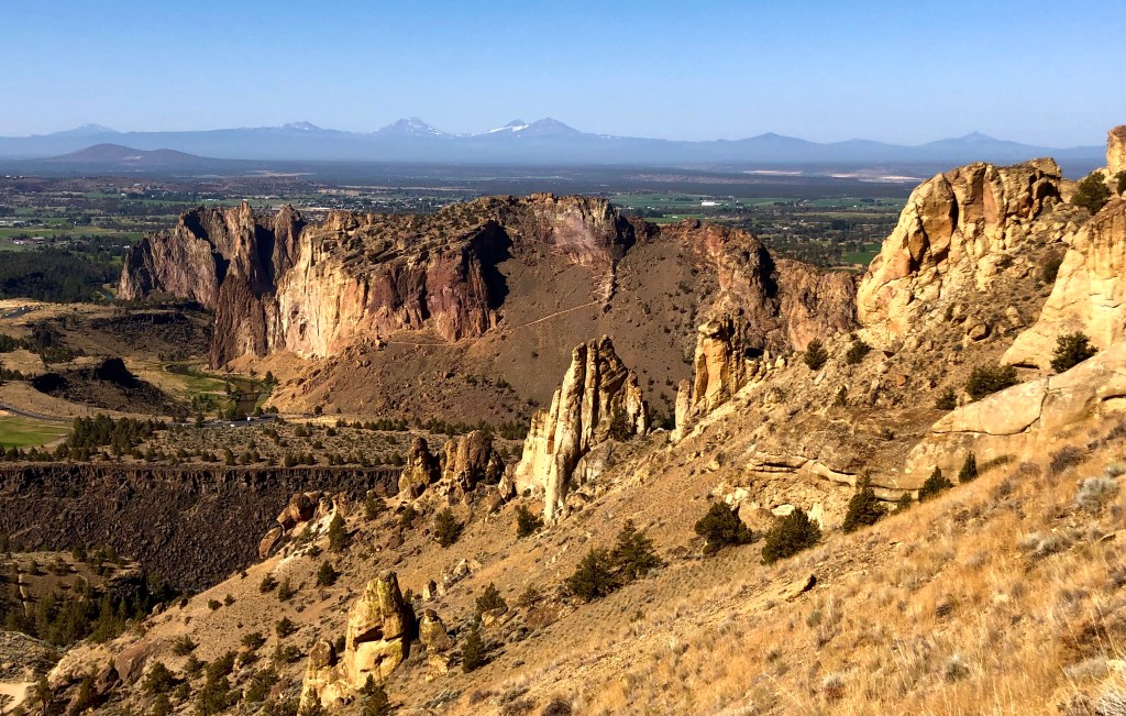
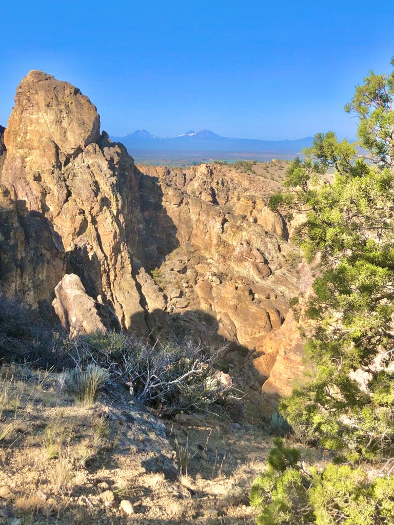
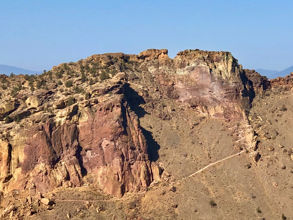
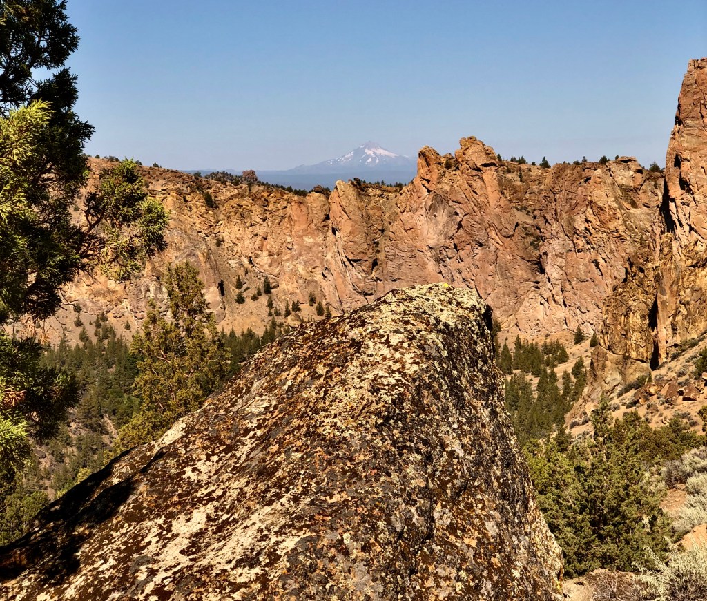
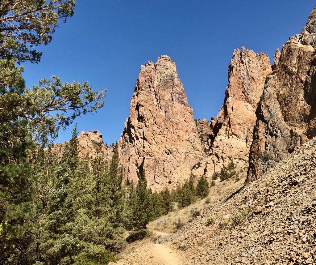
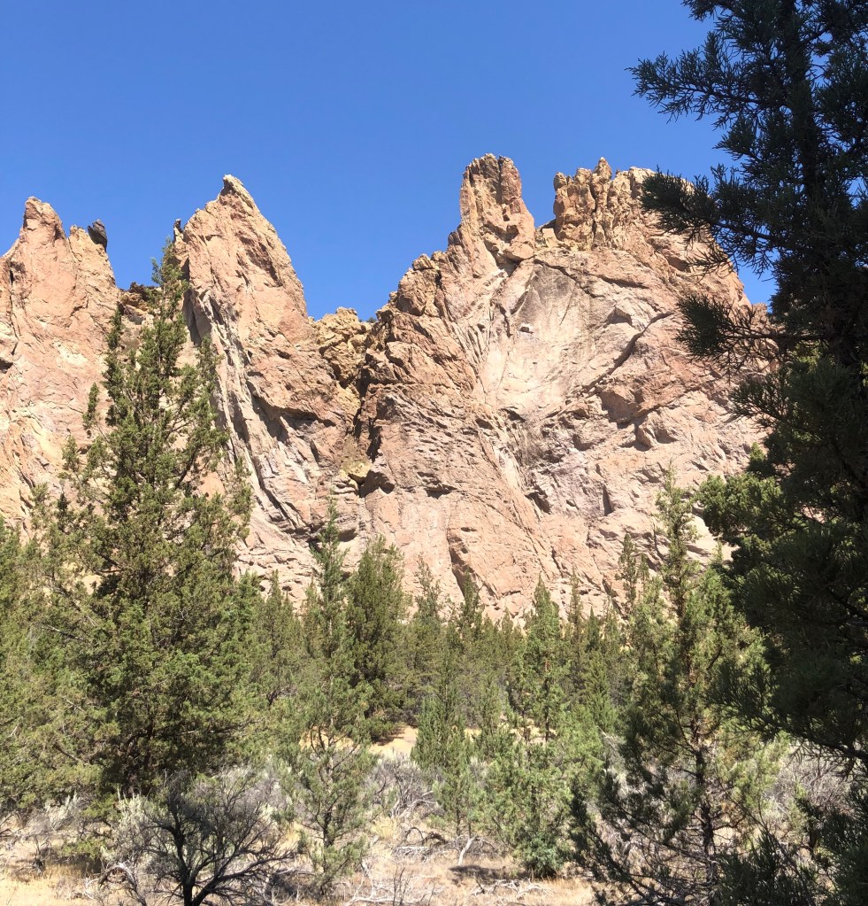
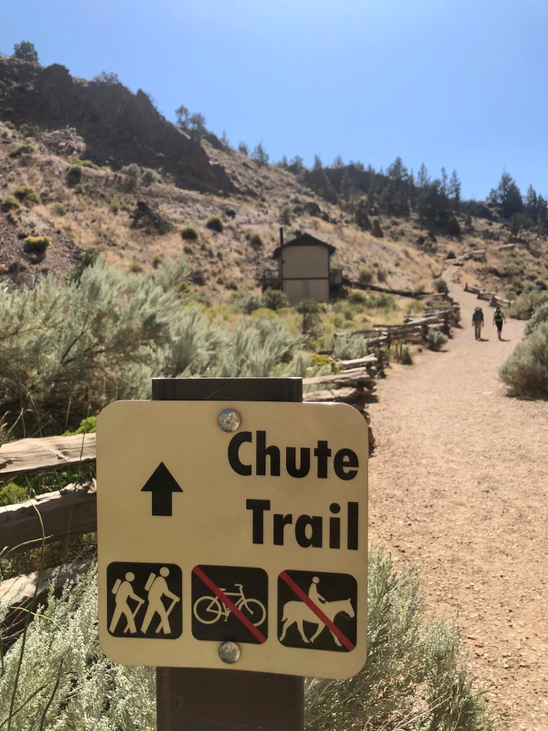
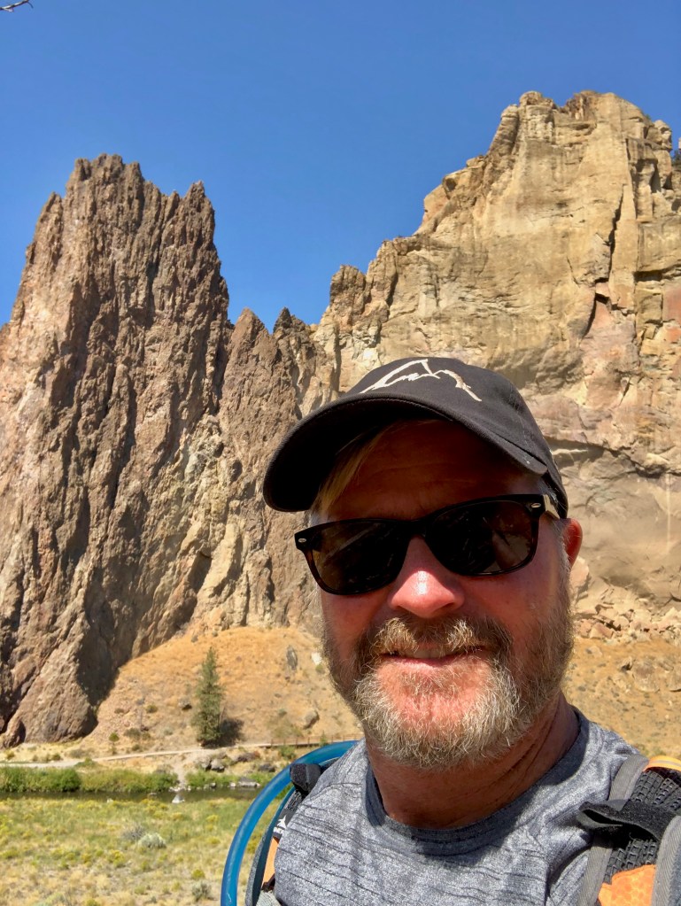
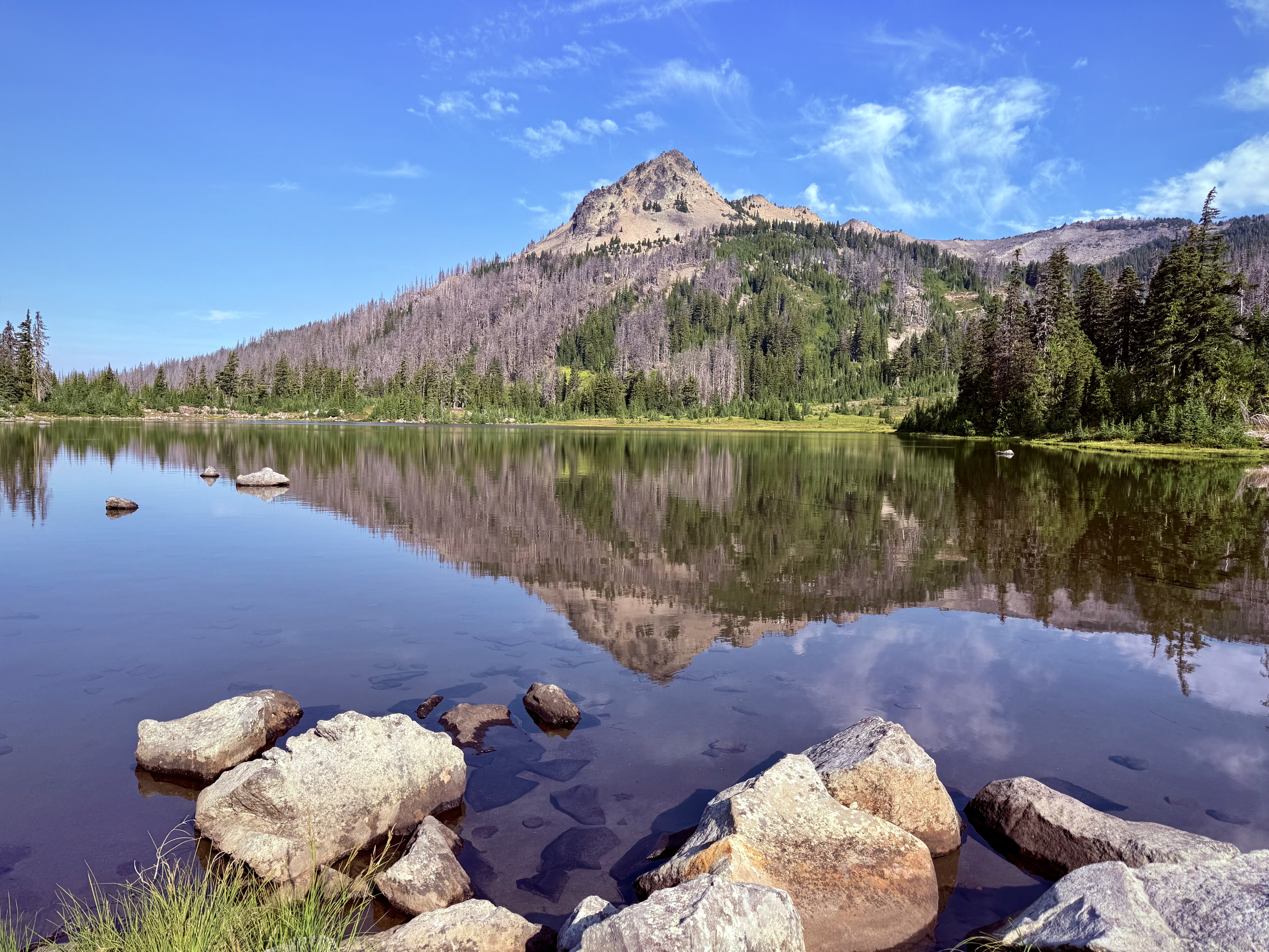
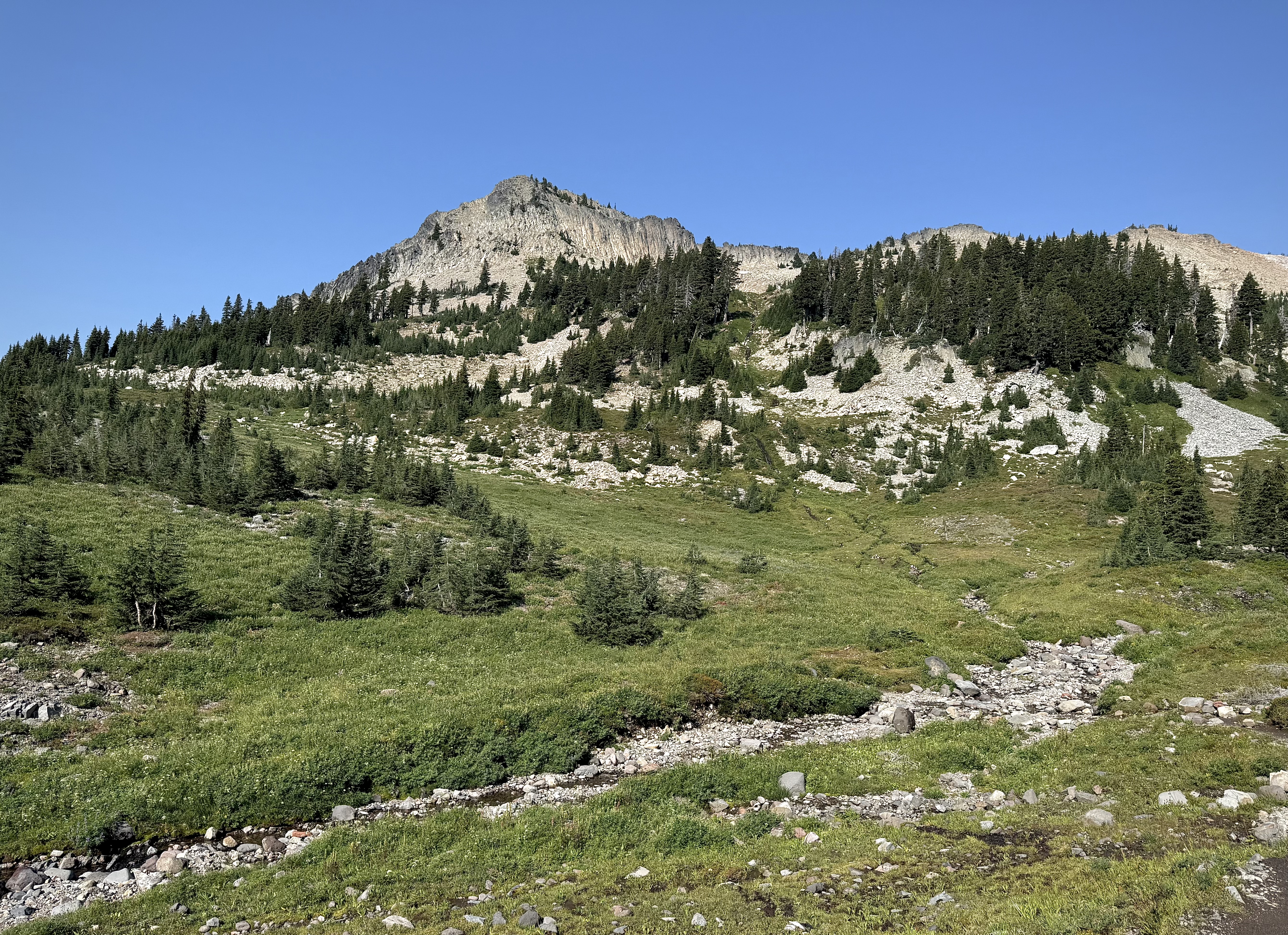
Smith Rock is one of those special places that is almost spiritual it is so beautiful. This was my second time to hike at Smith Rock, the last was hiking up Misery Ridge a few years ago with my fraternity brother Marcus, my son Alec, (then about 12), and a bunch of college guys, friends of Macus’s son. I found Misery Ridge to be aptly named for the crazy switch backs and quick elevation change, not only a challenge, but a stunningly beautiful hike and a fantastic climb.
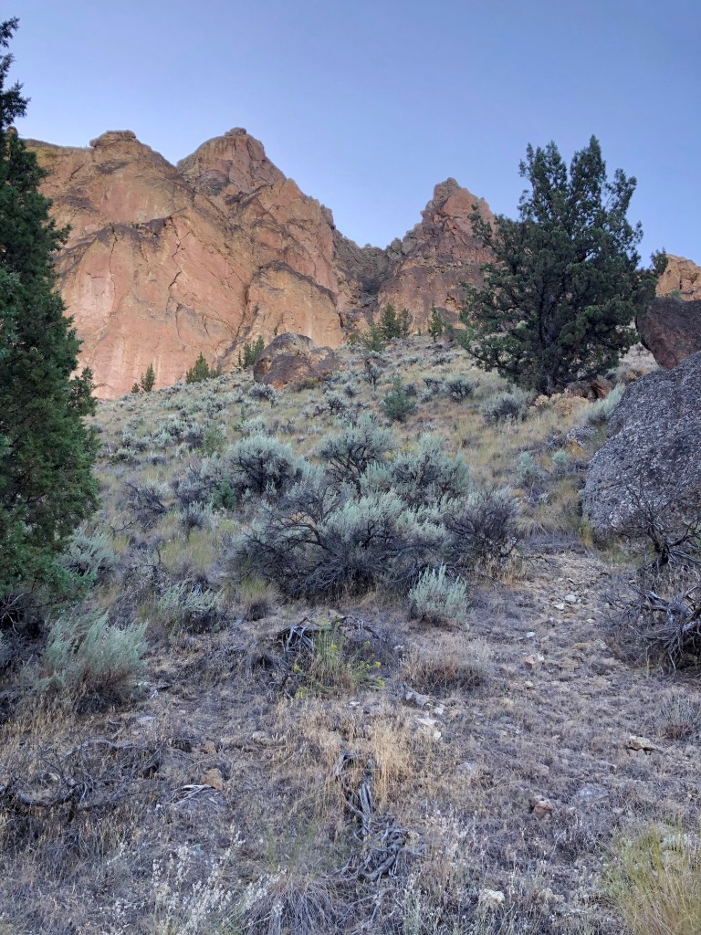
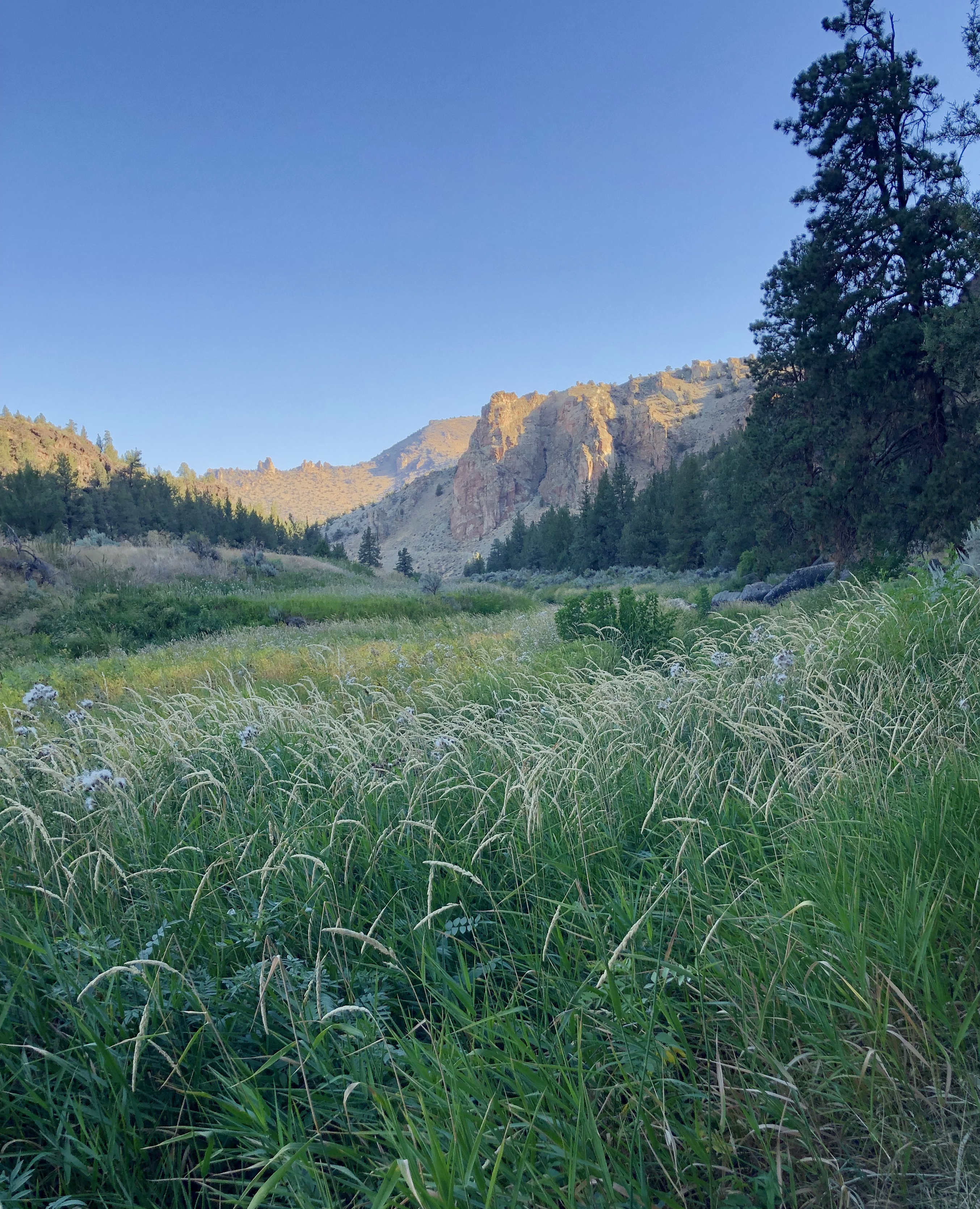
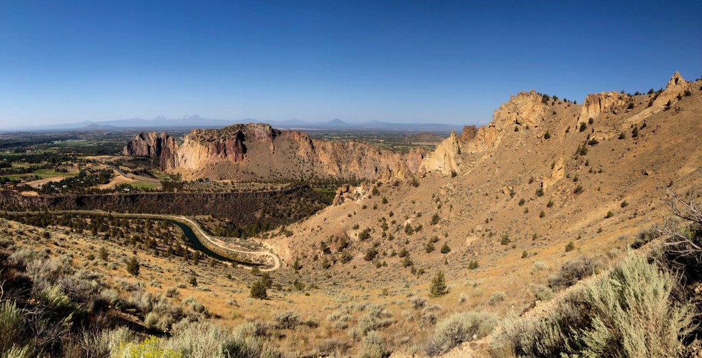
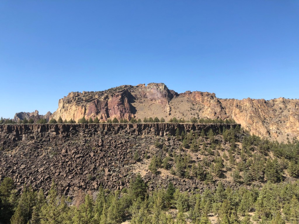
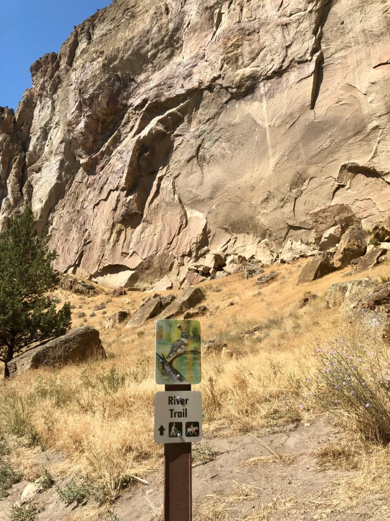
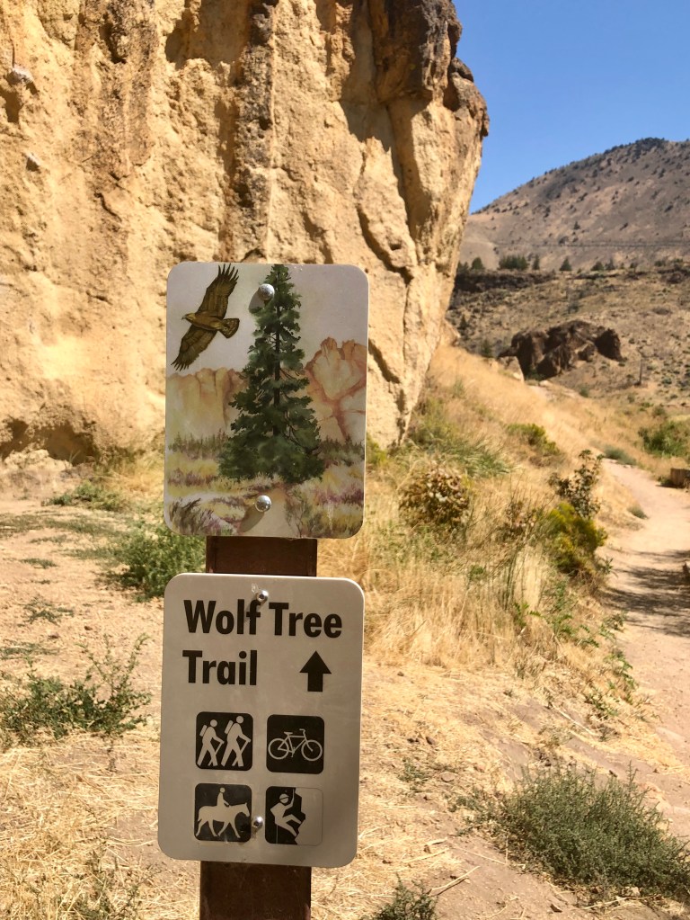
Wanting a different hike and experience I chose the Burma Road Loop. The loop is made up of multiple trails: The Chute, River, Summit, Burma Road and Wolf Tree Trails. It completely circumnavigates Smith Rock so you view it from every angle including looking down at it from the neighboring ridge. So any thoughts that this would be easier than Misery Ridge would be mistaken. Actually it is less aggressive in my opinion as the elevation is more spread out and over a longer distance. That being said however, there is a section with some fairly challenging switch backs as well.
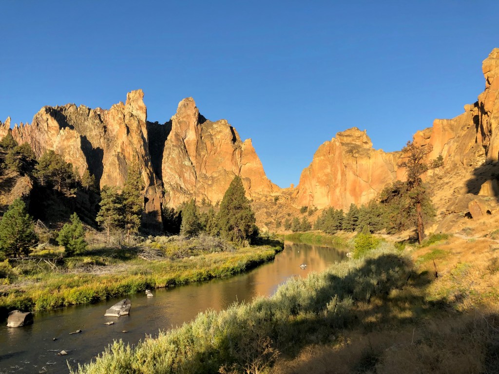
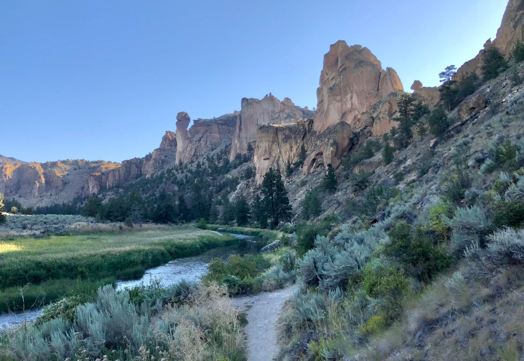
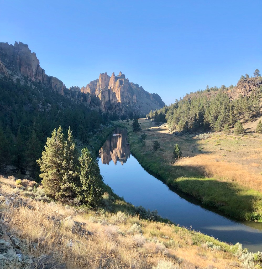
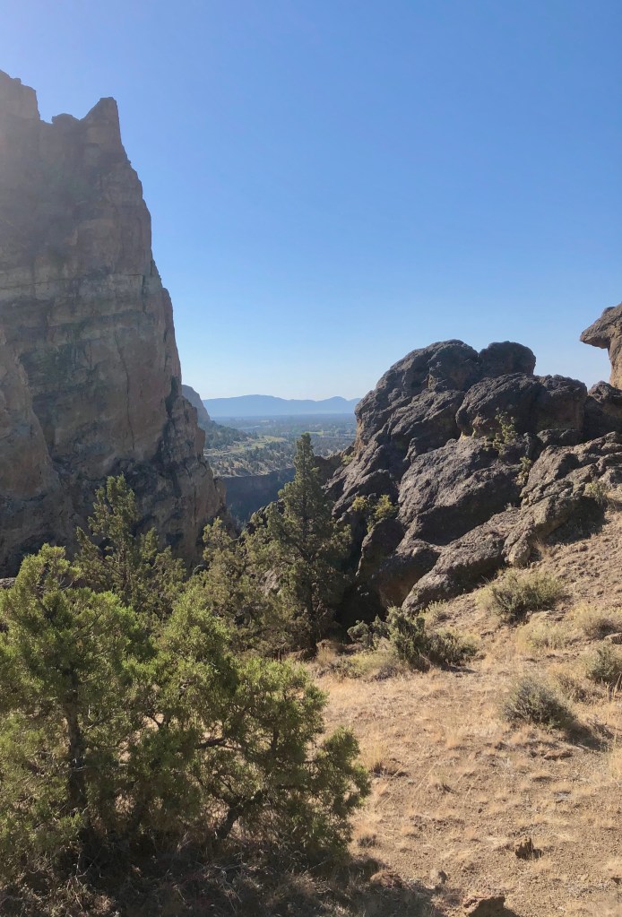
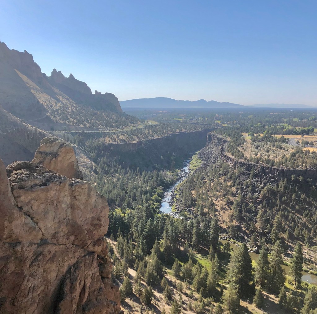
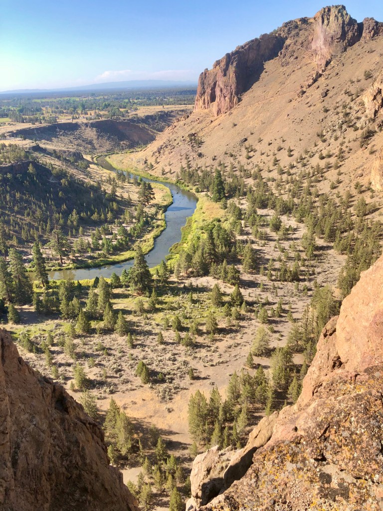
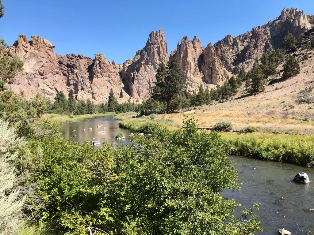
The trail drops down to the Crooked River which surrounds Smith Rock on three sides almost like a moat adorning an majestic castle. At this point the trail is easy following the awe inspiring walls of Smith Rock and along the River Trail, which is fabulous.
This was one of the hottest days of the year expecting to top out at 96 degrees. I was glad that I was getting an early start at 7:30 AM, which was most pleasant in the mid seventies, but by the time I completed my journey it was about 90.
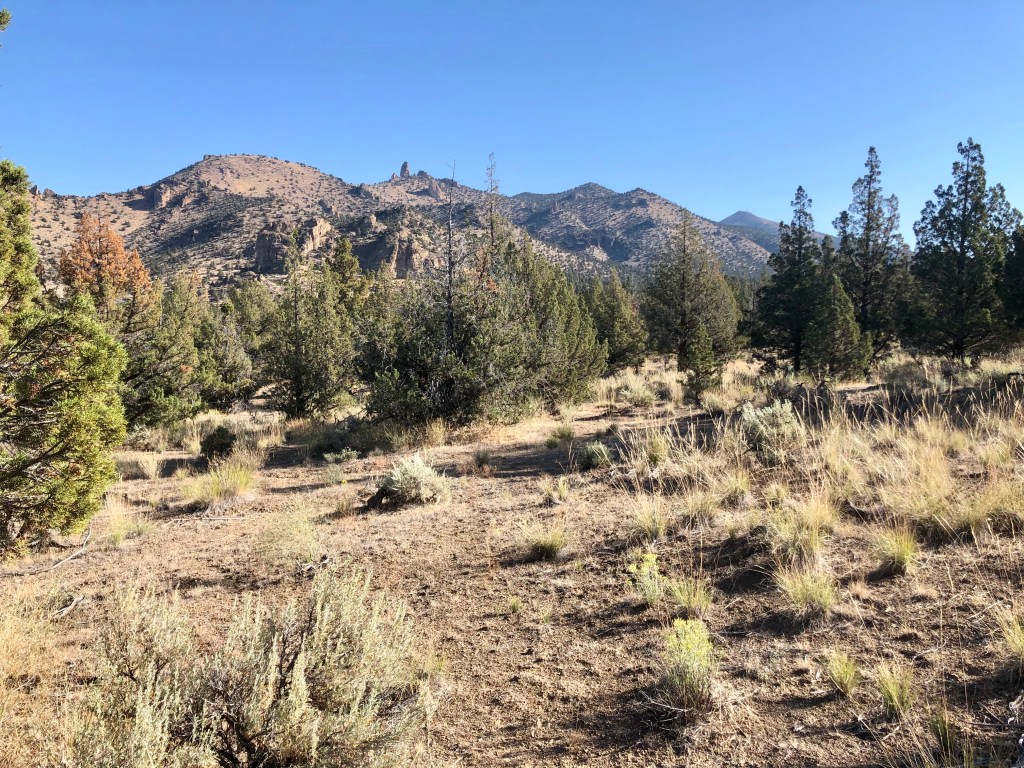
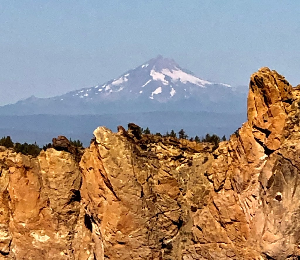
As I mentioned, the Crooked River wraps around Smith Rock. On the backside I headed up into a high desert scene. This is where the elevation starts going up and at a pretty quick rate with a number of switchbacks until you have a wonderful view of the river, the valley, Smith Rock, and the Cascade Mountains off in the distance. Just an spectacular view and with the wonderful rock faces and formations of Smith Rock it is simply a must do.
As I dropped in elevation the single track trail joined a double track road that was steep and not interesting, well… aside from the adjacent view of Smith Rock. My point is taking the Burma Road Loop clockwise is the way to go because going up a steep boring road with no switch backs would not be as pleasant, but working my way down it quickly with views of the valley and Smith Rock was perfect.
Once down to the valley floor there are more rock formations to take in, a wooded area, and then back to a delightful adventure along the Crooked River with ducks and geese, and a beaver. What an adventure filled with wonder… when you are Pursuing Balance Through Adventure.
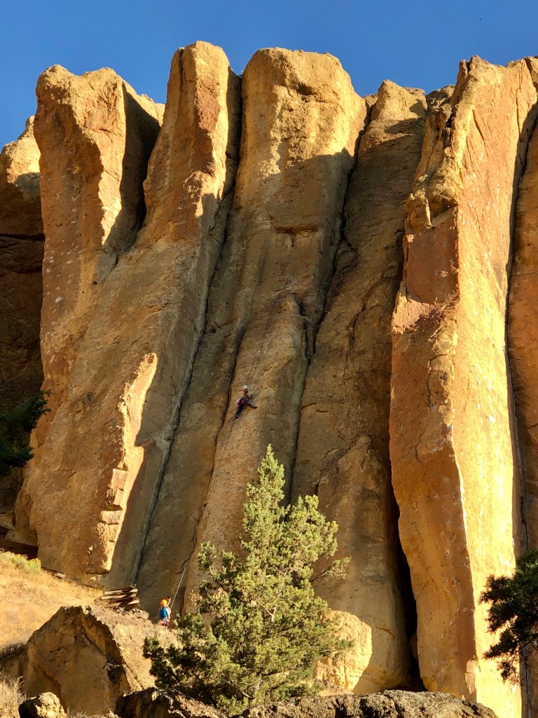
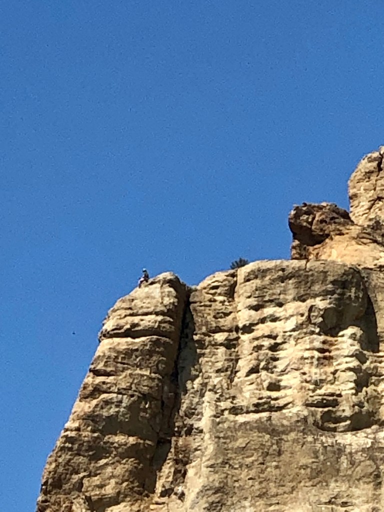
Climbers at Smith Rock
Looking down on Misery Trail Snack break“What do I do for a a living? I live for a living.” -Peter Karina
Wow, Smith Rock, ya’ just gotta’ luv it! Adventure and Balance is what we are pursuing so FOLLOW, LIKE, COMMENT, and SHARE so together we can accomplish this type of harmony.
Roger Jenkins Pursuing Balance Through Adventure
Video Clips of Smith Rock ‘Pursuing Balance Through Adventure‘
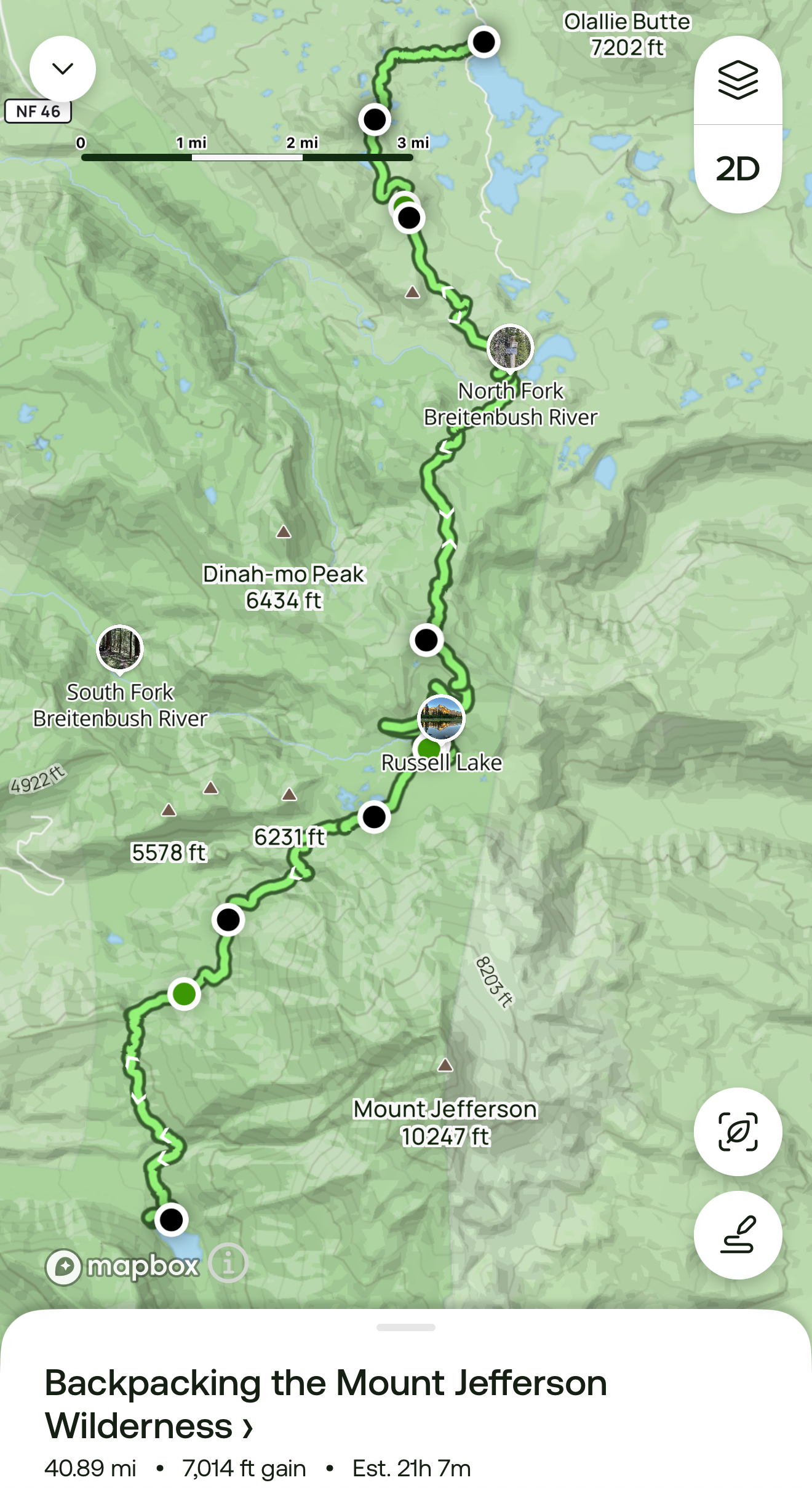
41 miles, 7,014 elevation gain, 21 hours moving time, rated Moderate to Hard
Date: 8/25-30/25
Day 4 & 5: Russell Lake – Cigar Lake – Olallie Lake
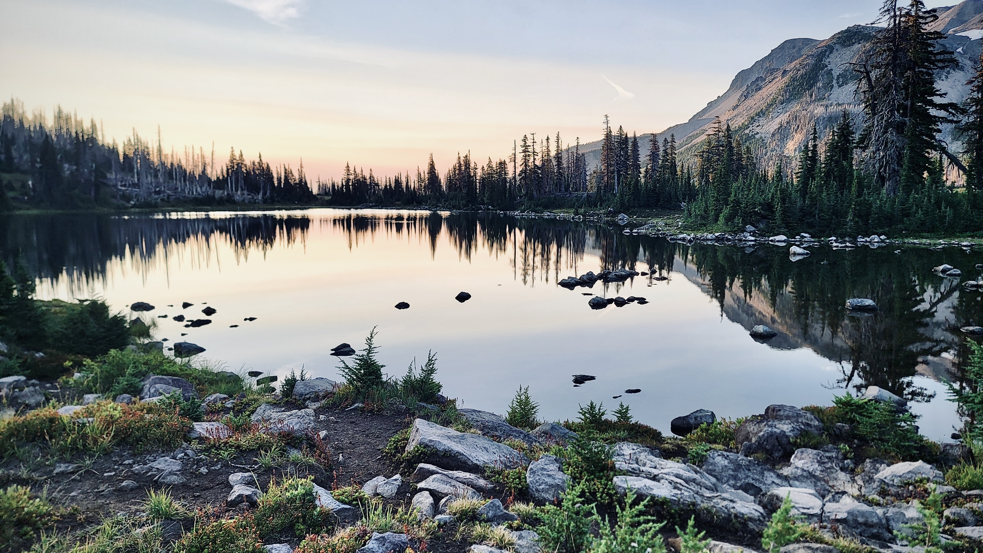
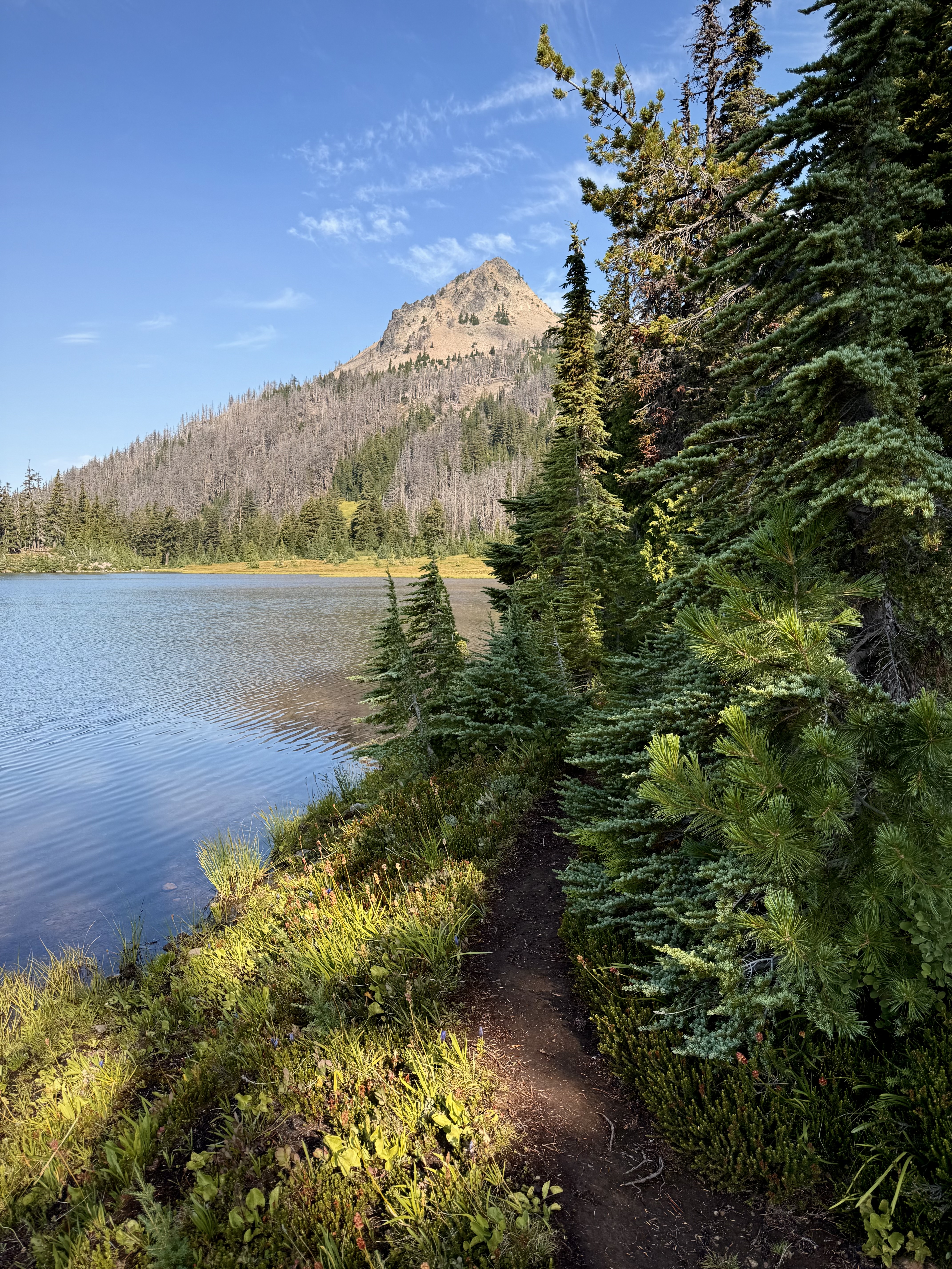
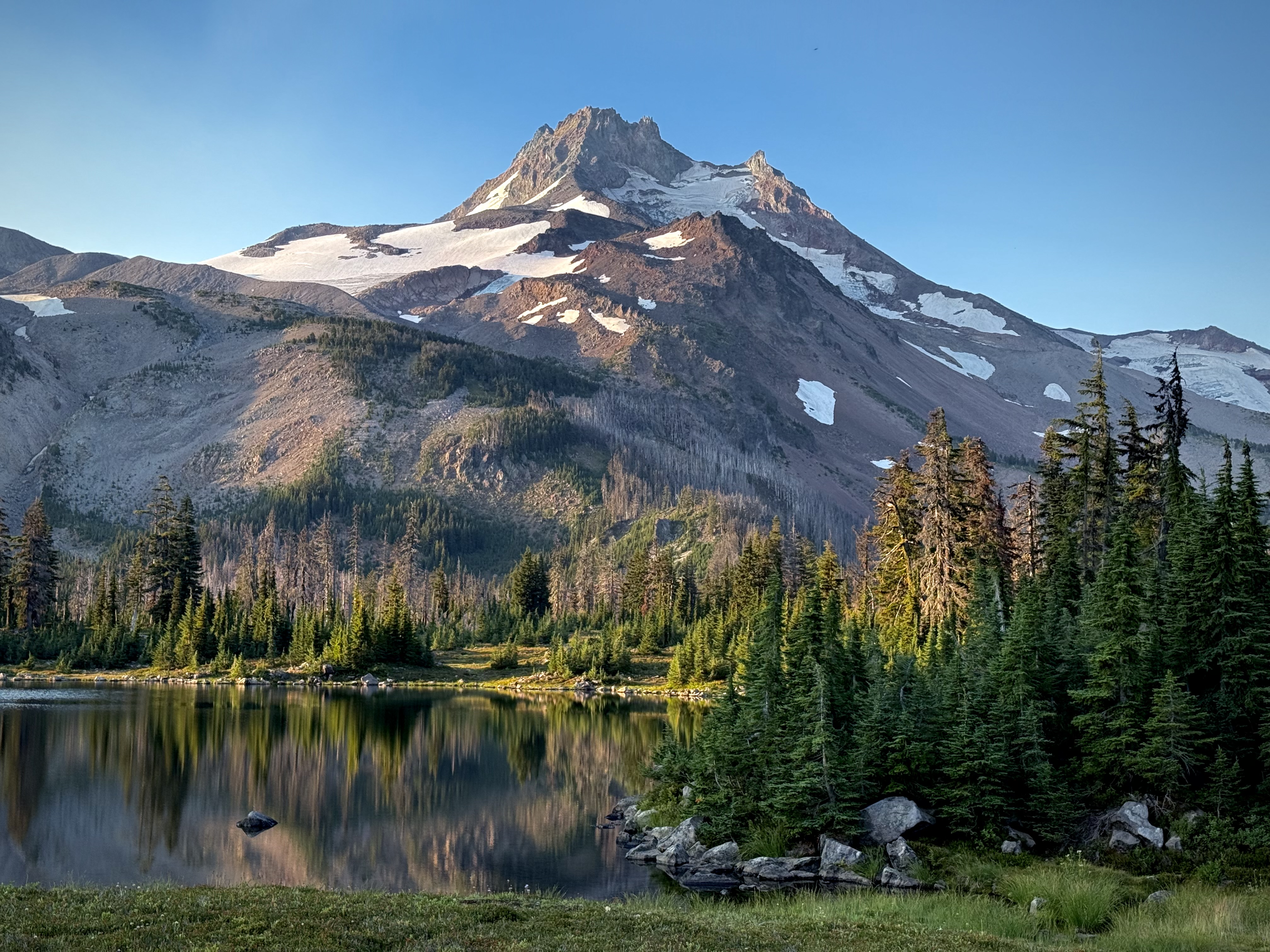
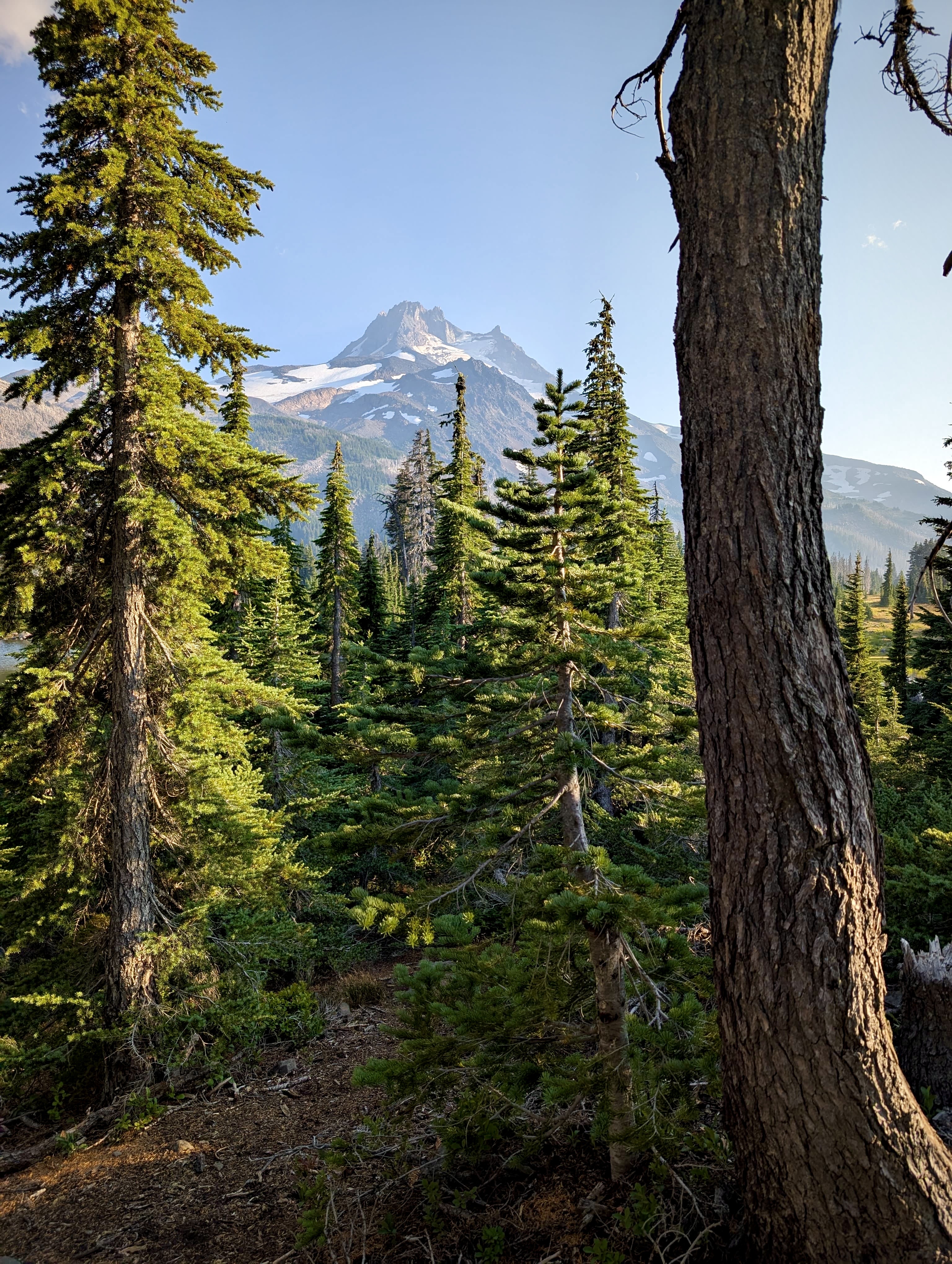
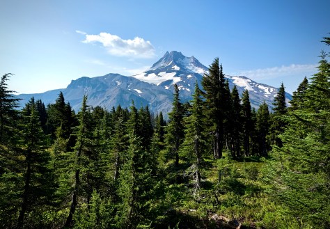
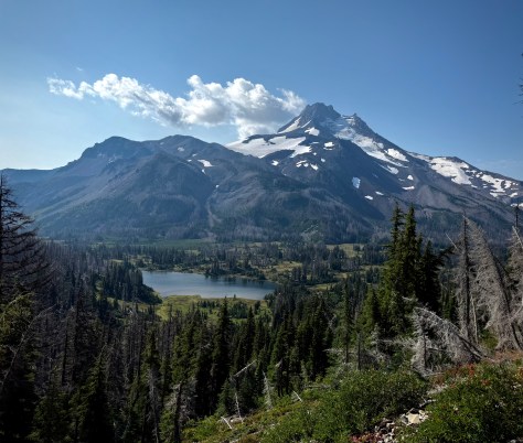
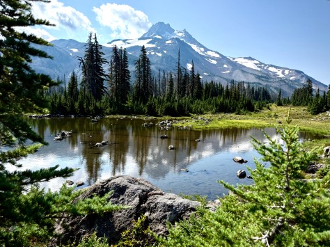
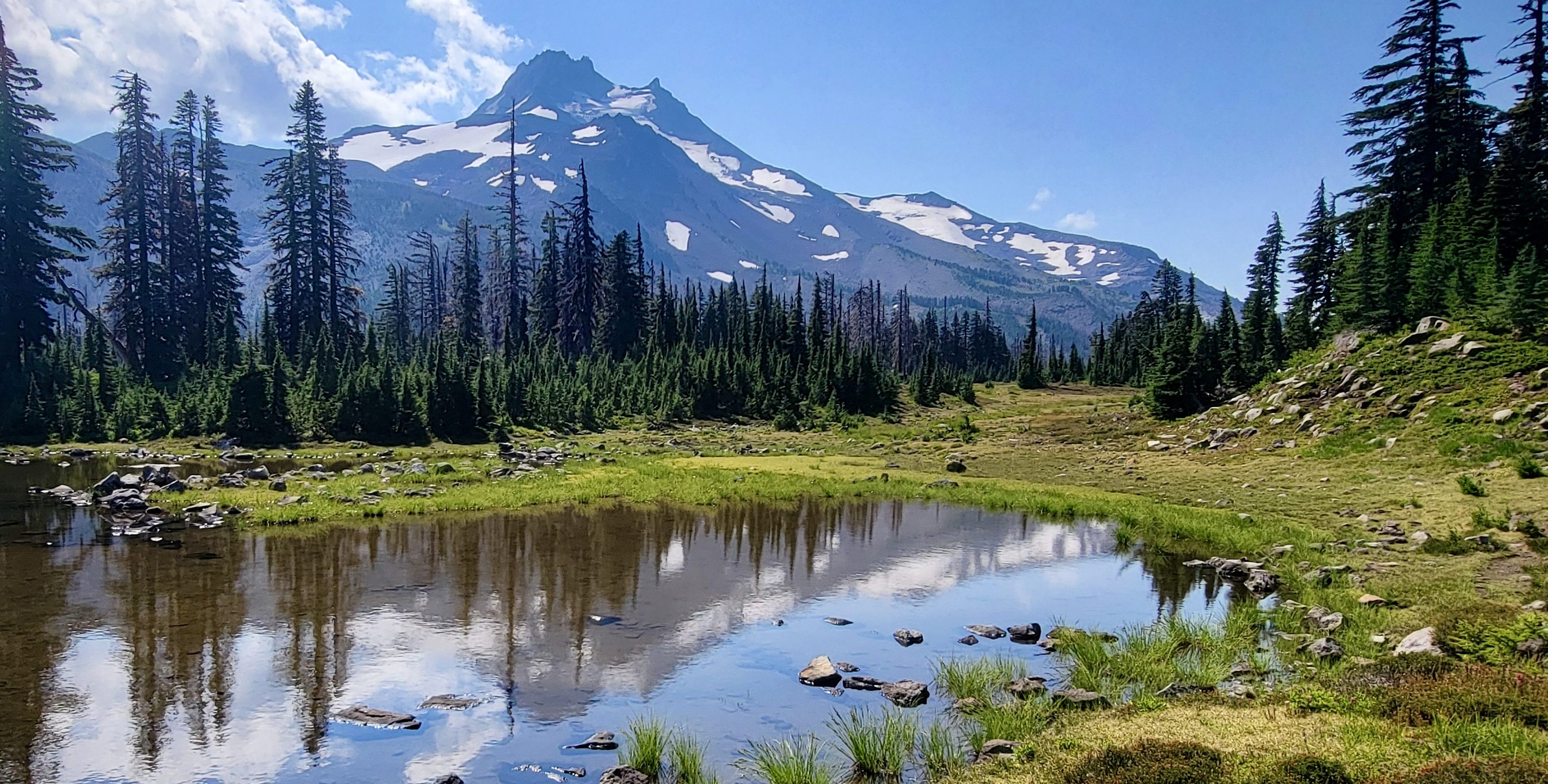
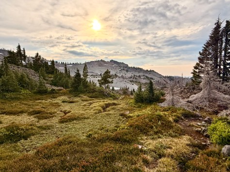
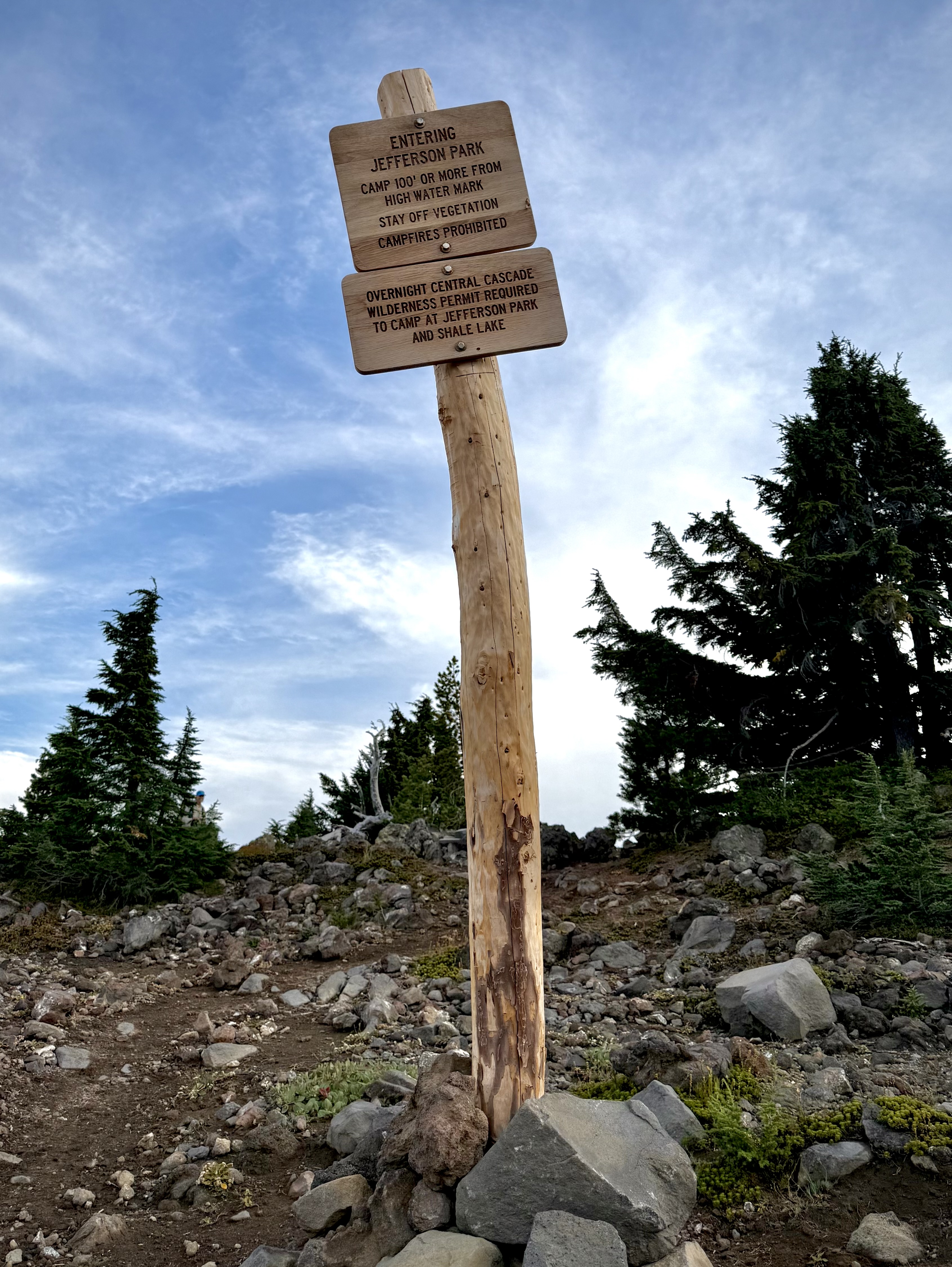
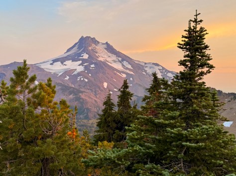
The serenity of Russell Lake, in the shadow of the magnificent Mount Jefferson, made it difficult to move on as Jefferson Park is in a word, idyllic.
The glaciers on the mountain pick up the soft light of early morning… the still waters of the alpine lake reflecting the regal presence of Mount Jefferson… this place of calm framed by towering firs is a quiet reminder to appreciate the richness of the moment.
I finished my breakfast while stuffing the last of my equipment into my pack. I watched as Anthony and Katie, who had set out already, took a jaunt around our little lake first. It was such a spectacular day that a side excursion was certainly in order.
I followed suit along a faint trail around Russell Lake that was later lost in a tangle of undergrowth, so I just tramped my way- bushwhacking back to the lakeside bank to finish my walk.
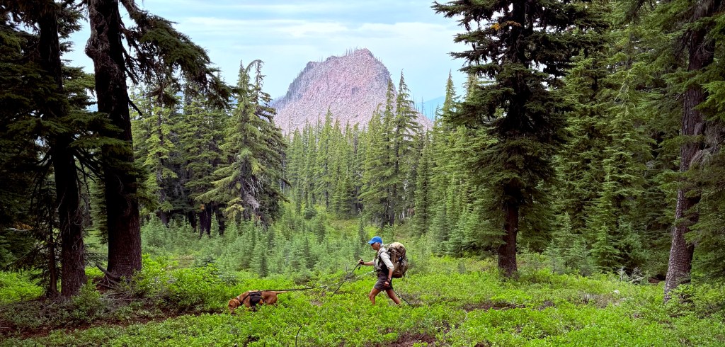
Peggy and Dale were packing up leisurely, enjoying our splendid campsite at the lake, as I headed up the mountain into the dense forest. I celebrated every footfall along the path carpeted in pine needles while serenaded by songbirds.
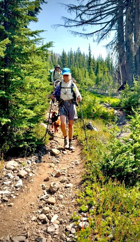
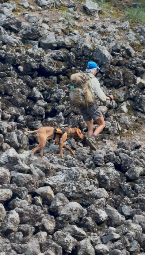
Every so often, through a peekaboo window that the woodland would open up, I could spy Peggy, Dale and their dog Jimi making their way to the foothill of our climb.
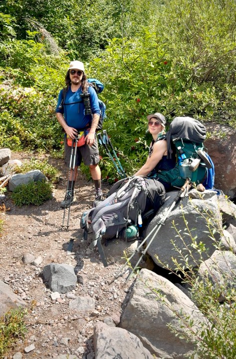
They were making good time and by mid-morning they had overtaken me so we proceeded together. My sister, Peggy confided that she was happy that we were hiking together for several reasons. One, obviously we planned to backpack this adventure to be together and together was more fun- despite that we may hike at a different pace. Two, she didn’t want to have to worry about me. Three, she was still a little apprehensive about her husband Dale since he had suffered the day before and as mentioned previously he had a bad experience on Mount Hood the year before. As it turned out her concern wasn’t without foundation.
Anthony and Katie loving life along the trail. Photo complements of Anthony E. King Photography
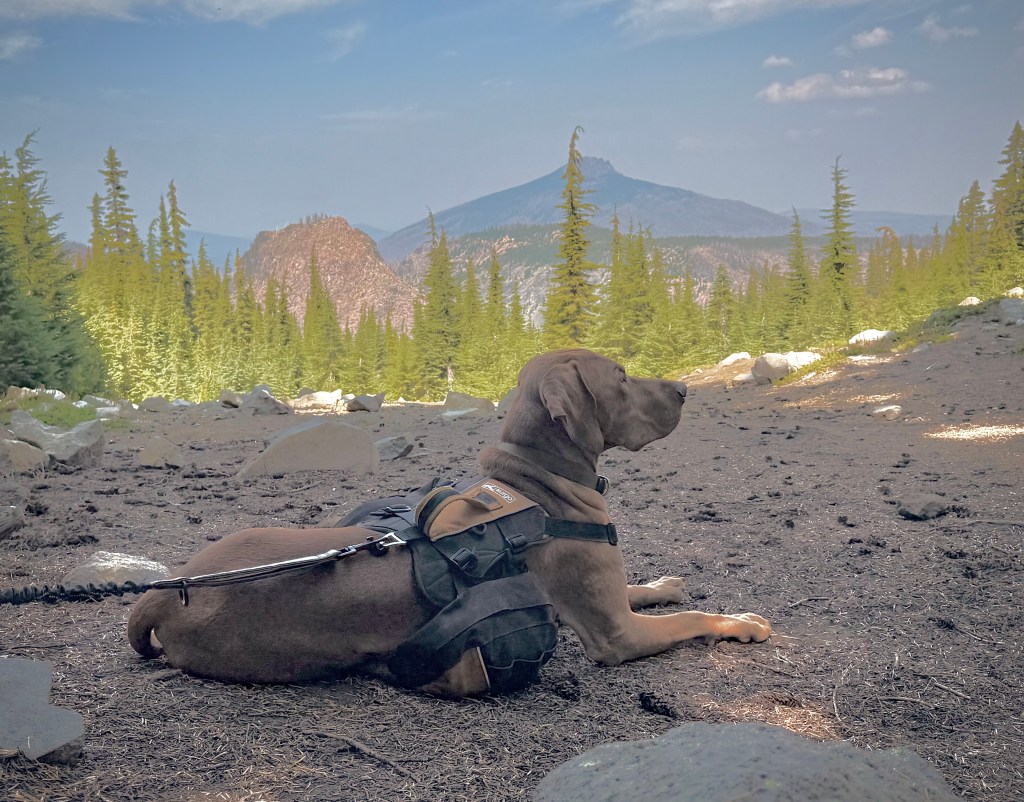
Peggy, Dale and their Vizsla Trail Dog Jimi
Dale, now 70, was about to learn that he was no longer Superman at least as far as the latter part of epic backpacking adventure. Just like the year before on the Timberline Trail he learned a lesson. The lesson being- during the latter days of trudging through the wilderness with a pack, especially during the second half of the day, exertion fatigue would for evermore proved taxing on him.
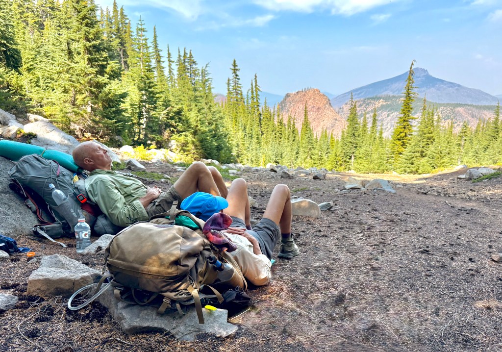
I was feeling good. It was only the first couple days climbing the mountain with heavy pack that I was feeling the plague of weariness. Of course admittedly we had now slowed our pace and were taking frequent breaks since Dale was not welling well.
Jimi Hendrix the backpacking VizslaRest Stop with a view
So, I certainly was not being pushed and now the pace was certainly a lot slower than I would have set if I was alone. I was still a bit concerned because seeing Dale struggle was something that I had not been accustomed to. But by slowing our pace and taking lots of breaks Dale was able to endure.
Photo complements of Anthony E. King Photography
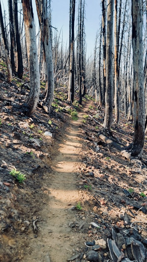
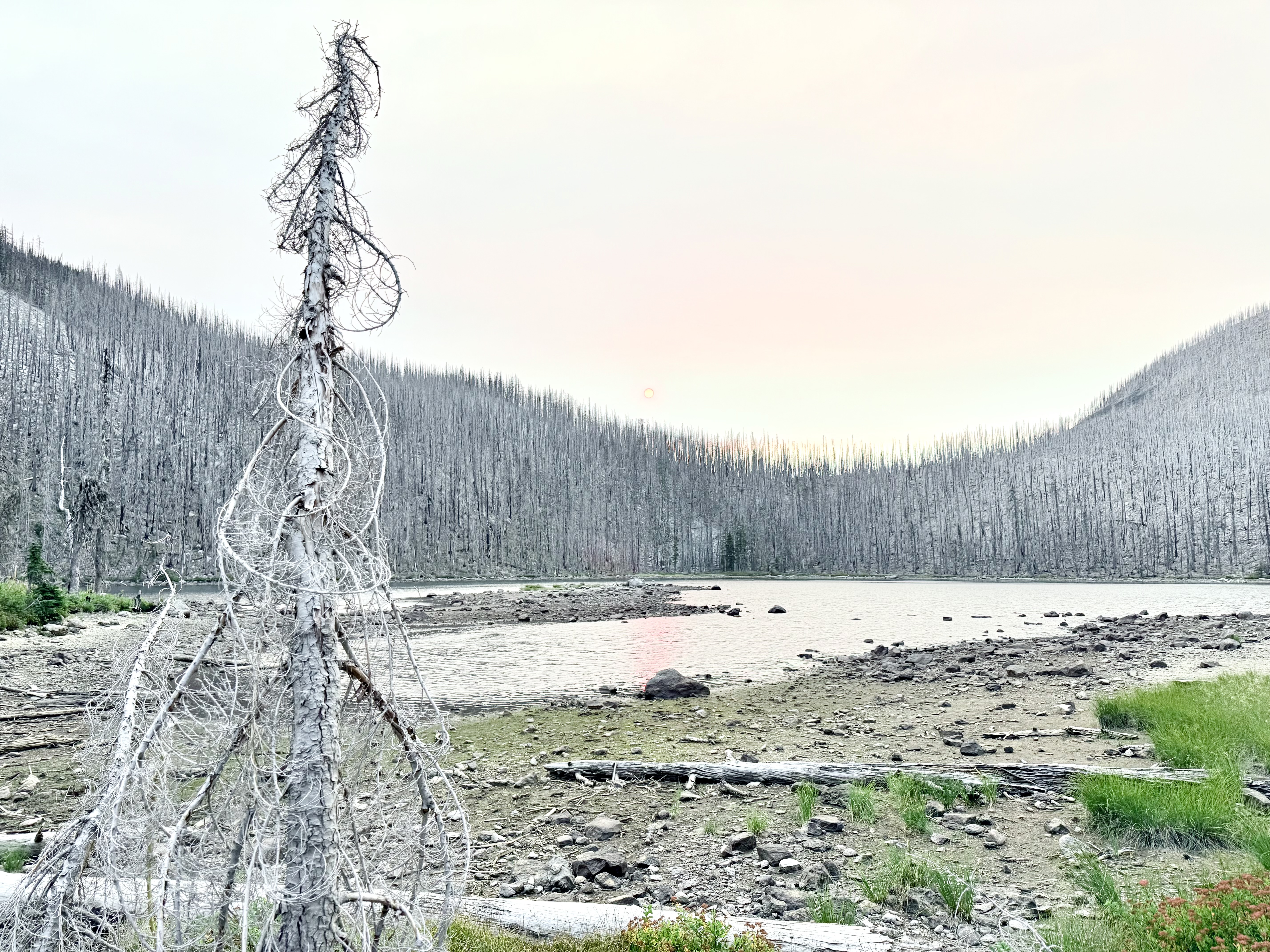
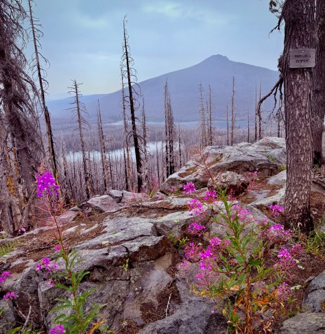
This day was another Beauty and the Beast regarding the dichotomy from the most alluring and stunning environment to the chard trunks of wildfire devastation. Everything everywhere just blackened truly a Land of the Lost. So utterly sad and dismal.
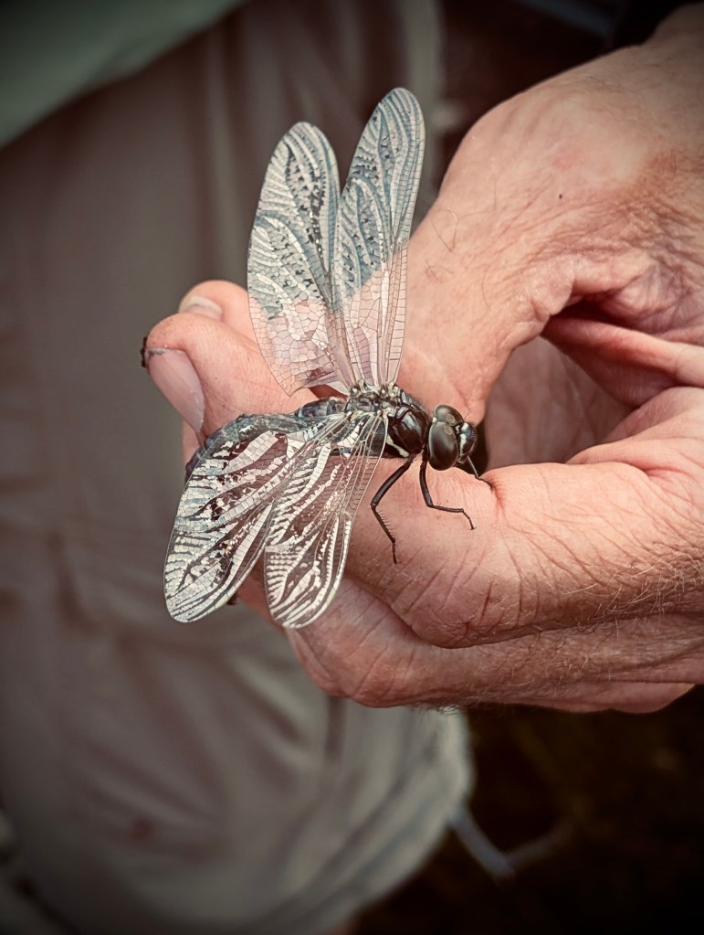
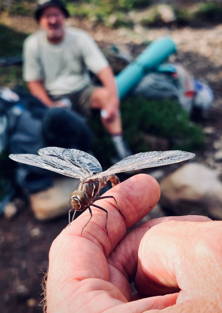
Bug Whisperer Dale and newly hatched Dragon Fly-Photo Anthony E. King PhotographyPhoto complements of Anthony E. King Photography
We could have hiked out on this day and I believe even though it would have been long and difficult that is what I would have preferred. I wanted to leave this wildfire Hell.
Anthony had planned out a day that would not have been as hard leaving us with an easy hike out the last day. He had a lake in mind. I kept contemplating, as we wearily plodded along, we can’t be to this lake yet because everything is still ugly. Dale kept getting worse and his pace continued to fall off with each on going hour of exertion.
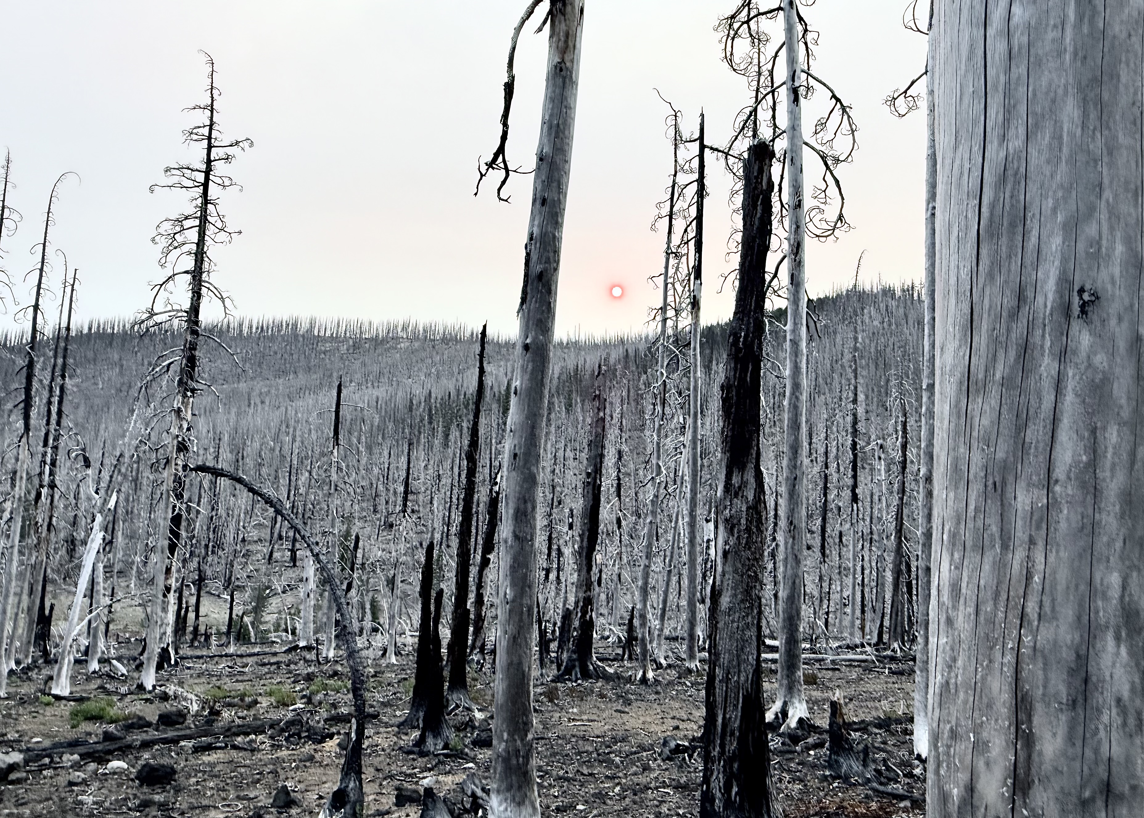
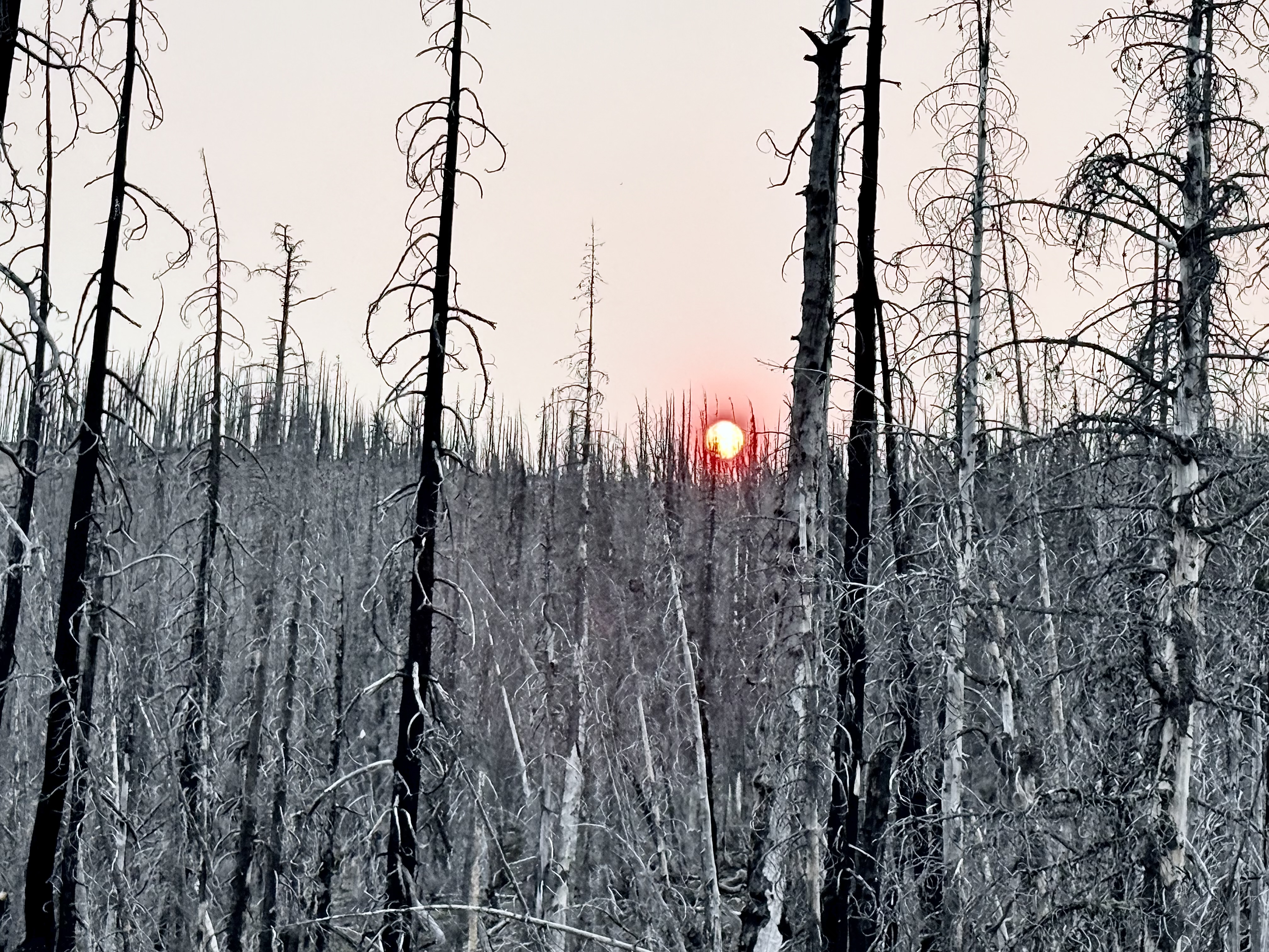
We finally pulled into where we were pitching our tents for the night. Cigar Lake, I am sure was named because of it’s shape, but I was thinking that it was ably named as it was all burned up. This Hades was surely the worst spot I have ever camped. The toppled timber was barren and black strewn about like matchsticks and the ground was ash. The smoke from the Sister’s Fire was choking out the sun giving it the appearance of a glowing red ball. It was an eerie apocalyptic setting.
Photo complements of Anthony E. King Photography
By the time we arrived Anthony and Katie had already set up their camp. The wind had painted the sides of their tents with ash. I really did not want to camp in that dirty, dusty place and searched about finding something more suitable in some nearby boulders. By the time I filtered water, set up my tent and started my Jetboil for dinner it was dark. There was nothing to see anyway so that was fine.
Photo complements of Anthony E. King Photography
During the night I got a wild hair and conjured up a plan. In my mind the beauty of this expedition was over. There was only the drudgery of the last final few miles through the land of doom. So a leisurely breakfast was certainly not something to be enjoyed in this place of destruction.
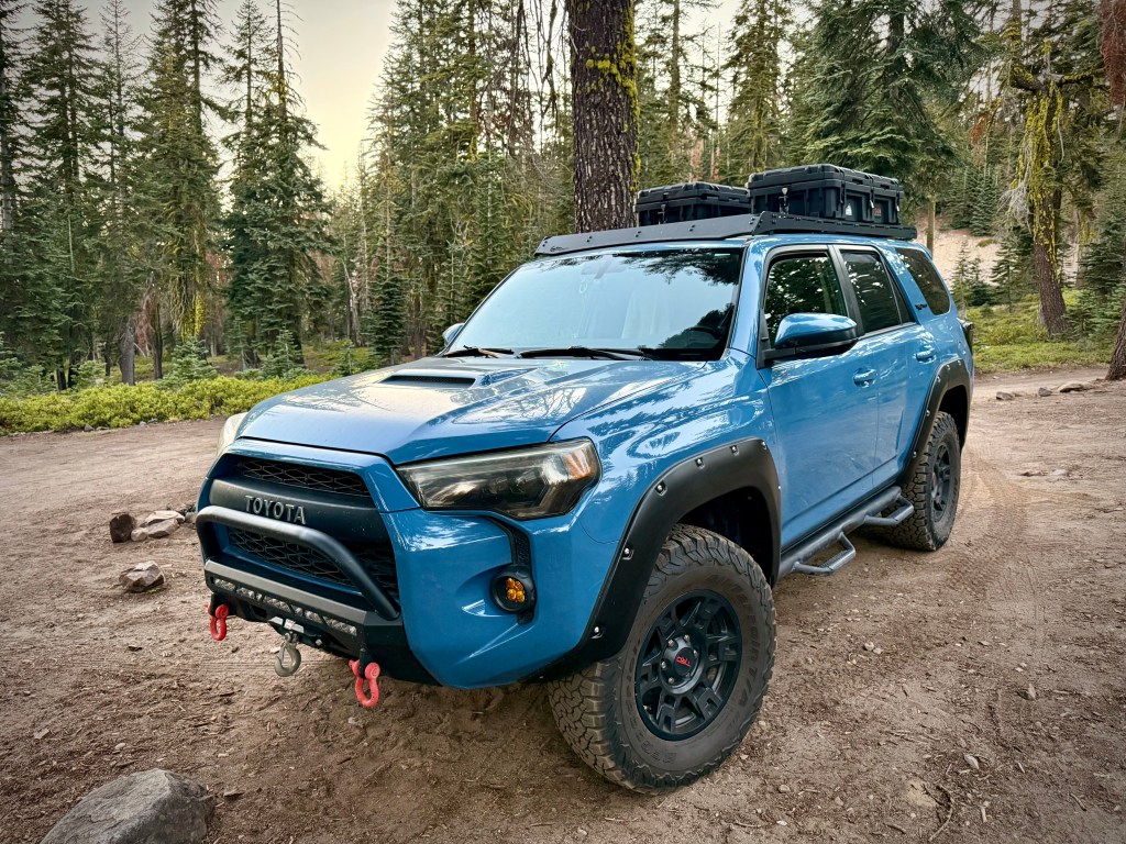
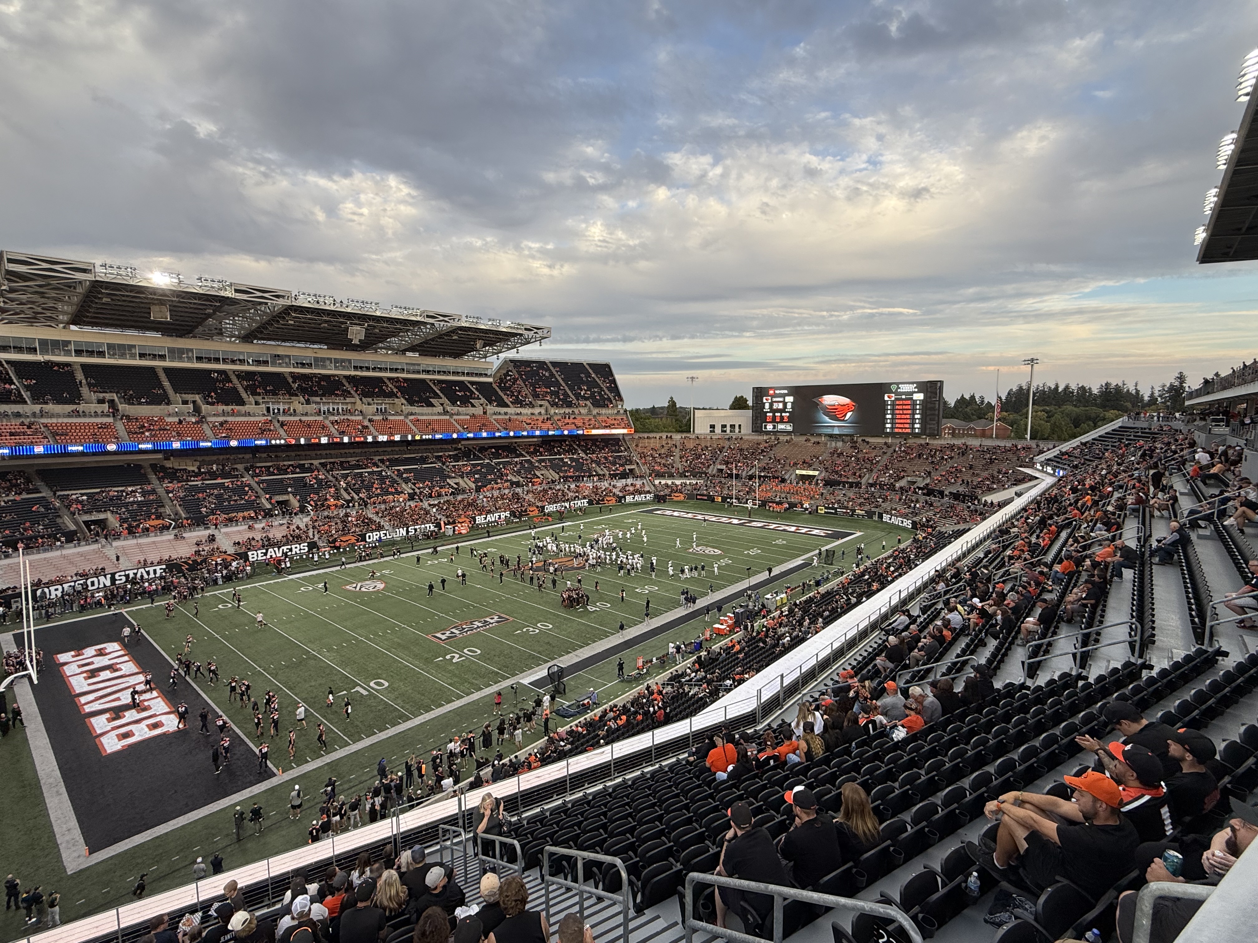
Beyond that I had been invited to return to my university, Oregon State, for a fraternity event which I thought that I would not be able to attend to the disappointment of my brothers. I had not set foot on campus since my graduation so seeing my fraternity brother chums and going to the football game was pulling at me. I thought if I got up early and high tailed it, hopped in my Toyota 4Runner TRD and 4wheeled out of there I just might make the event.
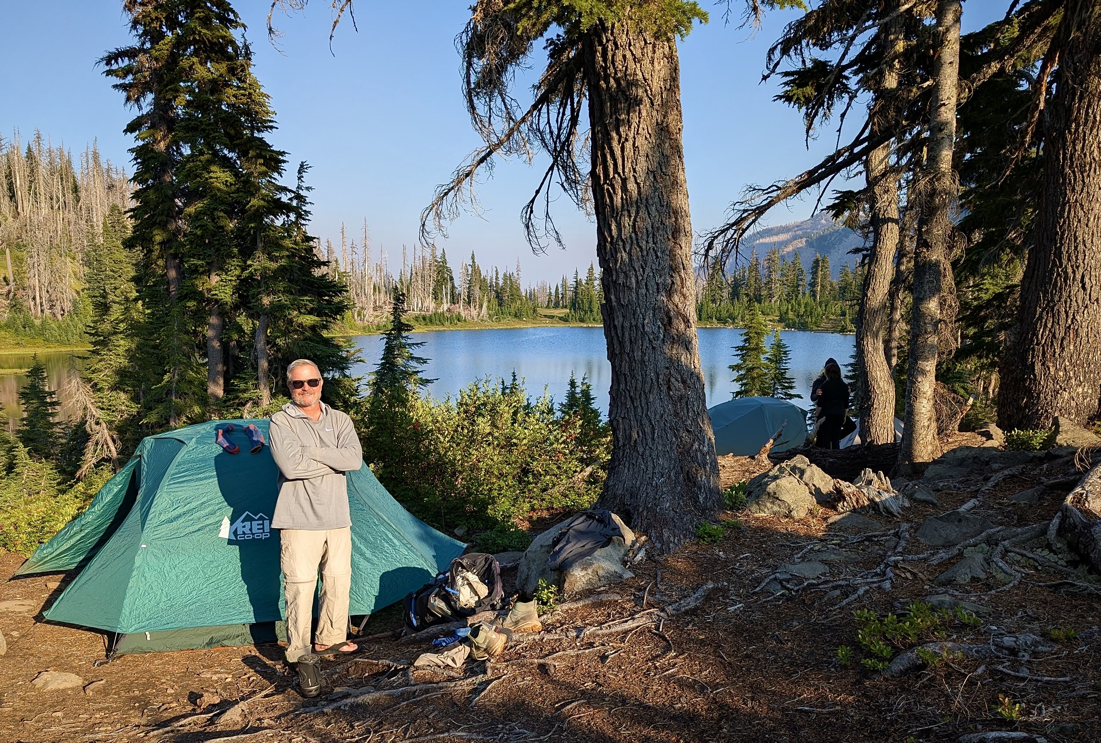
End of the Trail at Olallie Lake
So that is exactly what I did. I bid my expedition friends farewell and hauled butt. You would not think that I had ever struggled on the mountain. With new found exuberance I moved at PCT Through Hiker pace, almost running, lol! I jumped in my rig and was gone in a giant cloud of dust bouncing along the rugged jeep trail off to another type of adventure.
Pursuing Balance Through Adventure YouTube Channel Mount Jefferson Wilderness Finale CLICK THE PIC!
“True strength is not measured when you are at our strongest but when you are at your weakest.” – Rashad Evans
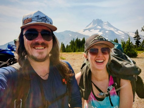
Anthony, Katie, Peggy & Dale
Our group of intrepid wanderers Anthony, Katie, Peggy, Dale, and I appreciate you FOLLOWING these episodes of ‘Pursuing Balance Through Adventure’ Oregon Hiking in the Mount Jefferson Wilderness. (Previous episode) Our adventure trail started in a forest of devastation, lifeless and charred by wildfire. It even began raining and I thought to myself this is not why I came to here, this sucks. Most of that first day we were surrounded by ugliness and hardship. But that struggle through the ravaged area brought us to one of the most beautiful places one could imagine. There were more of those days ahead for us on the journey, a balance of gorgeous and hideous. Lush, fertile forest balanced with blacken timber and scorched earth. Nature does not know good and evil and views wildfire started by lightning as a crucial step in renewal, adaptation and the maintaining of ecological balance. I write this Adventure Blog PBTA talking about Balance. This is just another type of Balance. The Balance of Nature. You can’t have a rainbow without a little rain. Forests need wildfire as hard as that is for me to digest. On this hike we got to see two extremes. All part of Natures plan. I will say the struggles that we experienced through spoiled forest and the physical struggles that I had at the beginning of the trip and that Dale had at the end of the trip- were worth it. We were stronger for it. We were able to experience something very special, something that most people do not get to. The journey although difficult for different reasons, was oh so glorious. The sublime portions were so marvelous. It was pay to play, but we were all winners. It is on to the next adventure so be sure to: LIKE, COMMENT, FOLLOW and SHARE. Please visit my Online SHOP APPARELfor top quality adventure wear that carries the mantra, the banner, the message, the logo: ‘Pursuing Balance Through Adventure’. Profound Experiences in Nature is what we seek to Balance ho hum everyday responsibility with thrilling escapades. The menu showcases the many locations that PBTA travels. Each location is a separate website and thus needs to be FOLLOWED independently.
41 miles, 7,014 elevation gain, 21 hours moving time, rated Moderate to Hard
Date: 8/25-30/25
Day 2: Park Ridge to Pamelia Lake
We survived the horrendous thunderstorm the night of ‘Mount Jefferson Wilderness, Day 1, that surprised us in the middle of the night on top of the Park Ridge. The rain came down in buckets with lightning bolts all around.
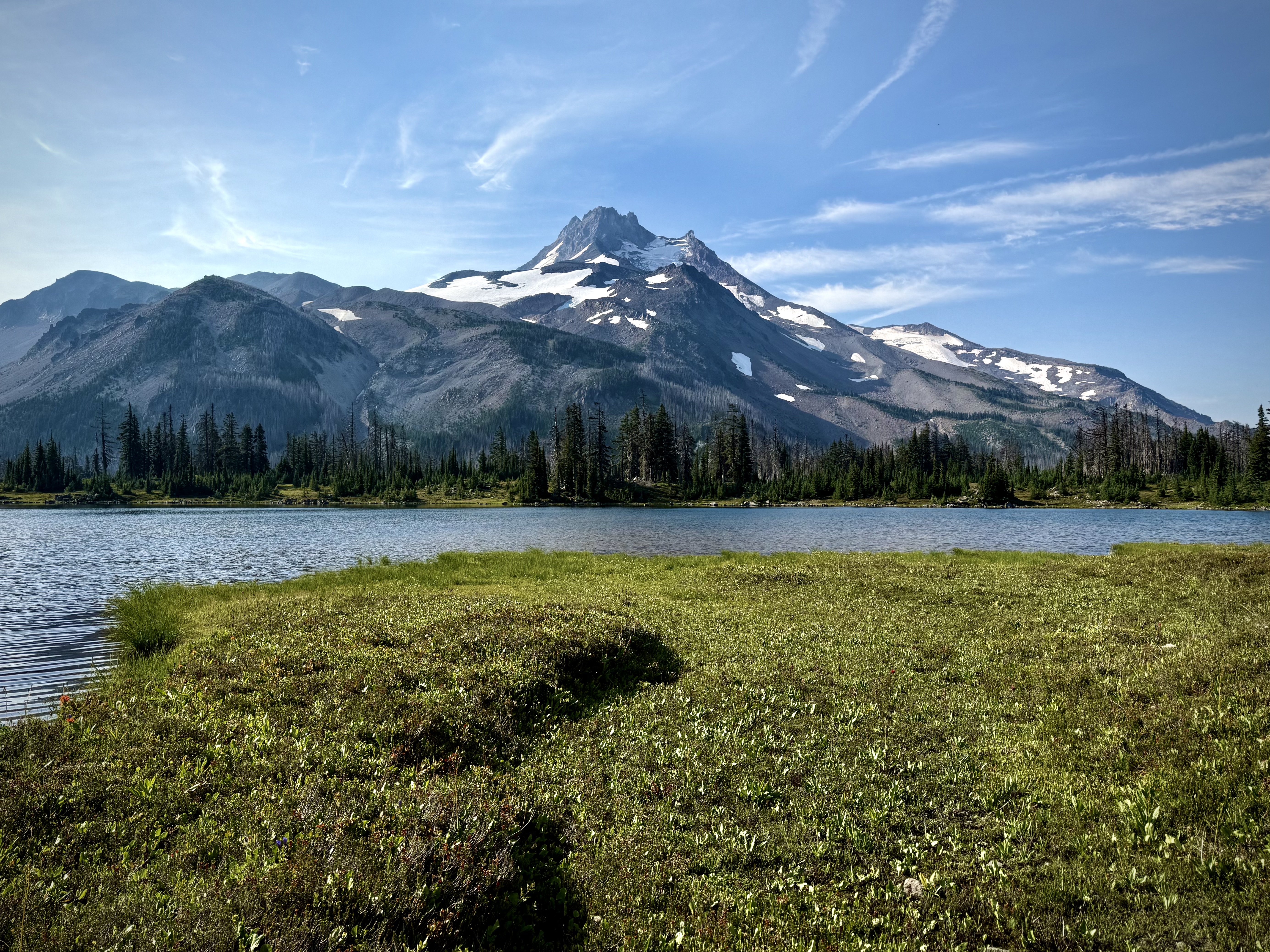
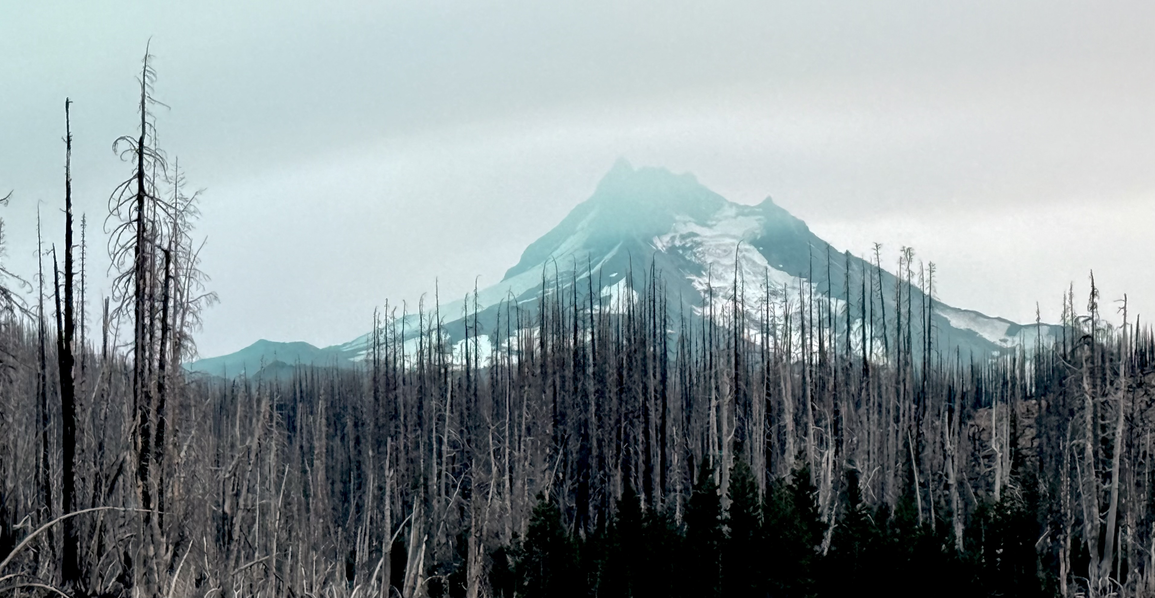
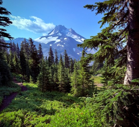
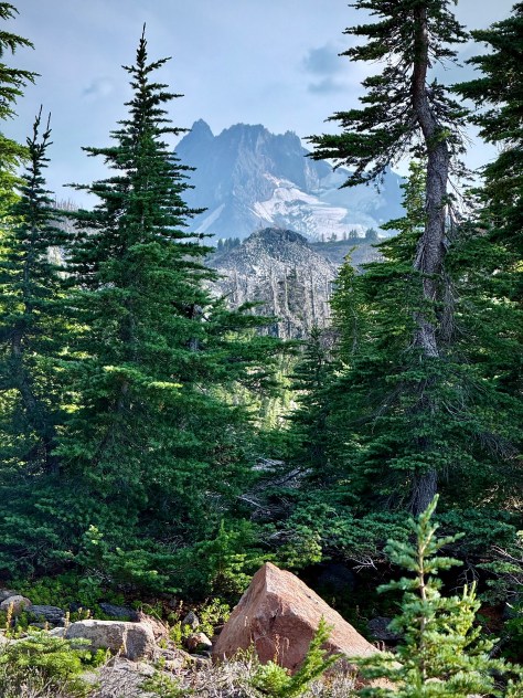
It was the dawning of a new day and there was that magnificent sight, Mount Jefferson, entrancing and bewitching us once again with it’s incredible beauty.
I decided since I was the one that was struggling with the demons of a heavy pack, not enough food and not enough nutrition, according to my trail mates, that I would set out early on my own. My own feelings of self doubt weighing heavy on my mind. Did I train hard enough? What is my frick’n problem? Why am I so slow compared to the others? Why am I struggling? We aren’t even at a high altitude for goodness sake. But of course I was headed downhill now so there was not the same strain and effort. So this day certainly felt better and less of an endeavor than the previous day. Plus the area was absolutely breathtaking from the marvelous views of Mount Jefferson to the thick lush forest that I was now traveling through. The others would not catch me on this part of the trek as I made my way down at a brisk clip enjoying nature and all her bounty.
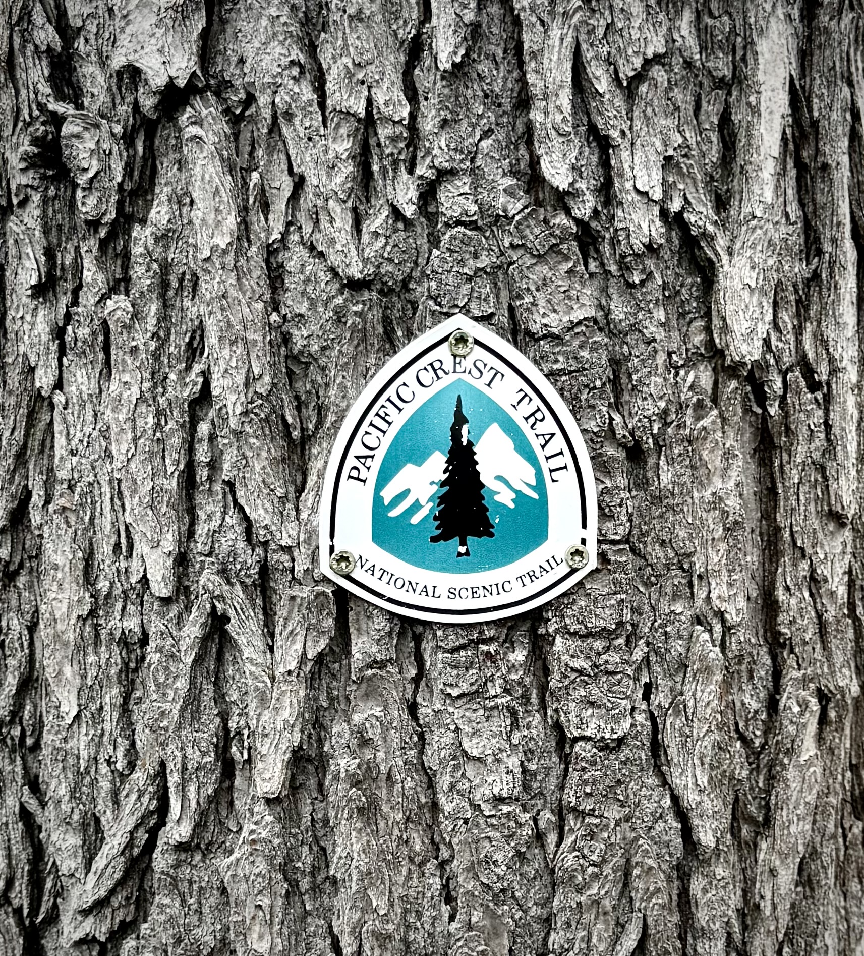
I passed different PCT Through Hikers coming from the opposite direction and chatted with them regarding the big storm of the night before. The first hiker recanted his experience regarding the extra miles he decided to push for. By the way these guys put in an heroic amount of miles each and everyday. This person said that he decided to continue to hike into the night. When he finally stopped he was exhausted and decided he would “Cowboy” it, meaning sleep out in the open without pitching his tent. In the middle of the night he started seeing glimpses of light and wondered who the Devil is flashing a flashlight to and fro? Then he realized that a big storm was a brewing. He hurriedly pitched his tent and got in just as the rain started pouring down. The funny thing is much later I came a couple of women PCT Hikers and they said that they heard thunder off in the distance, but experienced no rain at all. Obviously we are all in roughly the same area, but it seemed odd that the rain dumped on us up on the ridge, but these young women didn’t receive any precipitation down in the Park, weird. That just reinforces the thought that in the mountains all bets are off when it comes to weather. The mountains make their own weather, so always expect the unexpected. Hope for the best, prepare for the worst.
I made my way downhill through the forest and along a couple of alpine meadow open areas to our meet up spot far down below at Russell Lake.
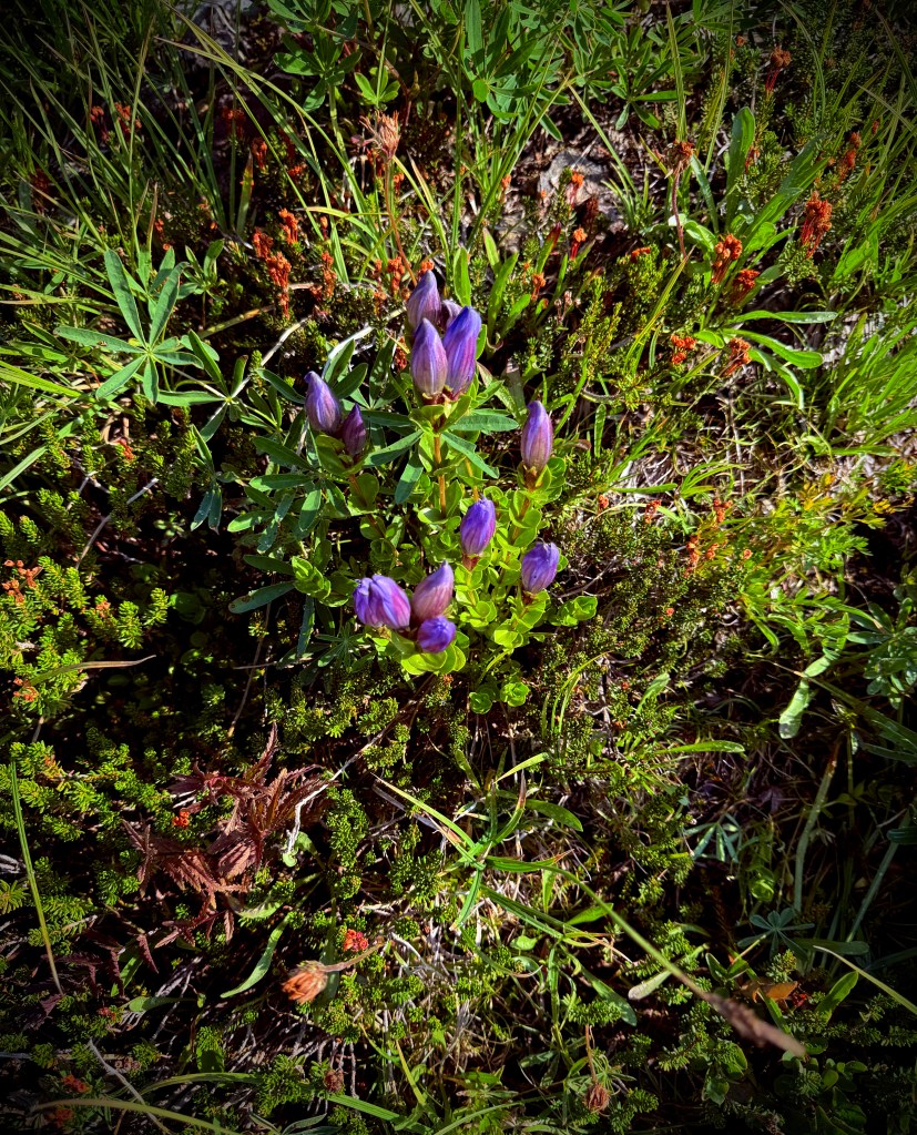
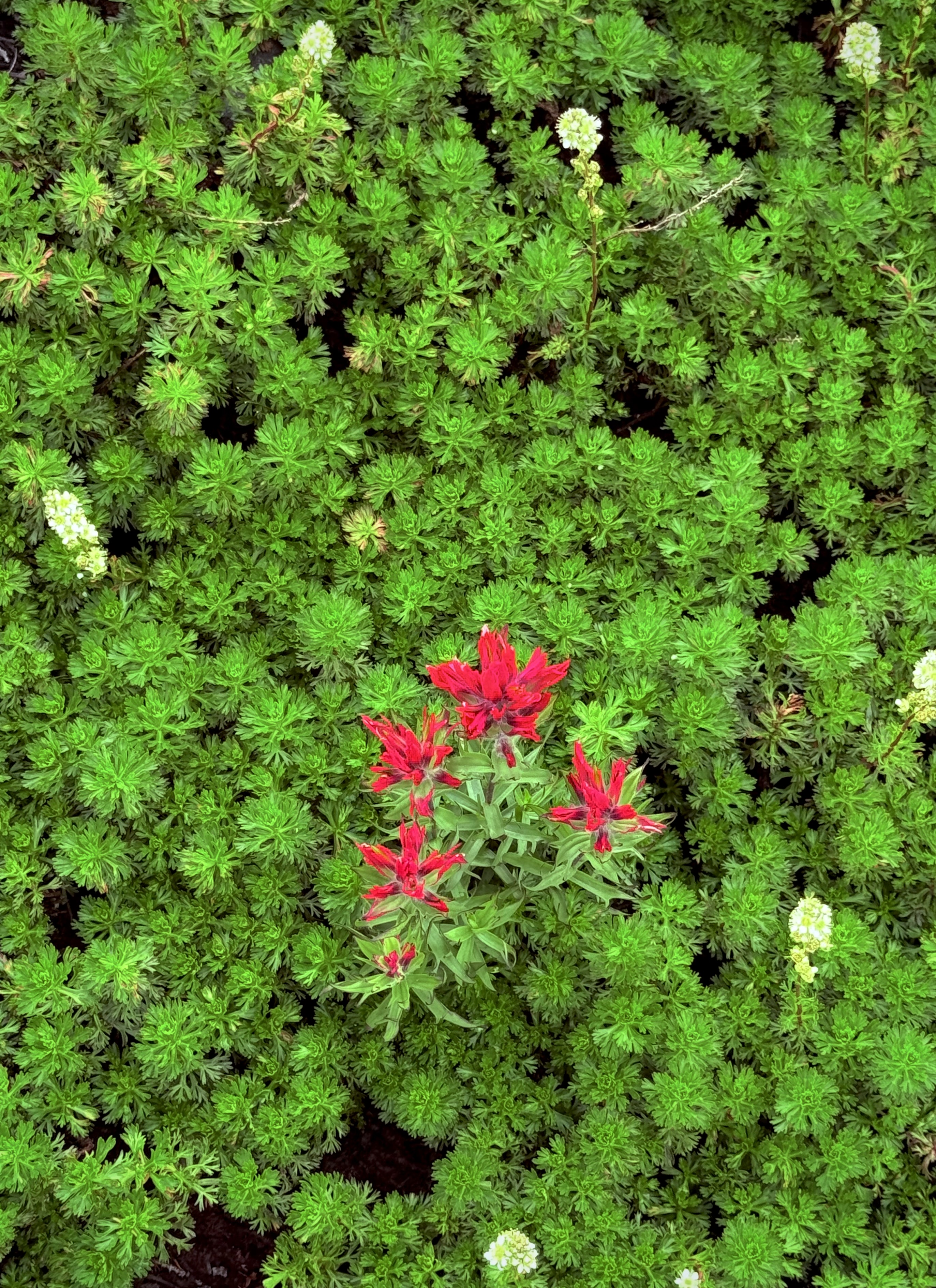
Wildflower Bouquet
I was glad to take off the heavy pack, enjoy the mountain and the wonderful little lake. While I was waiting for my friends to arrive I started chowing on wild blue berries and huckleberries. Oh my gosh, they were so good I could not stop!
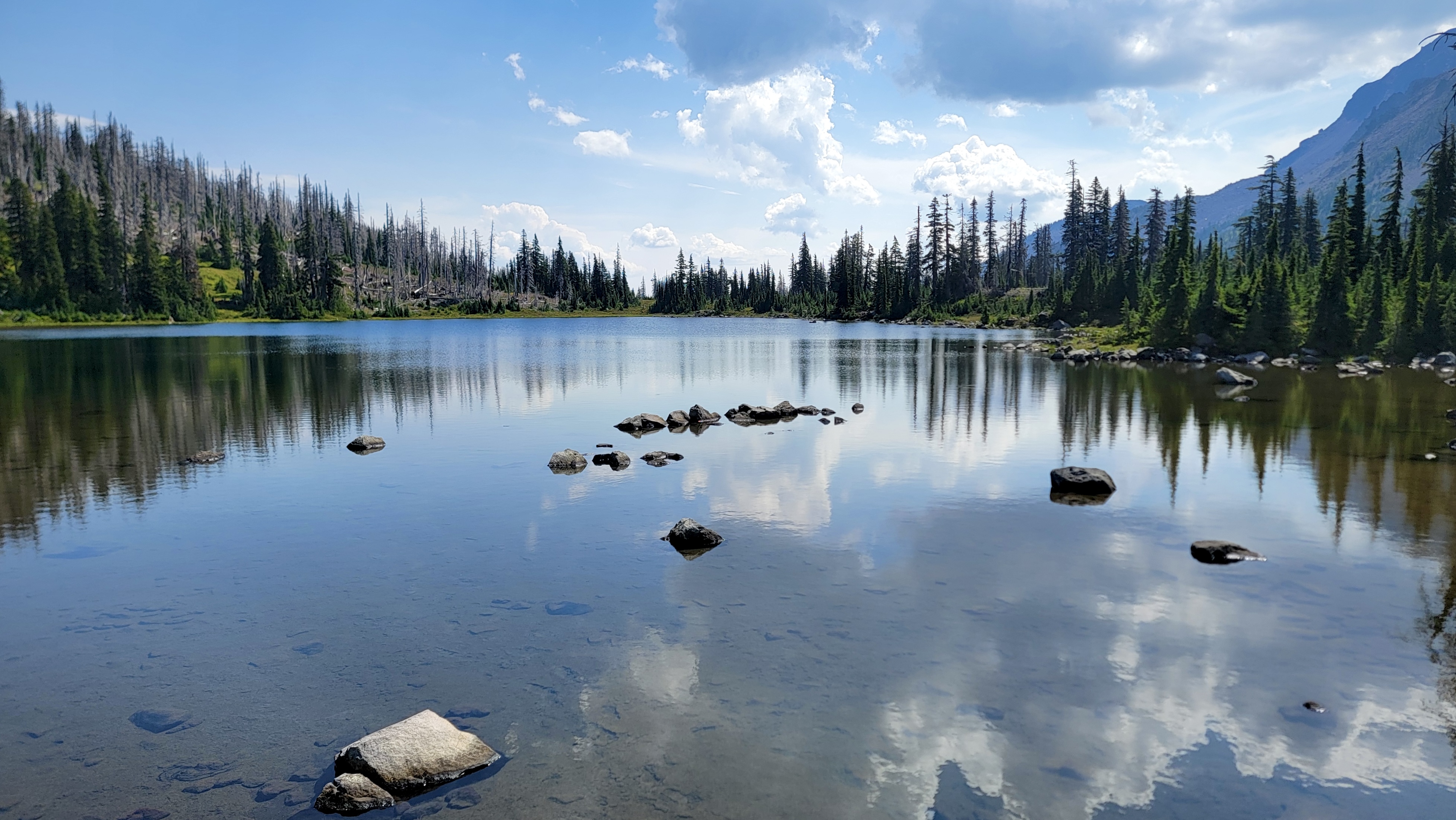
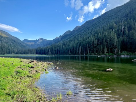
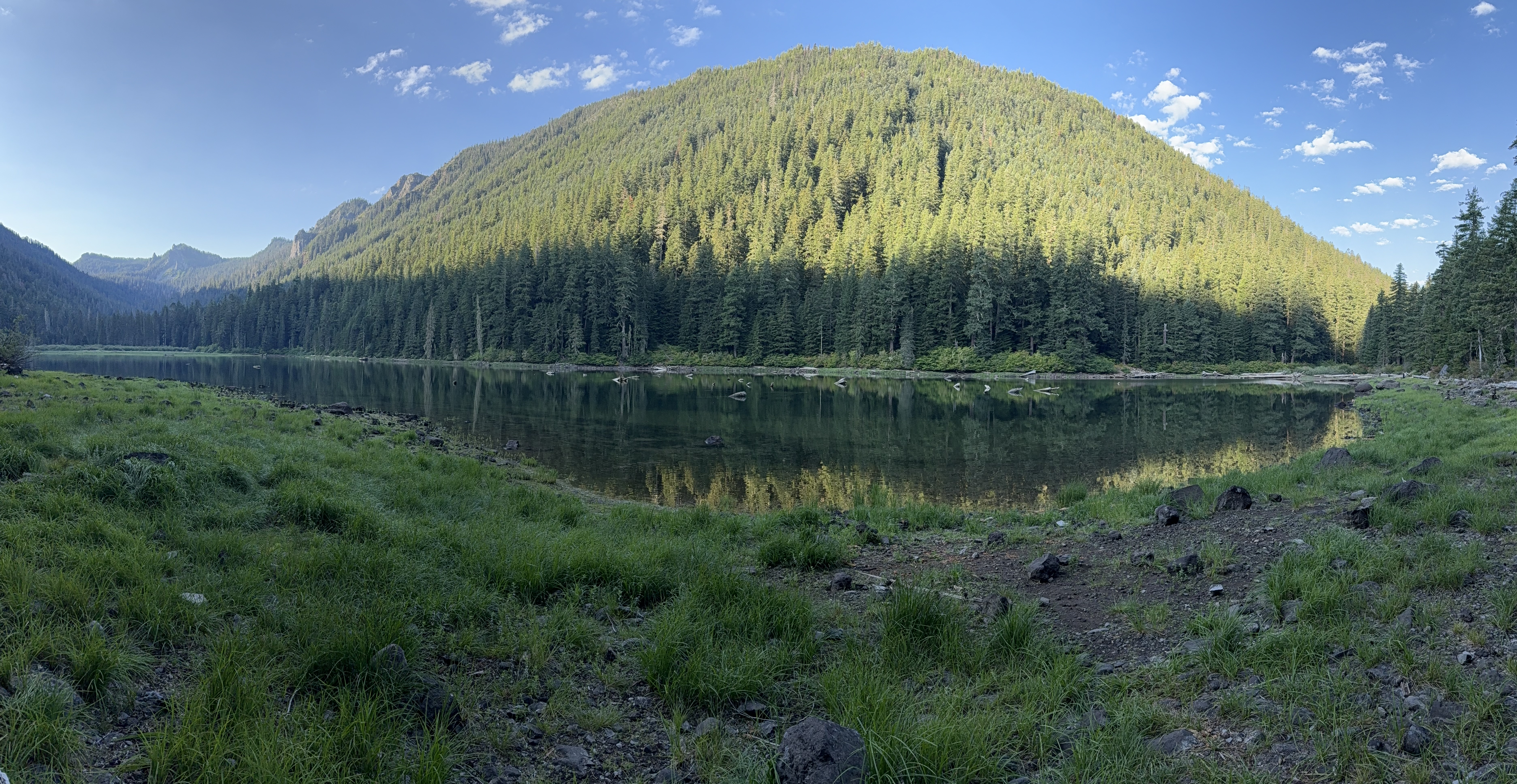
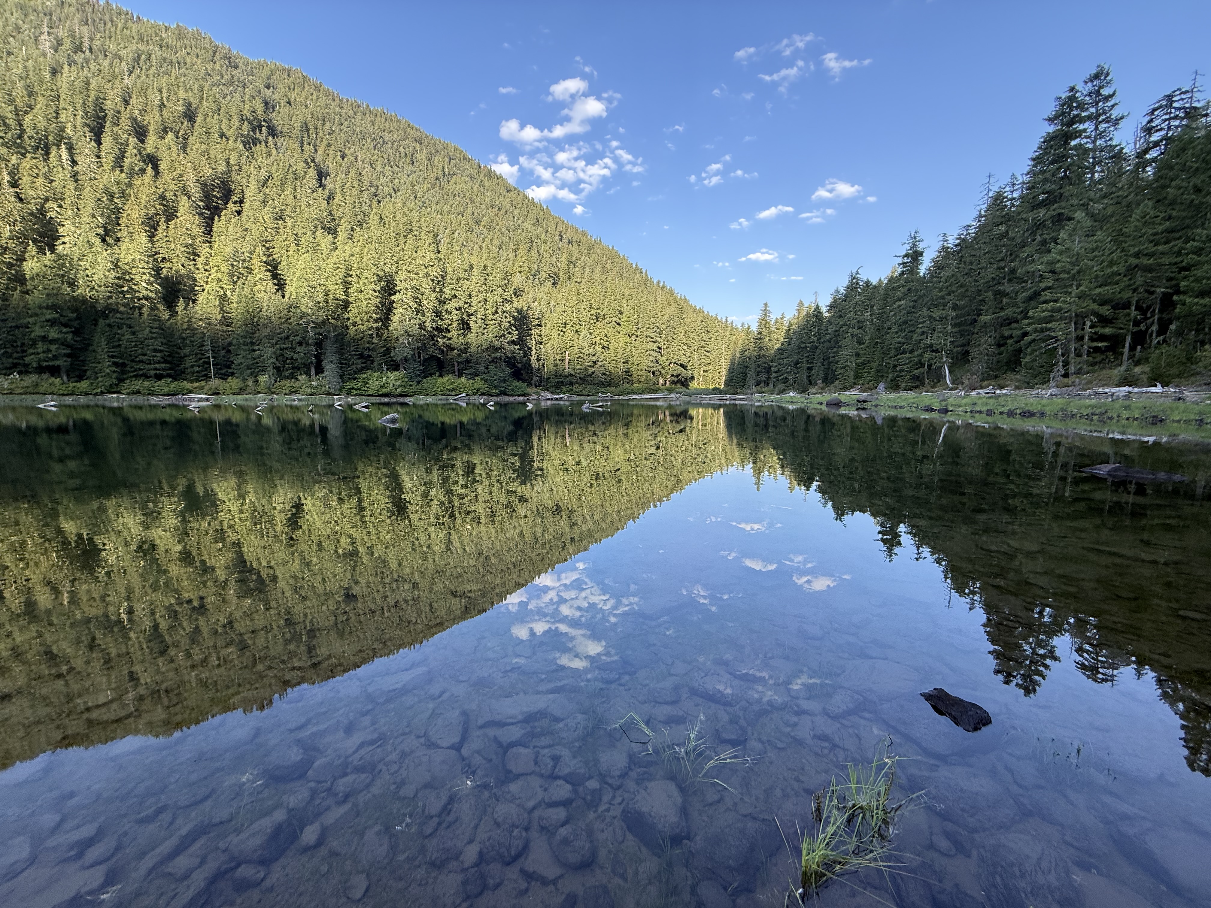
Russel Lake
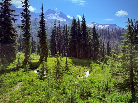
The lake and the mountain were superb. After everyone arrived we had a snack break and then hit the trail through the beautiful Mt. Jefferson Park, which was just incredible.
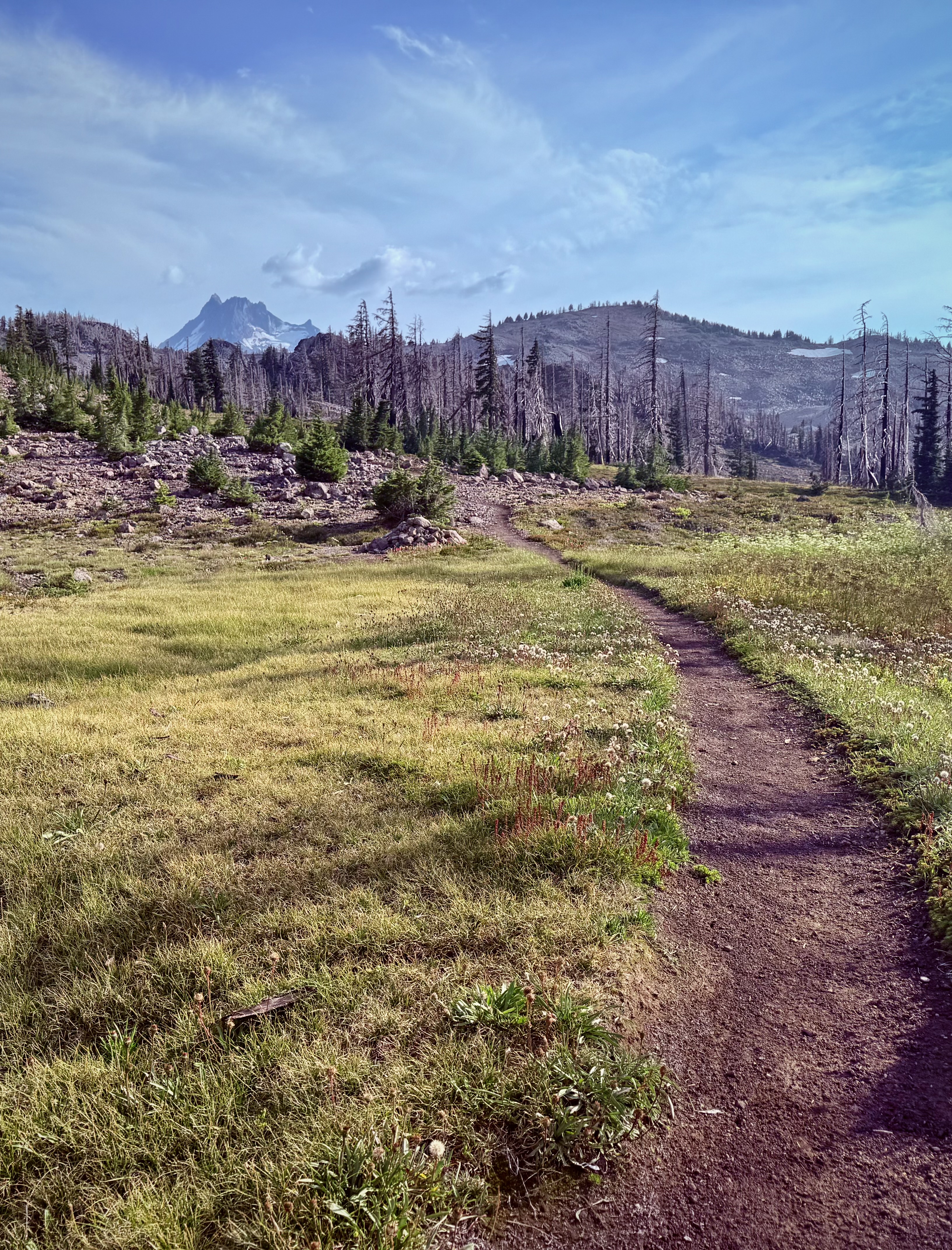
Mount Jefferson Park is a comparatively level garden of streams, subalpine meadows and little lakes with dazzling views at the base of epic Mount Jefferson, the second highest peak in the state of Oregon.
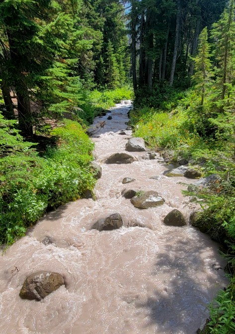
We crossed over a stream that seemed to be flowing with milk and honey. The aptly named “Whitewater Creek”. The chalky color is actually a fine silt mixed into the water coming down the mountain from the glacier. Not the place to be filtering water so it is important to plan accordingly.
Whitewater Creek
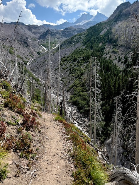
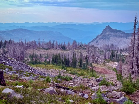
The next portion of the hike we did not really capture images of as it was just so disappointing. That segment was simply unbelievable devastation. The wildfire took out everything as far as the eye could see and we could see a longways from this sad vantage point. Every hill, every mountain, every valley, everything… just scarred dead timber.
Gorge Cut by Russell Creek
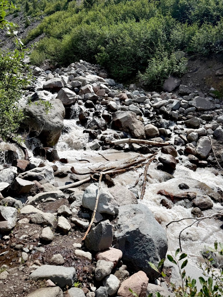
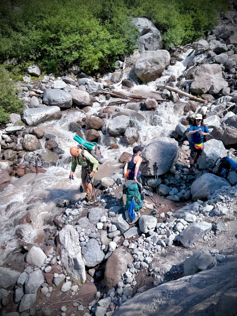
There were two water crossings of note. The first was Russell Creek. This stream section had fast moving water and was too wide to find boulders to hop across. We decided since this would be a significant event that we should all cross together. Anthony and Katie arrived first and a short time later I arrived.
We surveyed the situation and there was no easy way across. There were a three options. The first choice was near where we were resting, as we waited for team members Peggy and Dale, who were bringing up the rear. The first option had a thin log across a portion of the flow then transferred to a boulder and then onto another thin log, none of which seemed very secure. The next option was down stream a bit to maneuver a bundle of branches across the waterway that were soaked, partially in the water and wobbly. The group did not like either of those two choices of action.
Anthony despite being a 2xPCT accomplished hiker does not like heights, slippery surfaces on a slope such as snow or ice nor does he like fast moving water crossings. He will do them if he has to otherwise not to keen on the whole idea.
Sister Peggy is not to fond of water crossings either and was even considering not going further as most of that area was devastation anyway. She was privately thinking maybe just go back to beautiful Mt Jefferson Park.
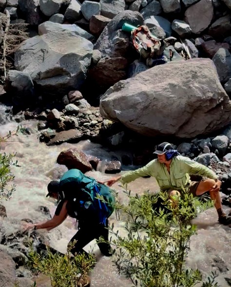
Dale an outdoorsman all of his life took the initiative and carefully made his way through the rushing water securing each step as he went and using his trekking poles to brace himself. Once across he gave instructions to the others. Anthony made a couple of attempts, but really did not like it so he was still deciding how he wanted to cross plus he wanted to make sure that Katie would be okay on the crossing. Dale anchoring himself by sitting down on a boulder partially in the water to give assistance with directions. Katie was next. Dale showed her the best spot and where to place her feet, informing her that the rocks were slippery. It was a little sketchy, but Dale reached out his hand and she was able to make a lunge at it and all went well. The others followed suit.
I hate to get my feet wet and will do just about anything to keep that from happening including taking on a little more risk. To many times I have suffered painful blisters from hiking in wet boots. I went back to the first option. The only one above the water. I took it one easy step at a time, sort of like a tight rope walker, the thin logs moved a bit as I went. A fall could mean possible injury and being swept by the water, certainly soaked along with everything in my pack. The pack makes such an endeavor all the more difficult by throwing off the balance a bit. It was a little nerve wracking, but I was successful. All just part of the adventure and I was the only one with dry feet.
The trek continued on through the scarred apocalyptic land of ruin. As usual our band of merry backpackers spread out due to age, fitness level, quest for solitude and so on. Anthony in the lead getting his Zen on, the youngster of the group Katie doing her best to stay in his same zip code. Peggy and Dale hiked with me for a good part of the day, but I finally told them to move along as I wanted to go at my own pace.
Peggy and Jimi the backpacking Vizla dog.
The last water crossing of any note, Milk Creek, cut through the forest, running down off of the mountain, but it was not that big of a deal and with a little rock hopping I was across. Yes, we were back to live, green, lush forest as we wrapped around toward the backside of Mount Jefferson.
Milk Creek
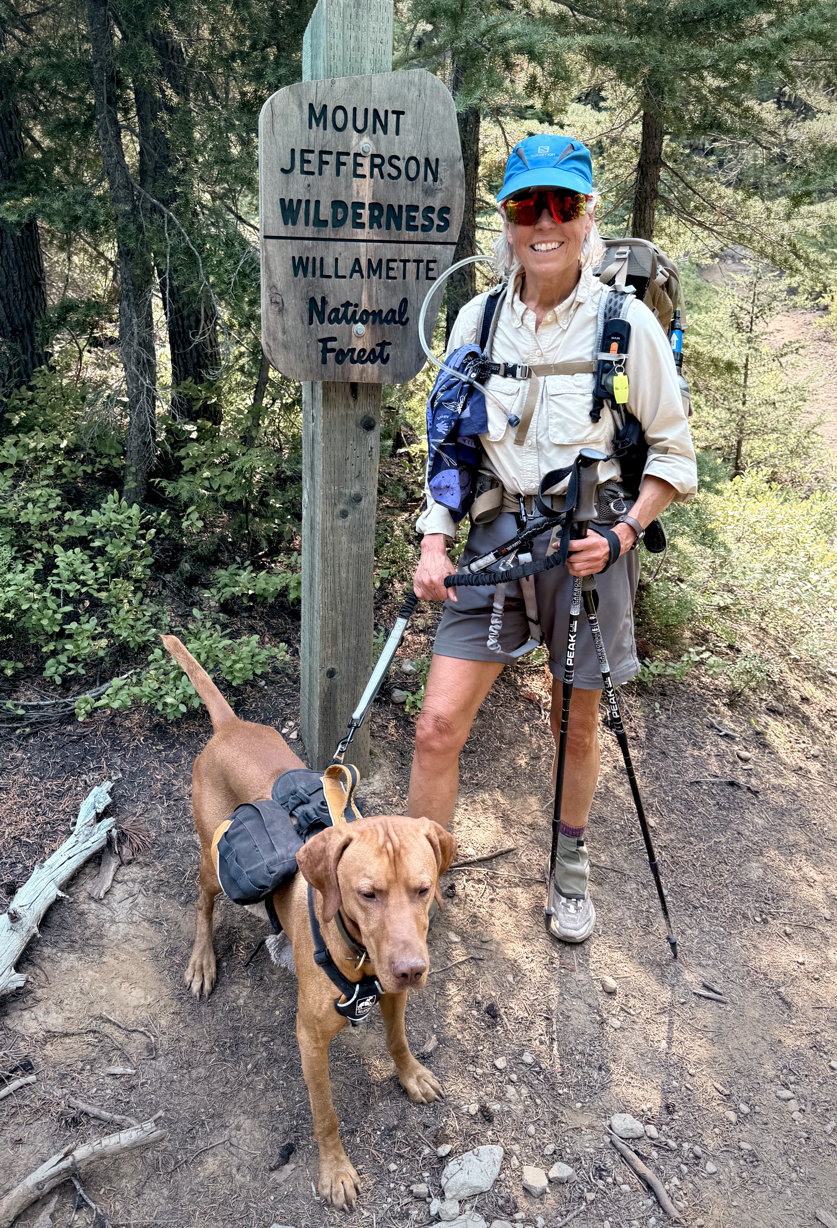
There was a junction where I found Peggy anxiously awaiting my arrival to not only check on me. She also wanted to ensure that I was well aware that we were now leaving the Pacific Crest Trail for Hunts Creek Trail which would bring us to our destination for the night Pamelia Lake. It was a rather insignificant trail that branched off and since I was fatigued it was quite handy that she was there, to be sure I was paying attention.
How pleasant the hike became at that point as we were in the sort of environment that PNW forests are known for big, bountiful and beautiful fir trees. We made our way to Pamelia Lake where we saw some other folks enjoying camping by a lovely alpine lake. We knew that Anthony would be searching for just the right spot. We made our way through the thick woodland along the banks of the pretty lake. On our side of the lake was thick forest the same for the other side other than that backdrop was steep mountainside leading up Grizzly Peak.
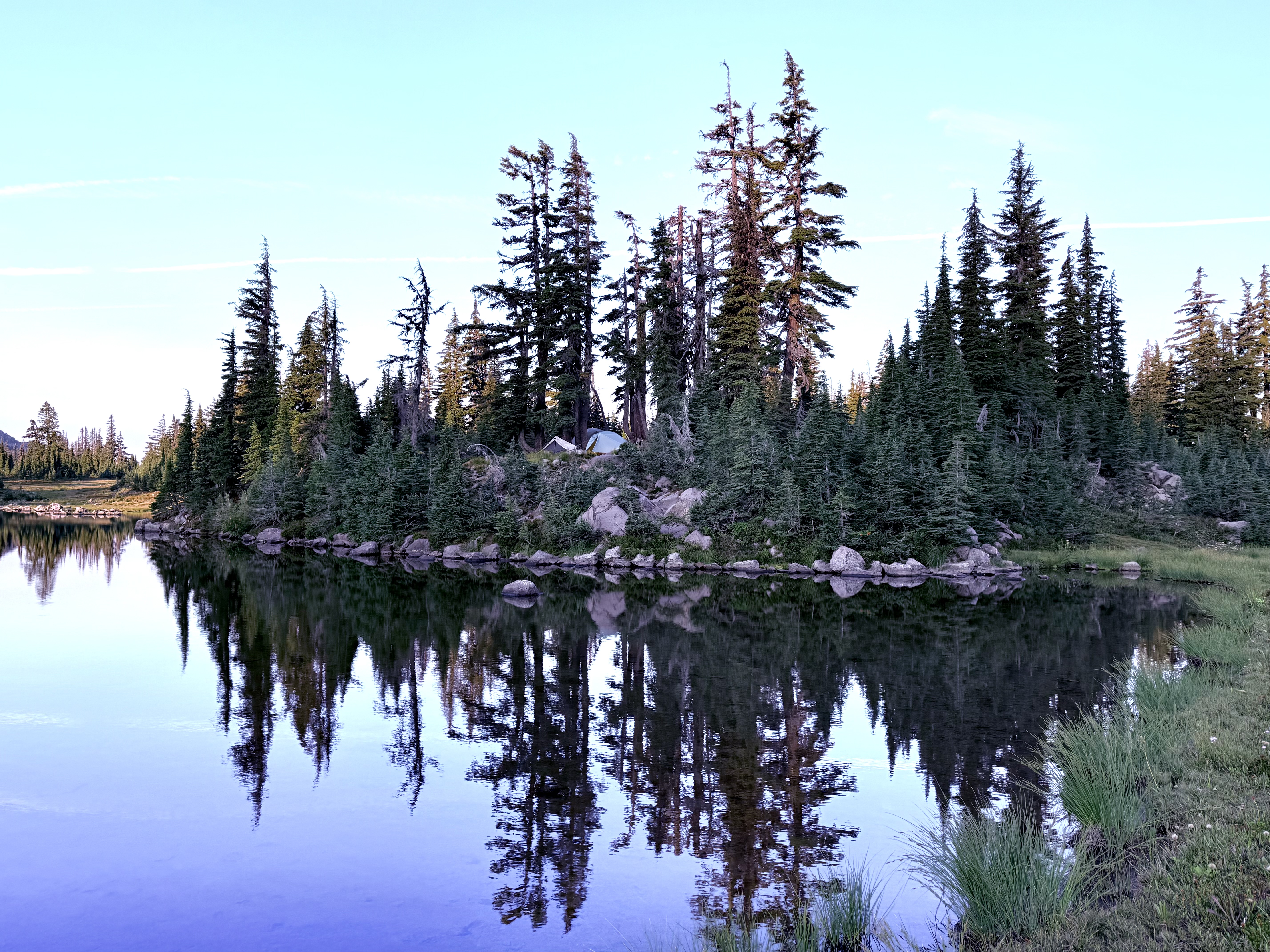
Pamelia Lake
We discovered our friends busy as beavers. They found some wonderful camp spots for us. We then did all of the usual things pitched our tents, filtered water, washed up a bit in the lake, cooked up some grub and just enjoyed each other and our splendid surroundings.
One thing that I remember about this spot was having to pee in the middle of the night. The forest canopy was so thick that the night was a black as coal. Usually when camping you can exit your tent and it would be much lighter, there would be moonlight, starlight and just atmospheric light, but the thick trees made it just pitch black forest. You could barely see the hand in front of your face. Luckily I found my tent, climbed into my sleeping bag and slumbered off into dream land, which was exactly where we were- a land of dreams.
Pursuing Balance Through Adventure YouTube Channel Mount Jefferson Wilderness, Day 2 CLICK THE PIC!
“What a blessing it is to be tired in the pursuit of a challenge of your own choosing.”
Anthony, Katie, Peggy & Dale
Anthony, Katie, Peggy, Dale, and I sincerely appreciate you taking the time to be ‘Pursing Balance Through Adventure’ with us in the MOUNT JEFFERSON WILDERNESS. One of the most beautiful and at the same time one of the saddest places to be. Immense natural beauty coupled with massive wildfire destruction and ugliness. The huge thunderstorm passed and we awoke to the dawning of a new day in a place so beautiful it was almost unimaginable. The mountain called to us, captivated us. Colossal, phenomenal, outstanding all seem pale as descriptive words to recount what we experienced. After we moved through the incredible area known as Mount Jefferson Park it wasn’t long before we were back to scarred land. It was more difficult to withstand on this day because unlike the day before where at least we had some refuge in sections of forest untouched by the devastation, it was just relentless on this day. As far as the eye could see what was once remarkable was no more. This was not the Balance that I was seeking where beauty was balanced with ugly, good was balanced with evil, but this was the way… Natures way, lightning caused the wildfire that wiped out virgin forest, now it must literally rise from the ashes. It’s natures way of renewal, but it is brutal. Once we closed in on Pamelia Lake, our destination for the night, we were back to forest big beautiful healthy forest. Good with the Bad… There is much more to share of our Mount Jefferson Wilderness Adventure. (Here is Day 3) Stay with us for more mountain trekking all you have to do is: LIKE, COMMENT, FOLLOW and SHARE. Don’t forget to visit my Online SHOP APPARELfor top quality adventure wear that carries the mantra, the banner, the message, the logo: ‘Pursuing Balance Through Adventure’. Profound Experiences in Nature is what we seek to Balance home/work life with peace and harmony. The menu showcases the many locations that PBTA travels. Each location is a separate website and thus needs to be FOLLOWED independently.
41 miles, 7,014 elevation gain, 21 hours moving time, rated Moderate to Hard
Date: 8/25-30/25
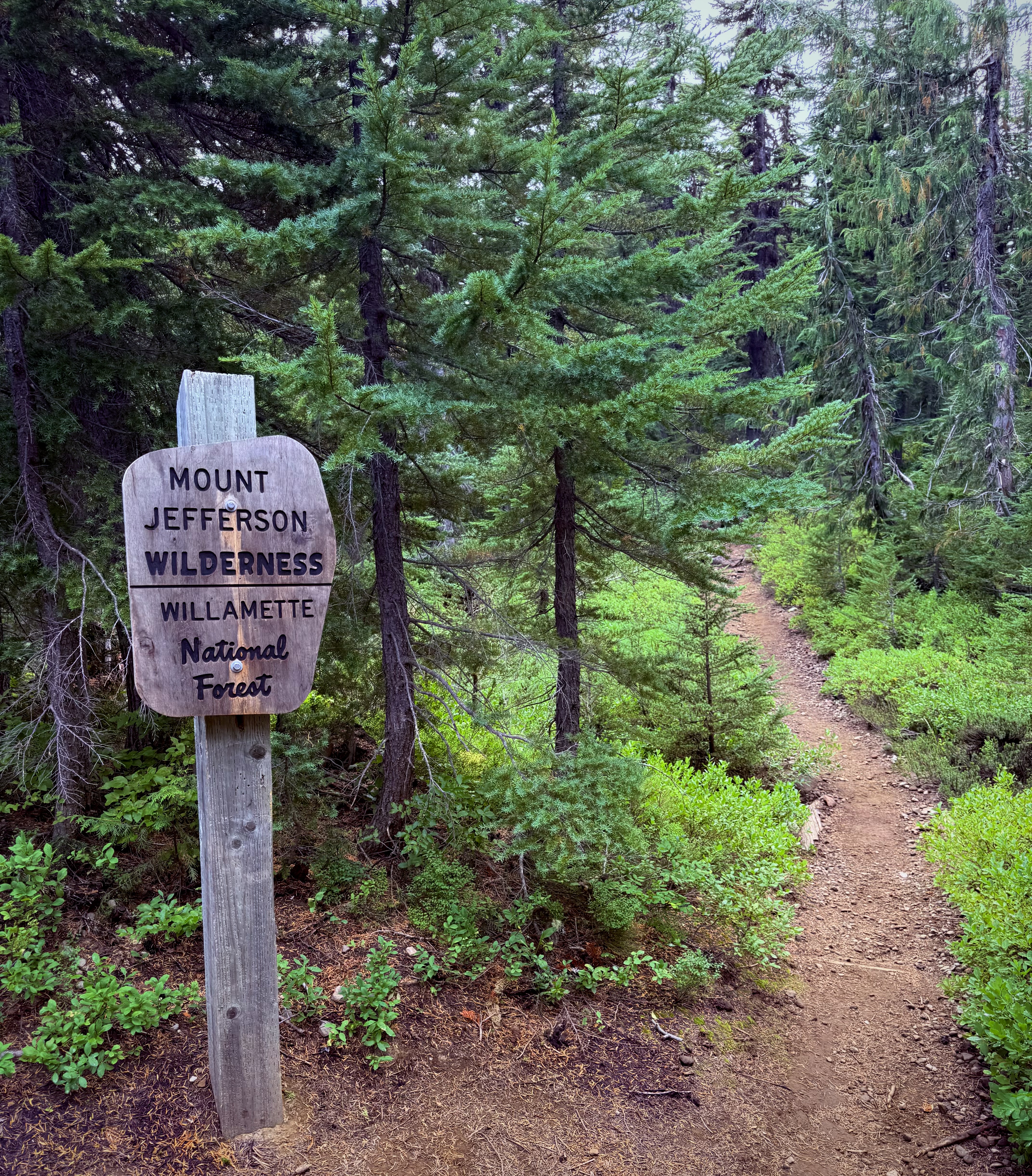
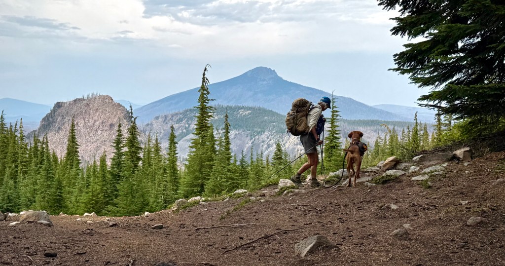
Day 1: Olallie Lake to Park Ridge
After a night of reunion and getting to know new friends, morning had dawned and it was time to hit the dusty trail, in this case it was ashy. Soon as we moved away from Olallie Lake, traveling along the Pacific Crest Trail, we were in wildfire devastation. It seems nowadays it is difficult to find beautiful hiking areas that are untouched by wildfire.
This place of great grandeur and natural splendor was now laid waste, ravaged by wildfire caused by lightning strikes 5 years prior. Our friend and team leader, PCT Through Hiker Veteran Anthony, had longed to get back to the place, something that he wished to share with us. However, this was not the woodlands that he remembered. We had been forewarned of the damage, but until you see it with your own eyes it is hard to fathom the ruin.
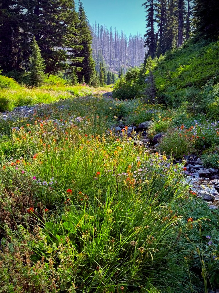
First life after devastation, Fire Weed.
On we pushed even though it was heartbreaking. Adding insult to injury it started to rain. I couldn’t help myself, mind drifting off, as we trudged on through the charred timber, to a rather dark place as the rain ran down my face like tears of sorrow for this once pristine forest. What am I doing here? This is surely not what I had in mind when I thought of Oregon and it’s most beautiful forests, mountains, and streams. Hour after hour of nothing but apocalypse.
Pond brings life back to total destruction.
As you will see from the pictures I display, I concentrated on the beauty rather than the beast. It felt like a struggle between Darkness and Beauty. It seemed that we were forced to take the Good with the Bad.
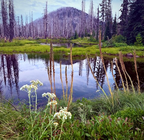
Later in the day we would come across a green area, a sweet little oasis in this desert of destruction somehow spared the catastrophic fire event.
I worked hard to celebrate this break and feel the joy of this tiny island of life.
Peggy and her Vizla pal Jimi
But it was not long until we stepped back into an ocean of ravaged landscape.
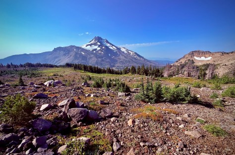
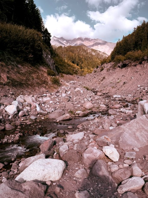
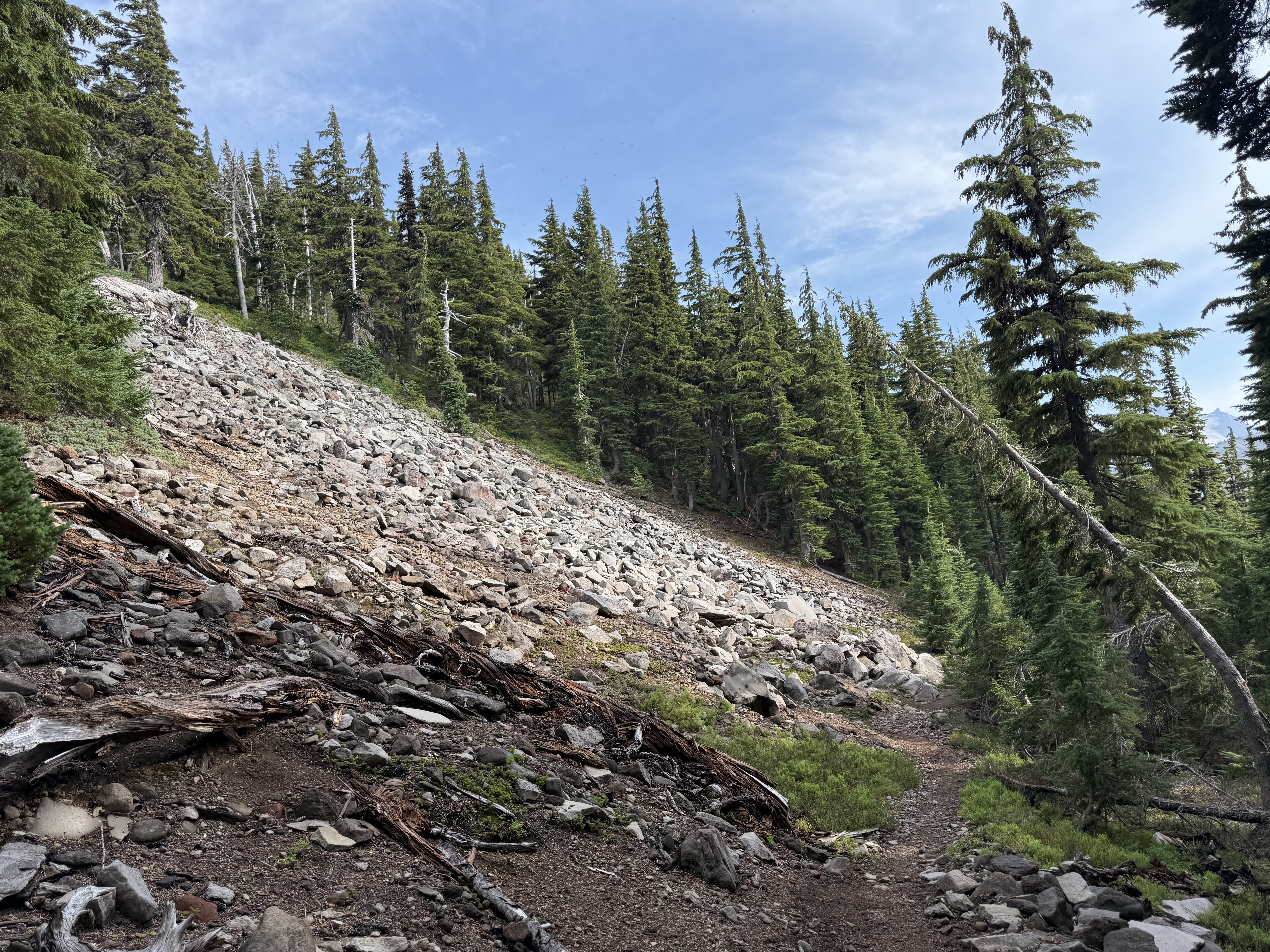
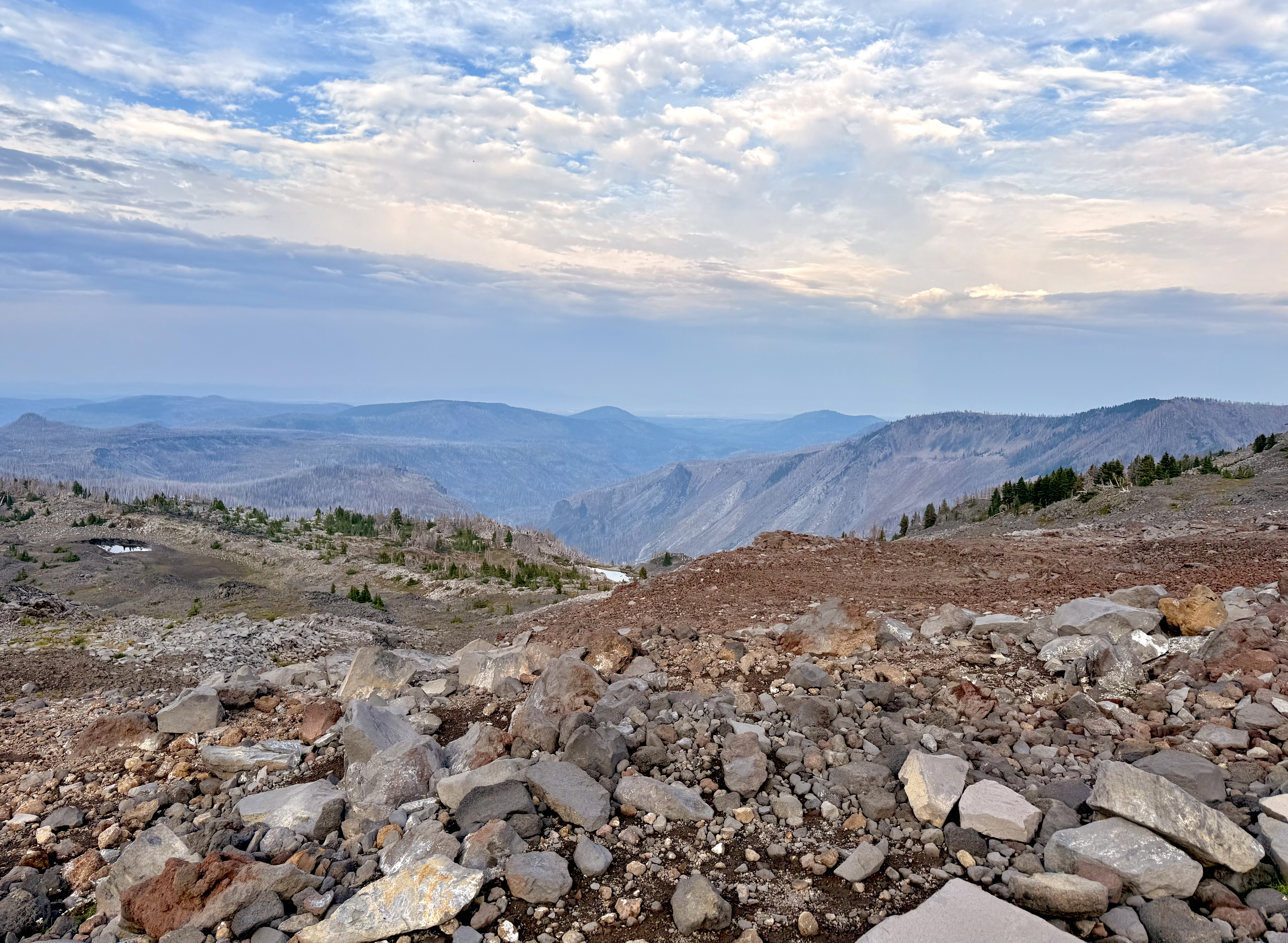
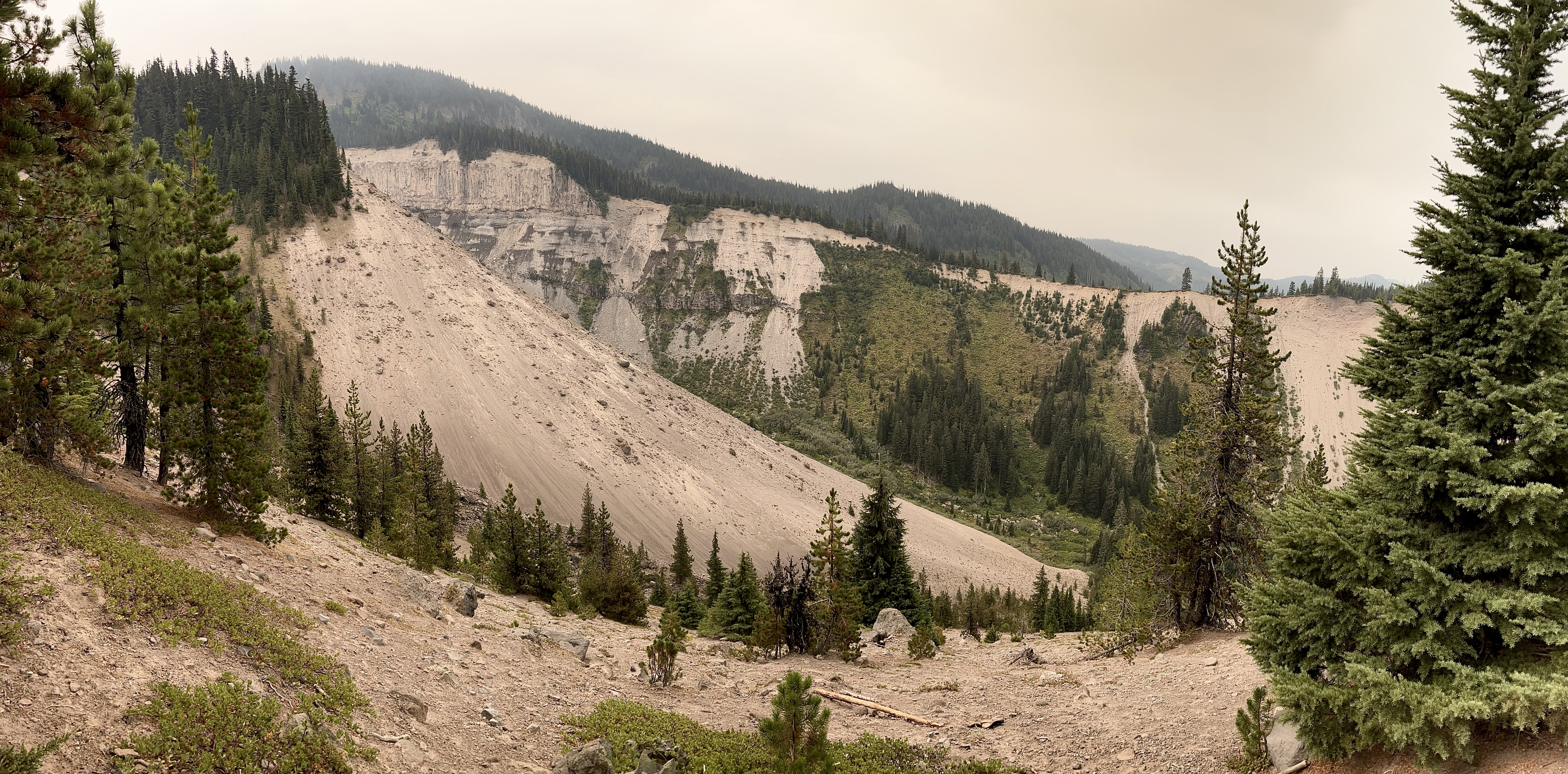
We moved on into a different ecosystem as we climbed to higher altitudes, less forest lands and more sand, grit, and rock.
We were headed for the ridge line. That is where we would camp for the evening. It had been a long, and for me an exhausting day. My pack weighed heavy on my back and the destruction of immaculate wilderness weighed heavy on my mind. Both of which were making this drudgery. My pace was labored, slower than the rest, I suffer from Altitude Sickness, however we were not at the high altitude that would bring that sort of thing on. This led to discussions and nitpicking of how much I carry in my pack, maybe I should go ultra-light, perhaps I should eat more and higher quality foods while hiking. I started doubting my preparation. I trained pretty hard and even tried to work my way up to this epic event with increasingly difficult hiking and backpacking, but perhaps I should have trained even more? The answer escaped me. Perhaps it is as simple as the struggle leads to a deeper appreciation of the gain.
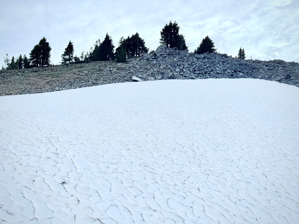
Crossing the snow field
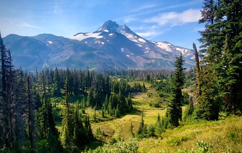
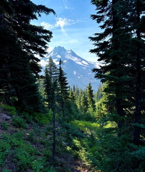
So when we crested the ridge adorned in the greenery of higher altitude type trees and brush and then…
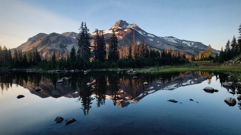
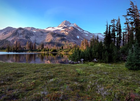
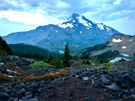
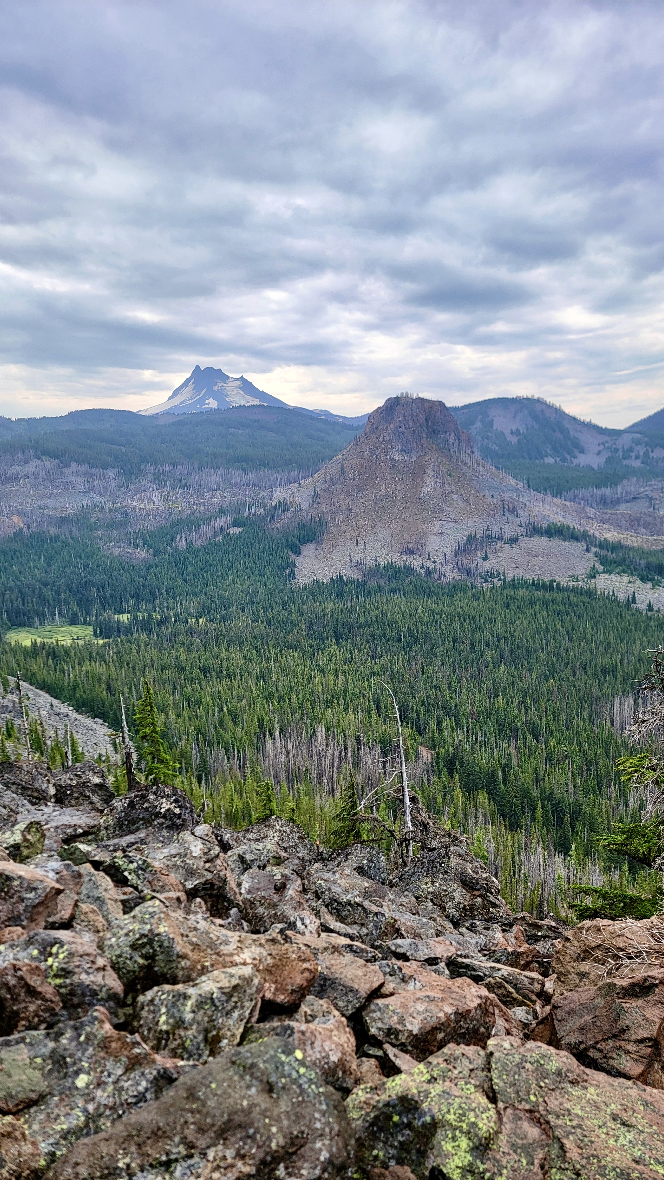
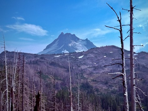
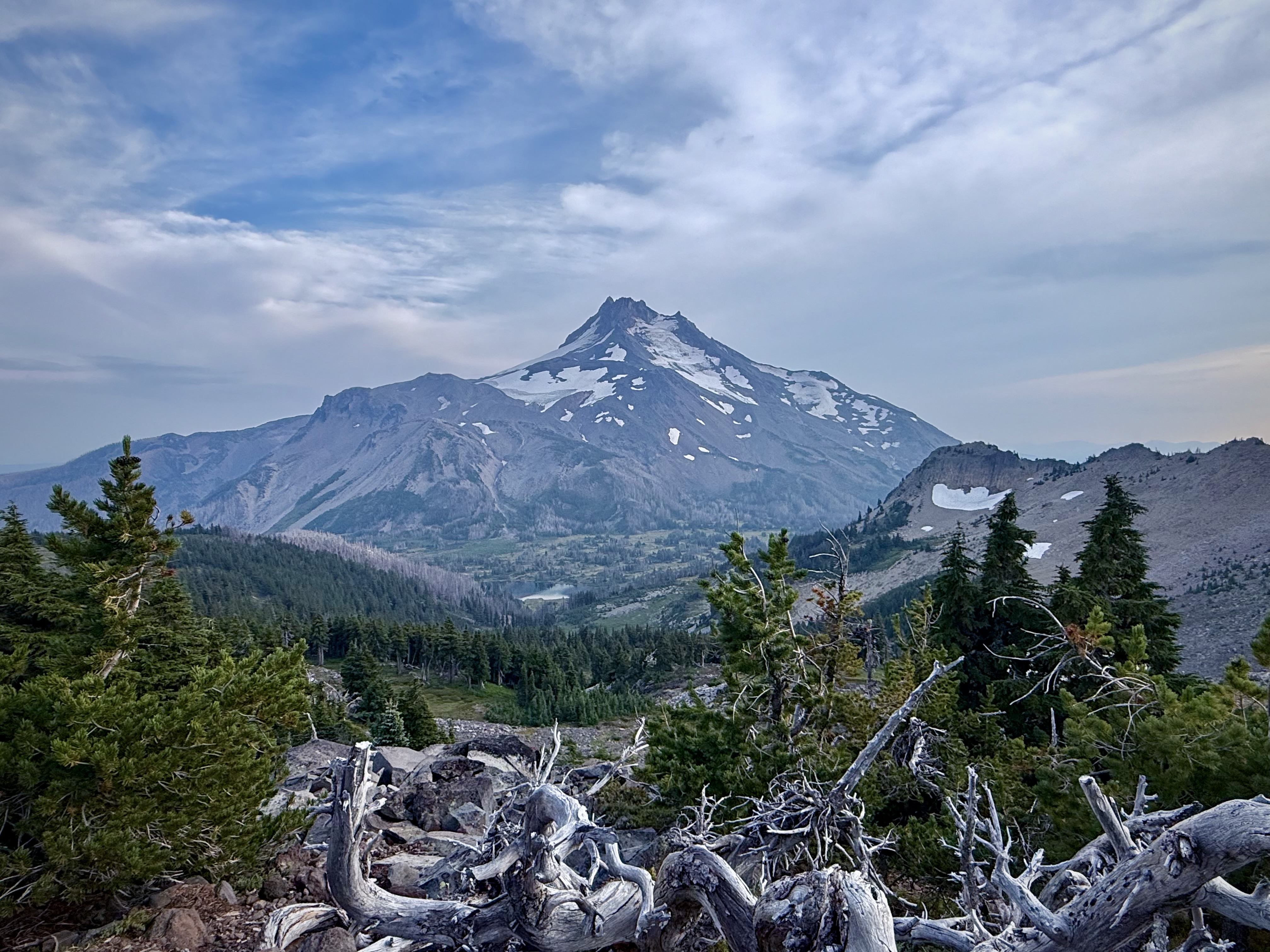
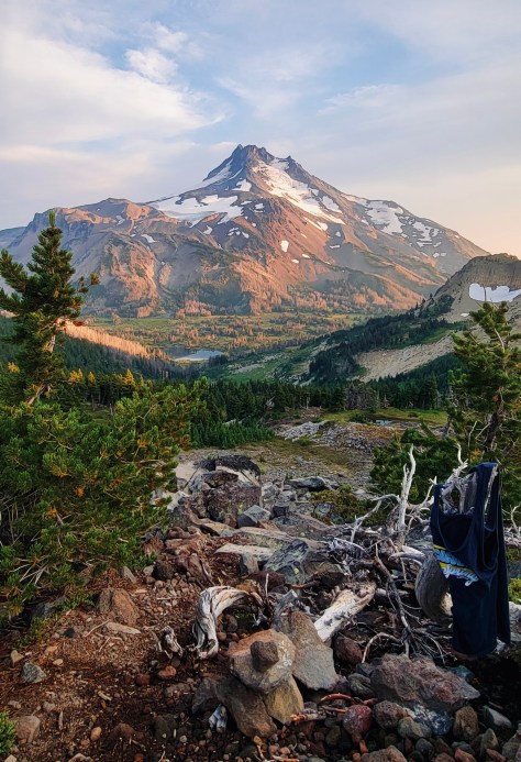
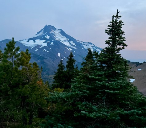
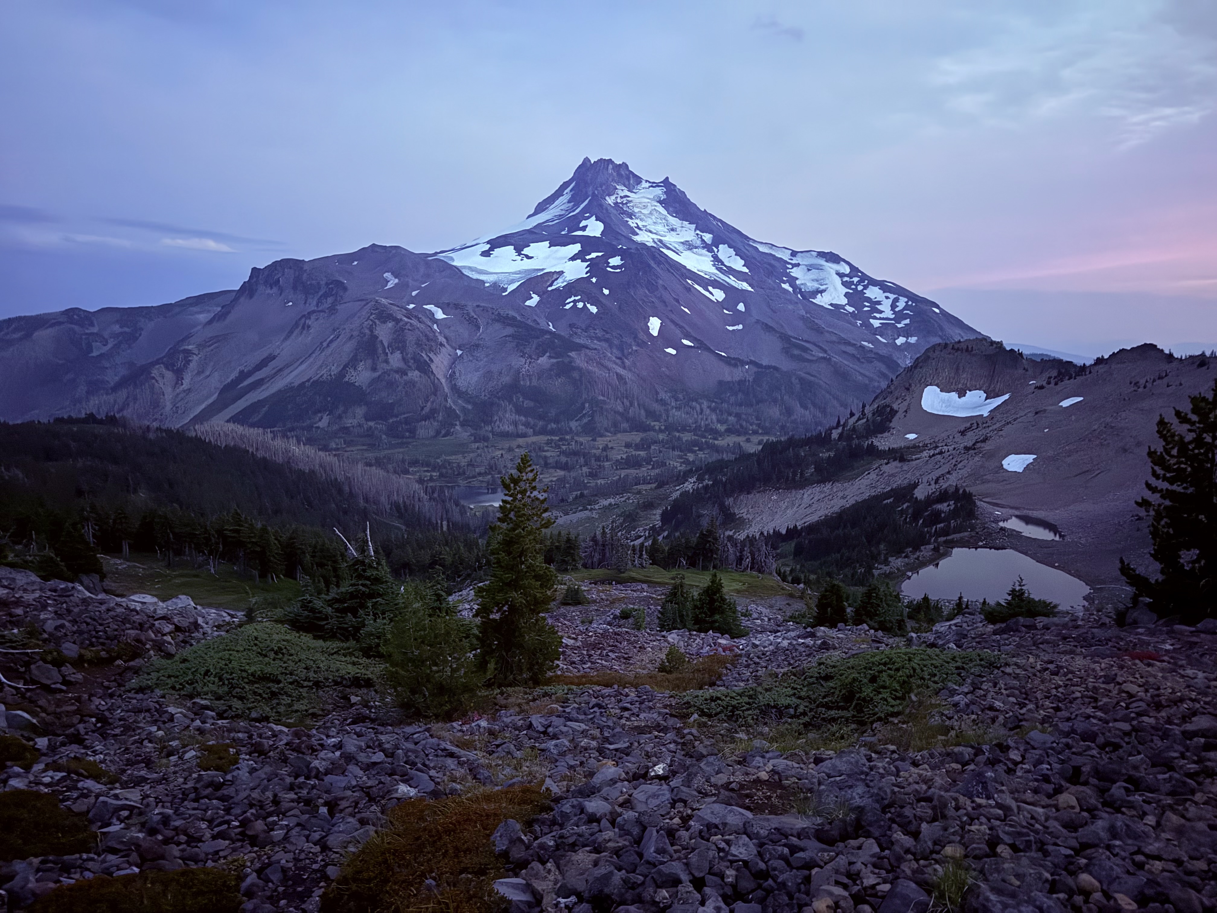
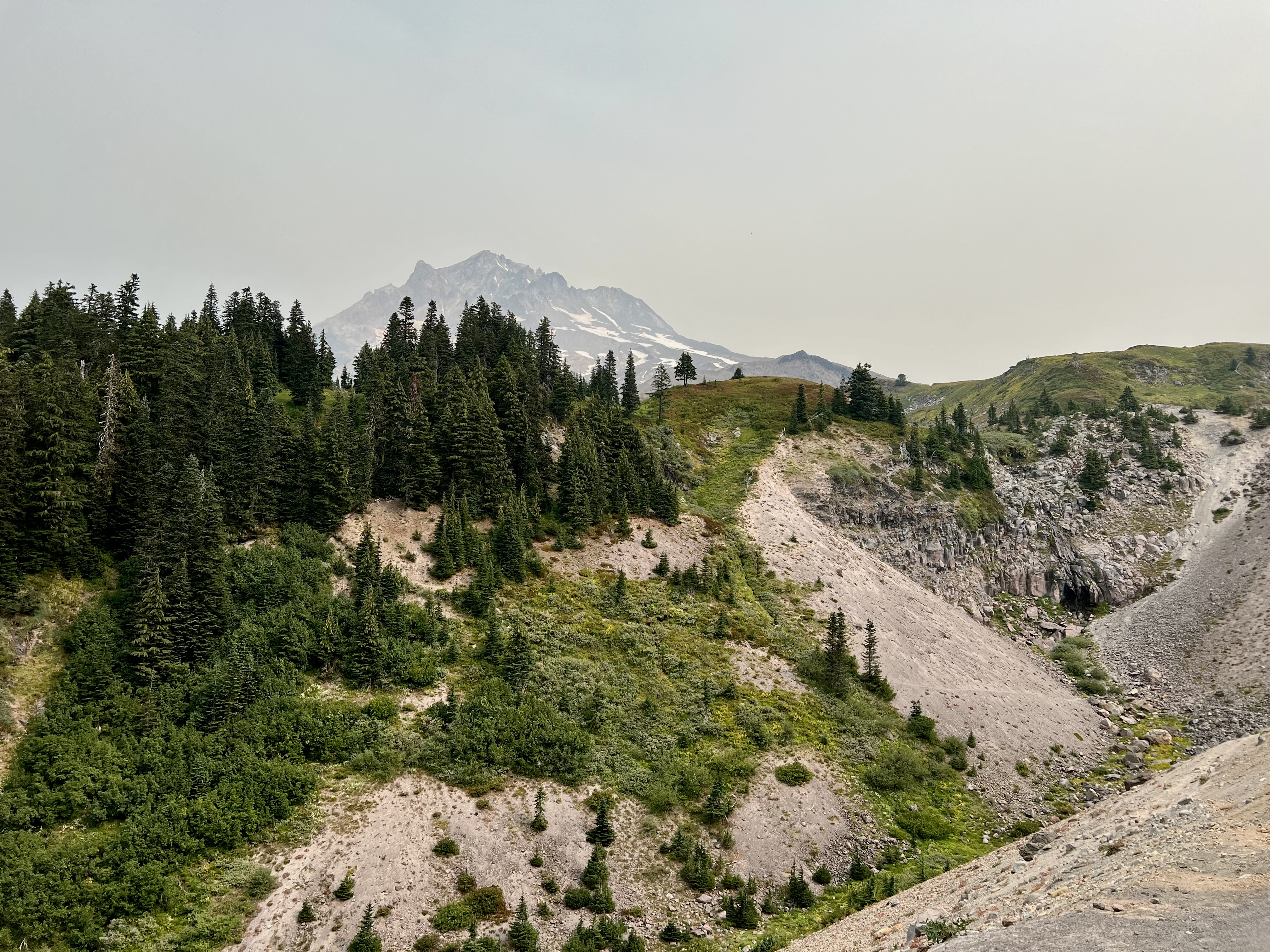
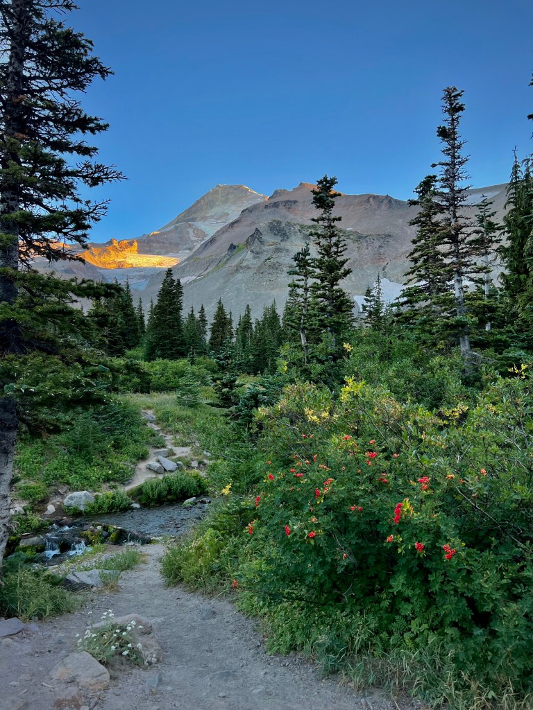
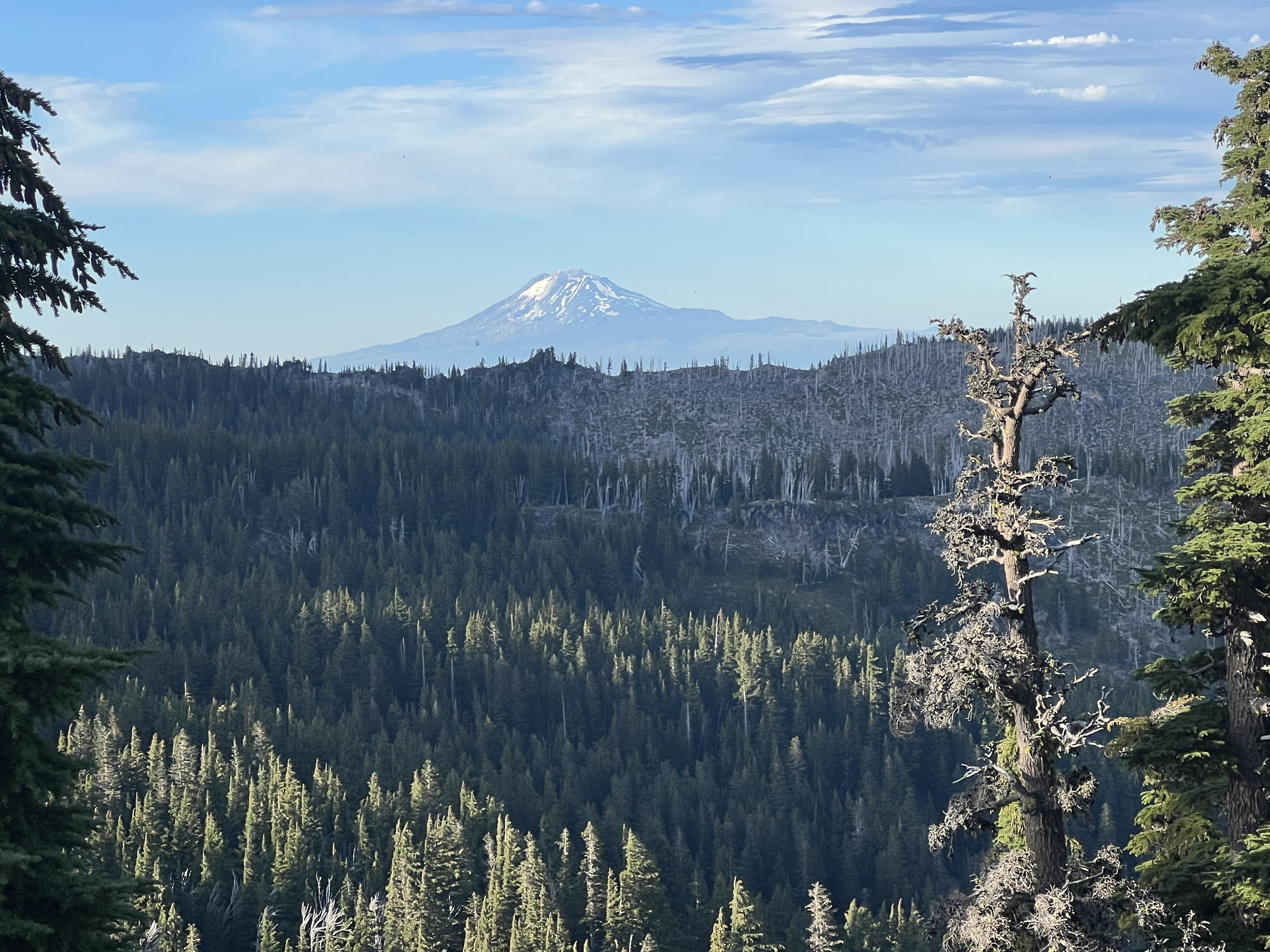
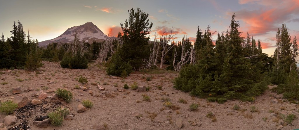
BEHOLD Mount Jefferson like a heavenly vision. It was magnificent!
We had paid so dearly slinking through the ugliness of destruction to now stand in the presence of glory. Wow, just wow! It was stunning the complete polar opposite of what we had been experiencing throughout the day. It was a very moving sight. What a place to call home for the night.
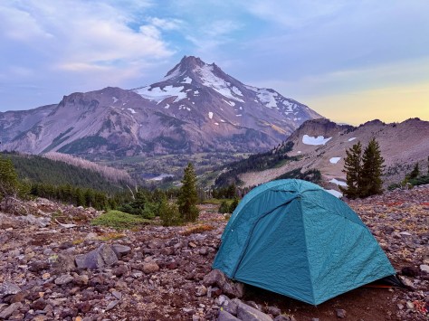
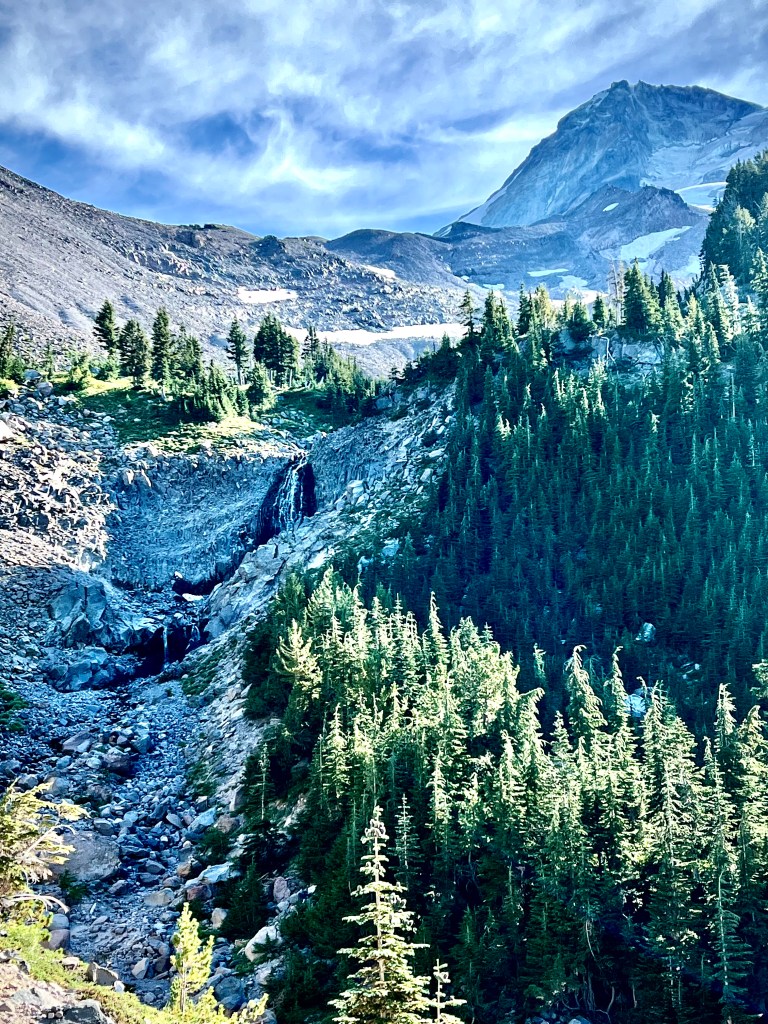
Mount Jefferson
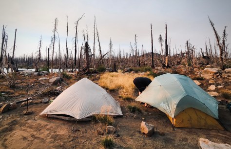
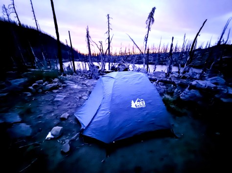
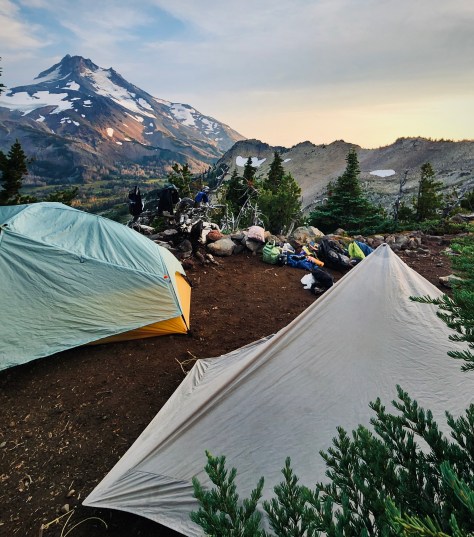
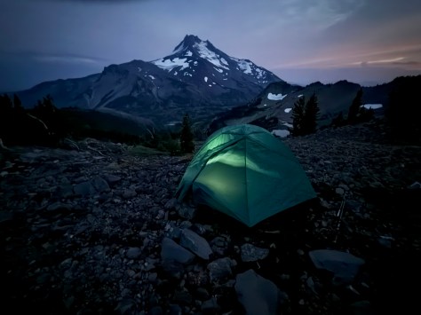
After taking a long moment to capture the rapture of what stood before us, it was time to set up camp. As usual since I was bringing up the rear the best tent spots with wind protection, level ground and wonderful views had been claimed.
Photo by Anthony E. King Photography
I was not about to settle so I searched further. What I came up with was utterly outstanding, and the view my camp spot commanded was unmatched, even if it was a little more exposed. Perhaps a little more than a little, but the views were to die for. (That thought will have more relevance in a moment.)
Once we had our tents all staked out it was time for some grub. While Anthony, Katie and I poured boiling water into a pouch for our backpacker dinners my sister Peggy and her husband Dale feasted on a fine supper of Peggy’s Salmon Curry Couscous Backpack Meal. She is a wonderful cook and brings that talent right out on the trail with her. She prides herself in making delicious trail cuisine that she prepares herself and packages for their backpacking excursions. All the rest of us could do was choke down our freeze-dried backpacker stroganoff and look on jealously drooling over their gourmet spread.
Last Light Dinner Time, photo by Anthony E. King Photography
All of us were utterly transfixed on the sight of Mount Jefferson. This was exactly what Anthony wished to share with us, beauty beyond compare. Easily one of the most beautiful things any of us had ever seen and that is saying a lot when you are considering that is our hobby, getting to enjoy what few can.
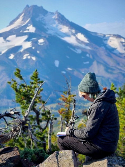
Katie journals her epic adventure, photo by Anthony E. King Photography
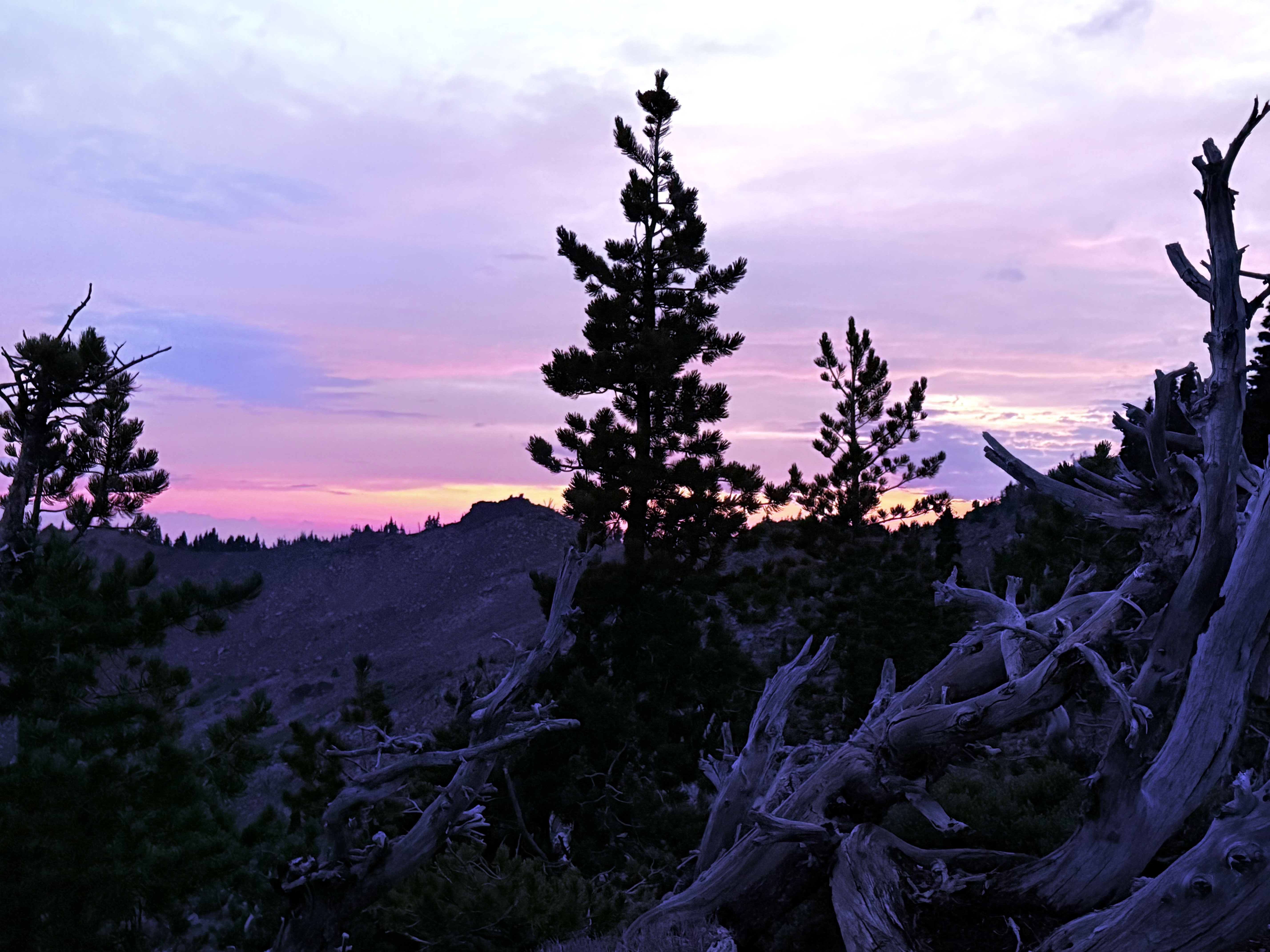
We couldn’t take our eyes off the mountain as the light continued to change and the sun sunk slowly into the West. We also couldn’t stop taking pictures of this incredible scene, lol.
As the light waned and the air chilled it was time to retire. From the warmth of my sleeping bag, in my tent perched precariously on the exposed side of the ridge, I stared out my unzipped threshold at the impressive mountain until finally it faded from sight.
I was awaken in the middle of the night by a strange noise. Little by little this rumbling grew ever closer with little flashes of light. Anthony had given us an updated weather report as we closed in on the ridge from his Garmin GPS device. After it had rained on us most of the day, he said that the rain had passed. But this is the mountains, it seems all bets are off when you are talking about mountain weather. Because it wasn’t long before the rain was coming down in sheets, the wind was picking up and lightning bolts were coming down- first a few miles away and then right on top of us! Since we didn’t die, it became all part of the Adventure.
Pursuing Balance Through Adventure YouTube Channel Mount Jefferson Wilderness, Day 1 CLICK THE PIC!
“When the going gets tough, remind yourself why you started. You’re here because you love the adventure, the challenge, and the beauty of nature. Keep pushing-your reward is just up ahead.“
Anthony, Katie, Peggy & Dale
Anthony, Katie, Peggy, Dale, and I set off into the Wilderness on the Pacific Coast Trail at Olallie Lake in beautiful Oregon- our goal? ‘Pursing Balance Through Adventure’. We learned straight off that Nature while beautiful, can be a bitch. In 2020 the Lionshead Fire, which was ignited by lightning strikes, became one of the most destructive fires in Oregon history pretty much wiping out the small town of Detroit. What was one of the most lush, beautiful and pristine forests was no more and it will be generations until it will return. So our journey taught us Nature is tough. Our beautiful wildlands are birthed by wildfire, it is part of the cycle. Some trees have built in defense to fire, but this fire was so hot that it literally scorched the earth. Still some pine cones are built so that they do not reveal their seed without fire. Sort of a Phoenix literally rising from the ashes. I suppose that lightning strikes and wildfire is part of Natures plan, but it is a brutal plan. An already difficult hike is made even harder when all you see is ugliness. The rain and the somber sight damped my enthusiasm. We endured the struggle of this land of disappointment, charred timber, destroyed natural beauty. But when we crested that ridge we were stunned by the most blessed sight. There is much more to share of our Mount Jefferson Wilderness Adventure. (Here is Mt Jefferson Wilderness Day 2) Stay with us for more mountain trekking all you have to do is: LIKE, COMMENT, FOLLOW and SHARE. Don’t forget to visit my Online SHOP APPARELfor top quality adventure wear that carries the mantra, the banner, the message, the logo: ‘Pursuing Balance Through Adventure’. Profound Experiences in Nature is what we seek to Balance home/work life with peace and harmony. The menu showcases the many locations that PBTA travels. Each location is a separate website and thus needs to be FOLLOWED independently.
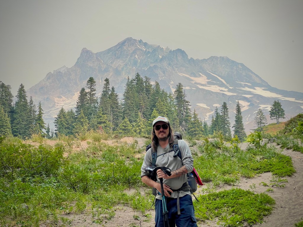
42 miles, 10,630’ elevation gain, 4 days out, rated HARD
Date: 9/7-10/22
Day 4
11 Miles with 3993’ Elevation Gain
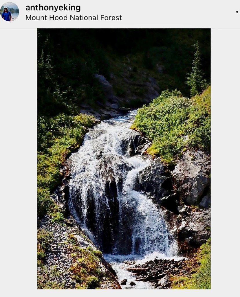
After a restful night, lulled to sleep by the sound of the tumbling water cascading down the face of Romona Falls, I packed up my tent and stuffed it into my backpack for the last time on this journey. I spent some time, before we set out on our final day of this spectacular trek around Mt Hood, sitting next to the glorious falls letting it’s magic envelop me.
Romona Falls
I had an important task to complete, doctoring the blisters that I had undoubtedly received from miles of hiking in wet boots when we waded through the frigid water at Elliott Glacier Stream.
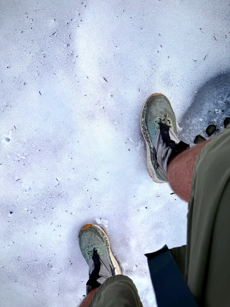
It would be a long hard day with the elevation gain being almost double that of any of the other days. There would be a long slog out of windy, dusty, canyons. We would experience more water crossings, one of which I decided that my best bet across the Zig Zag River was to do the standing broad jump from a rock to the shore with my heavy pack- and hooray, I stayed dry! There was more smoke in the sky from the nearby wildfires. But there were thick green forests to enjoy and handfuls of huckleberries to consume.
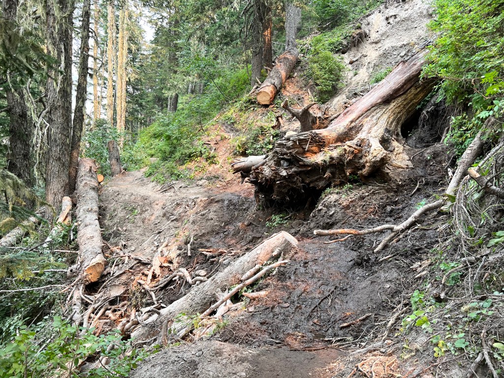
We maneuvered through a portion of forest with downed timber that we had to clamber over, under or around, and up a steep switch back trail. One spot seemed particularly treacherous with massive logs precariously perched above being held in place by saplings. It was quite unnerving to come around the bend and find trail all but wiped out by such a tree coming down the mountainside.
It was a bit worrisome to see large fallen trees precariously perched just above held in place by saplings. Some large timber had fallen in places just about wiping out the trail.
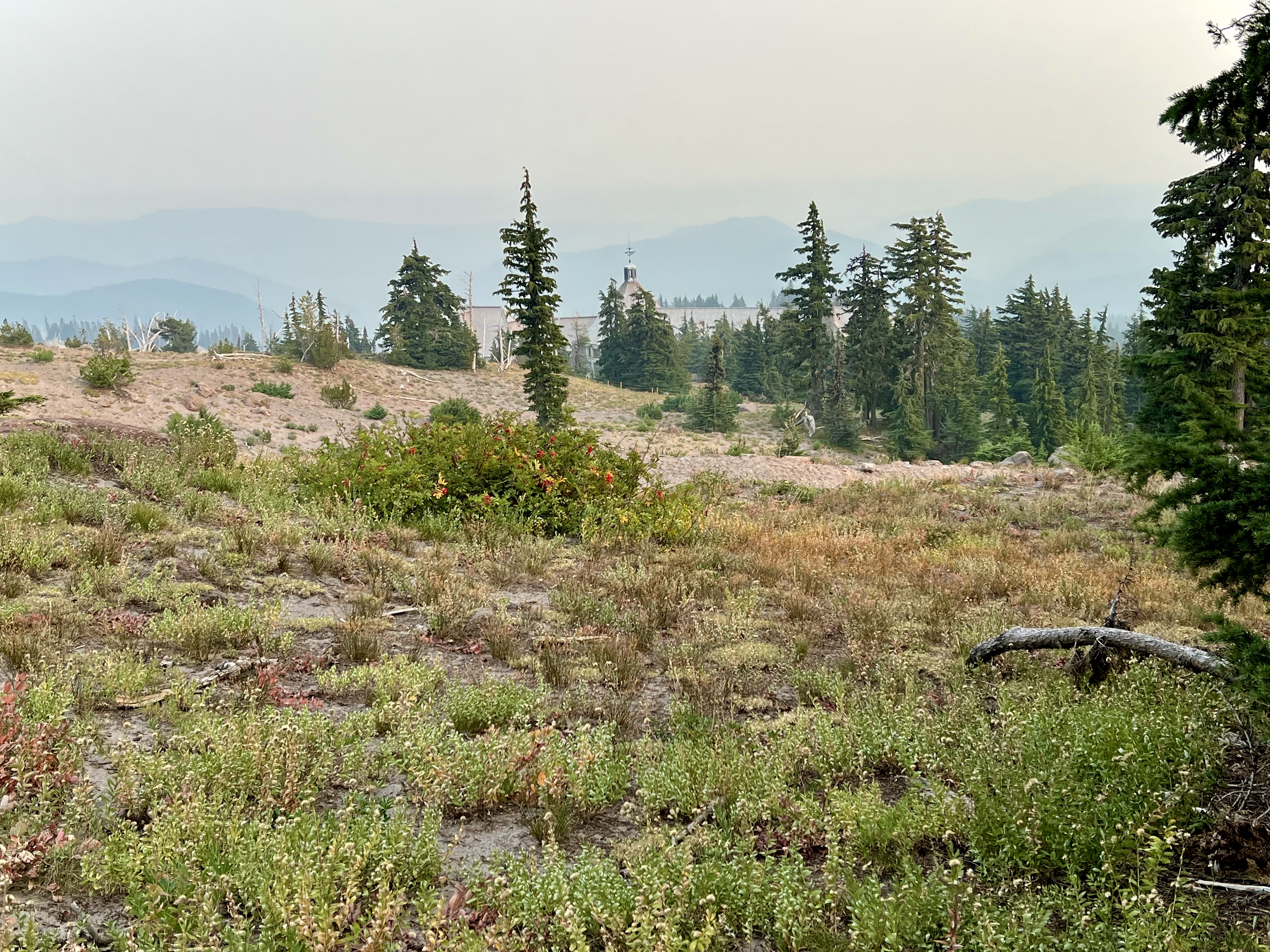
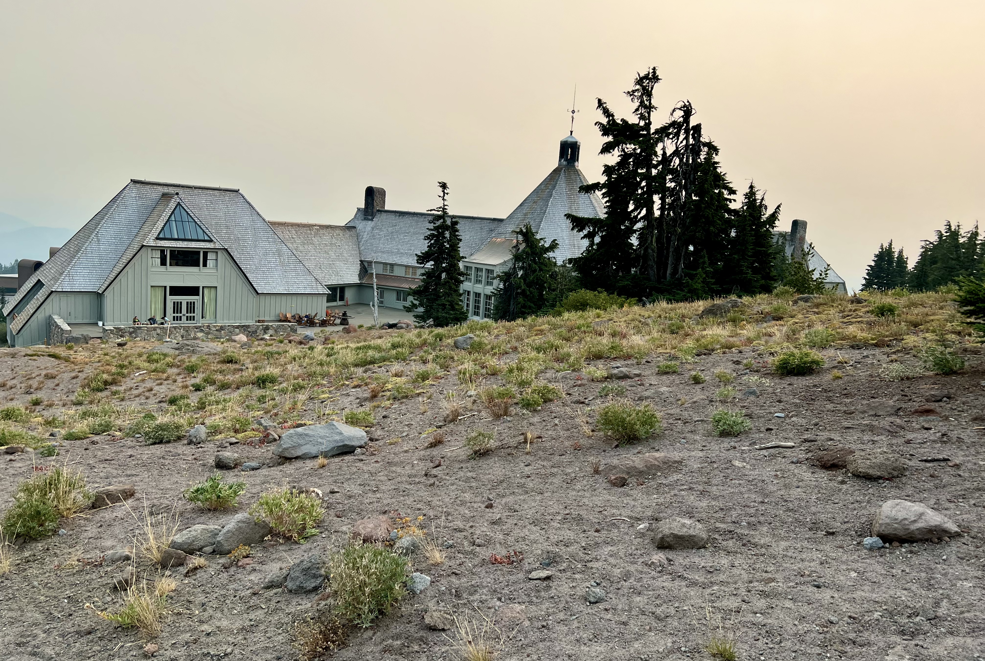
It was tiring, it was hard, it was glorious! Finally late in the afternoon I spied a most welcome sight, that of the roof of the Timberline Lodge which signified the end of the fantastic journey.
What a wonderful four days that Anthony and I spend with Mother Nature on arguably the Best Hike in America, Timberline Trail.
‘Pursuing Balance Through Adventure’ YouTube Channel. The best way to view a waterfall is with motion. CLICK THE PIC!
“These type of adventures do a body good, but it is the soul that finds it most beneficial.” – Roger Jenkins, Pursuing Balance Through Adventure
Thanks for accompanying my Through Hiker friend Anthony and I on this multi day backpacking extravaganza. Day 1,Day 2,Day 3 When you work hard toward a goal, but the reward of each step is profound beauty than it is not hard, it is soul nurturing. This my friends is what ‘Pursuing Balance Through Adventure’ is all about. Such a trek brings so much balance into the grind that can be everyday life. The circumnavigation of Mount Hood is a grind, but such a beautiful grind and I invite you to stay with PBTA because there is alway more. It is not the destination, but the journey that brings that balance. Stay tuned by completing these easy tasks: LIKE, COMMENT, FOLLOW and SHARE. We all need to seek out more journeys. As an aid to your discovering your own expedition I invite you to go the menu above where I have categorized outings mostly by location. Each location is a separate website and thus needs to be FOLLOWED independently. You will find Adventure Wear with the prized PBTA logo and mantra at SHOP APPAREL.
42 miles, 10,630’ elevation gain, 4 days out, rated HARD
Date: 9/7-10/22
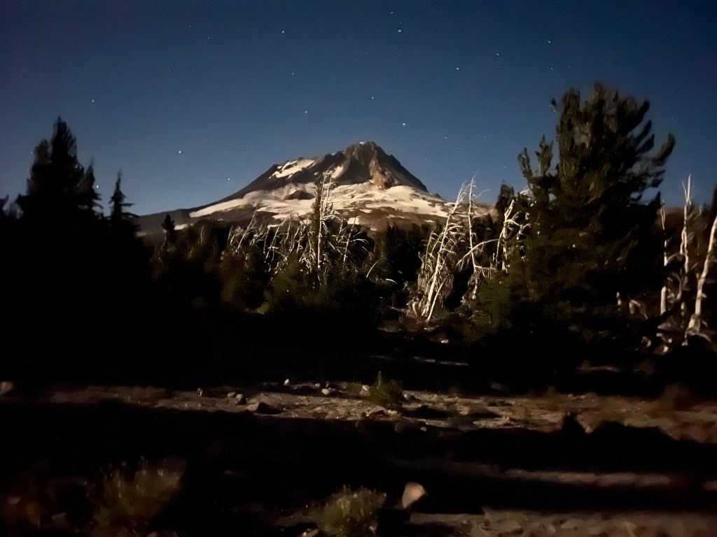
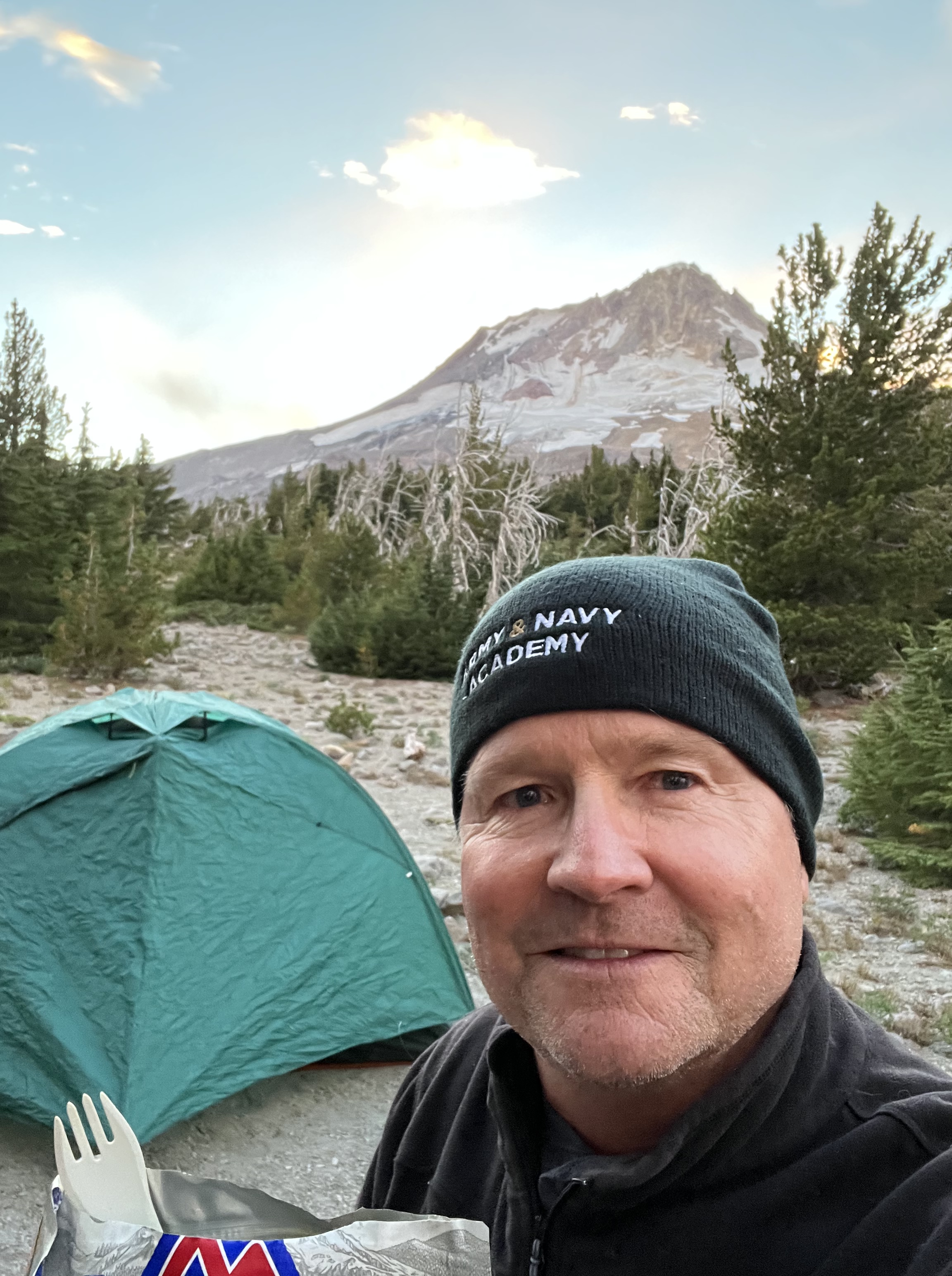
The first night on the mountain was awesome after a tough, but satisfying dance with nature all day on the Timberline Trail DAY 1. I always wanted to experience what I have seen in advertisements and that is pull back my tent flap and there before me is this outstanding view that just takes you aback. That is the experience I had on this morning.
Mount Hood from my tent after midnight. View when I unzipped the flap of my tent that morning.
Day 2
9.7 Miles with 1965’ Elevation Gain
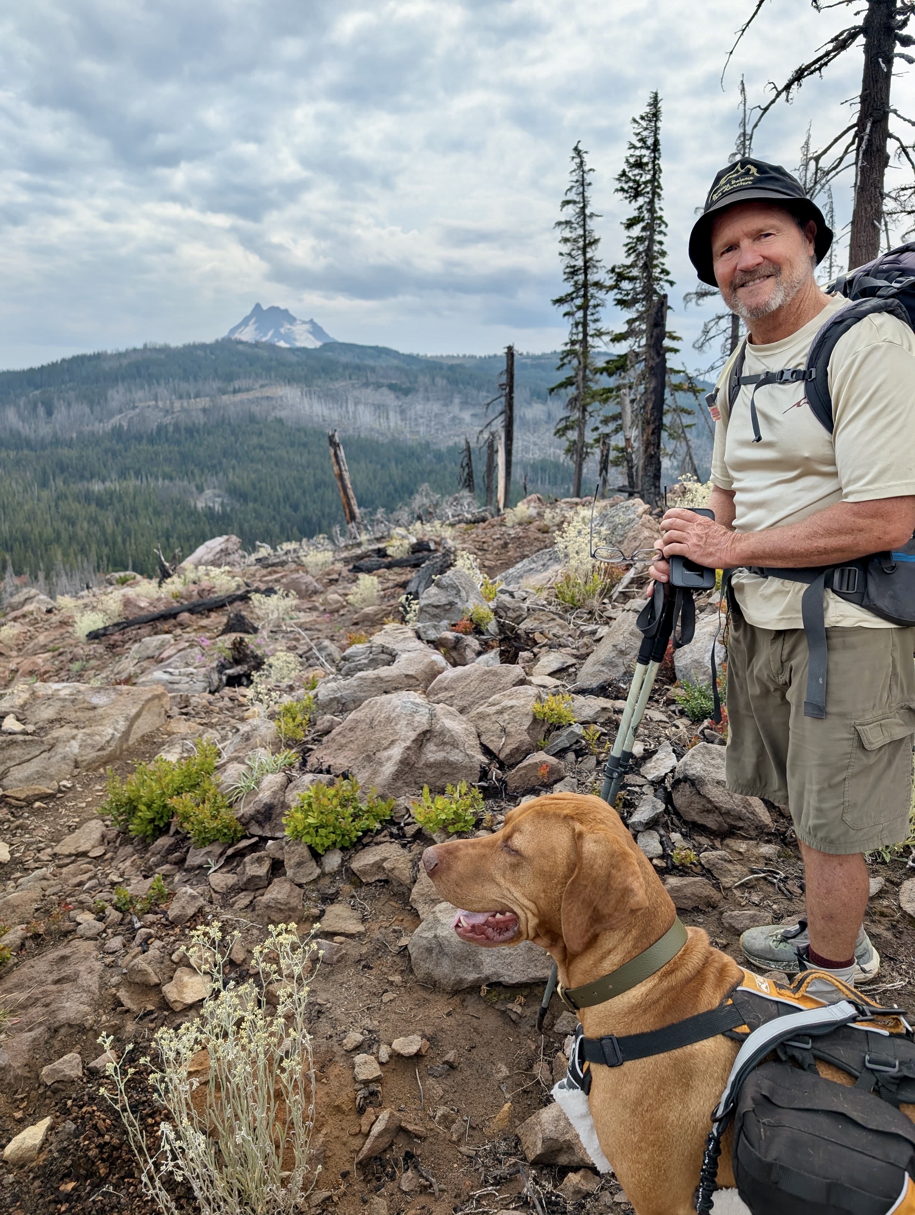
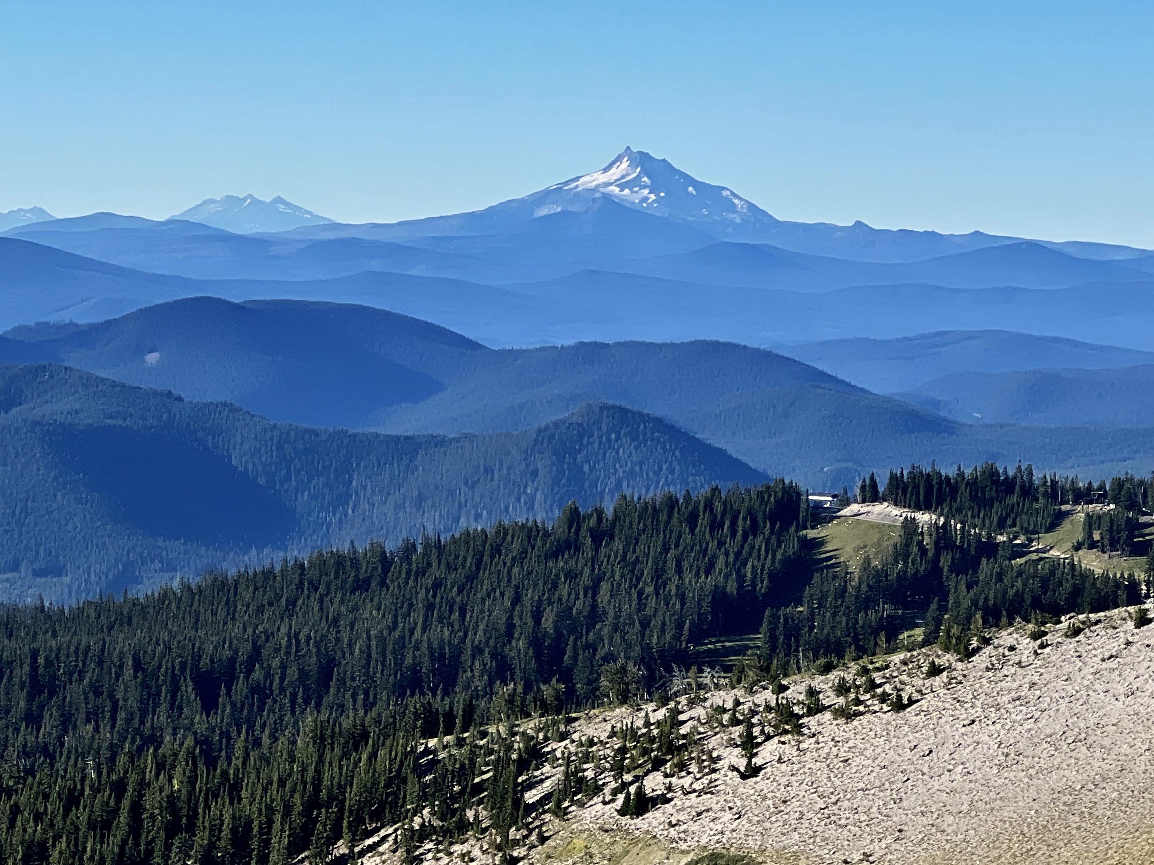
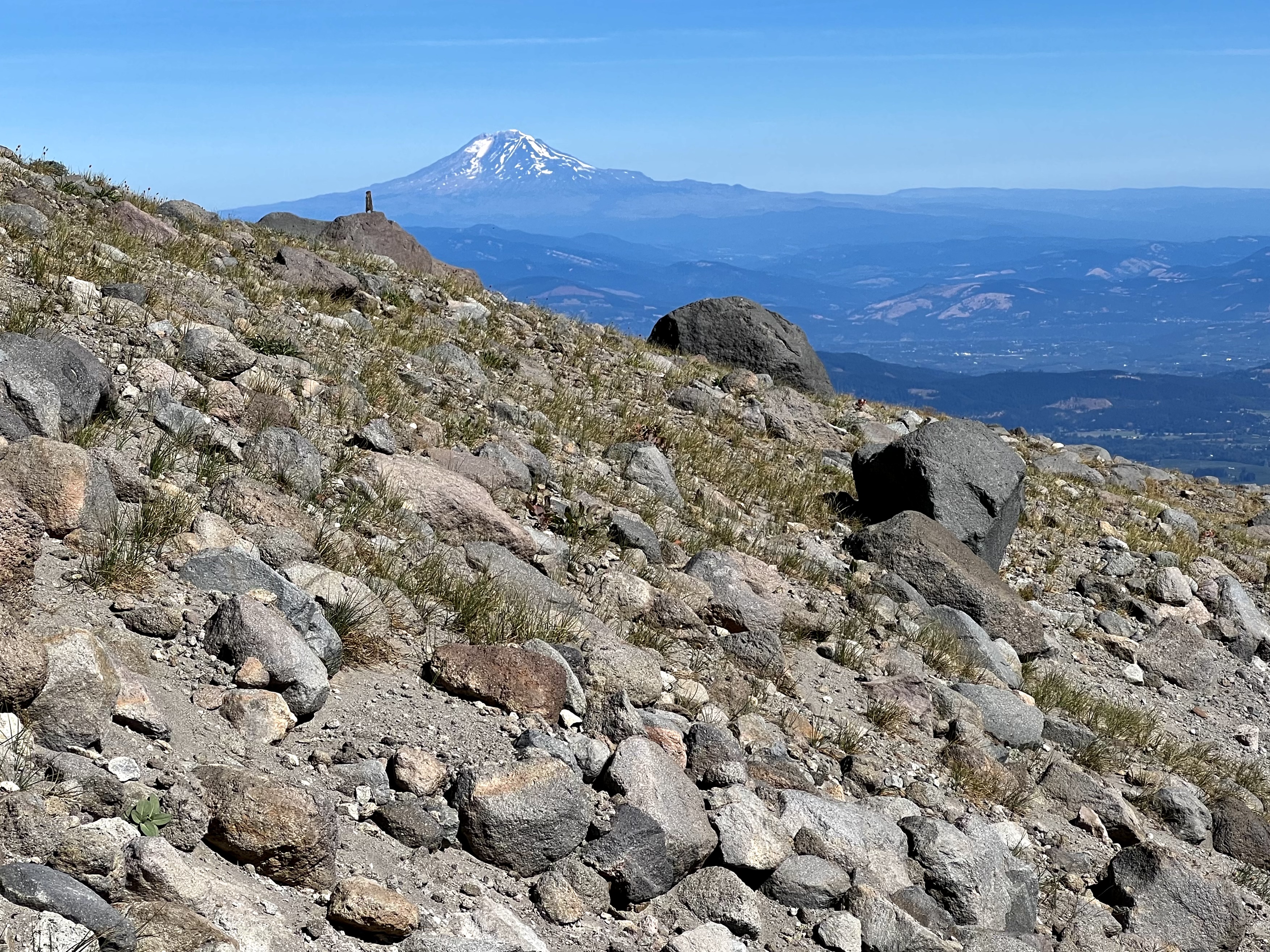
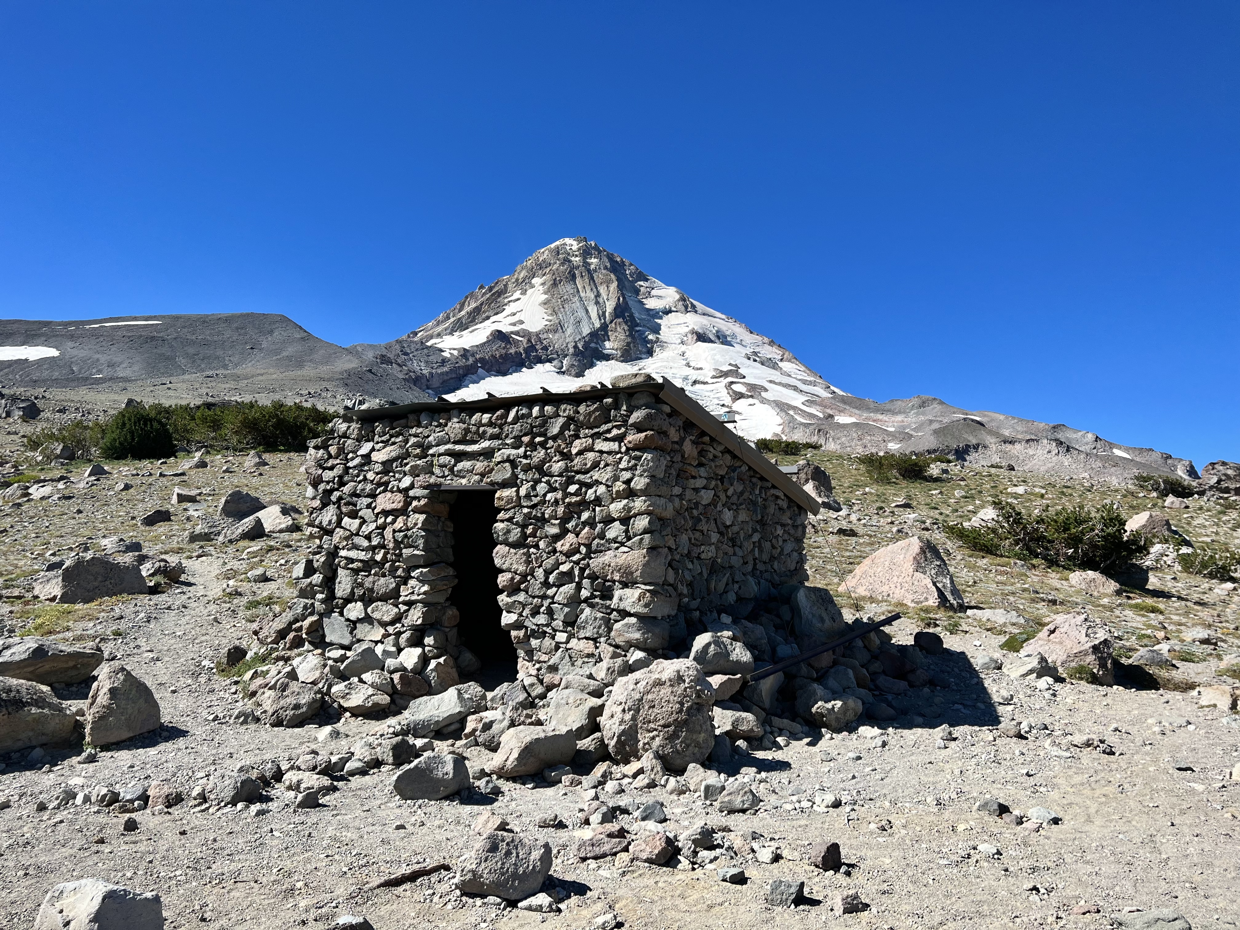
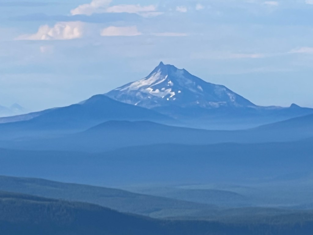
Thursday Sept 8th. Another beautiful day Anthony and I hiked mostly above the timber, soaking up the sun, and the magnificent views not only of our mountain, but majestic Mt Rainer, stately Mt Adams, and once the most perfectly shaped mountain, the infamous Mt Saint Helens. We took our break at an awesome rock shelter at Cooper Spur.
Mount Adams peaking through the evergreens.
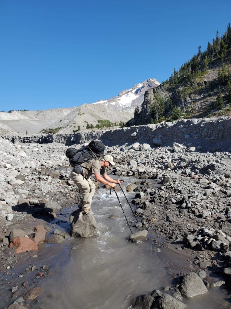
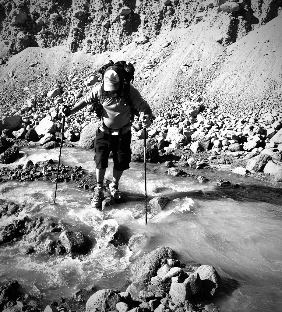
Really sketchy water crossing at Elliot Glacier Stream… Wading in thigh deep fast moving cold water can be a bit unnerving with a water fall drop just 15 yards away. The thought goes through your mind it should be fine, but what if it’s not? What if your feet get swept by the fast moving current and slippery rocks? The other thing is you are going to have soaked boots for as long as it takes for them to dry out, which ended up a long time. It turned out that it was fine. Except for the wet boots part… Then it was a crazy steep scramble out where everything was moving including chest size boulders. I cut my knee and shin on the scramble, so I either looked bad-ass or like a ding-dong with blood running down the length of my lower leg.
Elliot Glacier StreamAnthony recommended, “Keep moving and try not to die.”
Then it was wildflowers, trees, and streams finishing up another 10 mile day with about 2,000’ elevation gain. We camped at Elk Cove with a sweet view of the mountain top beside a babbling brook.
The scene from where we camped.
Pursuing Balance Through Adventure YouTube Channel. CLICK THE PIC!
“Don’t die without embracing the daring adventure your life was meant to be.” -Steve Pavlina
My Through Hiker friend, Anthony, and I appreciate you tagging along as we found ourselves ‘Pursuing Balance Through Adventure’ on our epic adventure circumnavigating this wonderful mountain. You know everything gets ramped up a couple degrees when you have a heavy pack on. Of course the hiking, and climbing up a steep ravine with a big pack is difficult and is a given, but what I am referring in particular is hoping rocks, or a maneuvering across a log, or in the case of this day, slogging through Elliott Glacier Stream. What would have been no big deal with out a pack is totally different wading through the frosty water across slippery rocks with the power of the water pushing you as you fight to balance the heavy pack. But pushing yourself is a big part of what this adventure was about and is a big part of what ‘Pursuing Balance Through Adventure’ is. Getting outside of your comfort zone, finding out what you can do is important and it sure helps balance things out. Nature, Adventure, self discovery… it is what it is all about. Stay with us. We are only half way through this journey around this iconic mountain. COMMENT, LIKE, FOLLOW and SHARE. The menu above will take you to spots I cherish all across this great West of ours. It just might give you some inspiration and some ideas for your next outing in Nature. You can purchase some wonderful Adventure Wear for your outing at my SHOP APPAREL.
42 miles, 10,630’ elevation gain, 4 days out, rated HARD
Date: 9/7-10/22
I soldiered through the blisters, blood, sweat and tears. The panting with each footfall became moaning with each step by each day’s end. The accomplishment of the endeavor and the beauty of the mountain made up for the pain and suffering which of course just added to the adventure of it all.
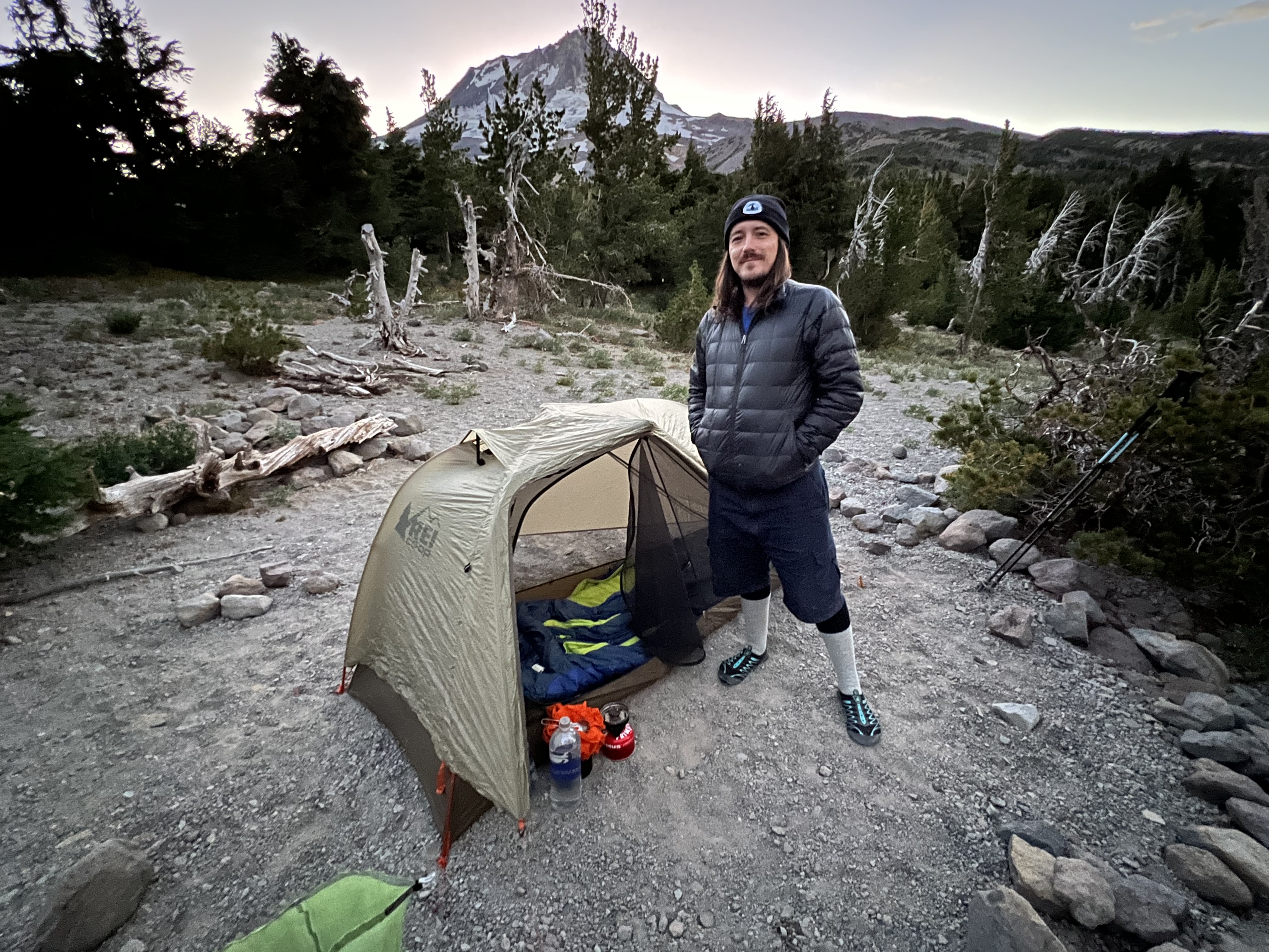
Although this was my most aggressive backpacking trip as far as days out, distance and elevation gain, I was with a fellow adventurer so at least I was not alone. The other person on the trek, a Through Hiker who has hiked over 800 miles on the AZ Trail this year and a year or so ago completed the PCT, is a hiking friend from LA. Anthony King a Bar Tender and Photographer flew in for the event and I picked him up at the Portland Airport. I have backpacked with Anthony once before. He is much younger than I so I was a little apprehensive about hiking with him, not wanting to hold him up. Turns out he hikes at his own pace. You either keep up or fall behind, your choice. So the way that we handled it was we hiked together some of the time, but generally we enjoyed oneness with the mountain. We met up for some of the breaks, as Anthony would take an extended break to allow me to catch up and I would have an abbreviated stop.
Day 1
10 Miles with 2,800’ Elevation Gain
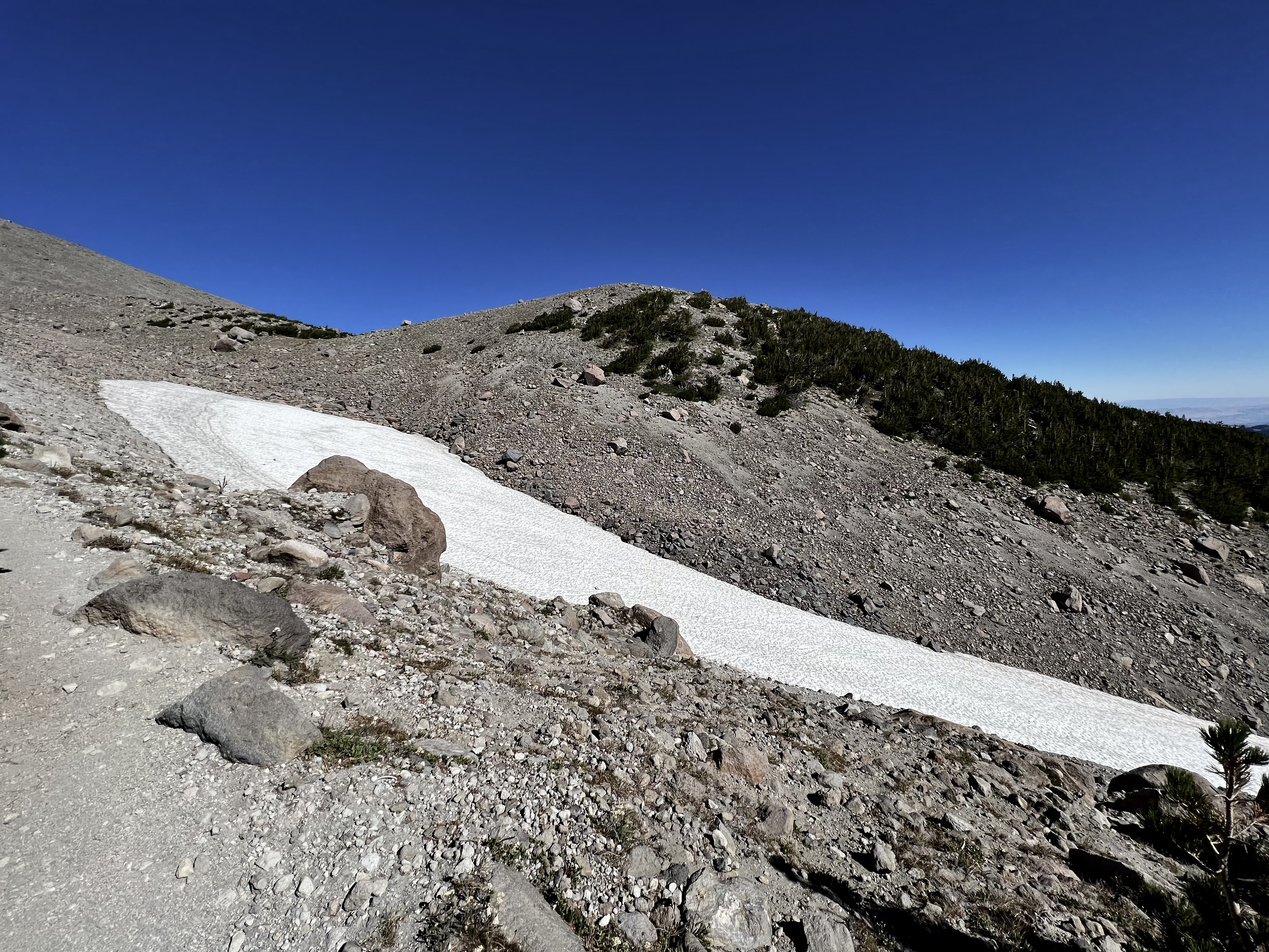
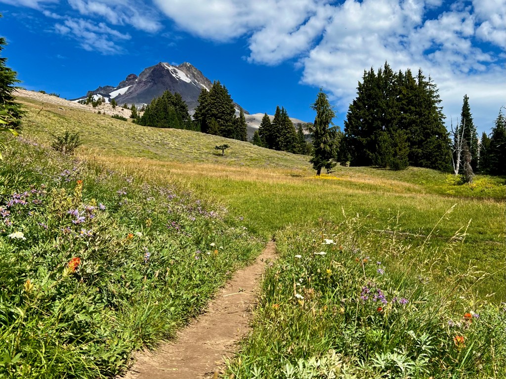
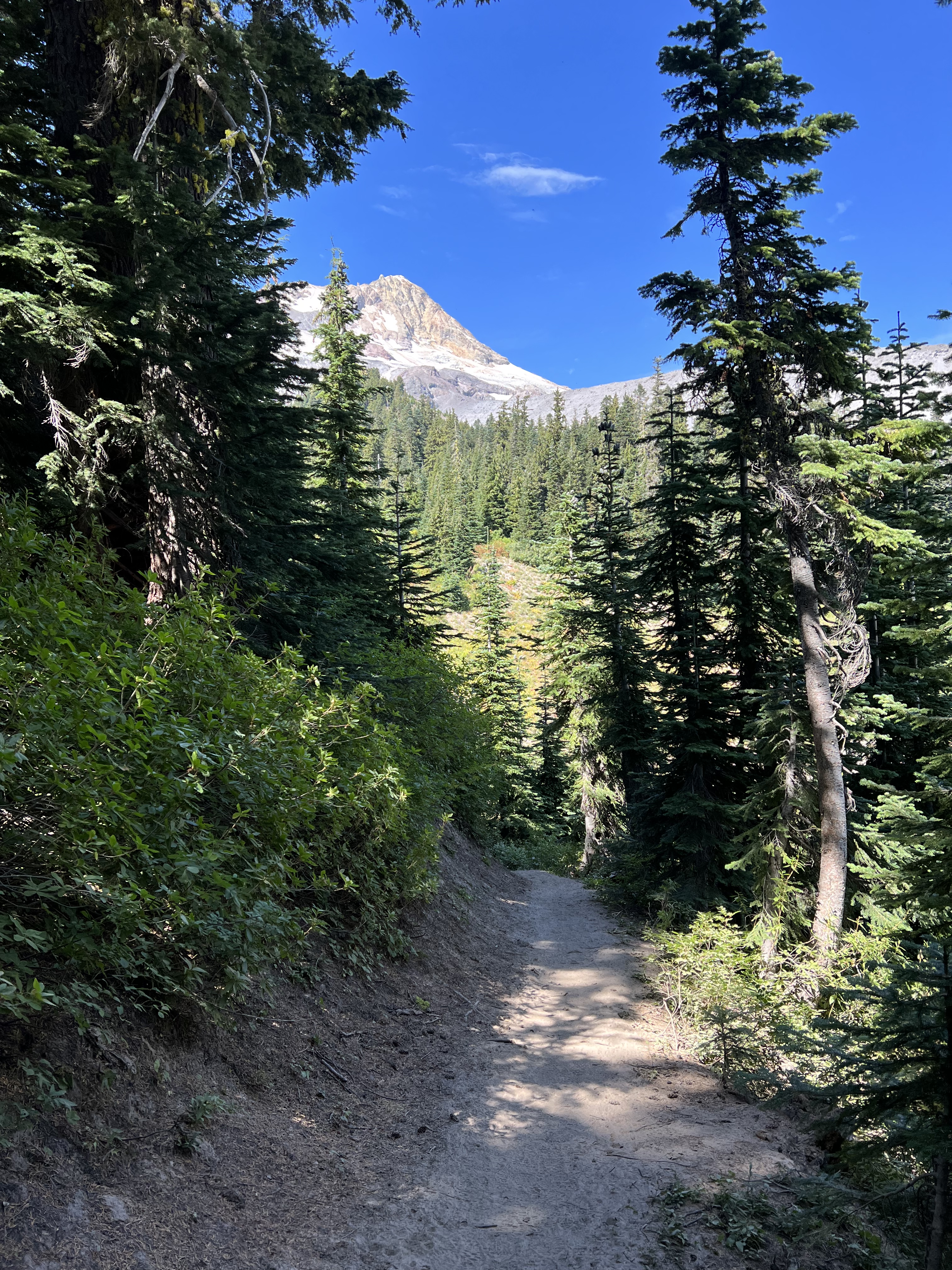
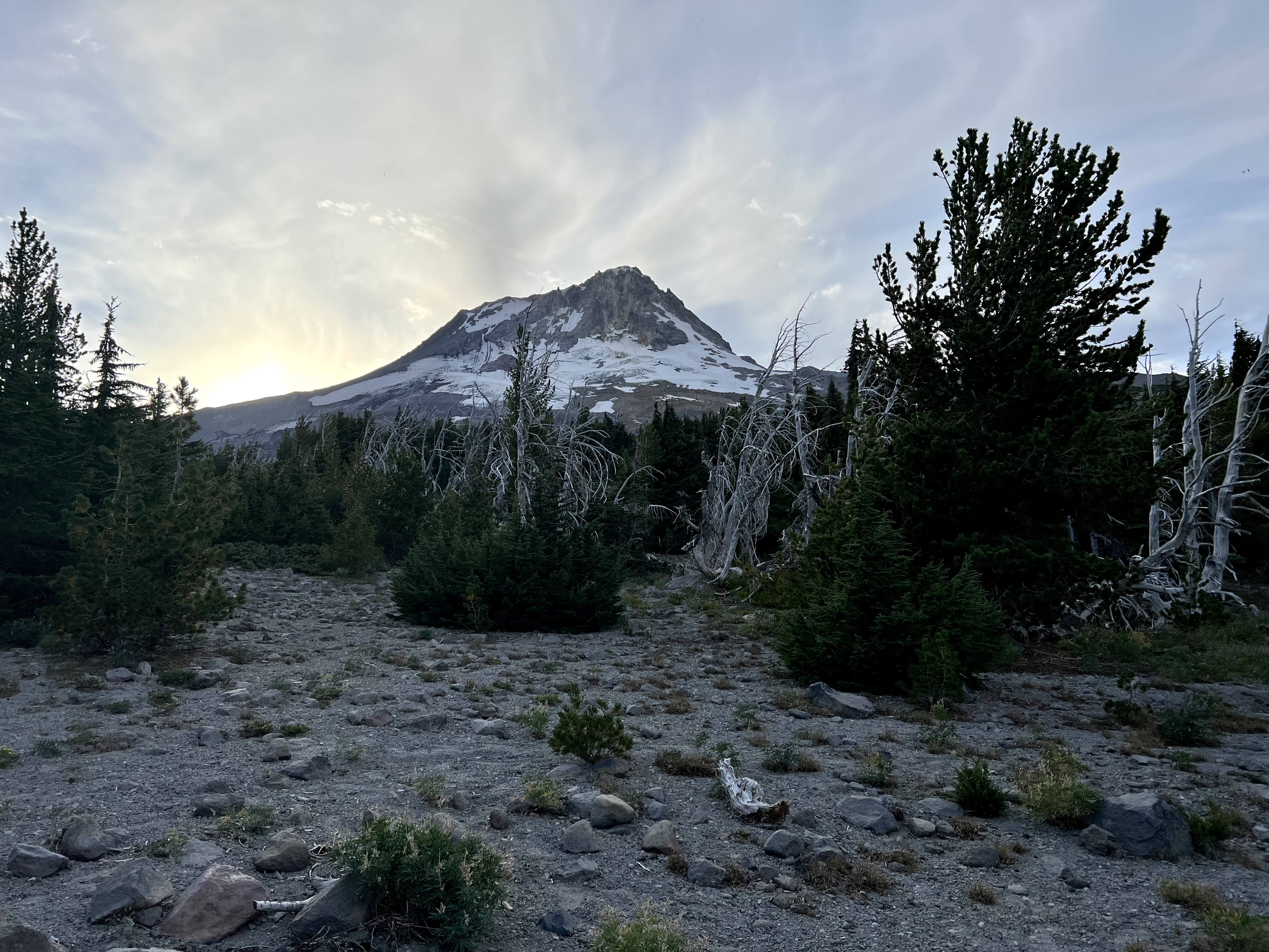
Wednesday, Sept 7th, at 8AM we set out past Timberline Lodge to circumnavigate Oregon’s magnificent Mt Hood counterclockwise on the amazing Timberline Trail under mostly sunny skies. The days were to be mild and the nights just a little chilly so really tremendous conditions to take on one of the best backpacking trips in America. Meandering through fields of wildflowers, in and out of wooded areas, spectacular views of Mt Jefferson, passed a couple small crossings of rushing water and waterfalls was how we spent the day. Hoping across rocks is a little tricky with a heavy pack, but we managed to stay dry. Now we climb… 10 miles and over 2,800’ elevation gain much of it up loose, steep, sandy, and crumbly material known as scree. We bedded down past Lamberson Butte near an old shelter with unreal views of the peak of Mt Hood right out my tent flap.
Make sure to CLICK THE PIC and see the water features in motion. Pursuing Balance Through Adventure YouTube Channel. Our Timberline Trail adventure began at Timberline Lodge.Majestic Mount JeffersonRock hopping trying to keep my feet dry. (Photo by Anthony King)A rocky, sandy, steep hike out followed each water crossing. Anthony crossing one of many water crossings along the Timberline Trail.
Sundown on Mt HoodThe mountains! They call to us so we can conquer them. But in reality we conquer our fears, our struggles, our weakness, and we come out victors. Go conquer your mountain!
Thanks for joining Anthony and I on this awesome adventure, the circumnavigation of Mount Hood where we found ourselves ‘Pursuing Balance Through Adventure’. This is the beginning of a four part expose of our backpacking trek of arguably the Best Hike in America. You can checkout Timberline Trail Day 2, Day 3, Day 4 here. You will want to stay tuned and you can do so by a few simple tasks: LIKE, COMMENT, FOLLOW and SHARE. If you care to peruse the menu above you will discover that PBTA travels extensively throughout the great West in hopes of inspiration and recommendations of glorious outing in nature, as we can all use a little break from our everyday ho hum lives. If you have a thirst for top quality Adventure Wear then quench it at SHOP APPAREL.
Activity: Camping, Day Hike, Scenic Views, Chasing Waterfalls
7.2 miles, 1224’ elevation gain, 2.5 hour duration, rated Moderate
Date: May 25 & 26, 2022
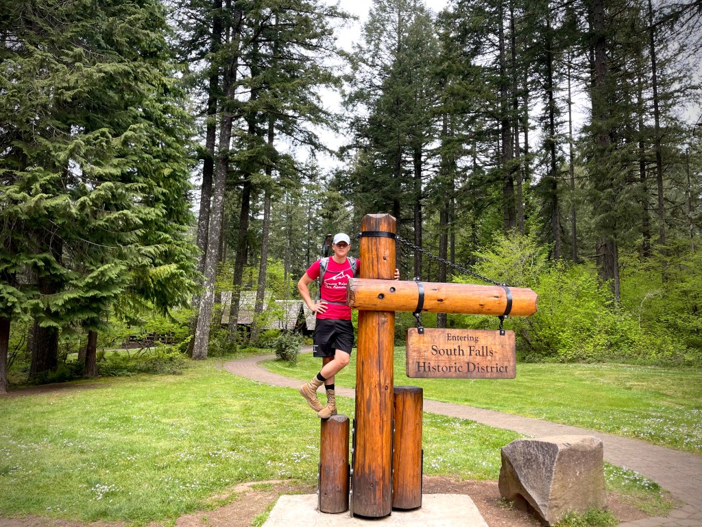
Silver Falls was a stop we made on our Road Trip from SoCal to Washington. It is outside of the city of Silverton and not far from Salem. I had been there once or twice as a boy and never forgot it and I wanted my son Alec and daughter Marina to experience it’s magic.
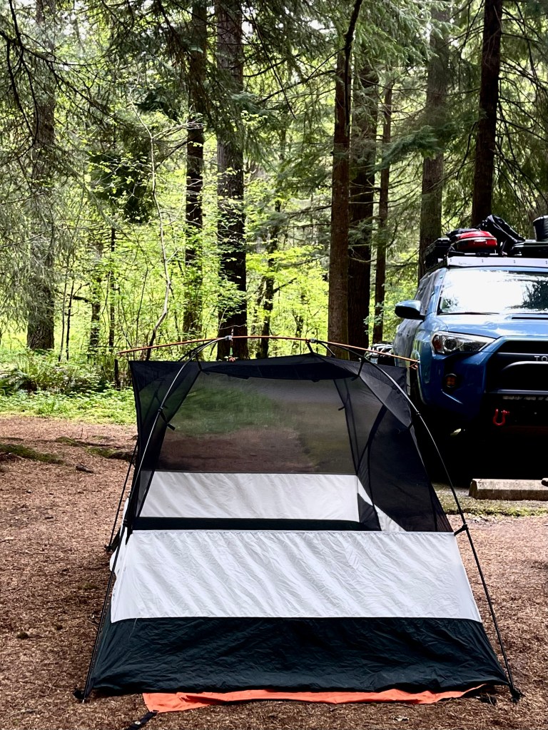
We were short on time and made a push from one last outing at Yosemite all the way to Silver Falls not arriving at the Silver Falls State Park Campgrounds until well past quiet time. I think we woke up half the campground as we pulled my Toyota 4Runner TRD Pro into our reserved camp spot. I know that we woke our neighbor as it took us awhile to get situated and set up the tent. He asked, “Are you about done?” – Sorry…
About an hour or so after zipping up my sleeping bag I heard a noise just outside my tent. I wiped the sleep from my eyes and though maybe that guy is really mad because he is right outside the fly of my tent. I got the flashlight and unzipped the tent not sure what was going on to find myself eye to eye with a cute little raccoon. He was cute for about 5 seconds as he had eaten a hole in our food bag and was munching away. I tried to shoo him away and saw that there were two of them and they were right in my face and they were not backing off, but inching forward despite me waving the flashlight at them. They were not worried about me at all rather each other. I did not know that raccoons growled, but it started as a low guttural growl and grew into a loud hissing crazy thing. About another hour after that disturbance all hell broke loose a few camp spots away and it sounded like World War Raccoon had just broke out with a whole gang of raccoons going at each other.
After a long drive and lots of activities the only thing that was going to get my kids up was camp grill breakfast. After eating, getting cleaned up and packed up we headed for the falls.
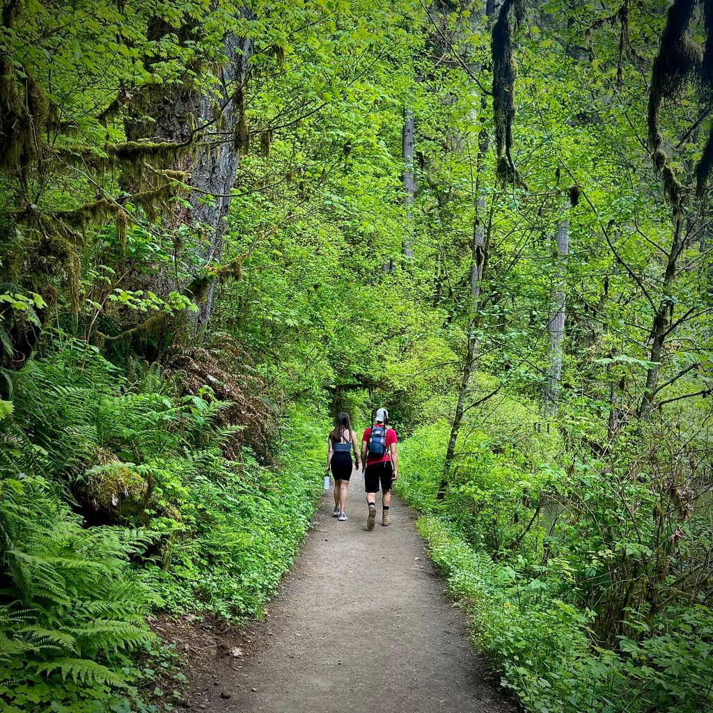
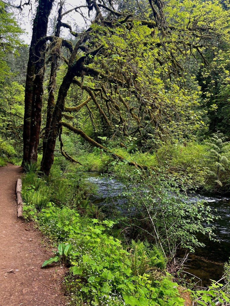
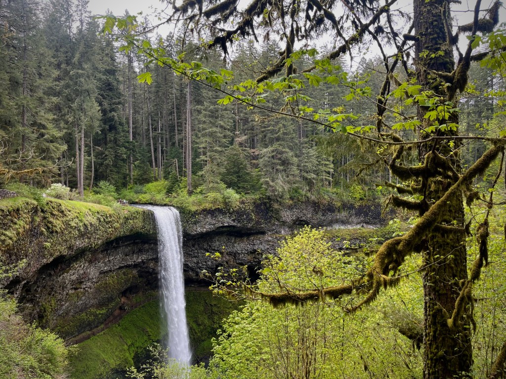
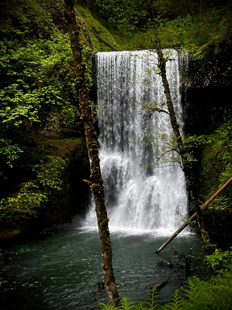
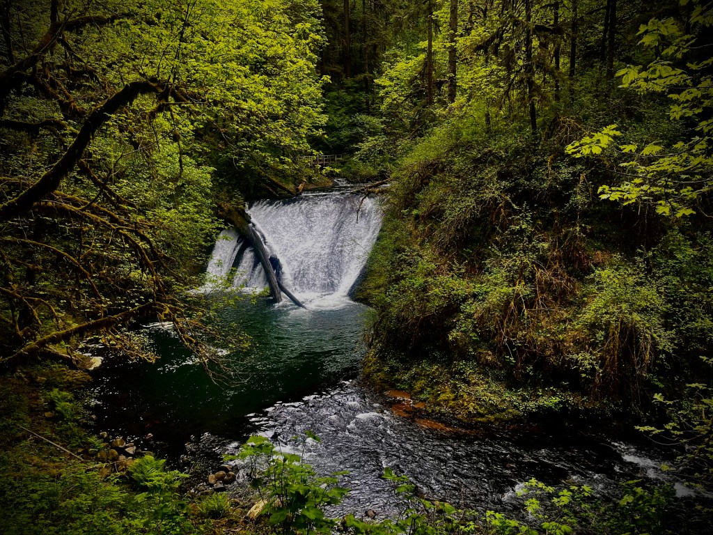
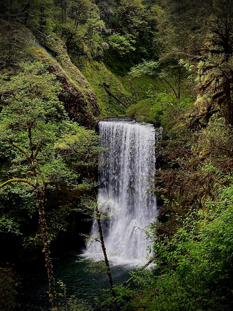
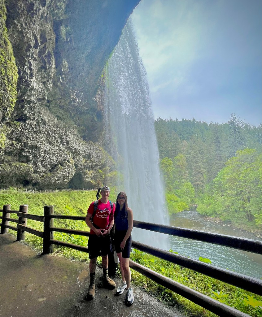
Silver Falls is the largest State Park in Oregon. It has a couple dozen miles of hiking paths across it’s 9,000 plus acres. In addition to that there are horse and bike trails as well. Silver Falls is a waterfall lovers paradise. You can see 10 stunning falls in less than an 8 mile hike. The forest is lush and spectacular, the stream are flowing and fabulous, but the star of this show is the waterfalls and boy are they certainly don’t disappoint. One would be happy with some of the little side show waterfalls that we are not even counting, but the 10 waterfalls are lovely, enchanting, and whimsical.
If you happen to be ’Pursuing Balance Through Adventure’ I cannot think of a better way than chasing waterfalls and at Silver Falls there are plenty to chase.
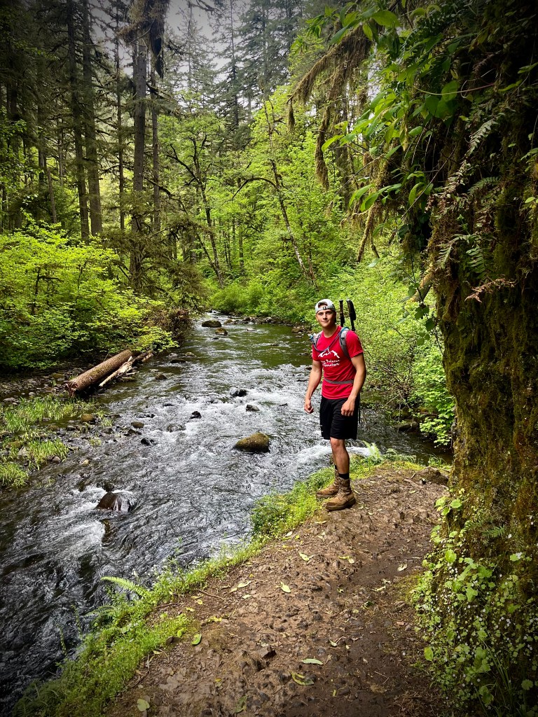
My son Alec summed it up like this: “If I could only go on one hike for the rest of my life it would be this one”. Marina nodded in agreement to her brothers statement.
The only way to view a waterfall is in motion. Please CLICK THE PIC for the PBTA YouTube Channel Episode. Life Like A Waterfall Between the rocks of mountains Emerged as the purest of spring Gushing, whooshing and pushing Over the rock by bashing and crushing Ferocious water swash Cold and strong making its own path Tickling over pebbles tumbling, whizzing and then swishing Curving tight round the bend Terrifying plunges wilder onto the rocks Finally cascading down Creating incredible splash Loud with echoing sound Leaving the waterfall starting to calm Now flowing gently as a river Leaving the trails of thrashing life behind. Alec and Marina behind the looking glass.
Thanks for joining Alec, Marina and I as part of our Chasing Waterfalls Road Trip at Silver Falls, certainly one of the most enchanting places we have ever been. Stay with us on this Road Trip as well as many other adventures by doing some super easy things: LIKE, COMMENT, FOLLOW and SHARE. If you like the hat and shirt that Alec has on in the pictures then I invite you to go to SHOP APPAREL for all of your Adventure Wear needs. PBTA travels extensively throughout the West if you go to the menu above you will see that the areas are categorized by area or activity. I am sure that this will fuel ideas when planning your next adventure.
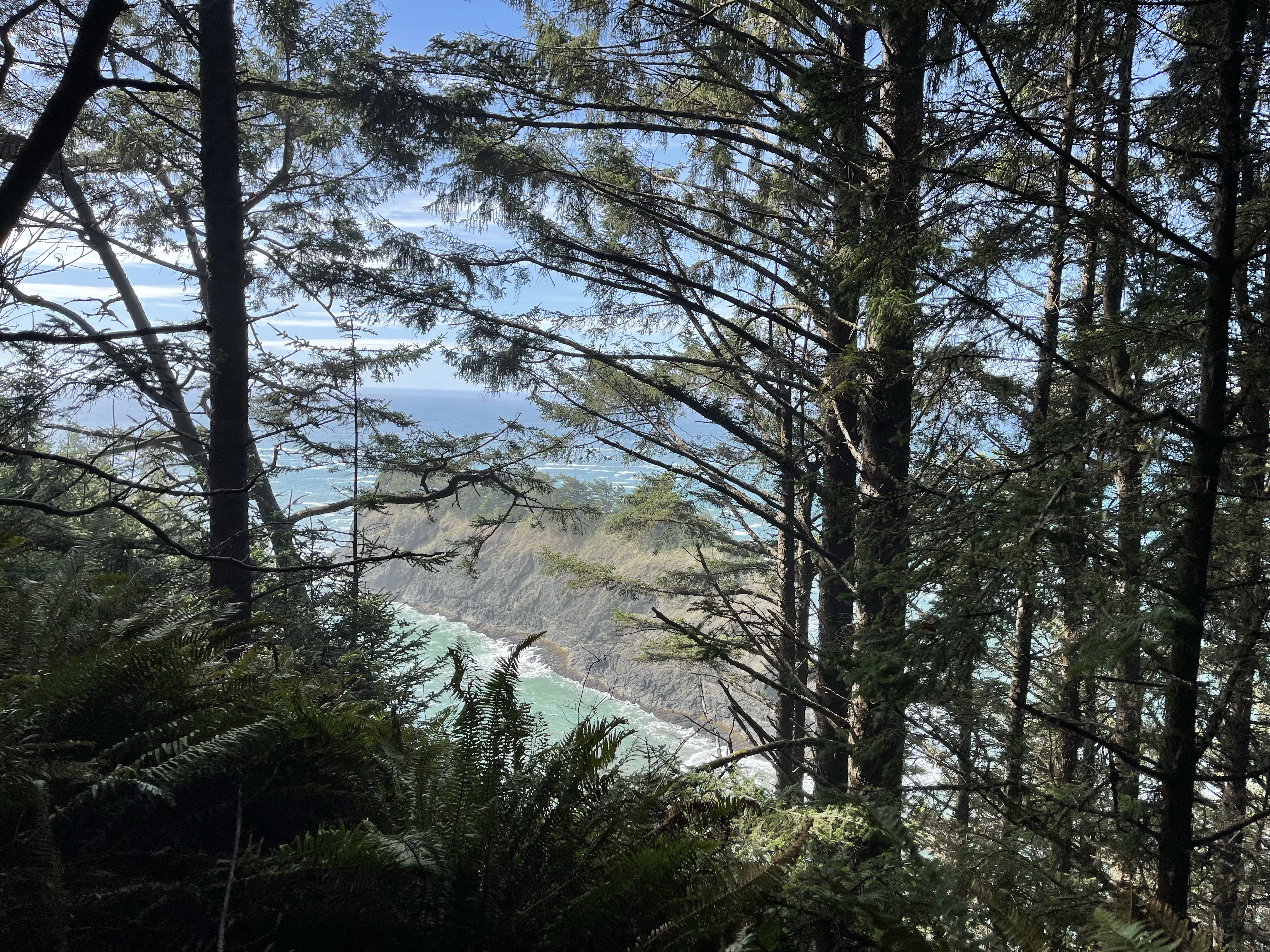
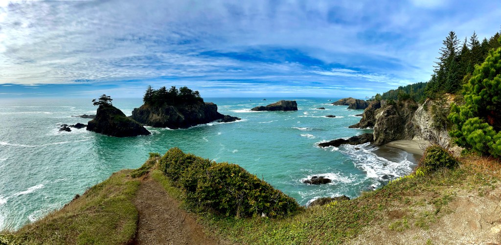
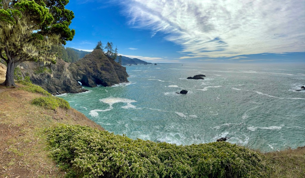
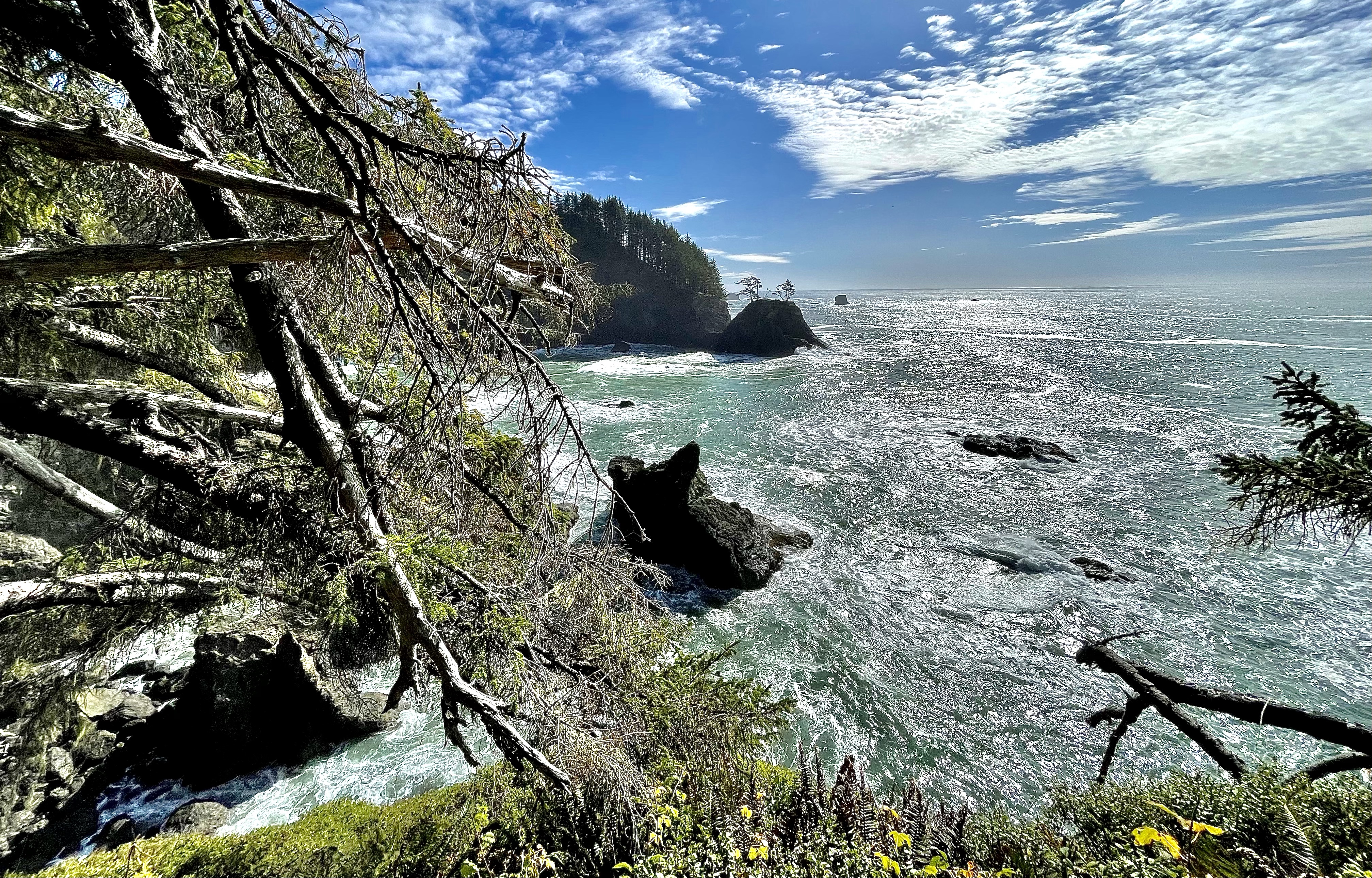
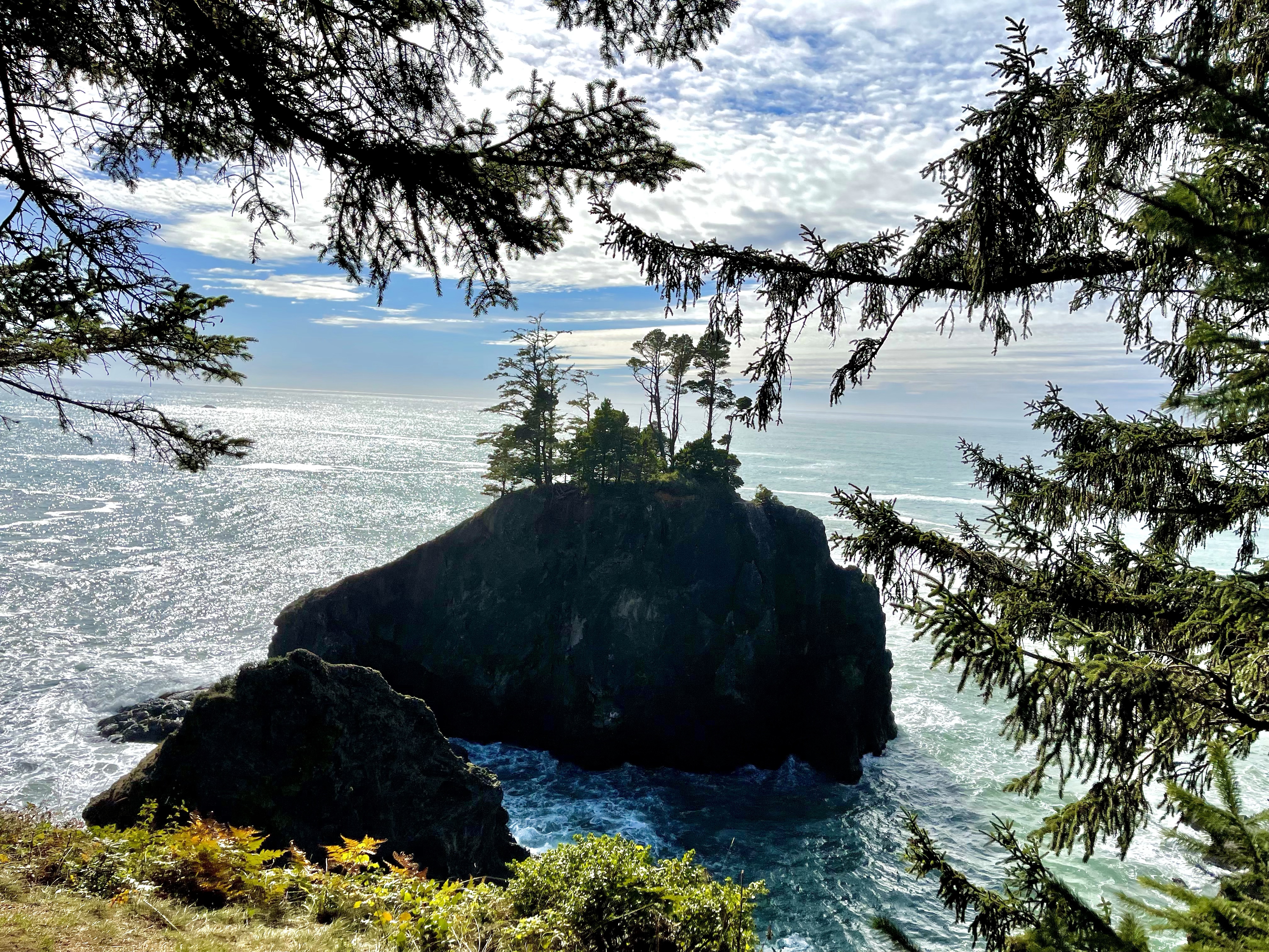
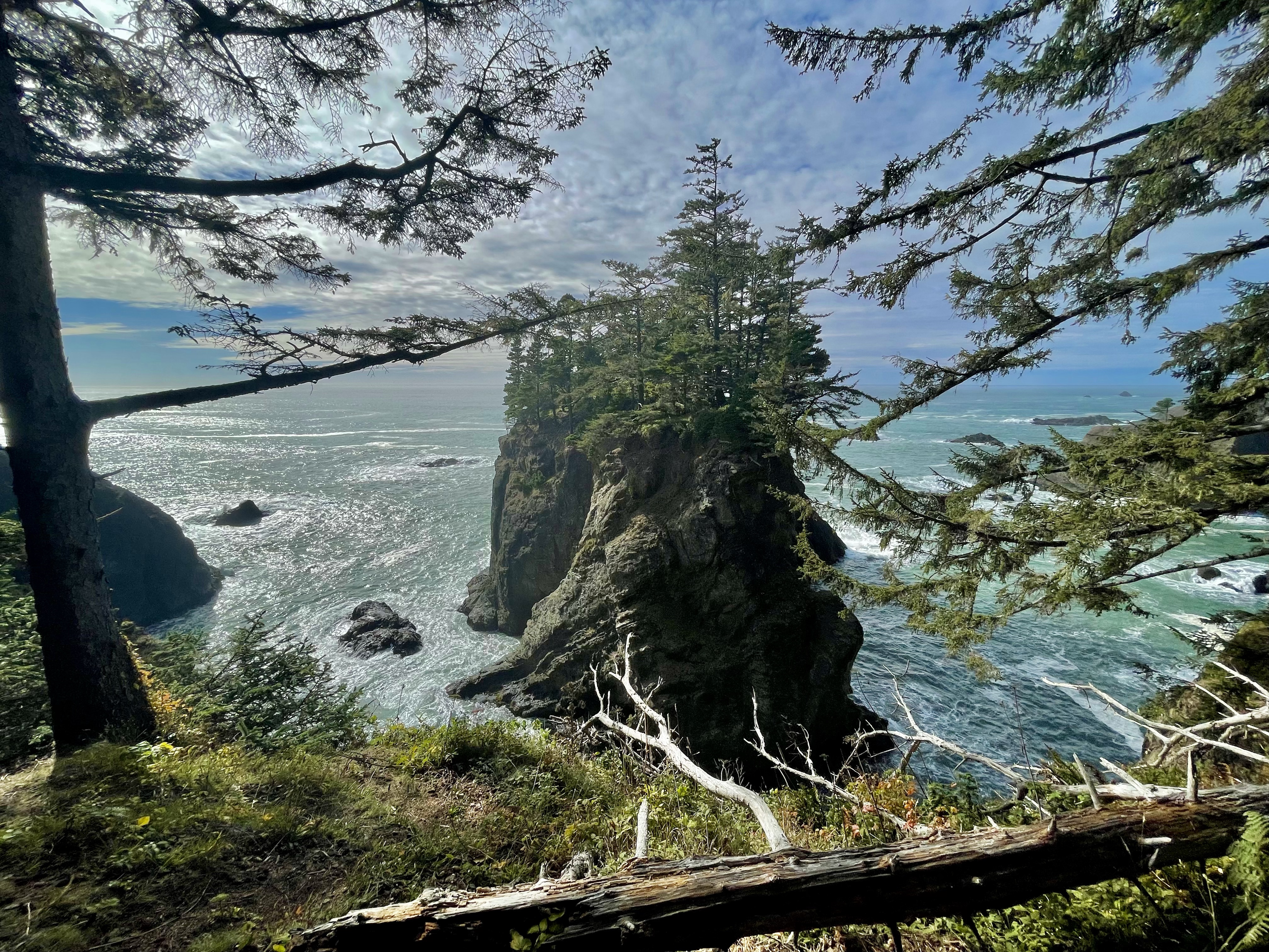
I had Samuel H. Boardman Scenic Corridor on my list, as I have seen the incredible pictures. Scenic doesn’t begin to describe it. Corridor however is a good word as this is not just one stop or one spot, but it is a lengthy passage.
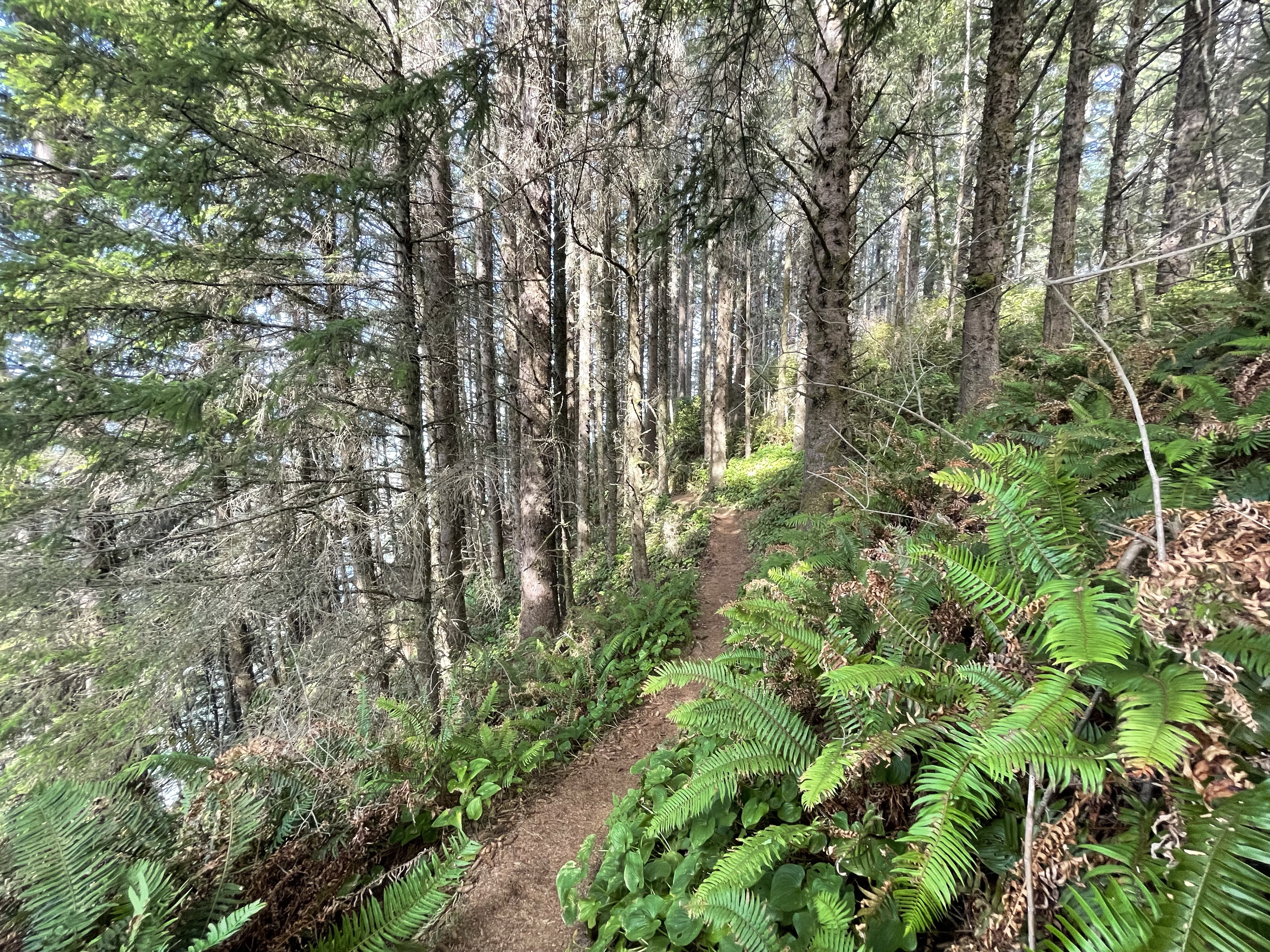
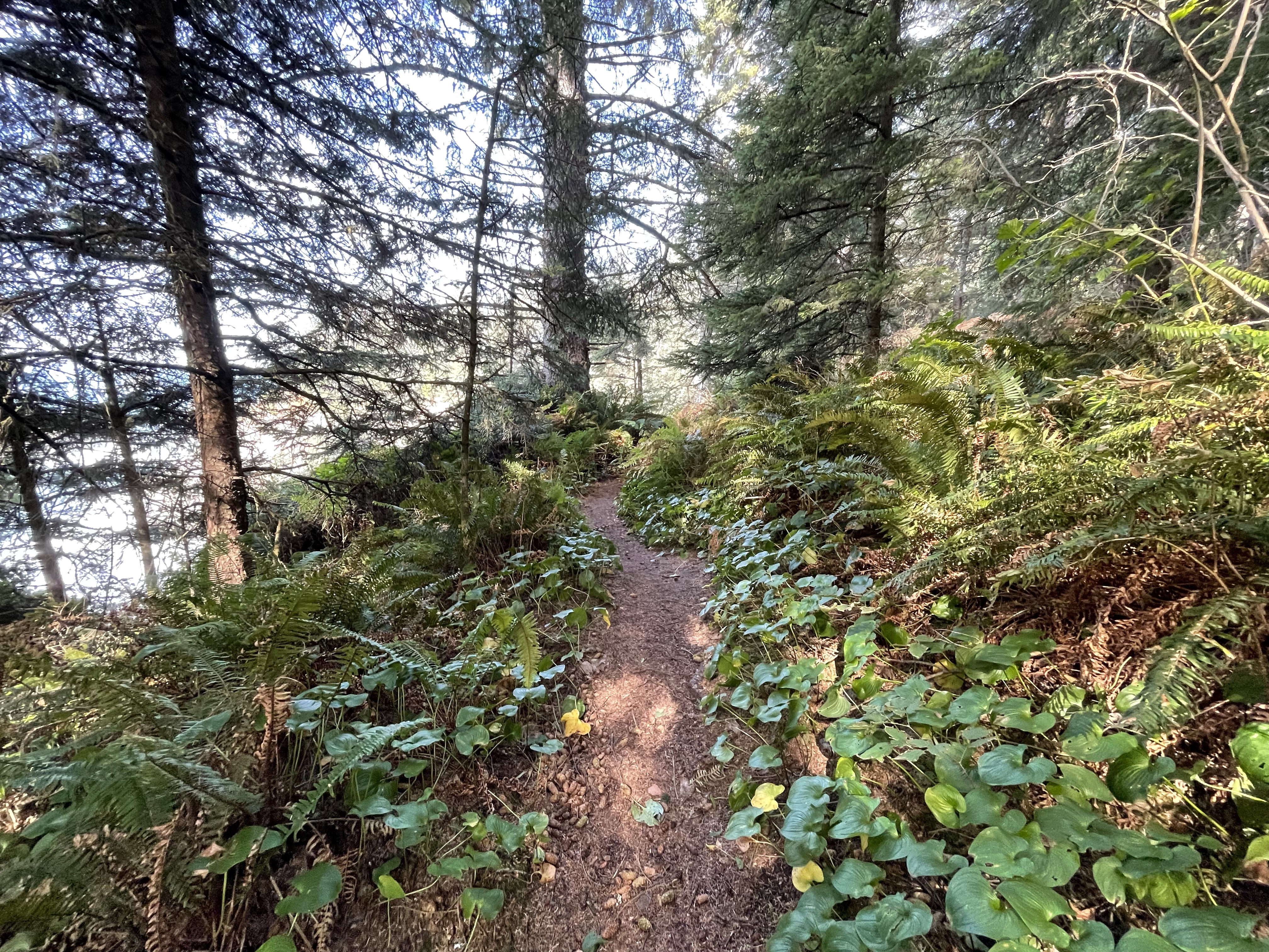
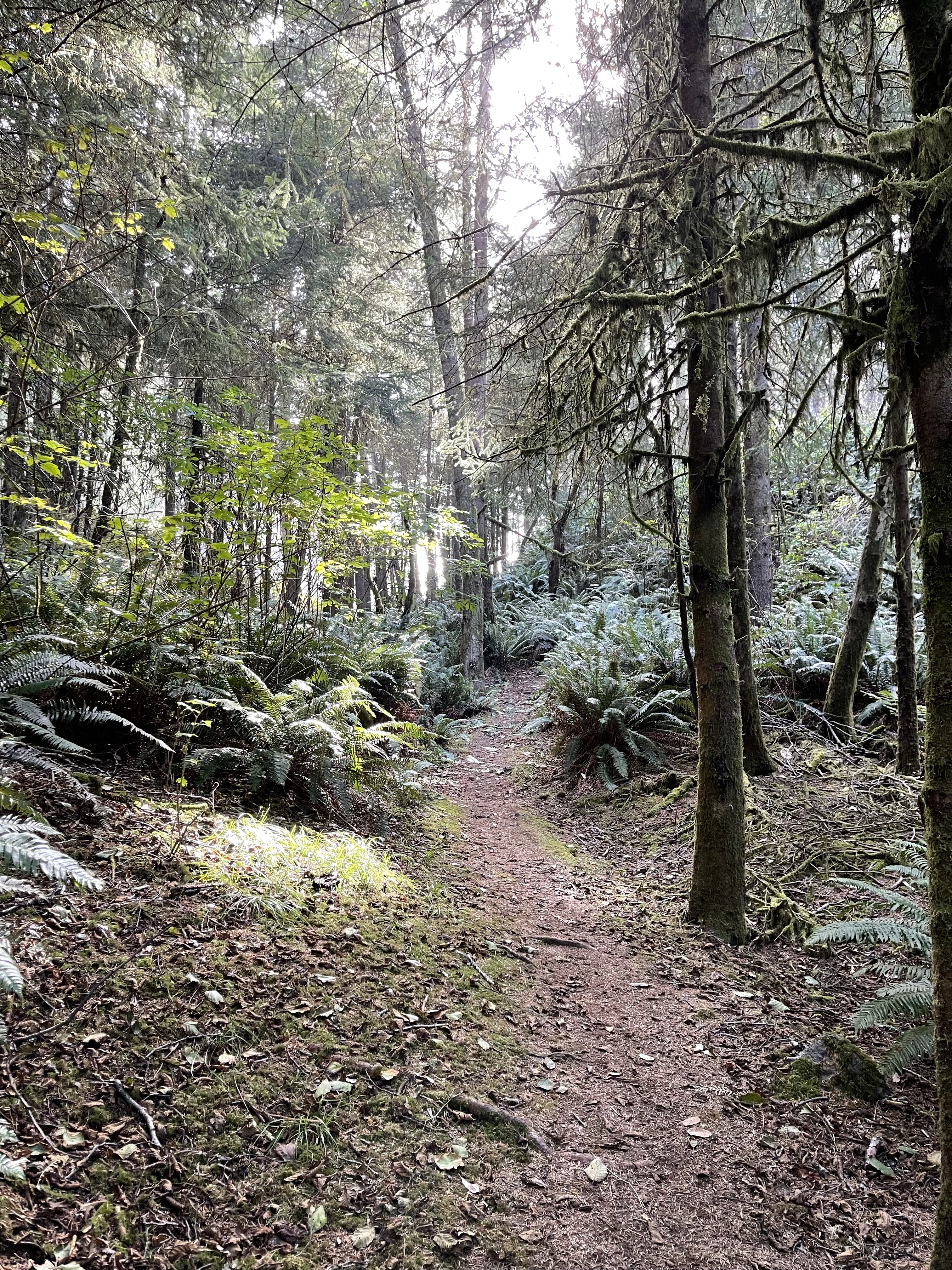
I had one picture in my mind that was a must see, so I stopped multiple times and went on multiple little hikes. They were all short hikes and as I said numerous ones so I am going to break with my tradition of mapping out a hike in this instance, but I will say this- each hike, each stop, was amazing so you really cannot go wrong by stopping at each turn off and checking it out once you get to this Corridor. Of course the whole Highway 101 in this entire stretch is pretty extraordinary so it is all good, strike that it is all magnificent.
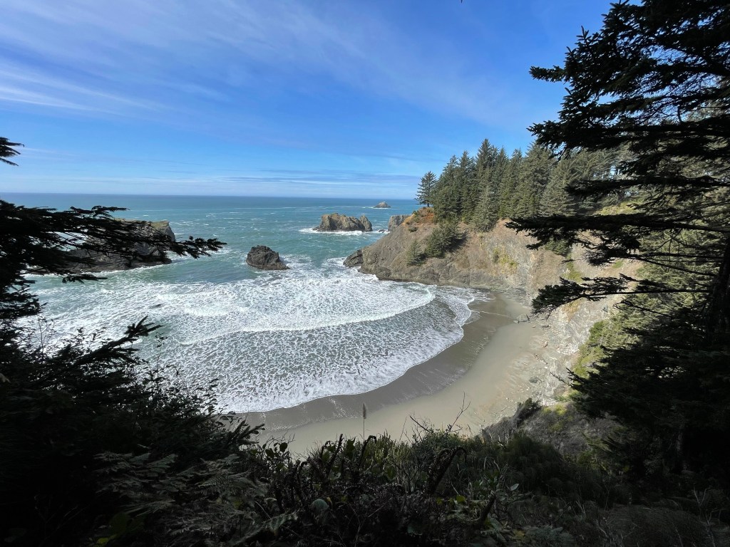
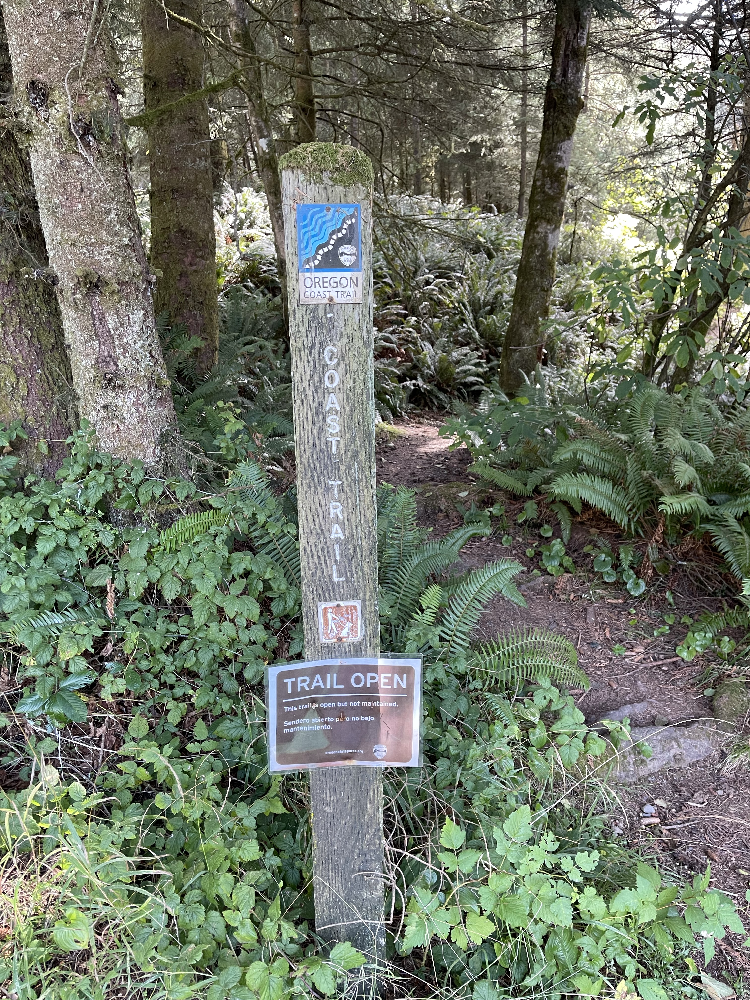
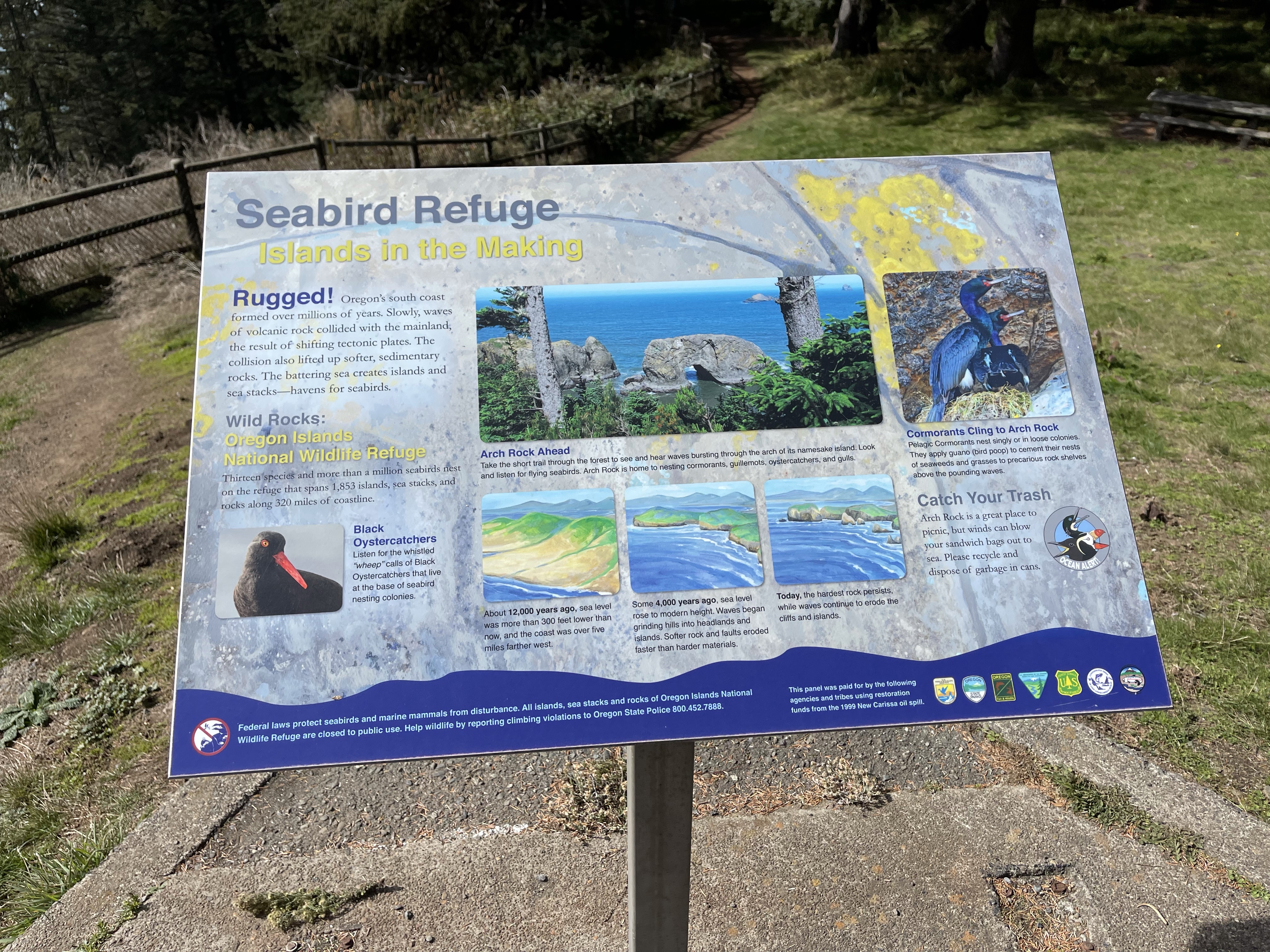
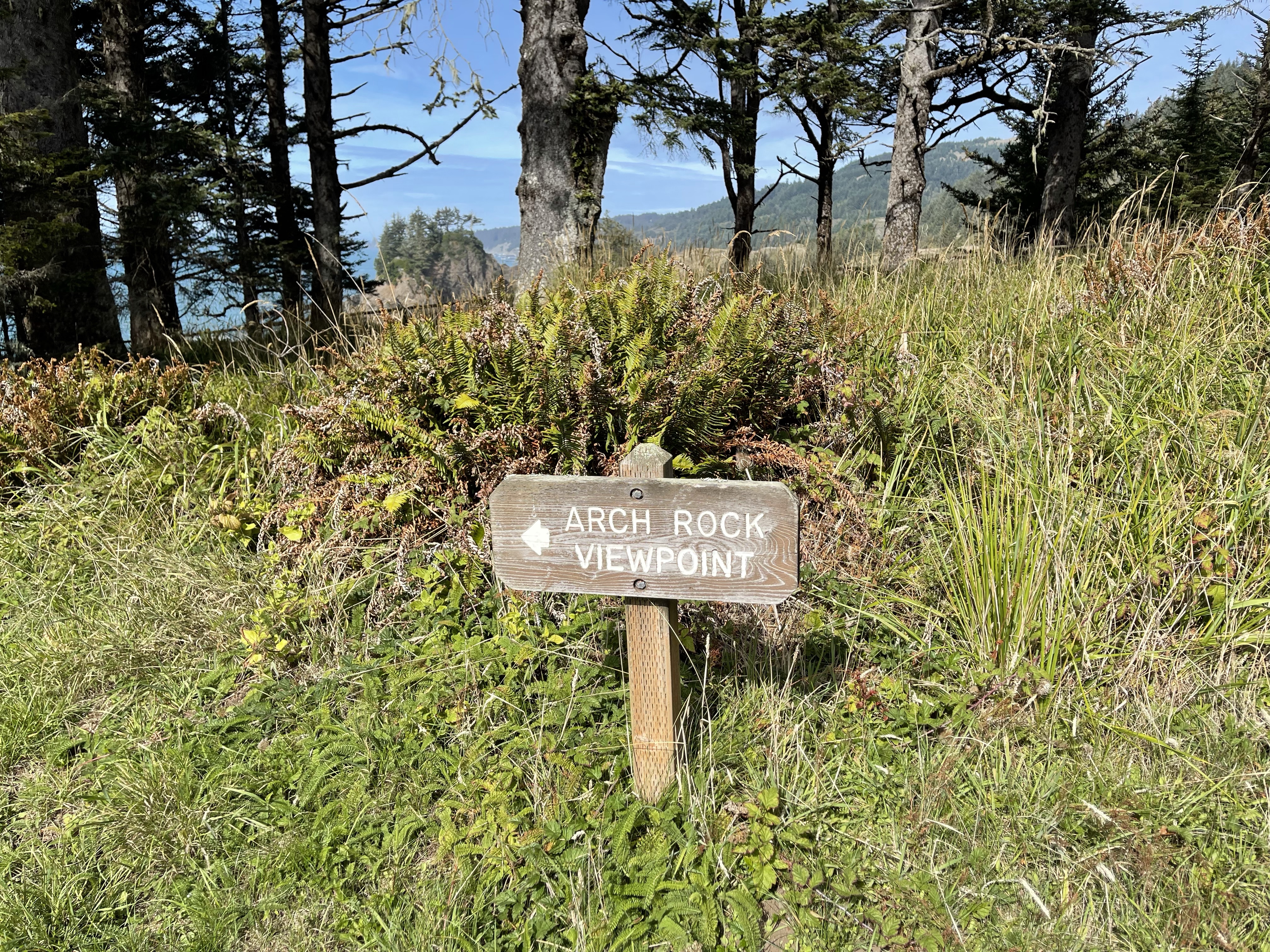
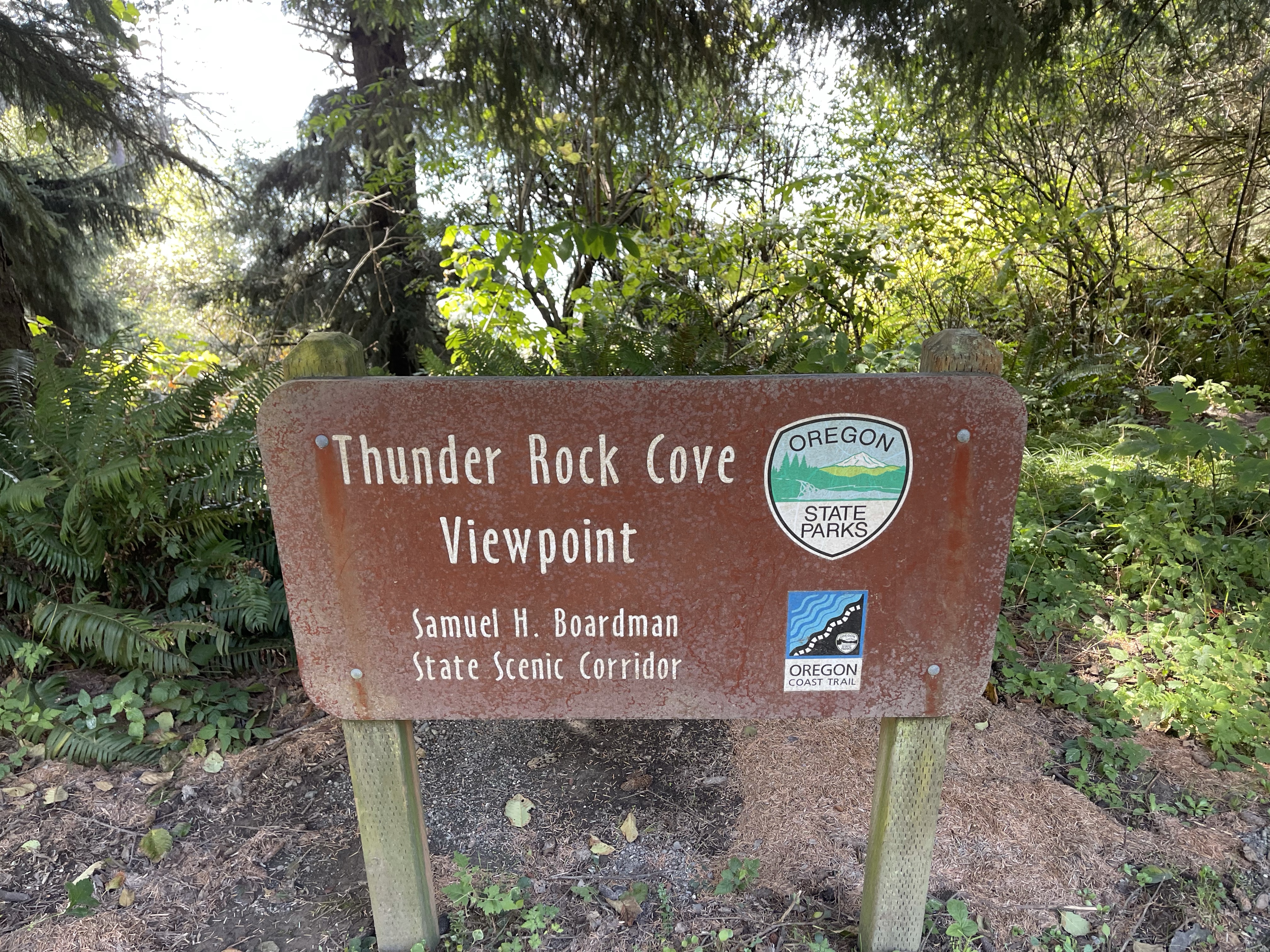
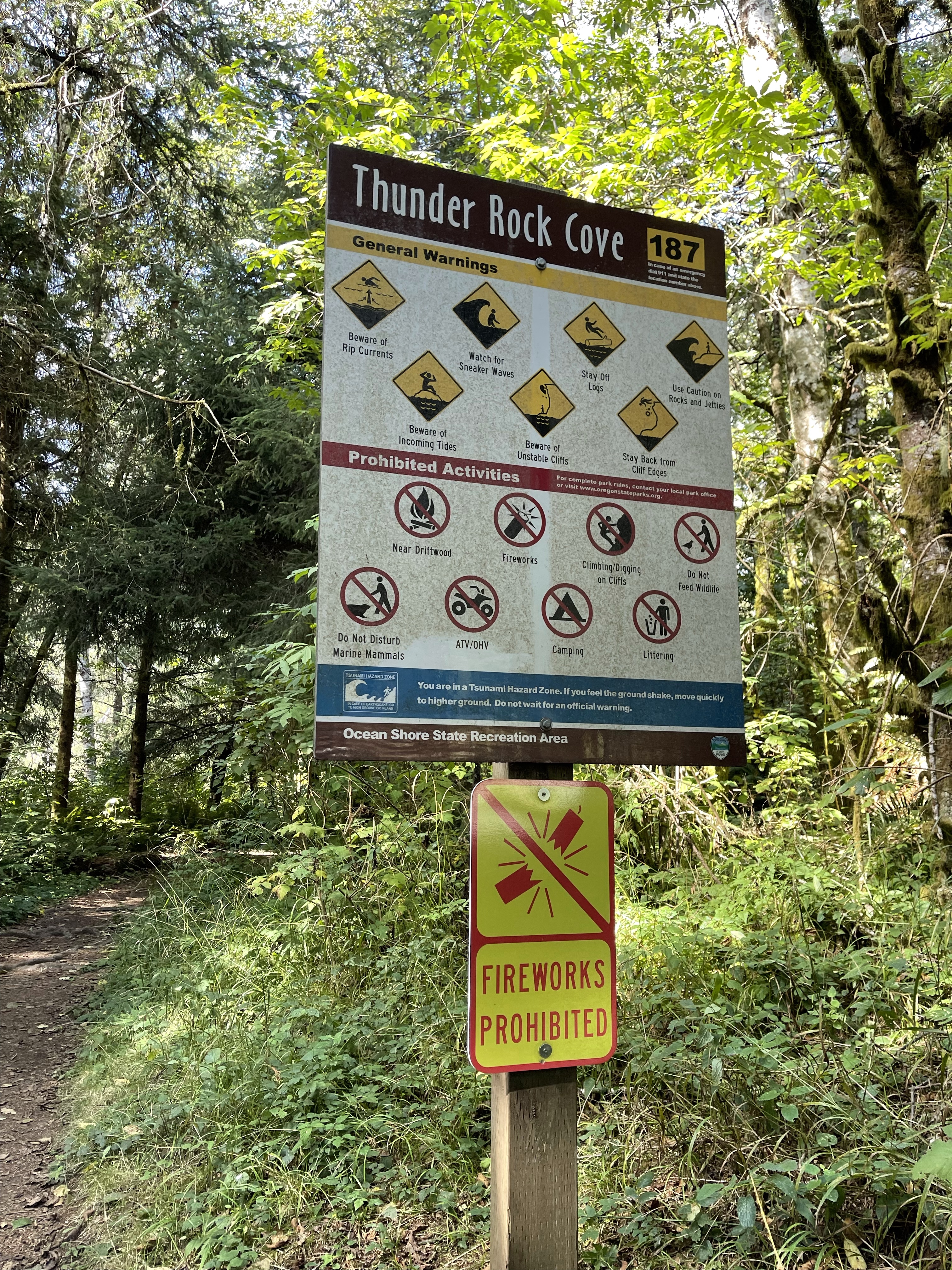
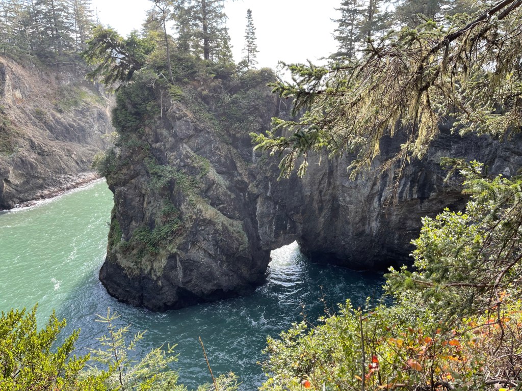
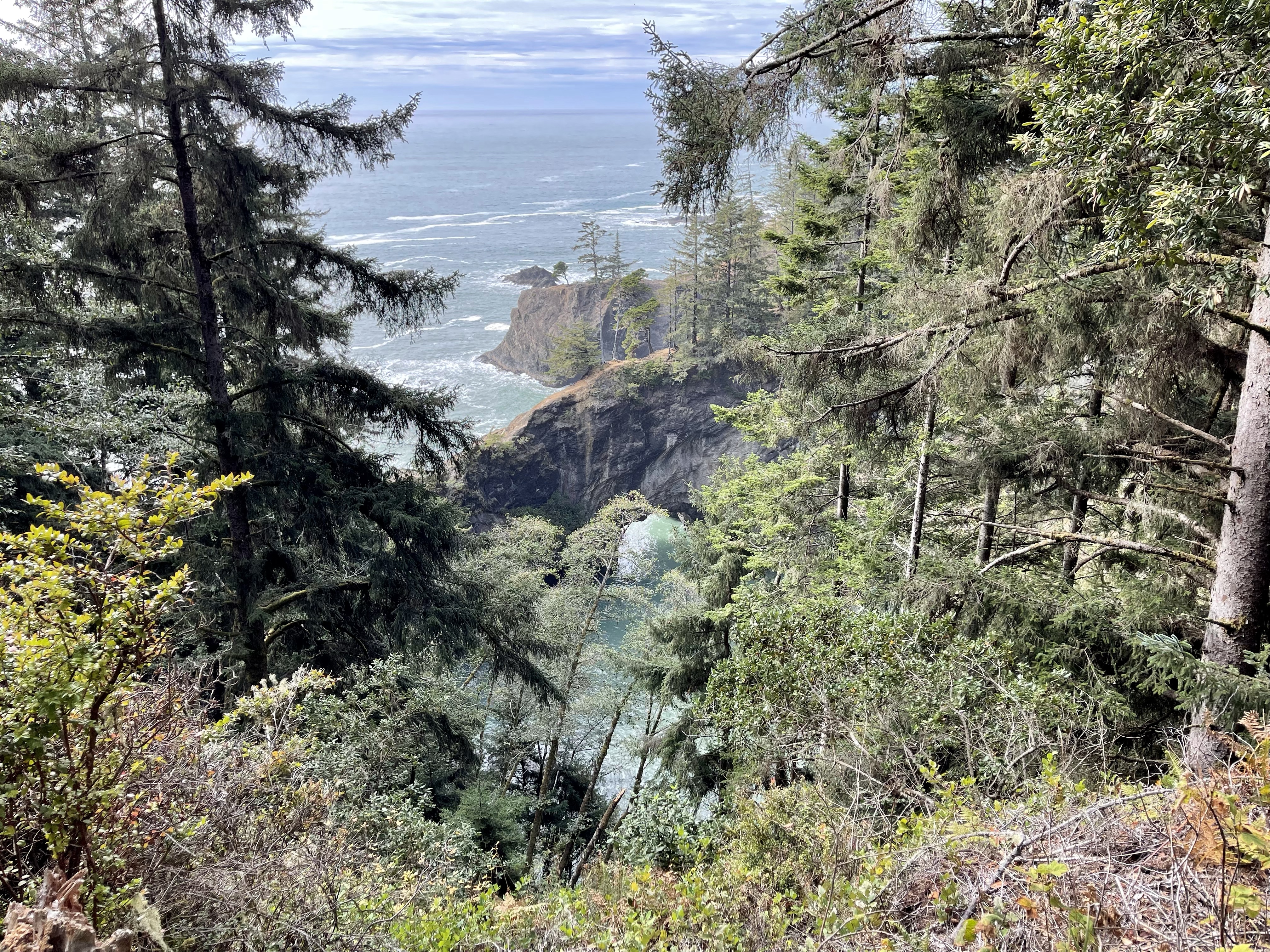
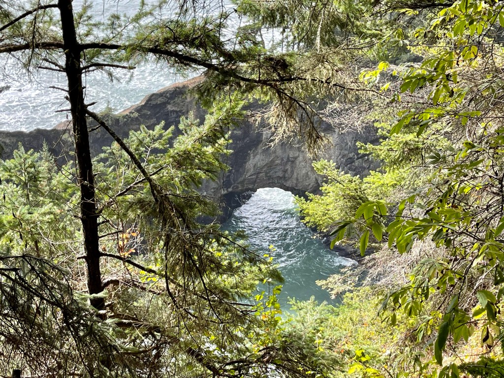
The pull outs have views of places with names like: Natural Bridges, Arch Rock, Thunder Rock Cove, Secret Beach, and Coast Trail. The Coast Trail and some of these trails do connect one stop to another, I know that I did that in at least one instance.
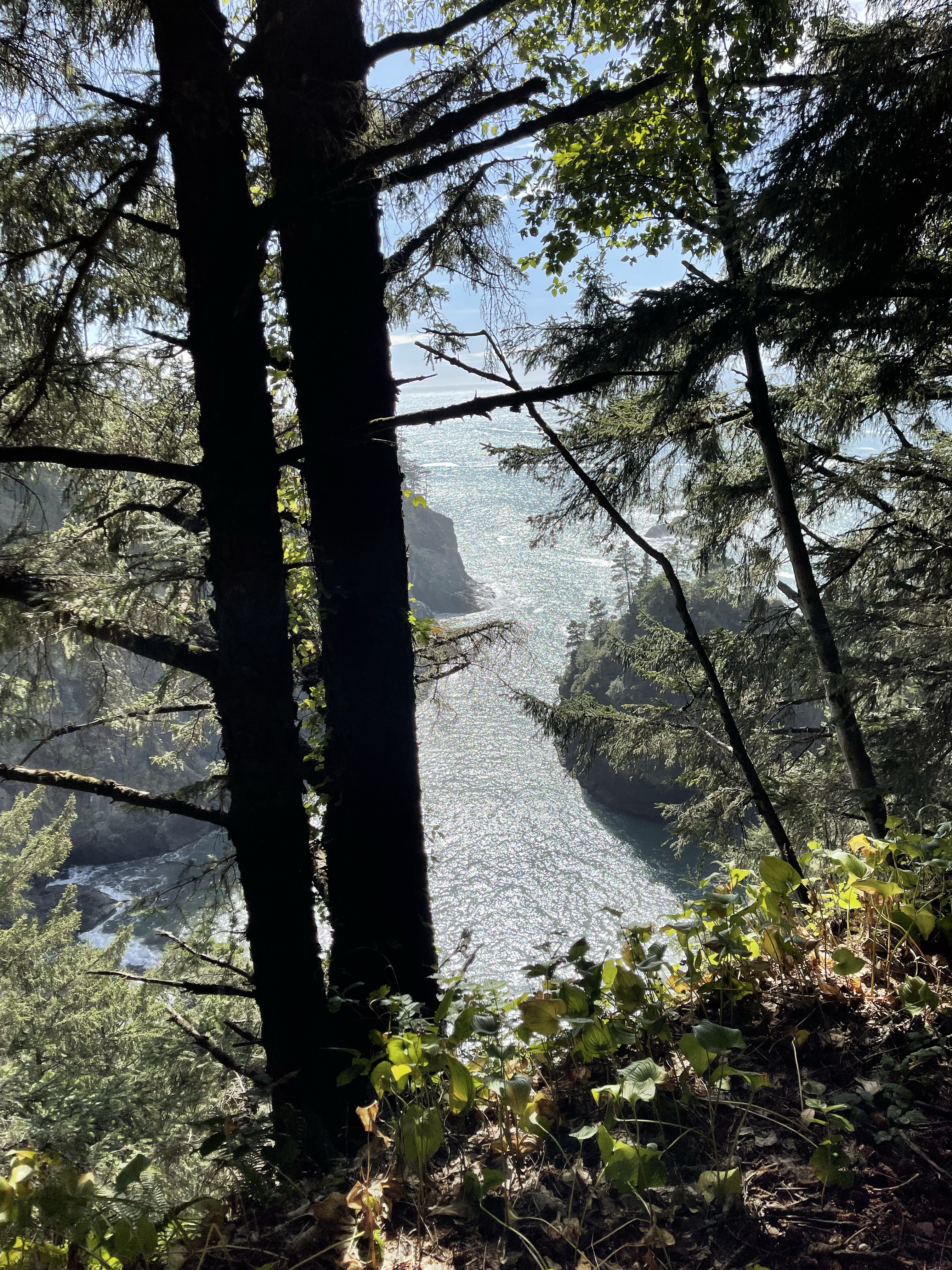
Samuel H. Boardman Scenic Corridor displays immense beauty. The kind of beauty with your eyes peeled wide, you hold your breath or it will be taken away. All of your senses come alive, absorbing every minuscule detail. Time moves slower so that you can enjoy each and every minute, etching it into your mind, imprinting it on your soul. Breath in the splendor, capture the moment, take a picture with your heart, because no photo or video can record this, at least doing it any justice. The best that photos can do is serve as a reminder of this instance of how it felt. Feeling the damp air, smelling the fragrant firs mixed with the dank scent of the moist earth and the salt of the sea, hearing the crashing waves below, the cry of a lonely gull, sights of forest, ocean, cliff, tiny islands, delightful coves, rugged volcanic rock and formations that are simply divine are intoxicating. Drink in as much of Nature’s Goodness as you dare.
The colors are so strong, so vibrant, the green firs, the lush ferns, the blues and greens of the Pacific, the midday sky with its wisps of white clouds… Rambling along the perfectly forested trails that provide peek boo glimpses of the ocean beyond, the turbulent sea catches your attention, but take caution you will come across dizzying heights, so be mindful of your step. The glory that beholds can act as a Siren just as the myth of Mermaids luring seafaring men onto the rocks, but in this case the view beckoning you ever closer to the edge for that perfect view. Be warned that these cliff edges could be undercut and give way. Even some large trees have their roots eroded and exposed to air and space. This is a strange, mystical, magical and wonderful place and very powerful.
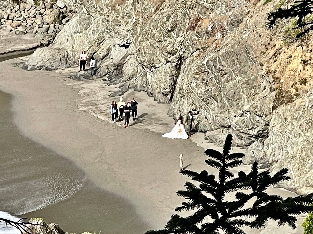
Pursuing Balance Through Adventure YouTube Channel. Click the pic and listen to the waves and see the power.Gold Beach
This would be a gorgeous place for wedding pictures, but I will say around the time of this picture a wave cornered the bride and groom and soiled her beautiful gown.
“There is pleasure in the pathless words… There is rapture on the lonely shore… There is society where none intrudes… By the deep sea and music in it’s roar… I love not man the less, but nature more… From these our interviews, in which I steal… From all I may be, or have been before. To mingle with the universe and to feel… What I can ne’er express, yet cannot all conceal.” – Lord Byron
Thank you for joining me in a forest, on a cliff with a view of complete splendor. While I found myself ’Pursuing Balance Through Adventure’ amongst the trees, nature provided “Natural Bridges” from the busy life of man to the sweet embrace of Mother Nature. Samuel H. Boardman Scenic Corridor was a good one and I will be hard pressed to try and top this place, but try I must and try I will. To join me: COMMENT, LIKE, FOLLOW and SHARE. The menu above has wonderful places throughout the West that PBTA explores check it out to spawn ideas of your next adventure.Each location is a separate website and thus needs to be FOLLOWED independently.SHOP APPARELhas top quality adventure wear for you to adorn yourself for your journey.