Activity: Day Hike, Scenic Views, Chasing Waterfalls
Date: September 18, 2025
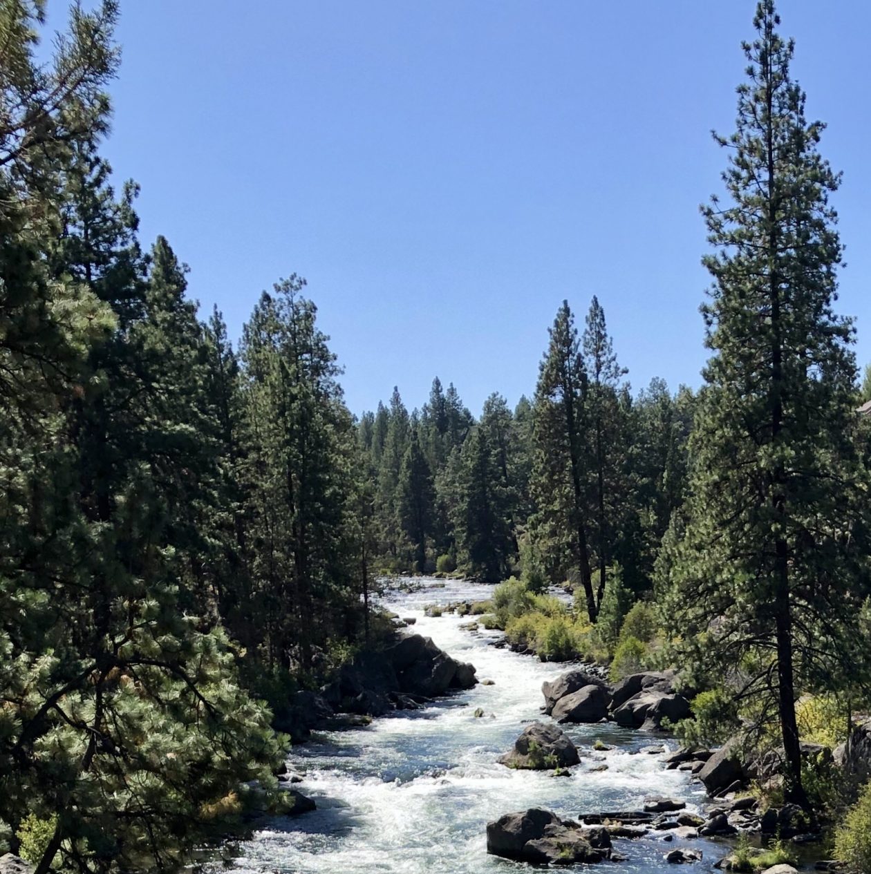
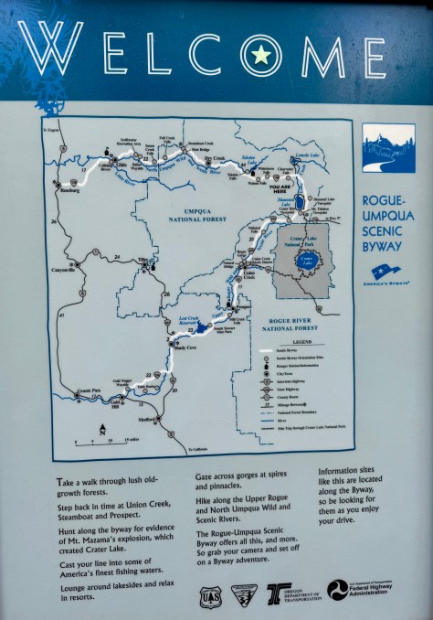
The Highway of Falls aka the Rogue-Umpqua River Scenic Byway is an exquisite spot to be chasing waterfalls as there is one after another along Highway 138 as I headed West after traveling down Highway 97 from Bend Oregon. The first stop was Clearwater Falls and the experience was only getting better.
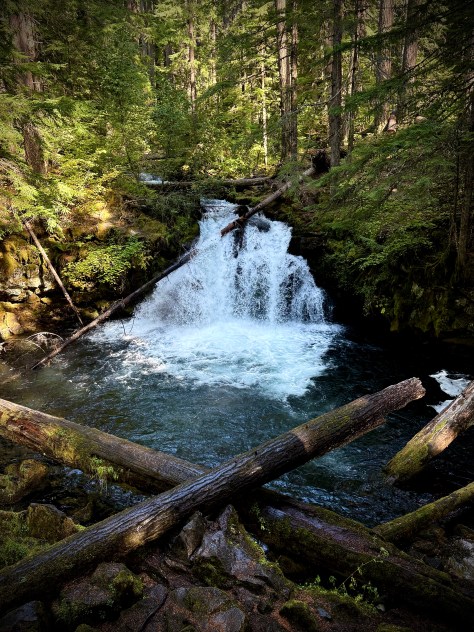
Pursuing Balance Through Adventure YouTube Channel White Horse Falls CLICK THE PIC!
This segment of my “epic roadtrip” from SoCal to Washington State was ending with this route along this wonderful “Highway of Falls” in green, lush spectacular Oregon.
Epic Road Trip
Now this is the type of Adventure one Pursues to gain Balance via Nature. Falling, cascading, rushing water tumbling over a cliff. The sound, the feel, the taste, the visual satisfaction, waterfalls are pure magic.
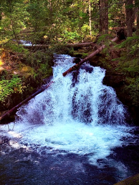
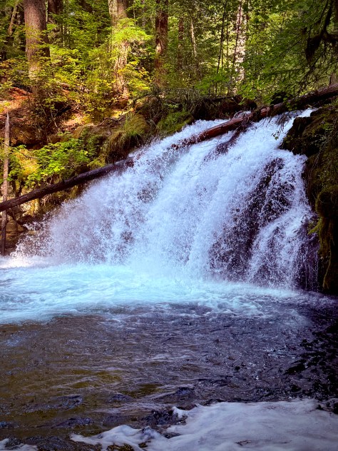
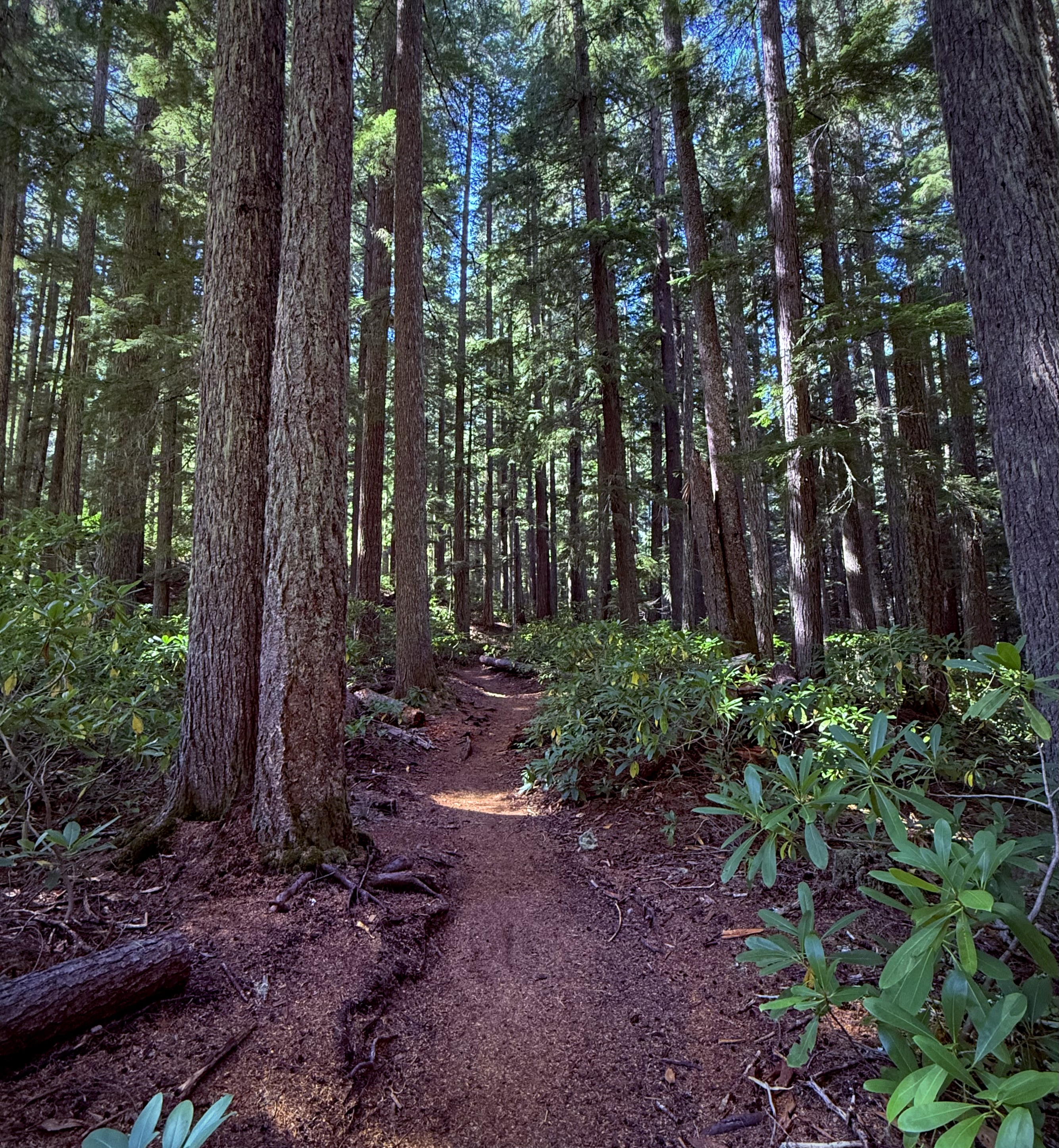
White Horse Falls has a short hike and a short 15′ drop, but what it is not short on is natural beauty. This lovely waterfall on the Clearwater River, in Southwest Oregon is an easy stop. The waterfall is set in a wooded picturesque setting, moss covered rock, framed by a peaceful tranquil old-growth forest.
Fallen timber has been tossed about it’s clear cool pool all part of this exquisite scene which can be viewed from the observation deck, so this waterfall is easy for one and all to checkout the affect that Nature and water can have on the human soul, mind and spirit.
“There is a hidden message in every waterfall. It says its natures way of laughing, go with the flow, and if you’re flexible falling won’t hurt you.” -Dreadhead_Derek
The waterfalls are getting better on this quest for bigger, taller, stronger, prettier, more magnificent. It’s all good. They are all beautiful on this Oregon “Highway of Waterfalls!” ‘Pursuing Balance Through Adventure’, Chasing Waterfalls, ya’ just gotta’ luv it ! Followers of PBTA you don’t have to wait because if you look at the Menu above you will find many adventures that you might want to go explore yourselves. Each location is a separate website and thus needs to be FOLLOWED independently. Speaking of FOLLOWING pleaseLIKE, SHARE, COMMENT, andFOLLOW. Also checkout SHOP APPARELfor all of your Adventure Wear needs. It’s all top quality.
Activity: Day Hike, Scenic Views, Chasing Waterfalls
4.2 miles, 758’ elevation gain, 2.5 hour duration, rated Moderate
Date: September 18, 2025
As part of my “Epic Road Trip” where I traveled from SoCal exploring many exciting and beautiful places in California, Oregon and Washington I found myself ‘Pursuing Balance Through Adventure’ in Central Oregon.
Once again I had a yearning to chase waterfalls and Oregon has some of the best.
(Checkout my trip to Silver Falls which has so many fabulous falls and all accessible if you are willing to hike a little… well, maybe a more than a little.)
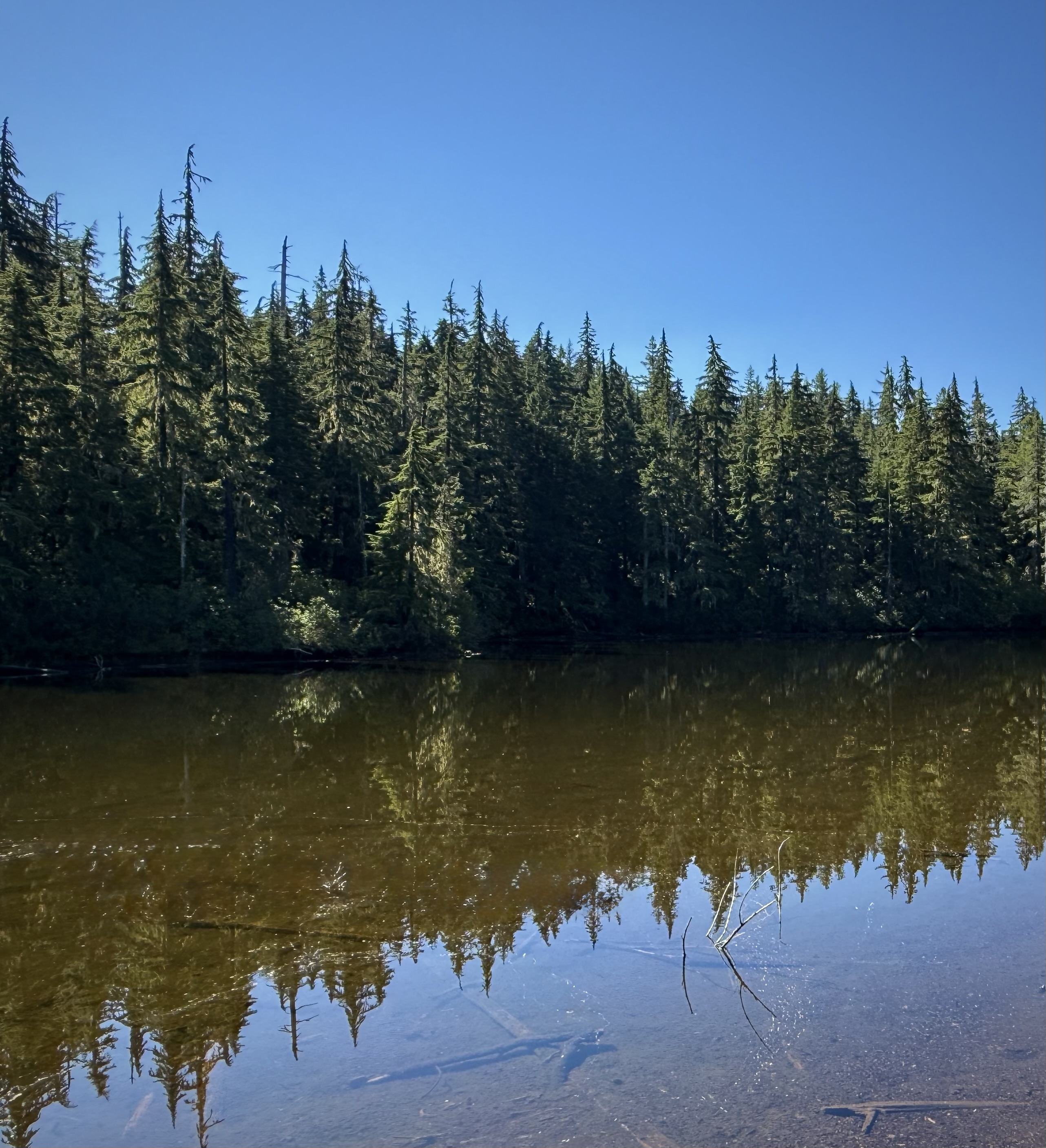
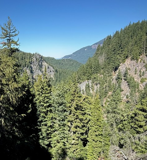
The hike I chose on this day encompassed two stunning waterfalls. It was a lovely hike through verdant forest, beside a still lake and along cliffs presenting sweeping views overlooking a breathtaking rugged gorge.
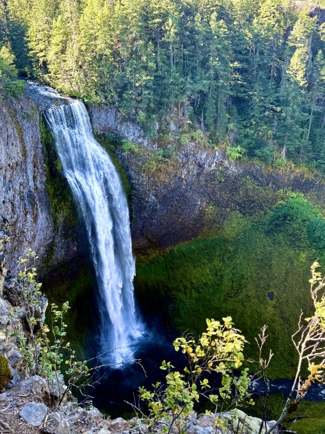
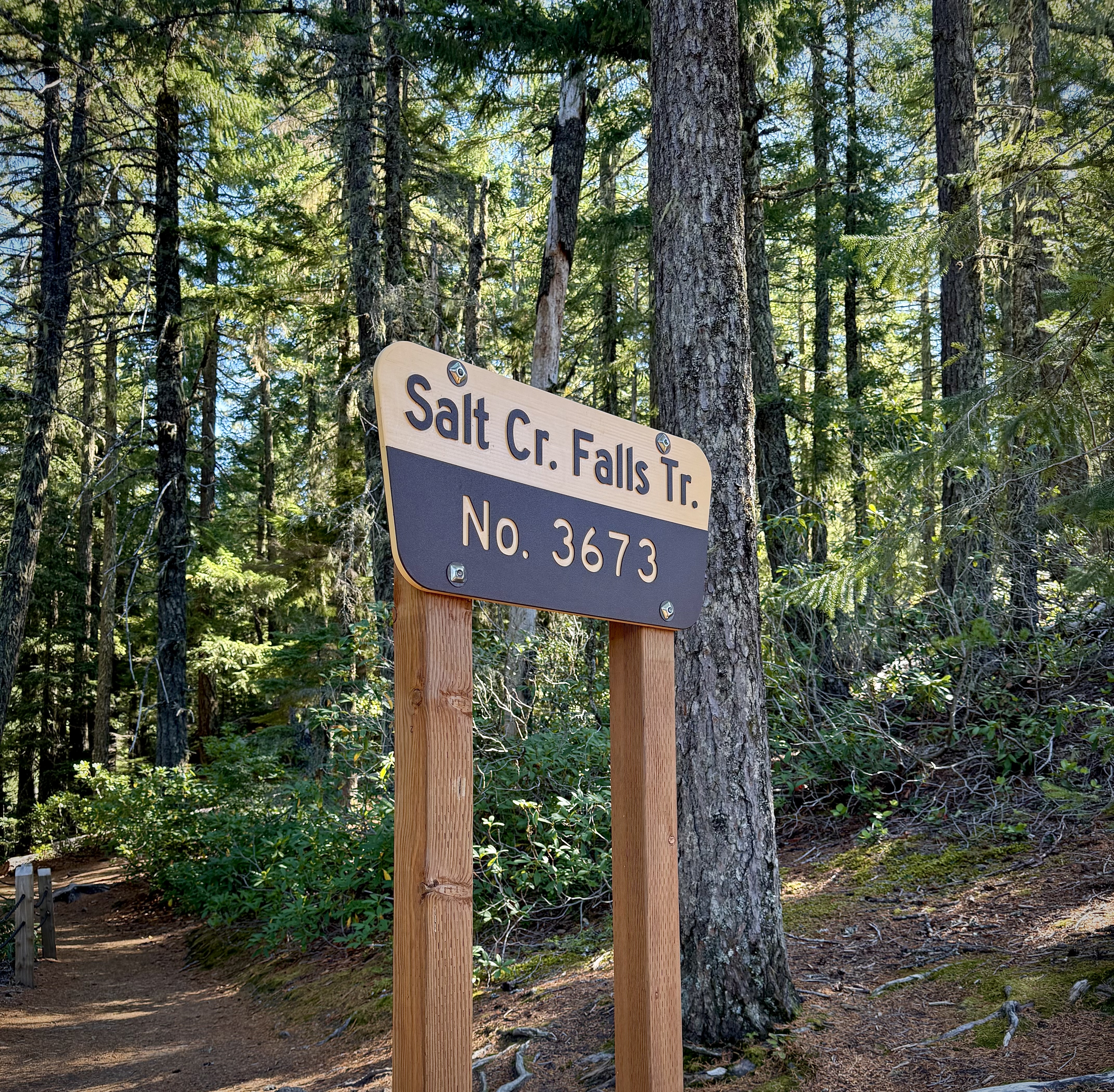
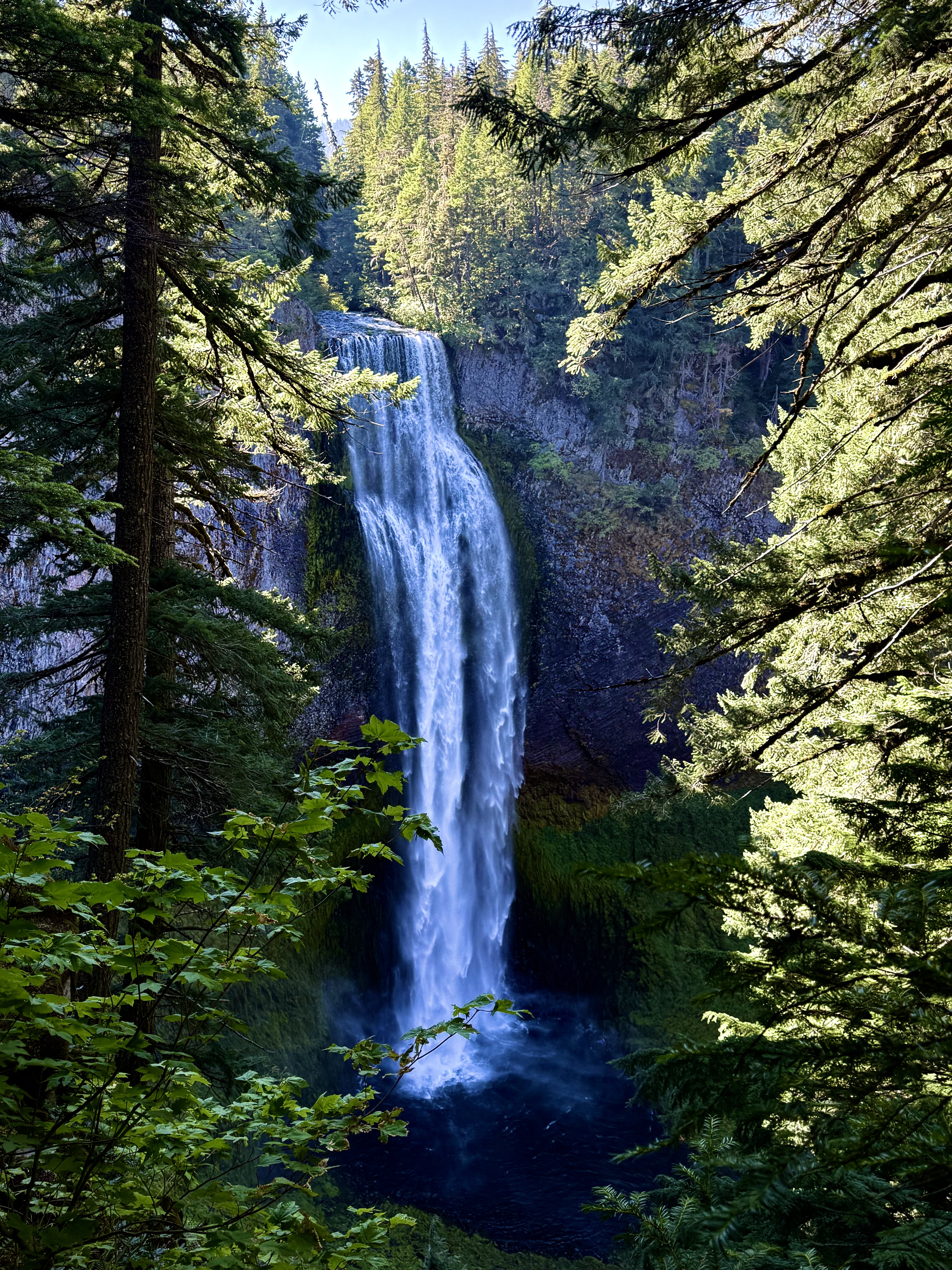
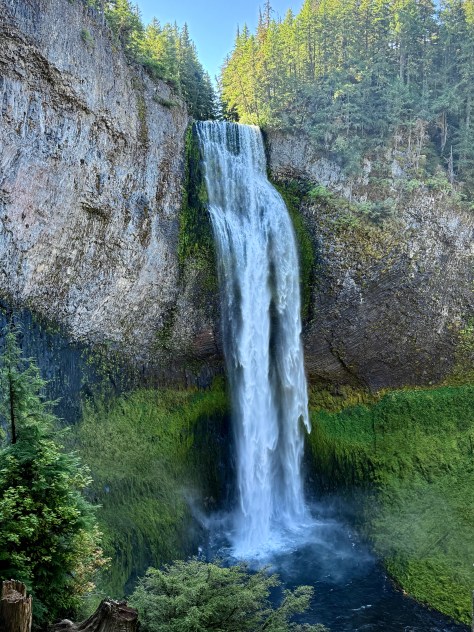
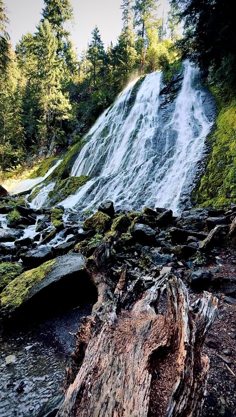
Salt Creek Falls
From the parking area I took Salt Creek Falls Trail. The magnificence of Salt Creek Falls is only a hop and a skip away for those in a hurry or perhaps less mobile. But- the way to experience this treat of nature, these extraordinary waterfalls, is to hike them.
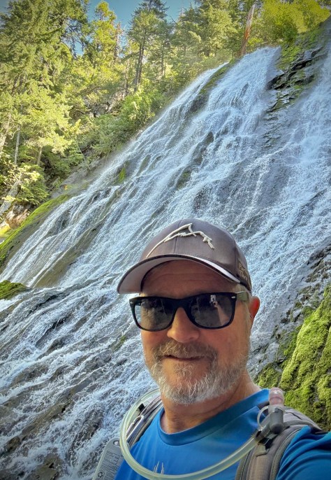
I stuck my head over the side to take in the view and indeed it was spectacular. It is easy to become mesmerized by the tumbling water as it flings its flow over the cliff, falling 286′ to the turbulent dark pool below. (Second highest waterfall in the State, the first is Multnomah Falls.)
I had to break myself of its spell and follow the trail down down down to an observation spot to see its wonders from a different angle and as you might imagine it did not disappoint.
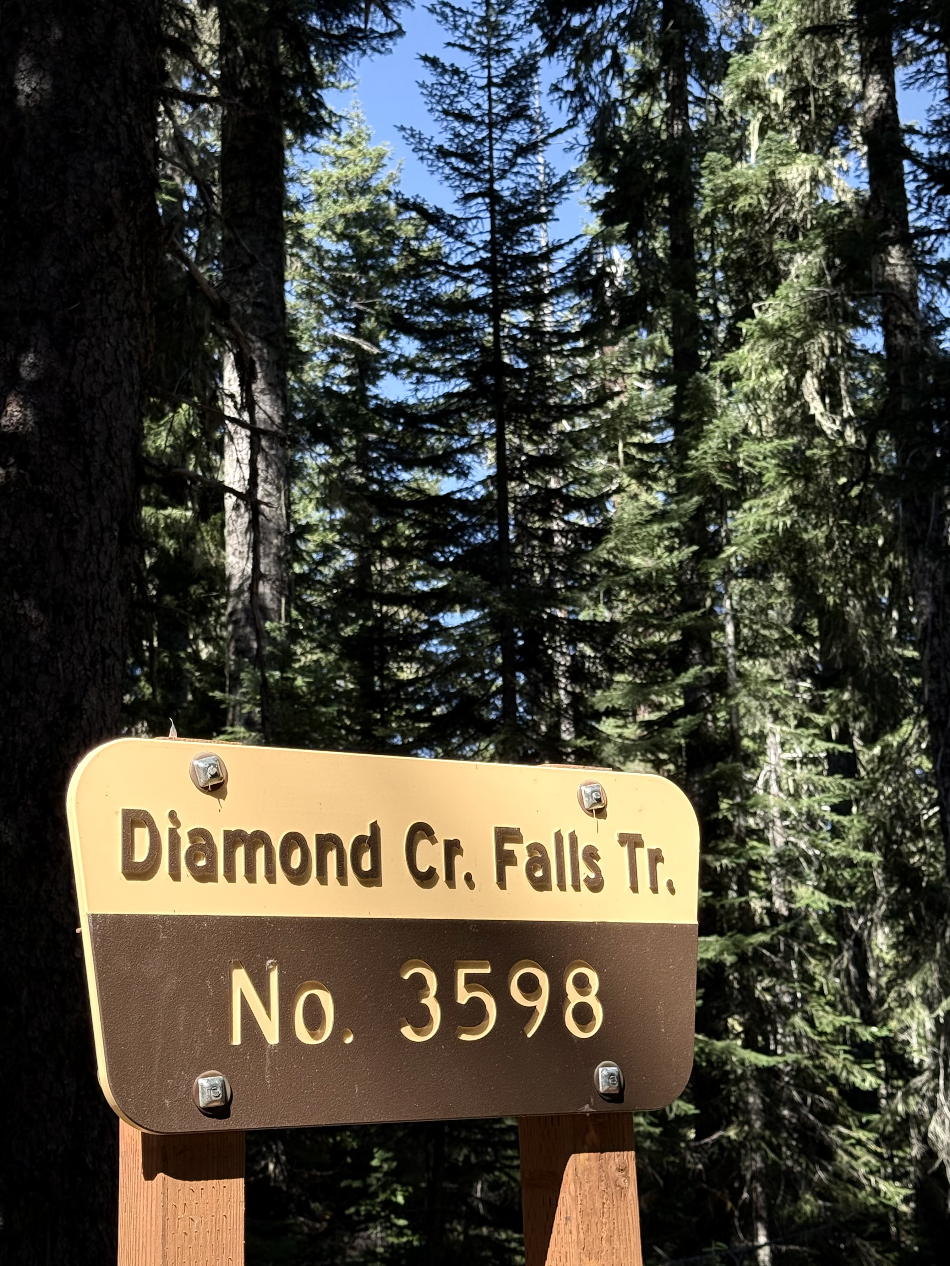
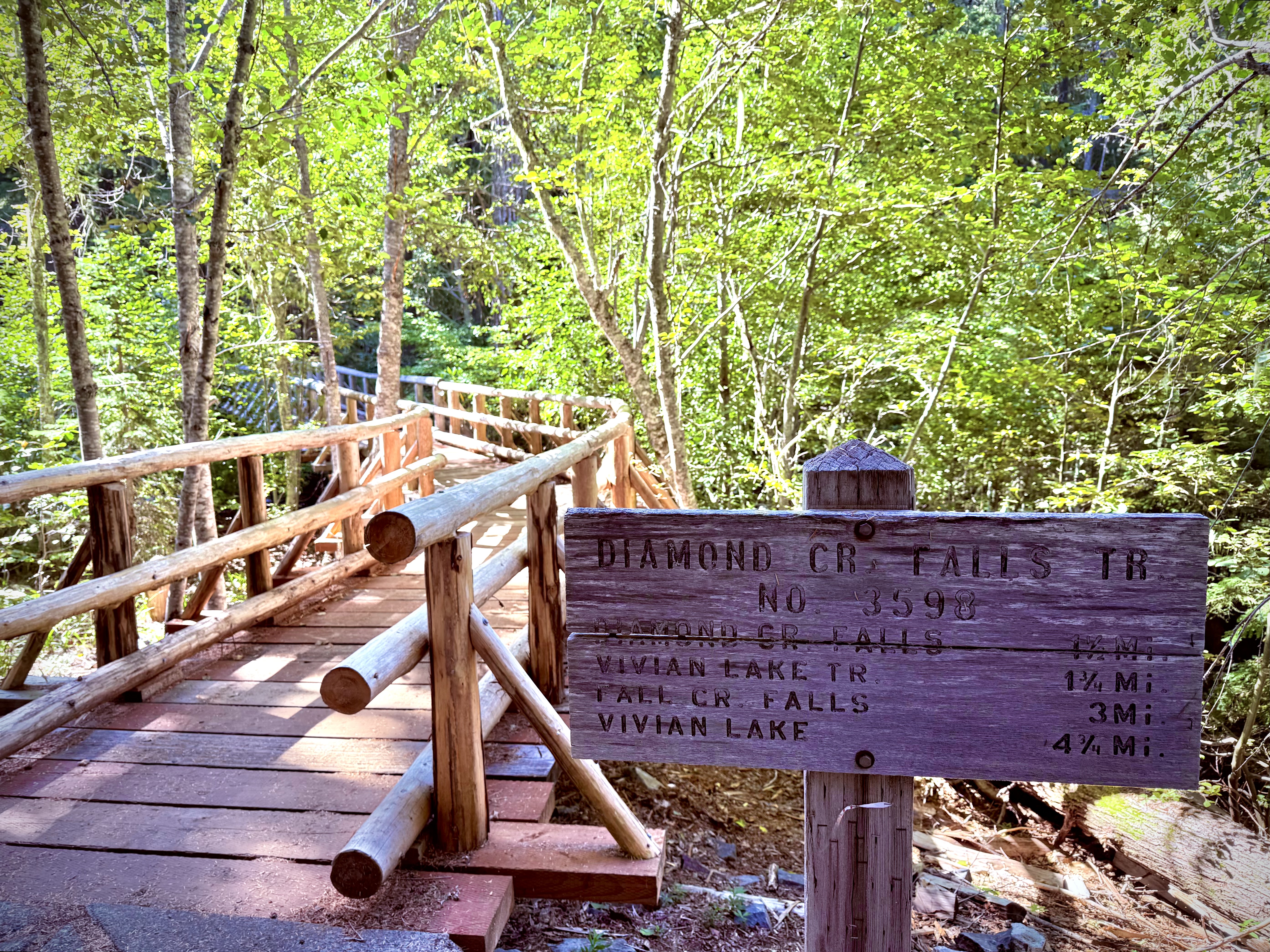
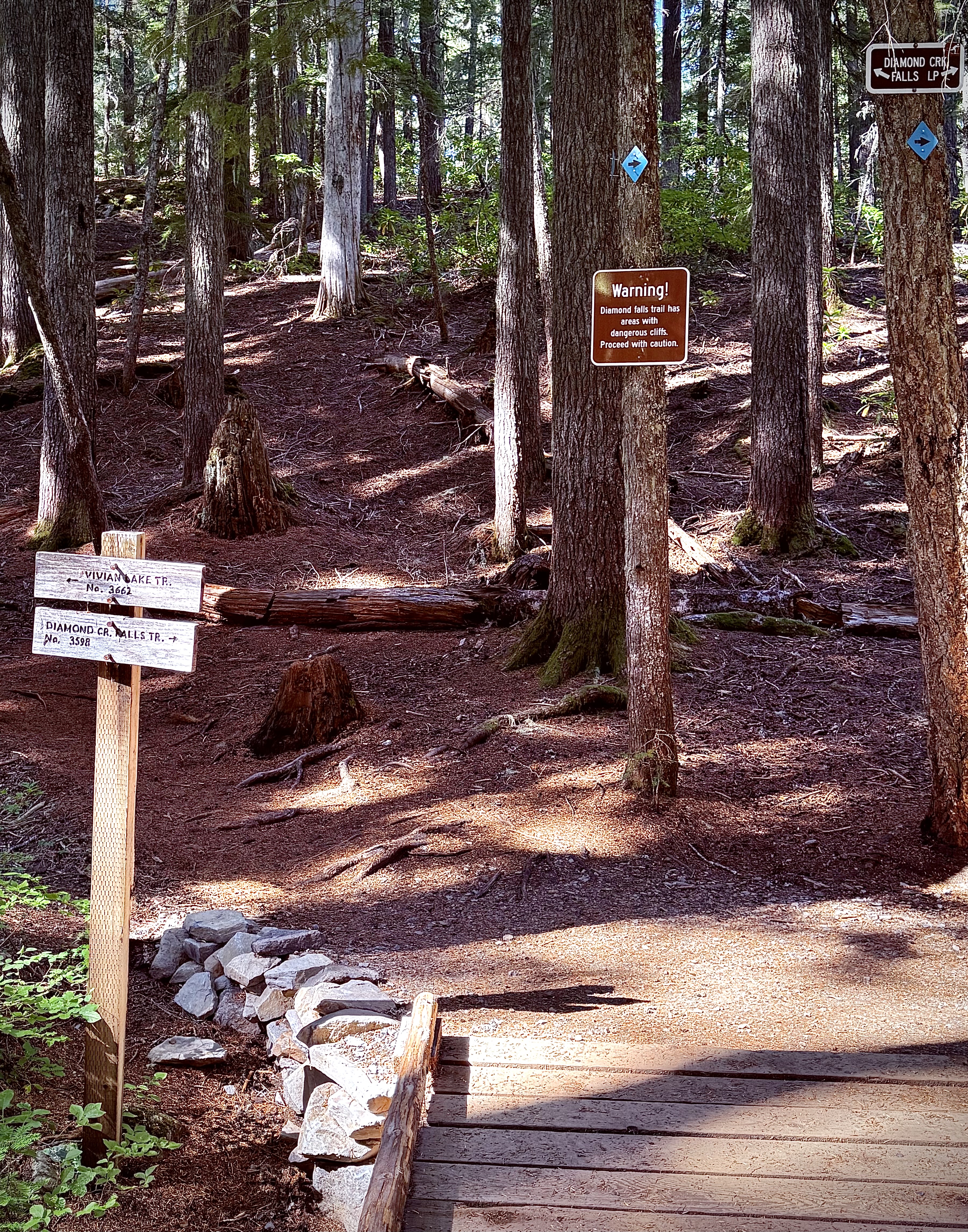
Then I retraced my steps back up to the top never missing an opportunity for another glimpse even if I had just seen it on the way down. Once on top I had to tear myself away again and ramble on down the trail connecting with Diamond Creek Falls Trail.
My trek was a delight with one final view up close and personal of Salt Creek Falls just before it goes airborne. I passed ‘Too Much Bear Lake’, which I am sure was named that for a good reason, but on this day I did not see any bear.
I would cross the stream a couple times and carefully creep up to the side of the cliff, which warning signs hand mentioned beforehand.
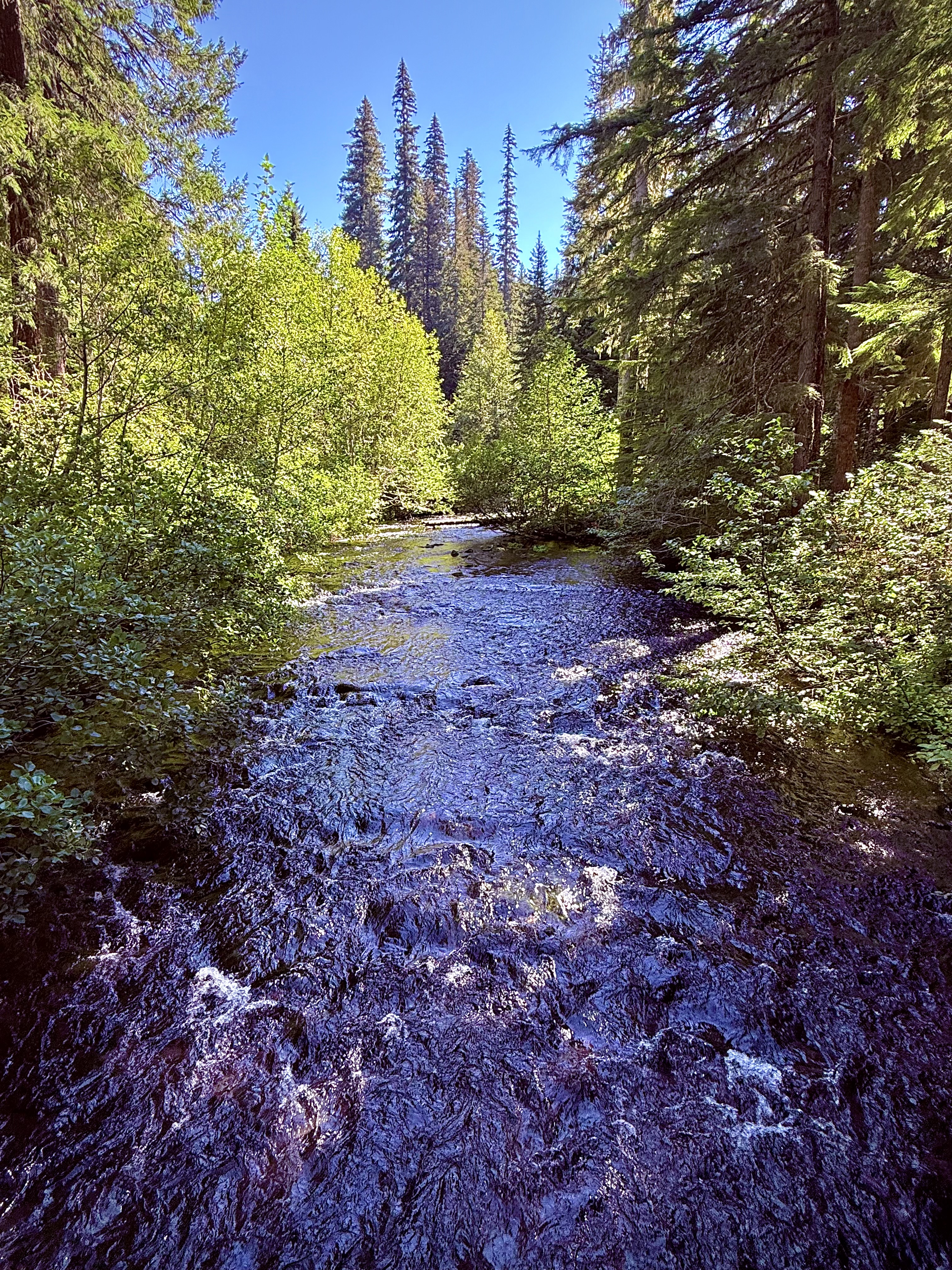
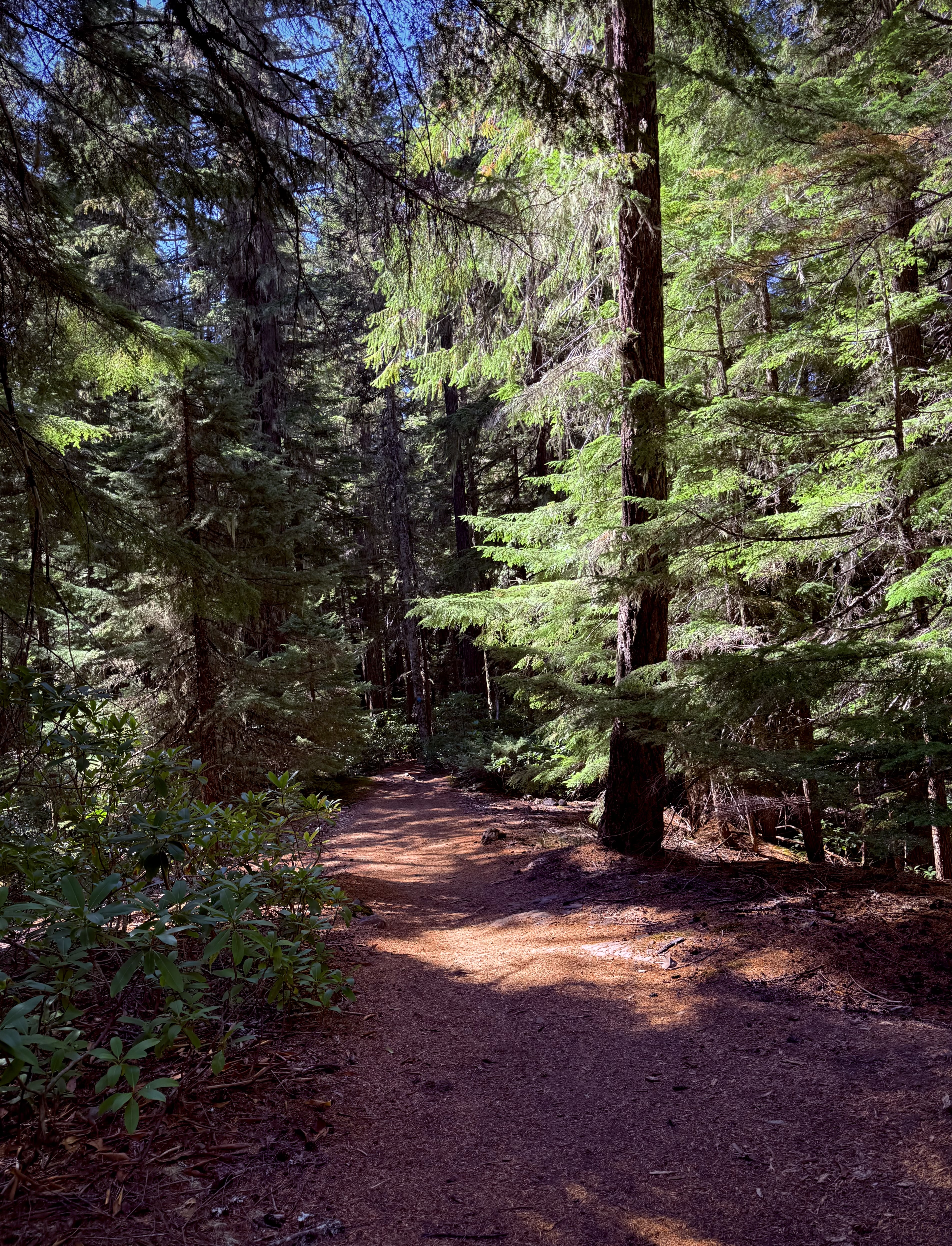
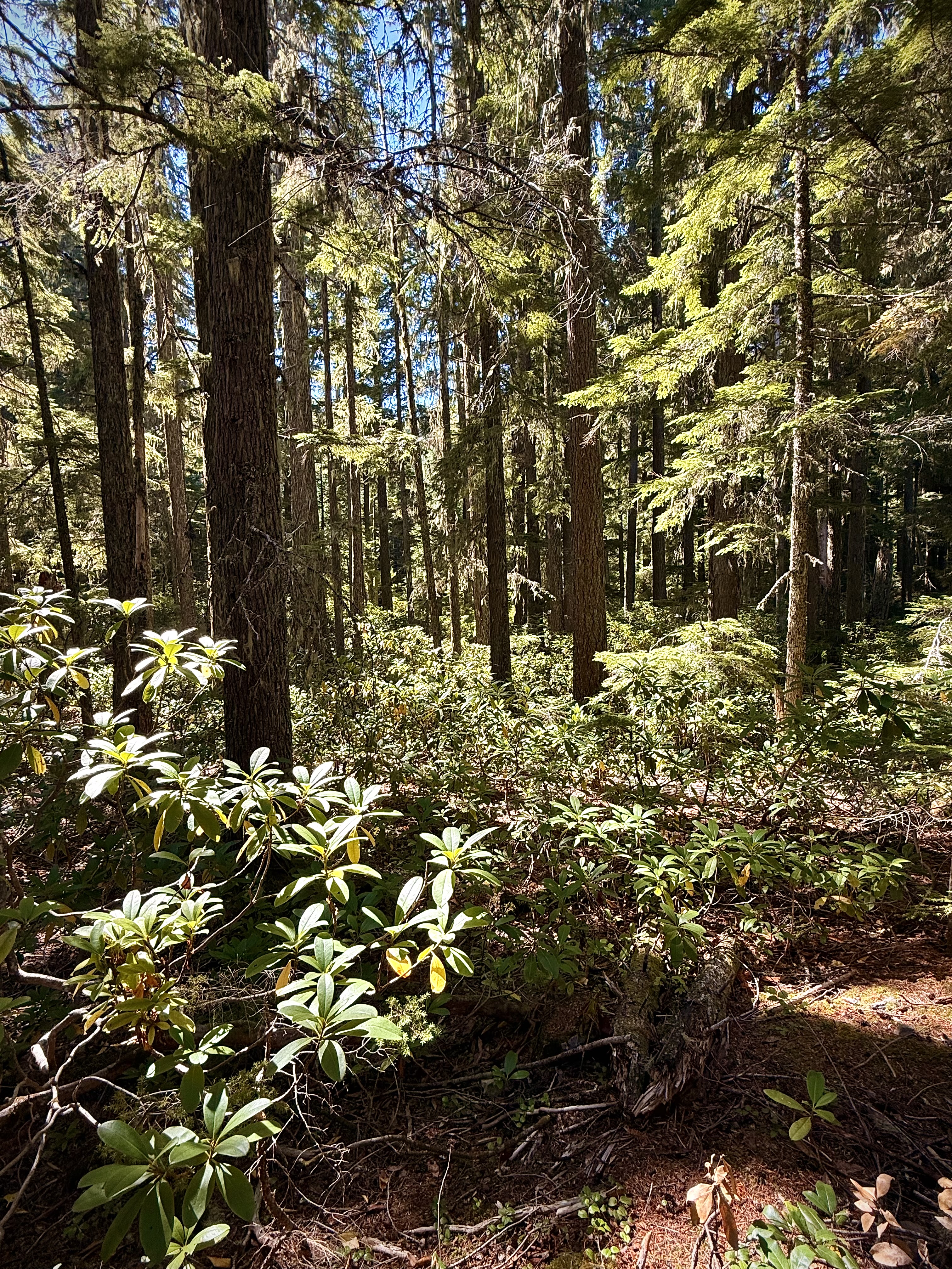
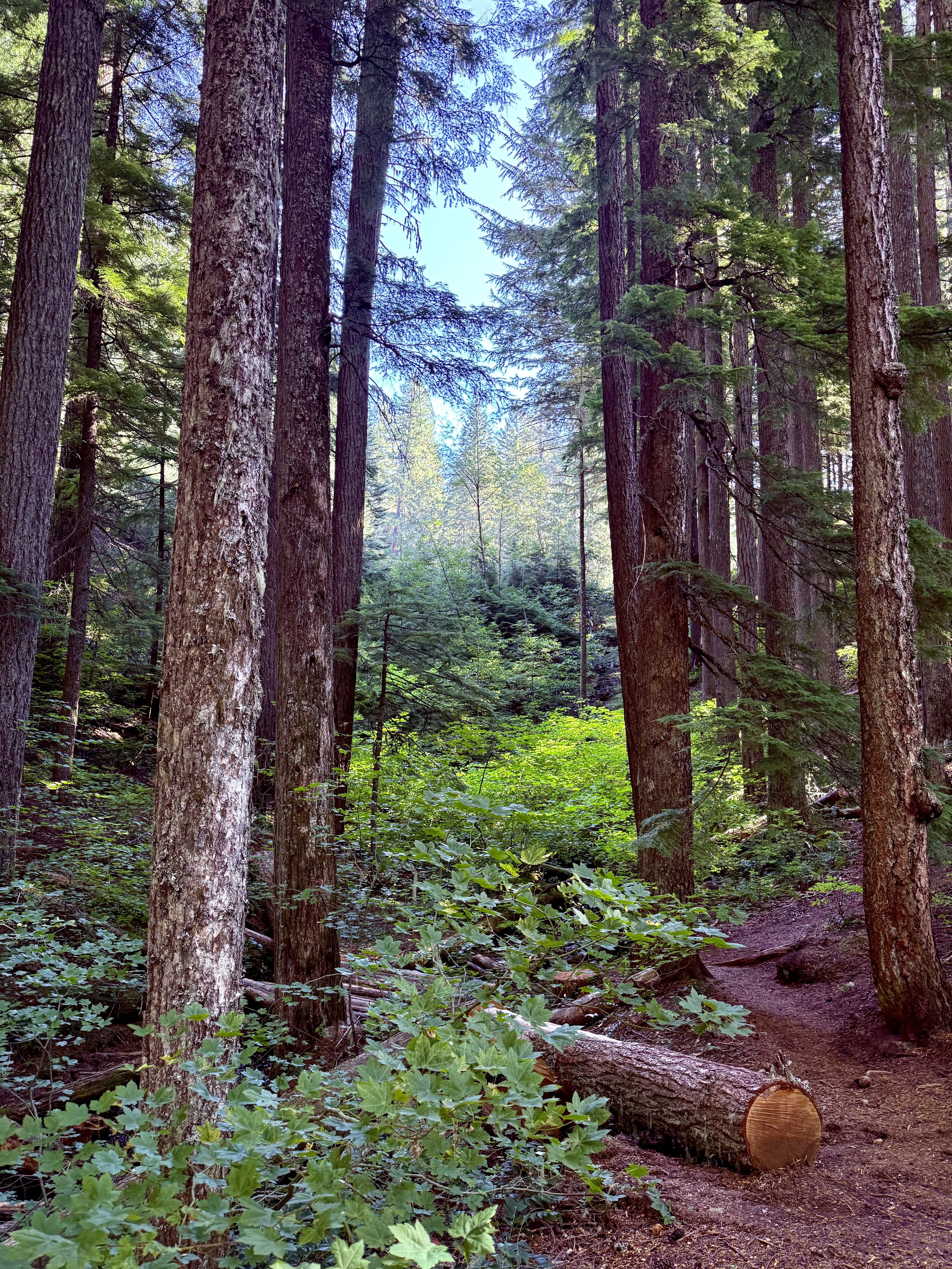
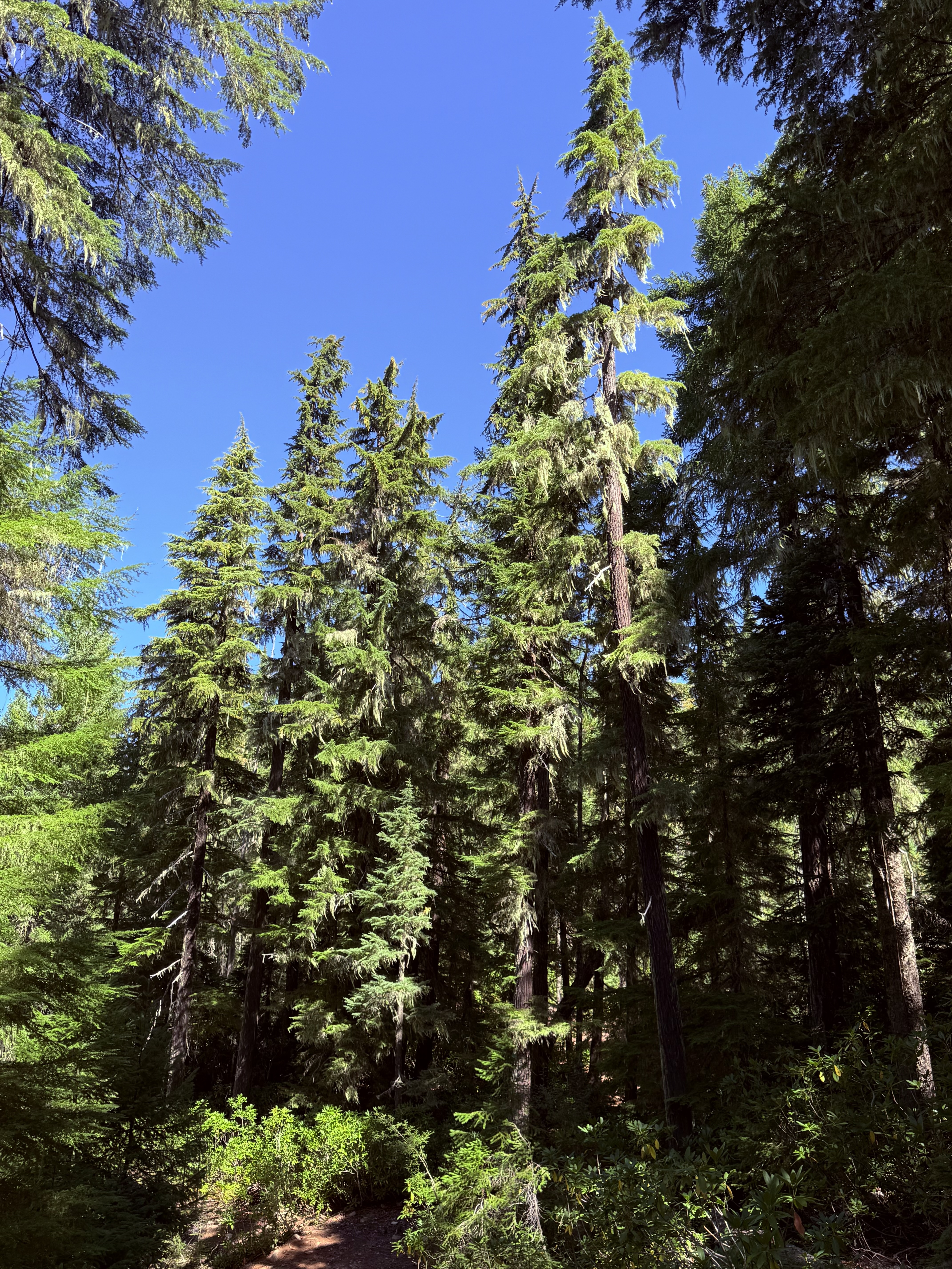
The trail led through an enchanting forest, pine scent and all. The sound of the flowing stream was a constant companion, but as I drew closer to my next objective the welcome sound of crashing water beckoned me onward.
Diamond Creek Falls was much different than Salt Creek Falls both incredible in their own way. The water coming down Diamond Creek Falls fanned out, tumbling down the slanted face of the moss covered rock to the shallow pool below, perfectly framed by lush forest.
Diamond Creek Falls
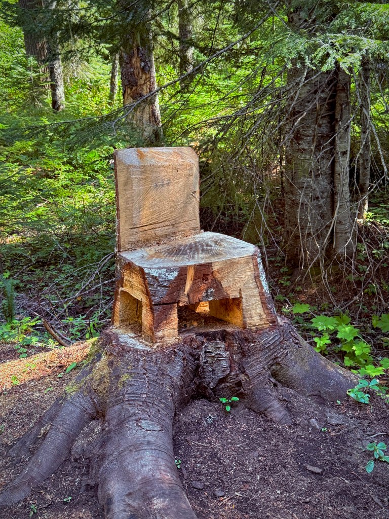
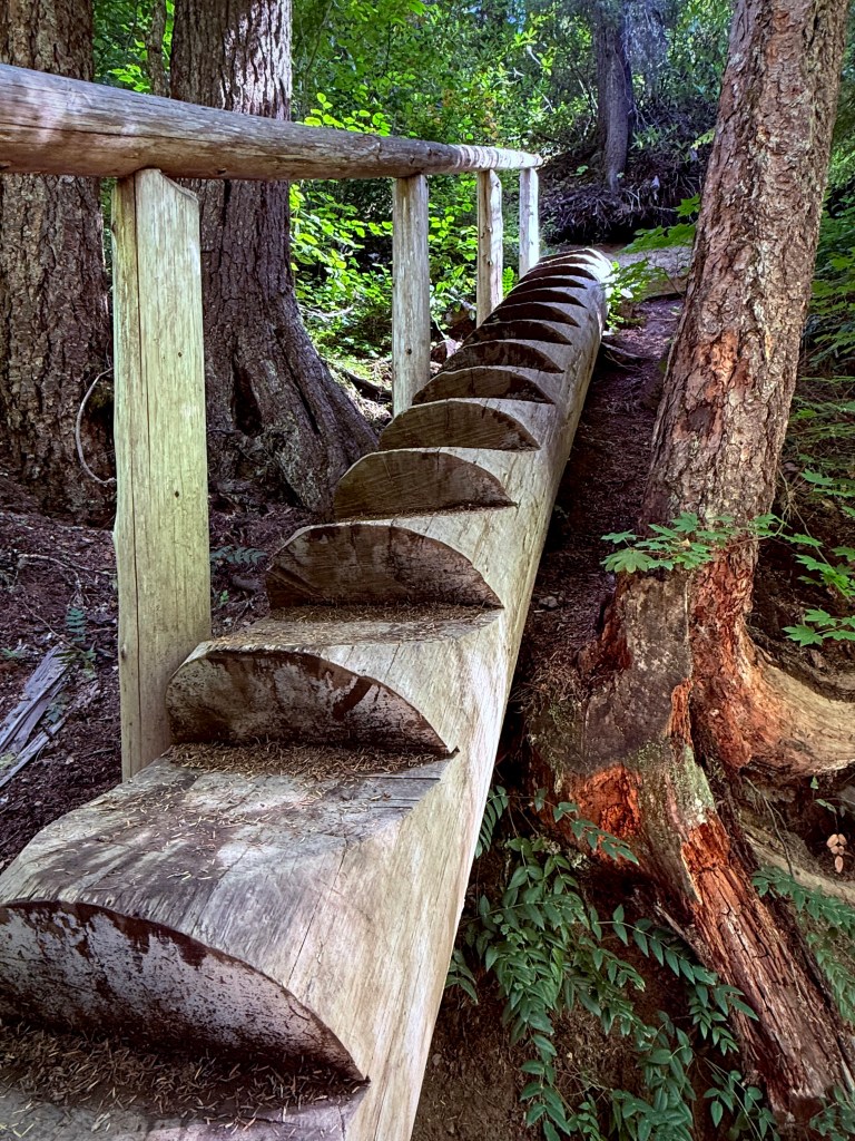
How about this chair carved from a stump?How cool is this log stair case?
Pursuing Balance Through Adventure YouTube Channel Salt Creek Falls and Diamond Creek Falls CLICK THE PIC!
“Moving through lush forest vegetation to reveal a stunning waterfall pouring gracefully over a rocky grotto deep in the woods. The sound of rushing water thunders through the canyon – a perfect moment of peace surrounded by nature’s beauty.” – Matt Swack
Thanks for joining me on my epic Road Trip from SoCal through Pinnacles National Park and then Mount Shasta in NoCal. I traveled on to my main event, Backpacking the Mount Jefferson Wilderness in Oregon. Afterwards I journeyed to the Northern parts of Washington. During my return I visited Mount Rainier National Park and outlying areas. I then set my sights on the Highway of Waterfalls. How intriguing does that sound? My tour would encompass many waterfalls in close proximity such that I could do it justice and complete this endeavor in just a couple days of hiking. This undertaking would leave me enchanted, spellbound and my soul full. There are many waterfalls to come so I wholeheartedly suggest that you LIKE, COMMENT, FOLLOW and SHARE. If you like the hat I have on in the pictures then I invite you to go to SHOP APPARELfor all of your Adventure Wear needs. PBTA travels extensively throughout the West if you go to the menu above you will see that the areas are categorized by area or activity. I am sure that this will fuel ideas when planning your next adventure.
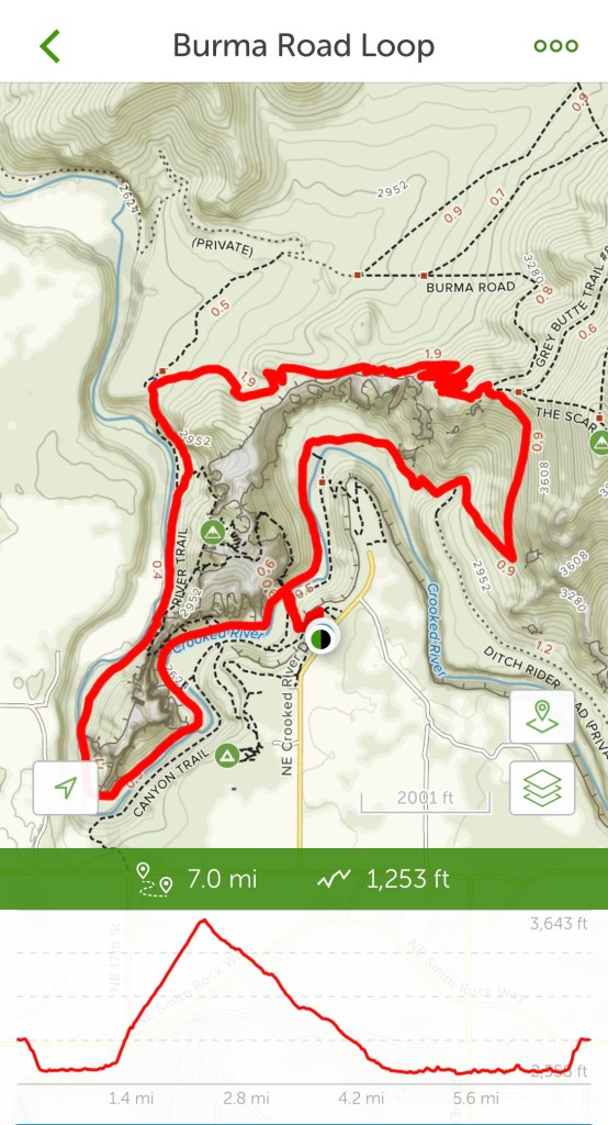
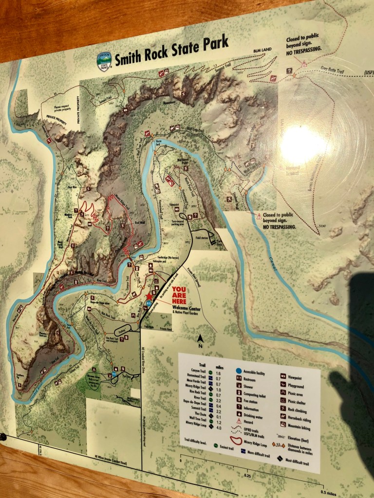
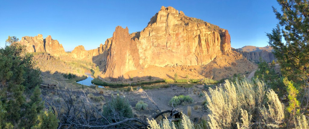
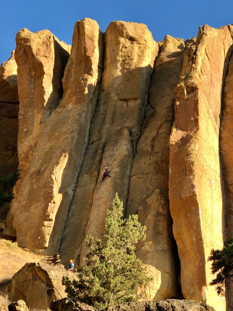
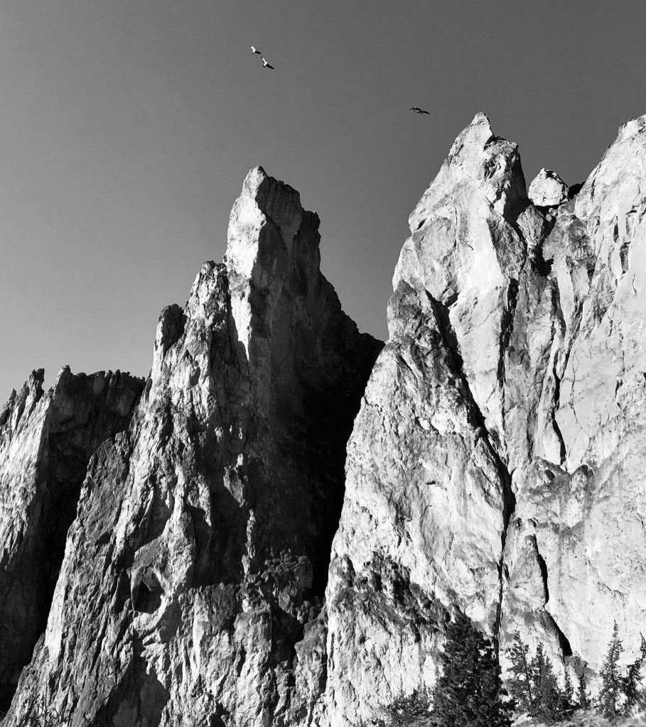
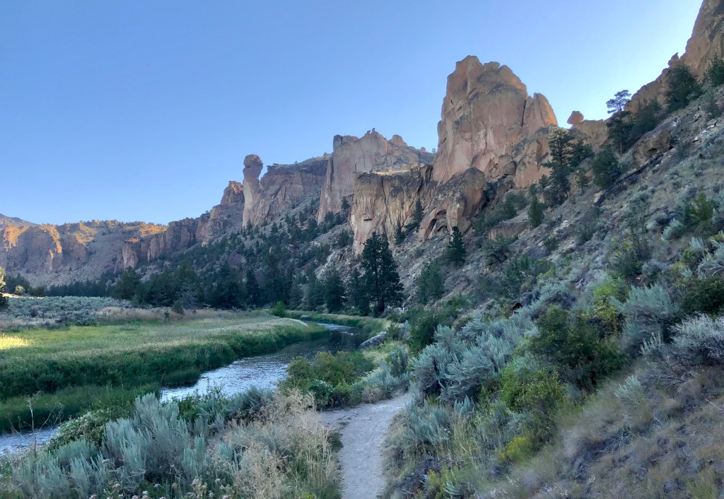
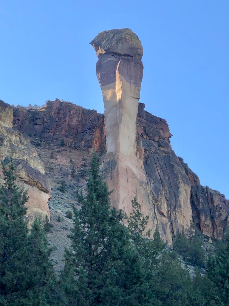
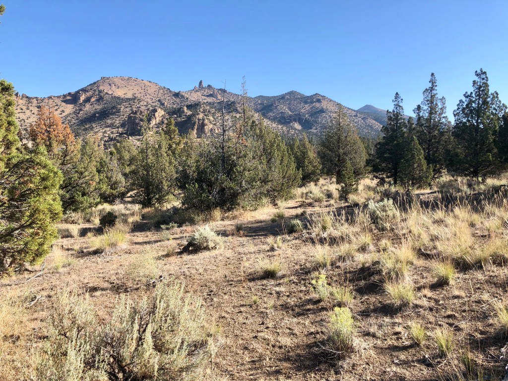
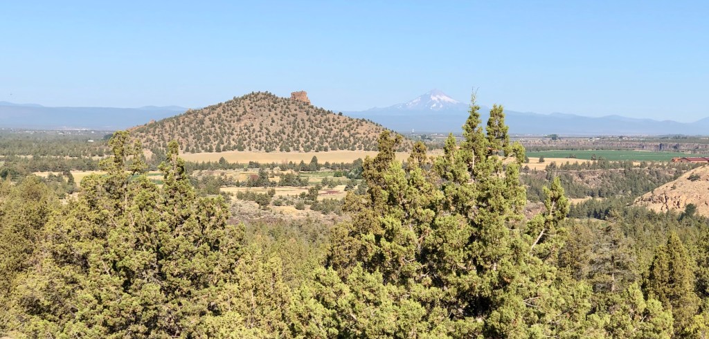
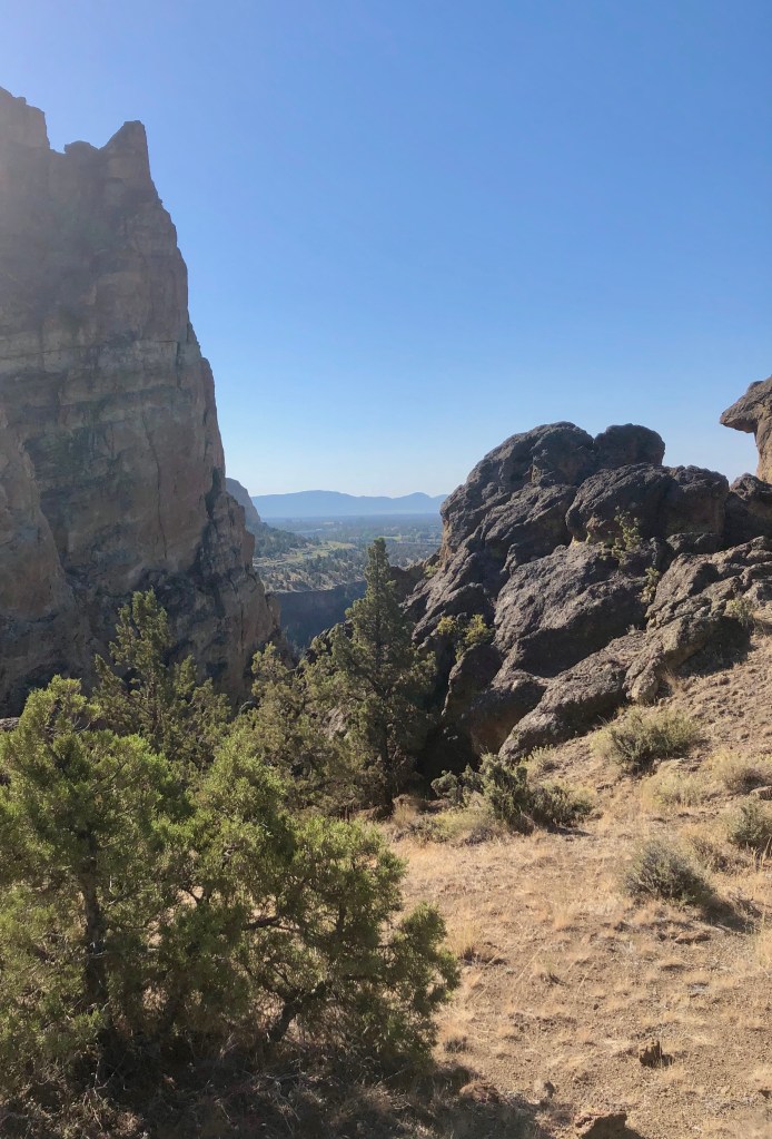
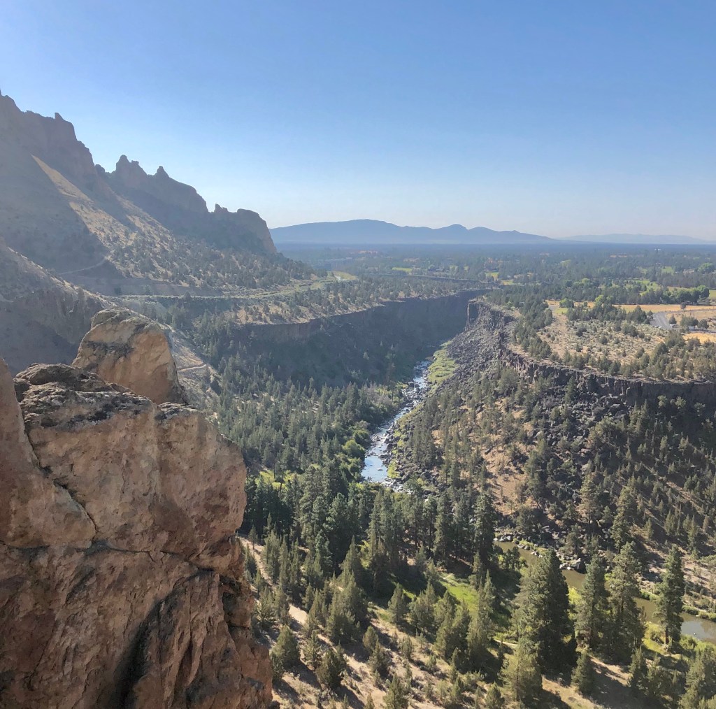
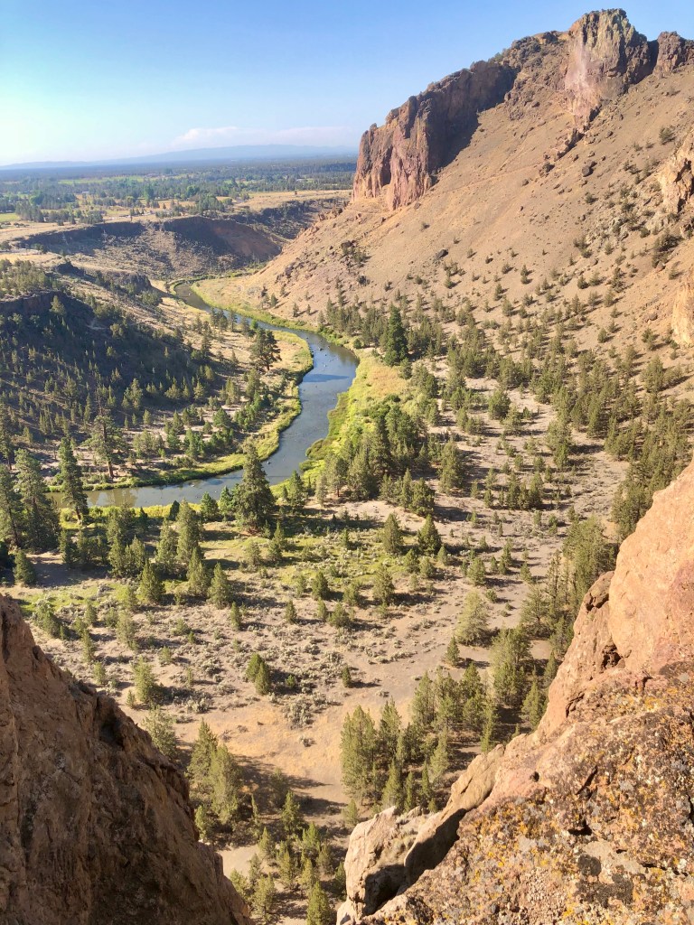
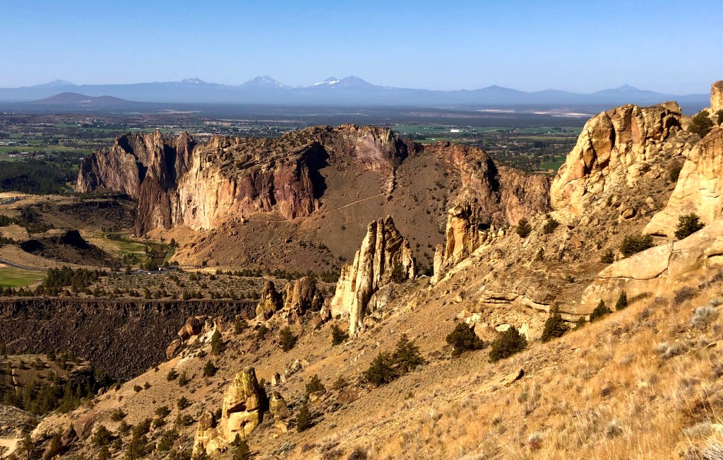
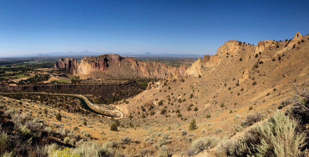
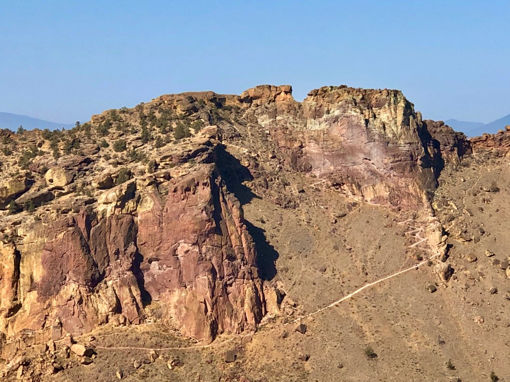
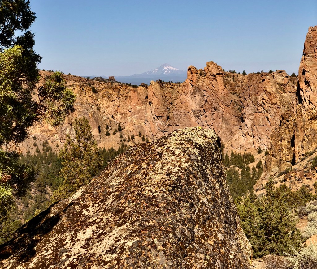
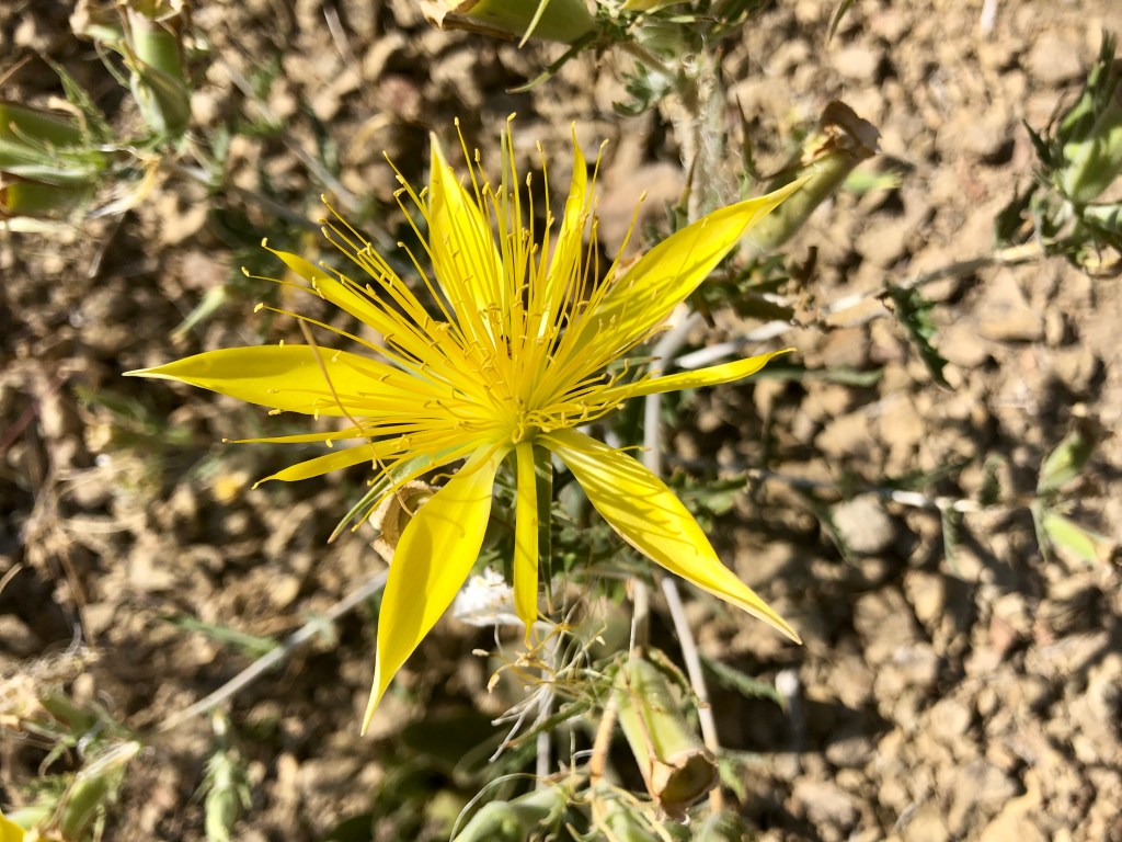
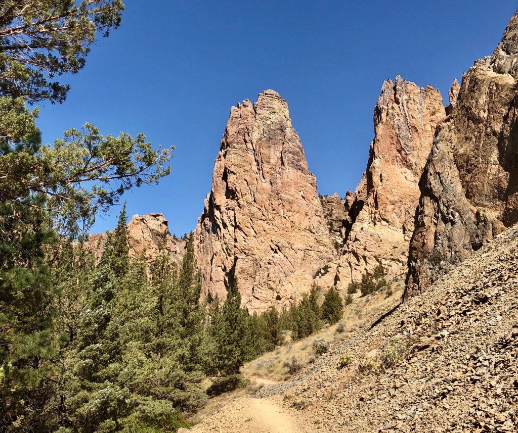
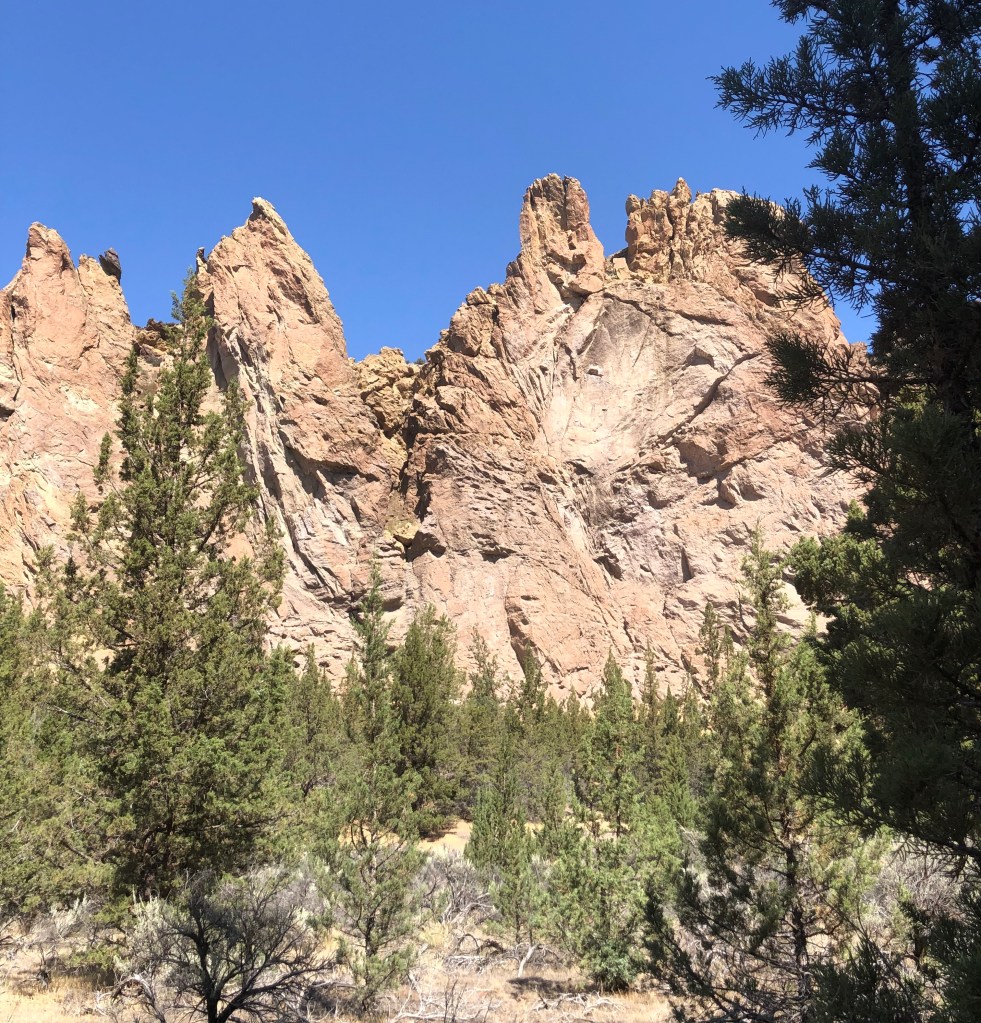
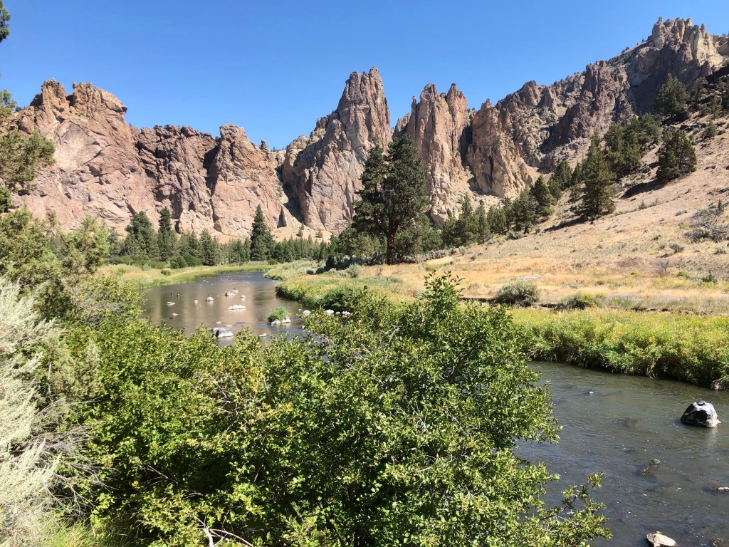
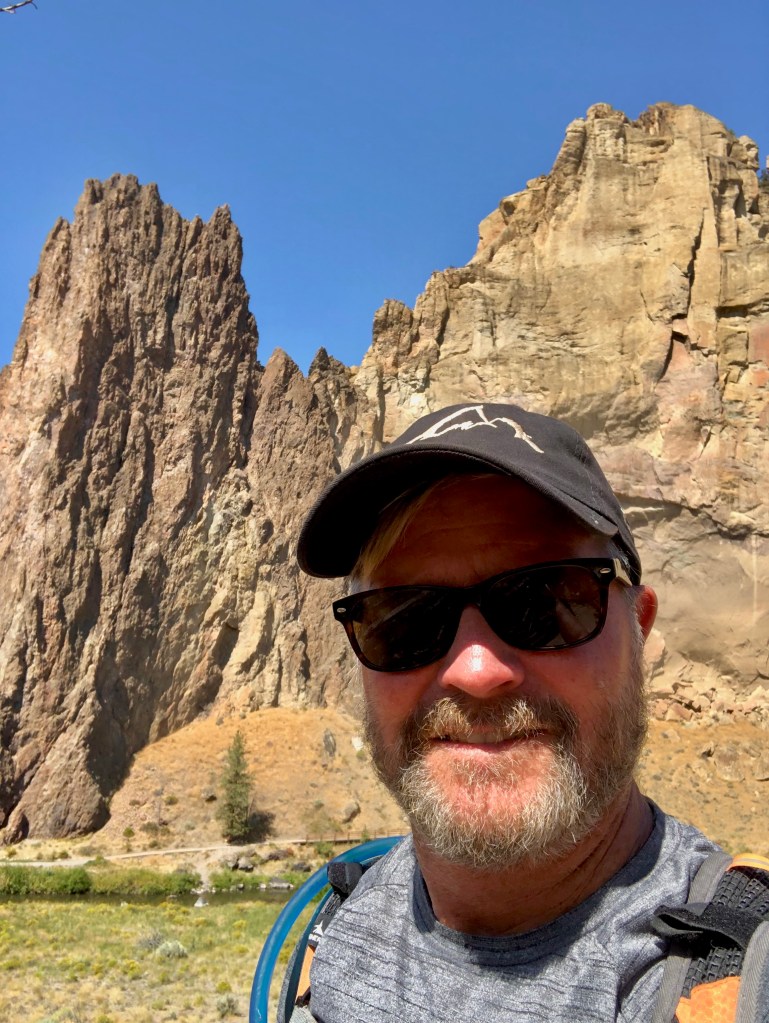
Smith Rock is one of those special places that is almost spiritual it is so beautiful. This was my second time to hike at Smith Rock, the last was hiking up Misery Ridge a few years ago with my fraternity brother Marcus, my son Alec, (then about 12), and a bunch of college guys, friends of Macus’s son. I found Misery Ridge to be aptly named for the crazy switch backs and quick elevation change, not only a challenge, but a stunningly beautiful hike and a fantastic climb.
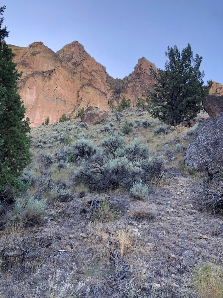
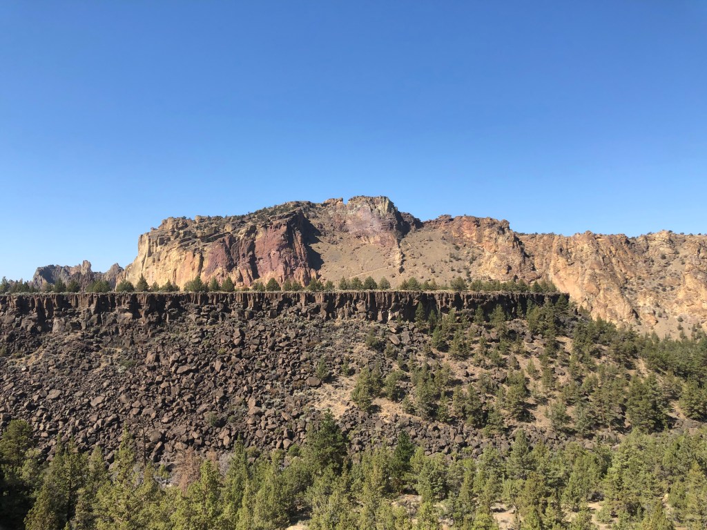
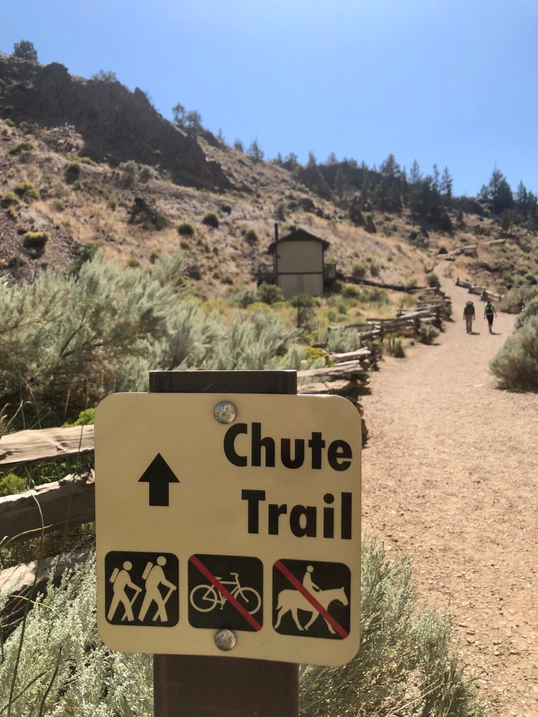
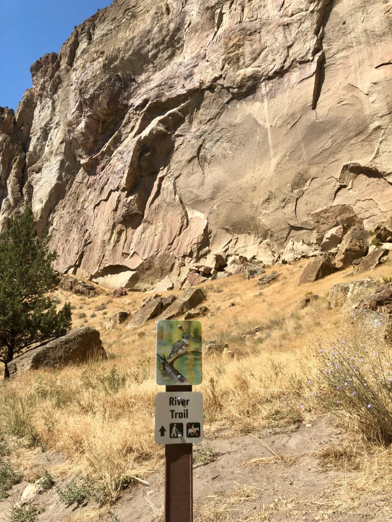
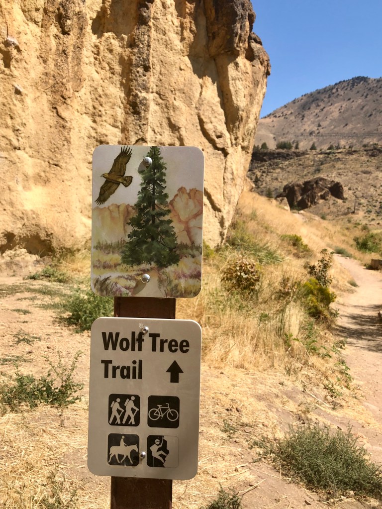
Wanting a different hike and experience I chose the Burma Road Loop. The loop is made up of multiple trails: The Chute, River, Summit, Burma Road and Wolf Tree Trails. It completely circumnavigates Smith Rock so you view it from every angle including looking down at it from the neighboring ridge. So any thoughts that this would be easier than Misery Ridge would be mistaken. Actually it is less aggressive in my opinion as the elevation is more spread out and over a longer distance. That being said however, there is a section with some fairly challenging switch backs as well.
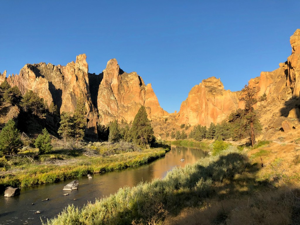
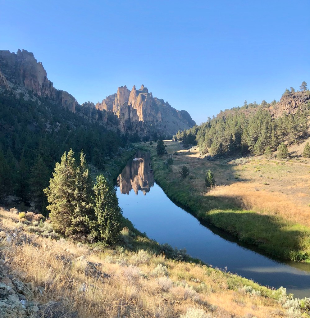
The trail drops down to the Crooked River which surrounds Smith Rock on three sides almost like a moat adorning an majestic castle. At this point the trail is easy following the awe inspiring walls of Smith Rock and along the River Trail, which is fabulous.
This was one of the hottest days of the year expecting to top out at 96 degrees. I was glad that I was getting an early start at 7:30 AM, which was most pleasant in the mid seventies, but by the time I completed my journey it was about 90.
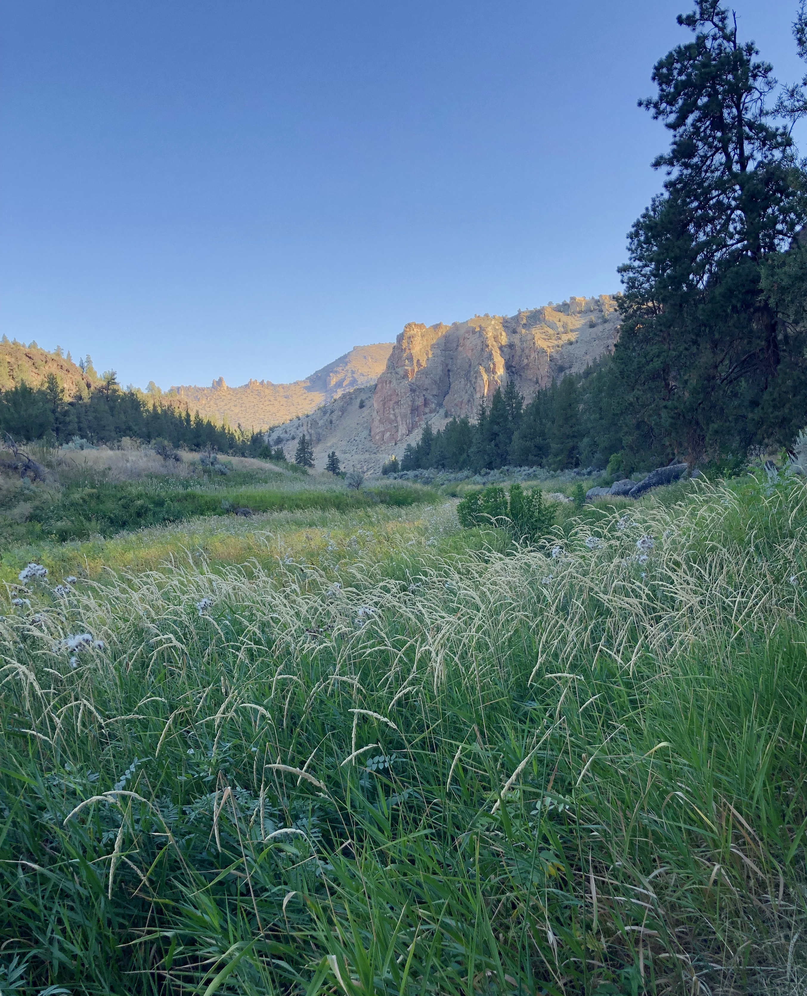
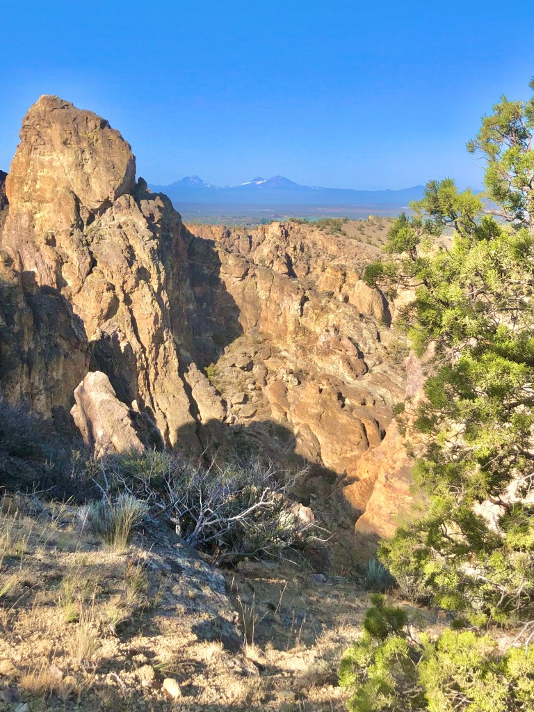
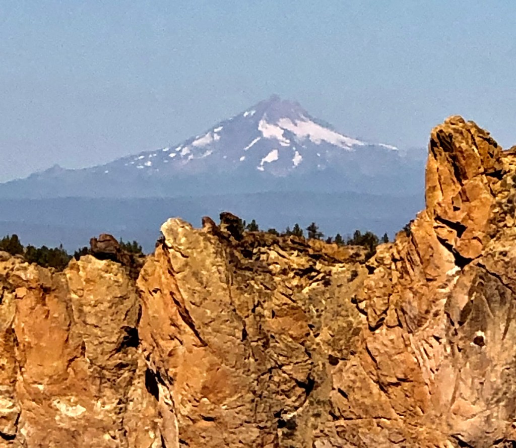
As I mentioned, the Crooked River wraps around Smith Rock. On the backside I headed up into a high desert scene. This is where the elevation starts going up and at a pretty quick rate with a number of switchbacks until you have a wonderful view of the river, the valley, Smith Rock, and the Cascade Mountains off in the distance. Just an spectacular view and with the wonderful rock faces and formations of Smith Rock it is simply a must do.
As I dropped in elevation the single track trail joined a double track road that was steep and not interesting, well… aside from the adjacent view of Smith Rock. My point is taking the Burma Road Loop clockwise is the way to go because going up a steep boring road with no switch backs would not be as pleasant, but working my way down it quickly with views of the valley and Smith Rock was perfect.
Once down to the valley floor there are more rock formations to take in, a wooded area, and then back to a delightful adventure along the Crooked River with ducks and geese, and a beaver. What an adventure filled with wonder… when you are Pursuing Balance Through Adventure.
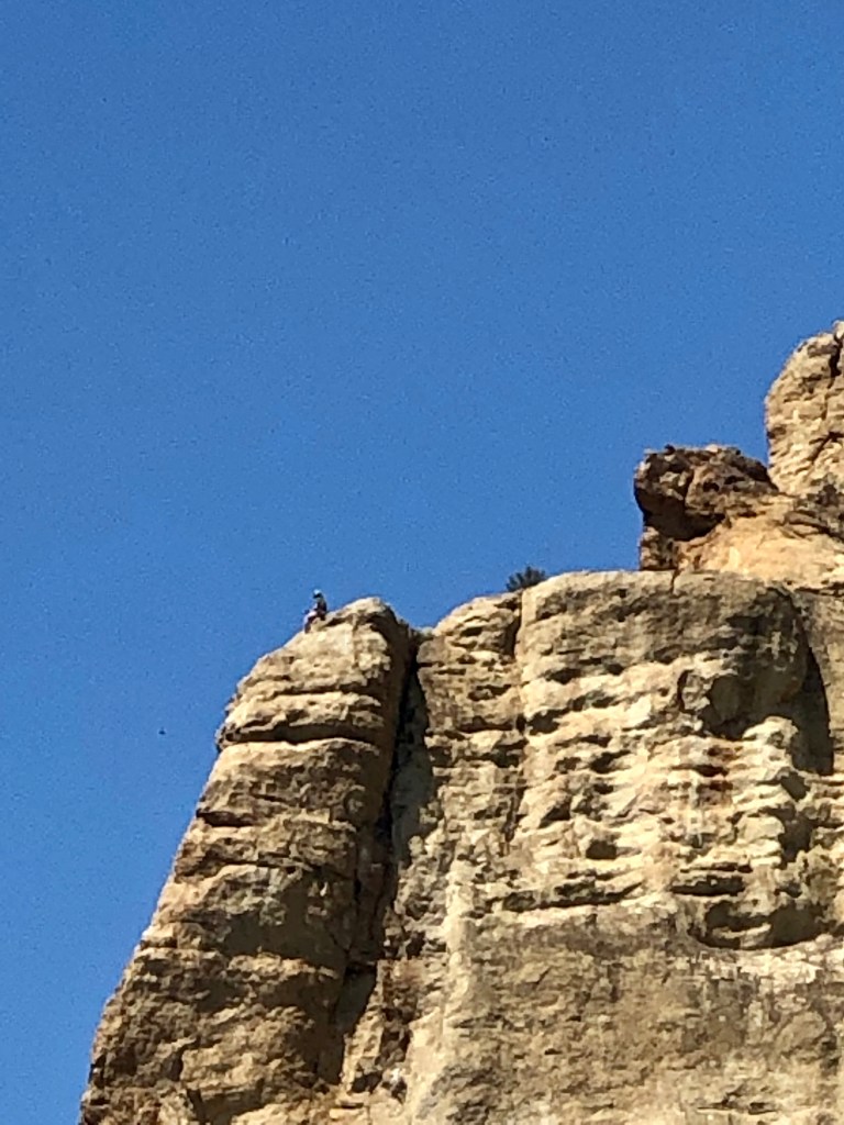
Climbers at Smith Rock
Looking down on Misery Trail Snack break“What do I do for a a living? I live for a living.” -Peter Karina
Wow, Smith Rock, ya’ just gotta’ luv it! Adventure and Balance is what we are pursuing so FOLLOW, LIKE, COMMENT, and SHARE so together we can accomplish this type of harmony.
Roger Jenkins Pursuing Balance Through Adventure
Video Clips of Smith Rock ‘Pursuing Balance Through Adventure‘
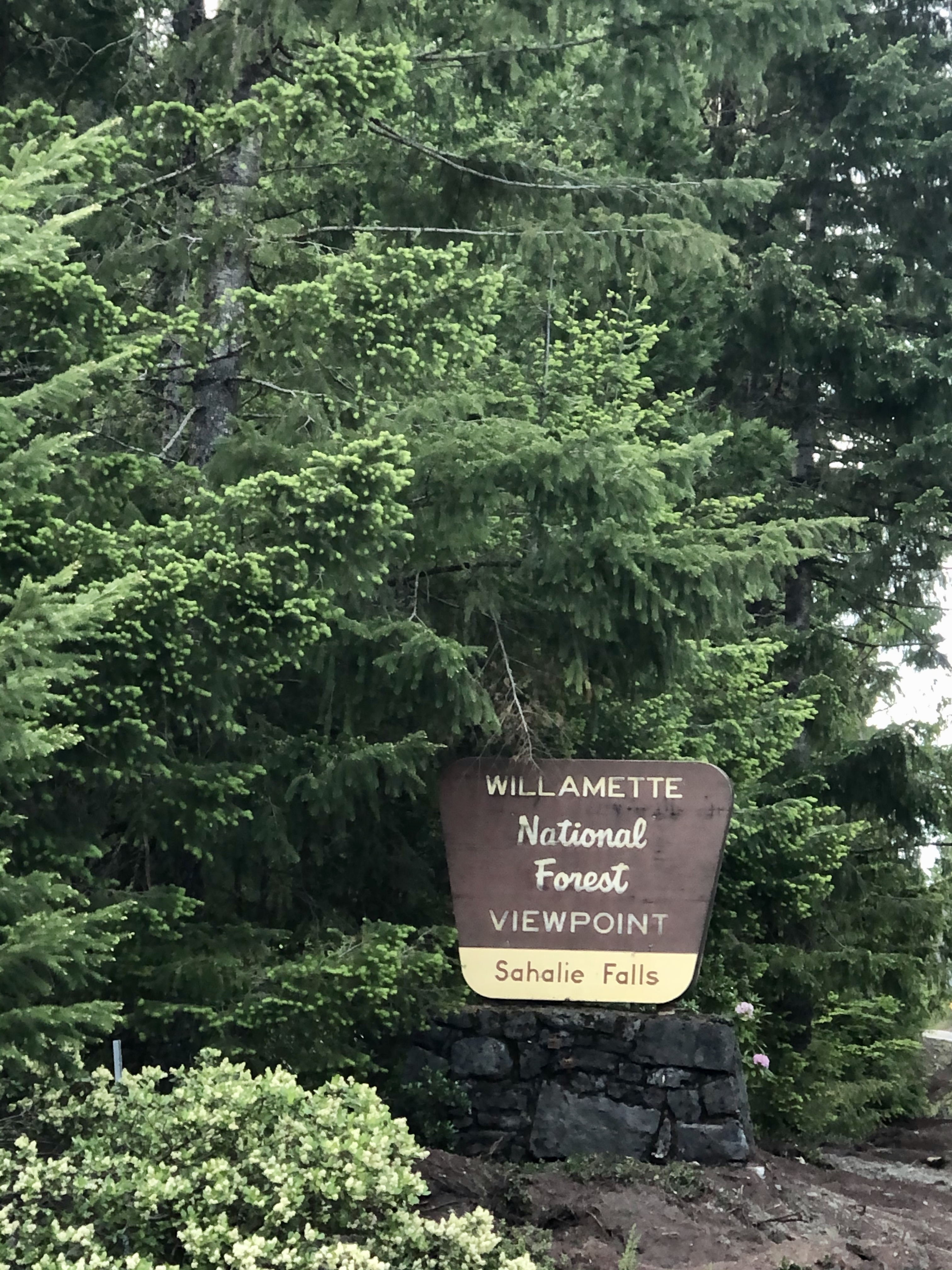
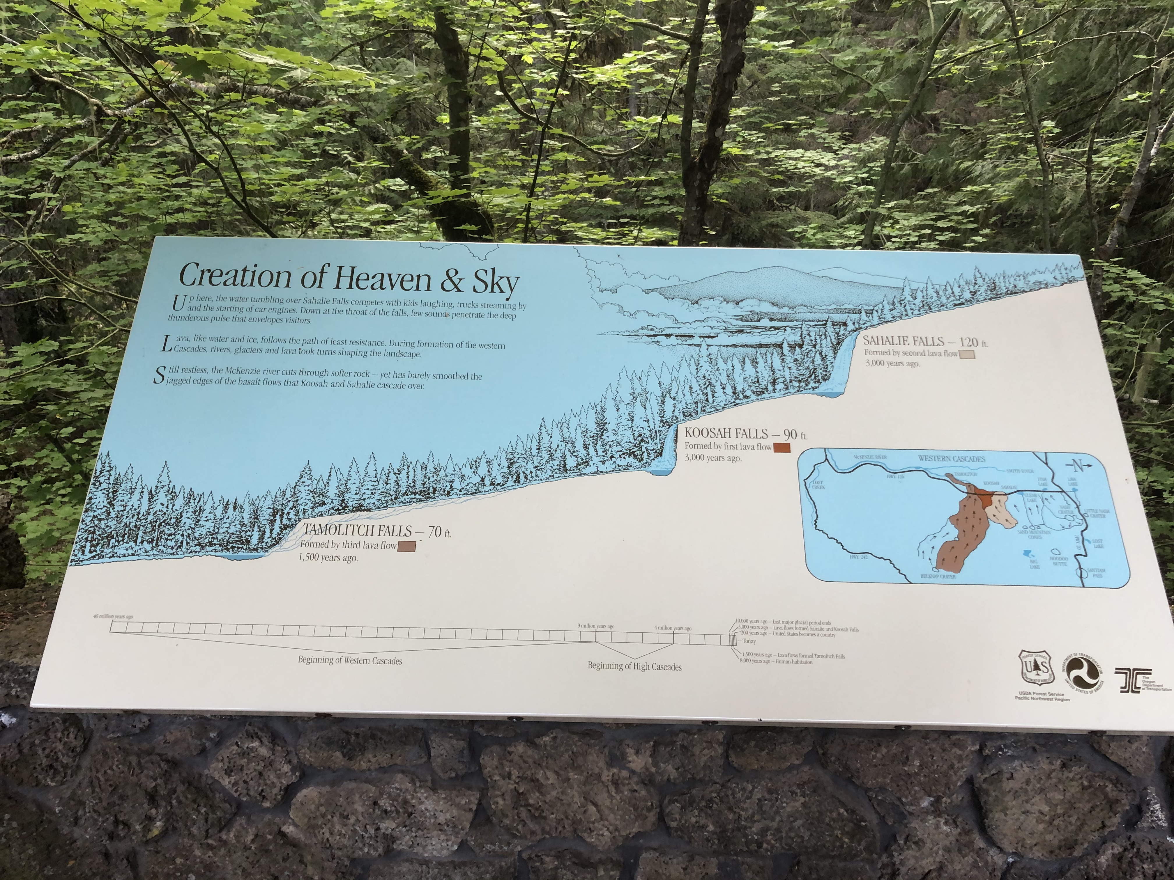
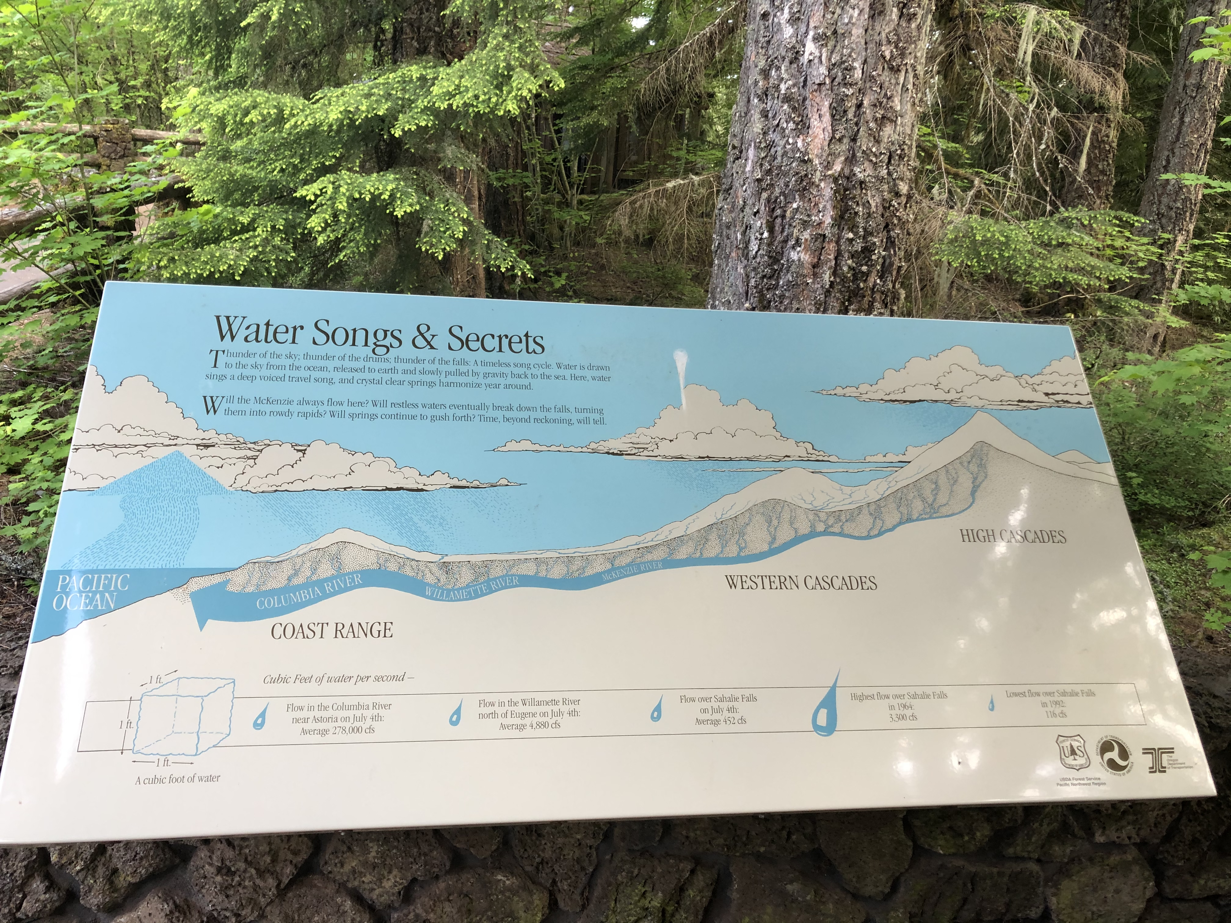
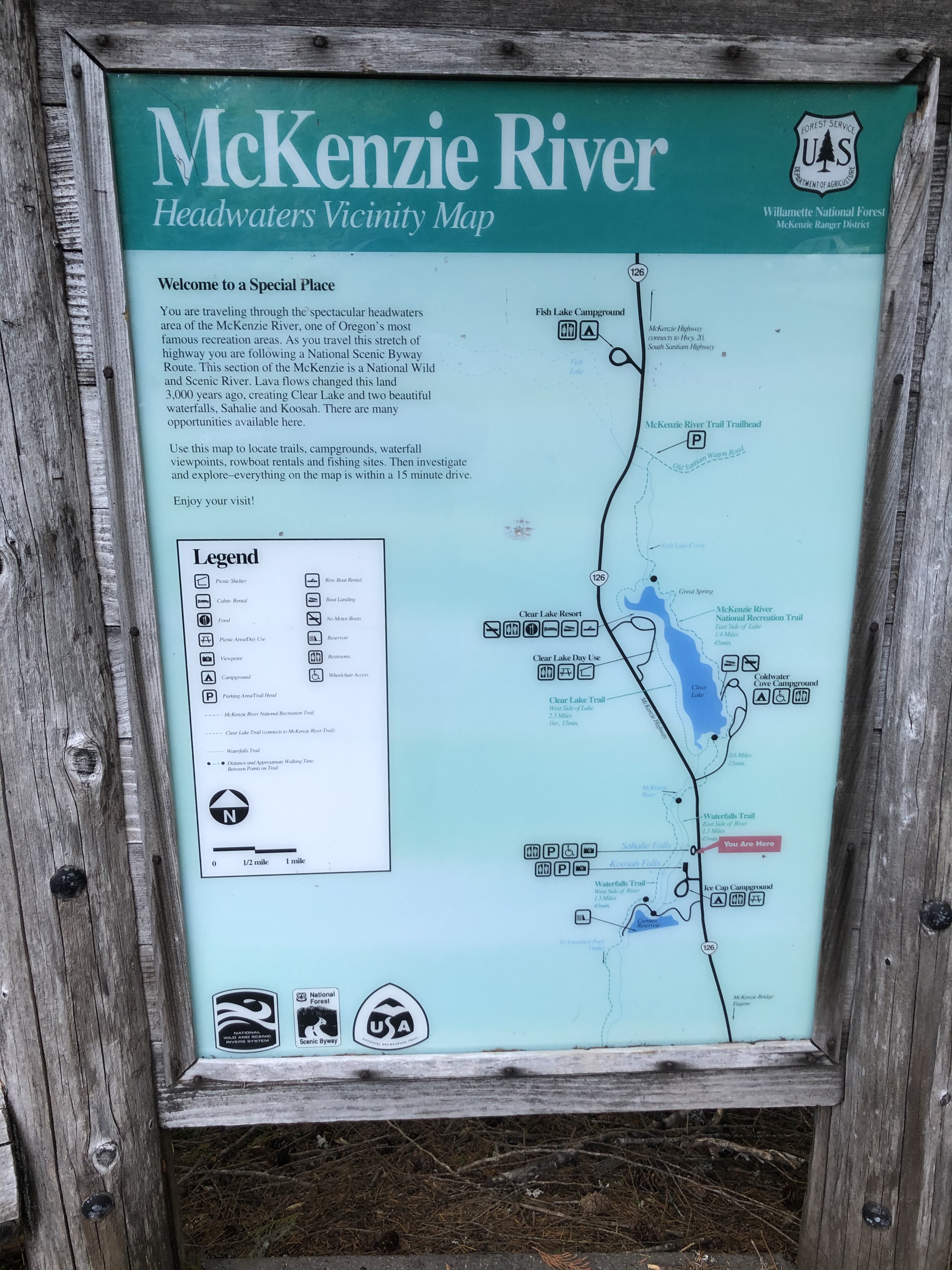
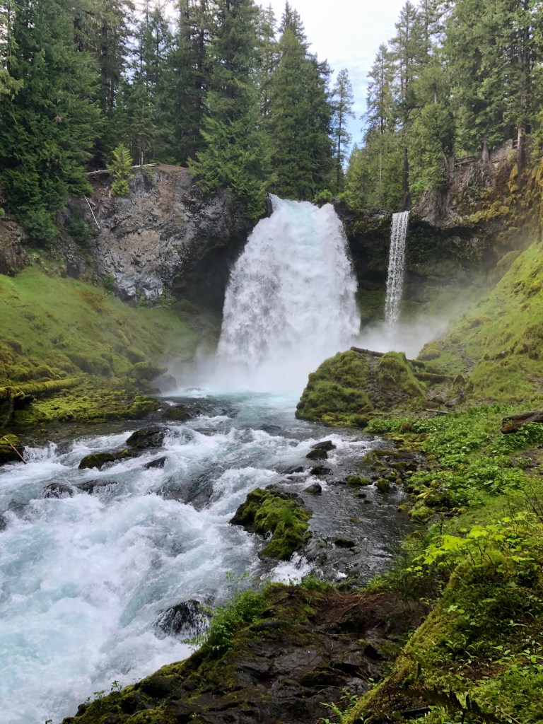
I was trekking across Central Oregon with my good friend and Fraternity Brother Bruce leading the way. He was kind enough to share his expertise and local knowledge on the area. We stopped at extraordinary Sahalie Falls. We had squeezed in many fantastic adventures during our 3 days enjoying this magnificent place called Oregon. So unfortunately our final day was running to an end and thus we did not have time for much of a hike at the falls. Still, we did go above the falls as well as down stream to partake in the wondrous views of this gorgeous spectacle.
Bruce could tell that I was astounded by what was before me. Upon first sight of the Sahalie Falls my eyes widened and my jaw dropped. I love chasing waterfalls, so it was not like I have not seen a lot of wonderful falls. But the power of the McKenzie River was quite literally launching the stream into space. This is a must do, and even my Fraternity Brother who lives in Central Oregon will make a stop here just to check it out when passing by.
There Is Nothing Like A Waterfall
There is nothing like a waterfall When rhododendrons bloom in spring The sound and the earthy smells Two of the joys that nature brings.
Green moss grows on everything A soft and spongy feel So magnificent the scene is Why, it doesn’t seem quite real.
Just listen and close your eyes The world just floats on by There is nothing like a waterfall
by Marilyn Lott
We appreciate you chasing Sahalie Falls with us. It’s time for you to go out and find an adventure that can ignite the passion of your soul, while you stretch your legs, feel the light spray from the waterfall on your face, and drink in all that Mother Nature has blessed us with… or heck you certainly can tag along with us as we continue ‘Pursuing Balance Through Adventure’, – We’re perfectly fine with that, but to do so you will need to FOLLOW, SHARE, COMMENT, and LIKE. If however, you are ready to find an adventure there are plenty to inspire you just go to the menu above. Each of the locations is a separate website and thus needs to be FOLLOWED Independently. Yes, that is a PBTA cap atop my noggin. You can buy one at SHOP APPAREL where there is currently a SPECIAL DEAL going on.
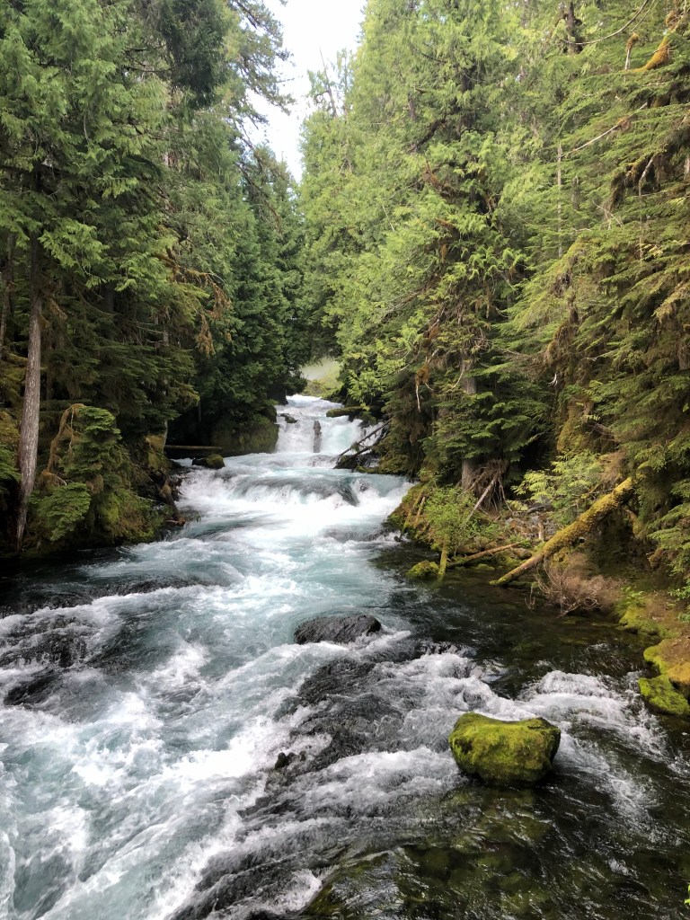
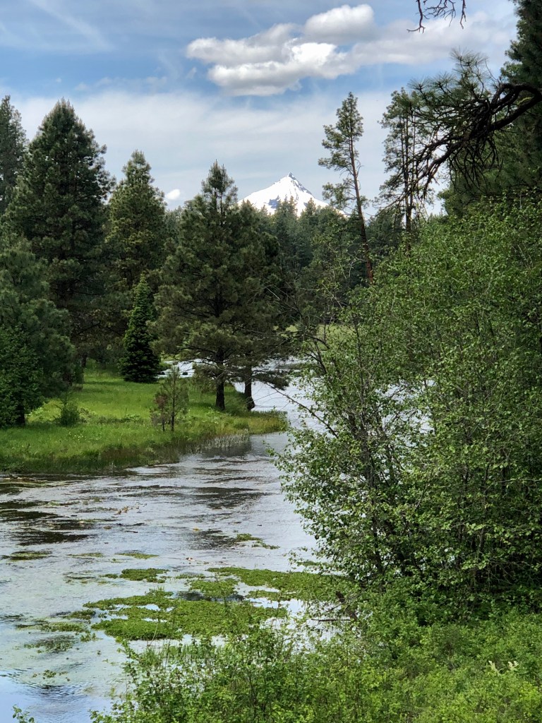
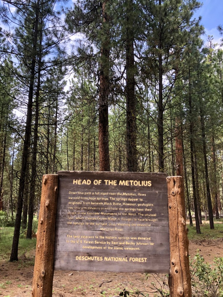
This is not really a hike. It is more of a nice little outing in nature. Just a real pleasant walk through Ponderosa Pines, to a quiet and tranquil scene of a slow flowIng river that started at that spot. Along with the spectacular river scene, which is absolutely idyllic, you will take in picturesque green meadows, beautiful fir trees and Mt Jefferson perfectly framed. What a zen like place.
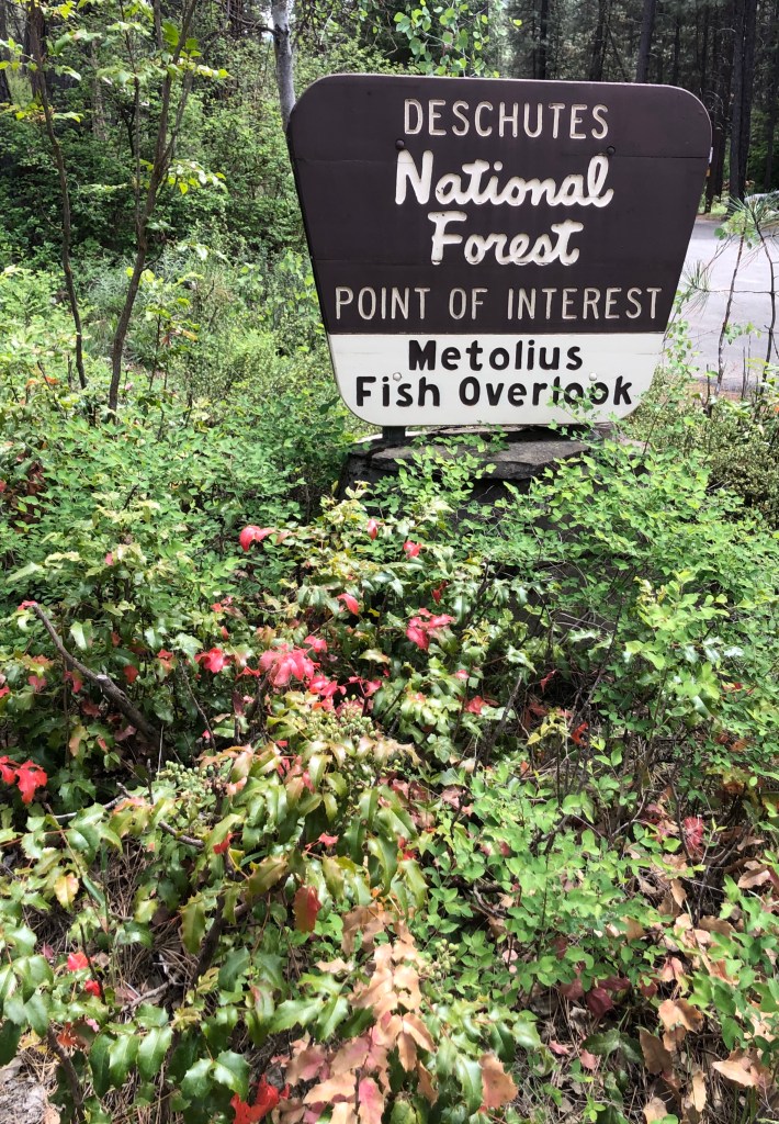
What is unusual about the phenomenon that is the Head of the Metolius is that most of the time rivers are started by mountain snow run off, or a bunch of springs all which join together over a pretty good chunk of land to form a river, that is not the case here. The Head Waters of the Metolius River comes right out of the ground right at that spot, and not in a trickle by any means. We are talking 50,000 gallons a minute.
After checking out this peaceful setting we stopped by the quintessential General Store type of establishment that is a must do. Just outside the doors the river runs by and there is great fishing to be had.
Really cool outing for the whole family.
“A river seems a magic thing. A magic, moving, living part of the very earth itself.” -Laura Gilpin
Thanks to my good friend Bruce for sharing this enchanting scene as we adventured across Central Oregon, and thank you for joining us ‘Pursuing Balance Through Adventure’. If you liked the post then take a second and COMMENT, LIKE, FOLLOW and SHARE. If you glance up at the menu you will see that PBTA goes to many different locations you might just find a few to put on your list. Please note that each locations is a separate site and thus needs to be FOLLOWED independently. For the very best quality adventure gear stop by PBTA’s SHOP APPAREL.
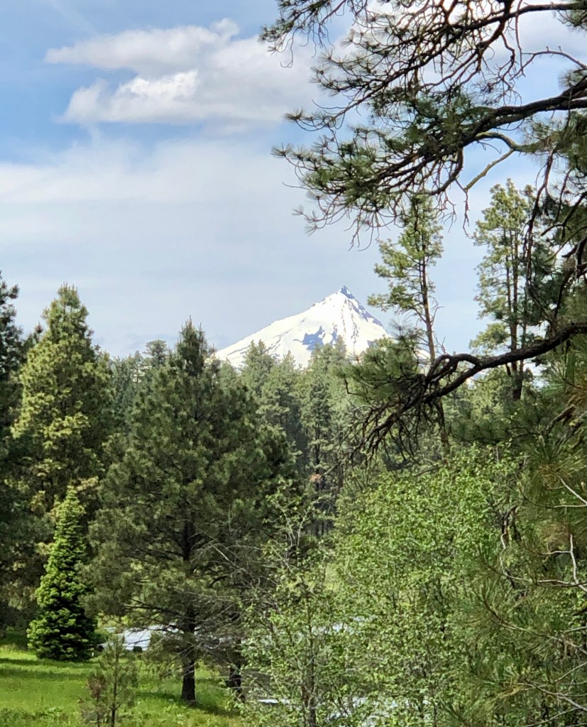
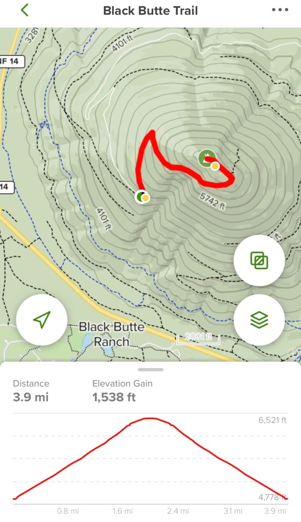
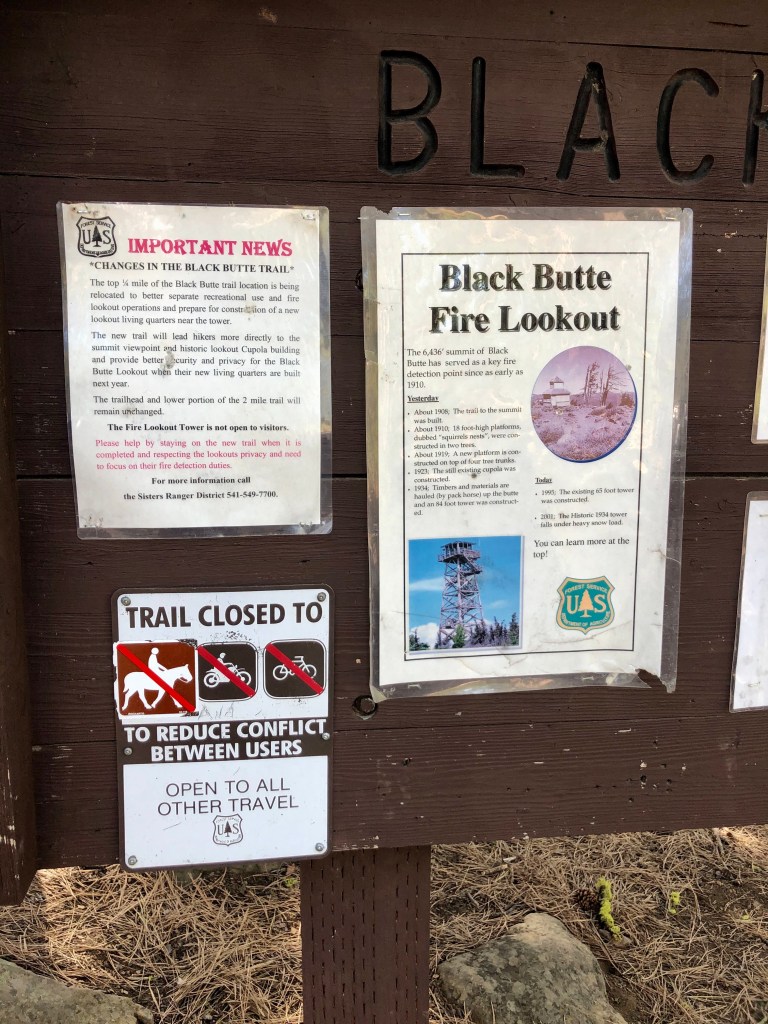
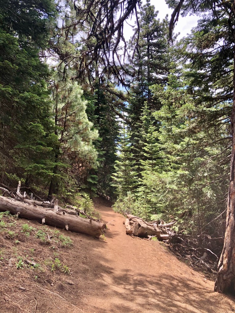
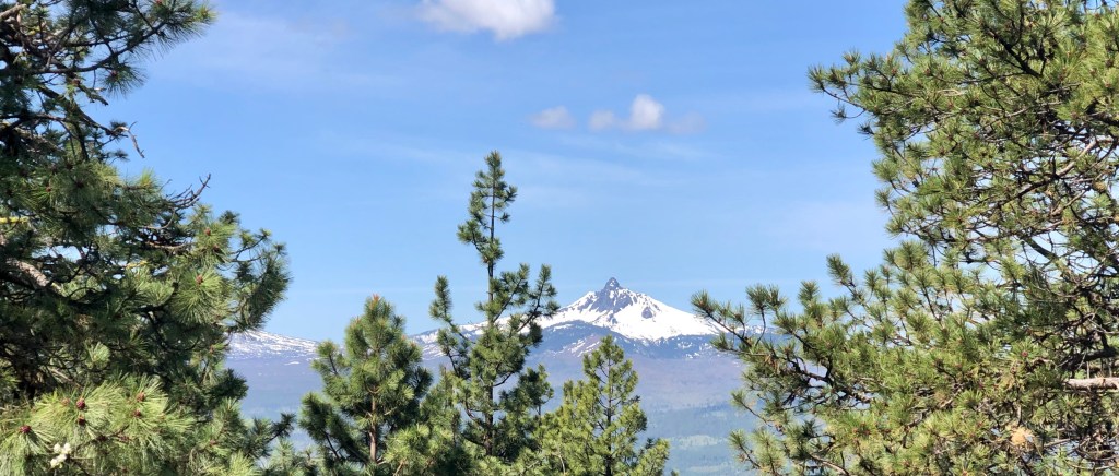
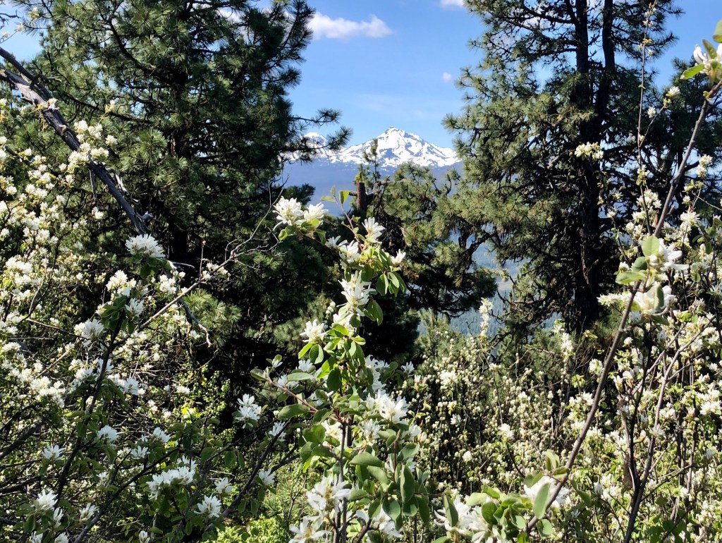
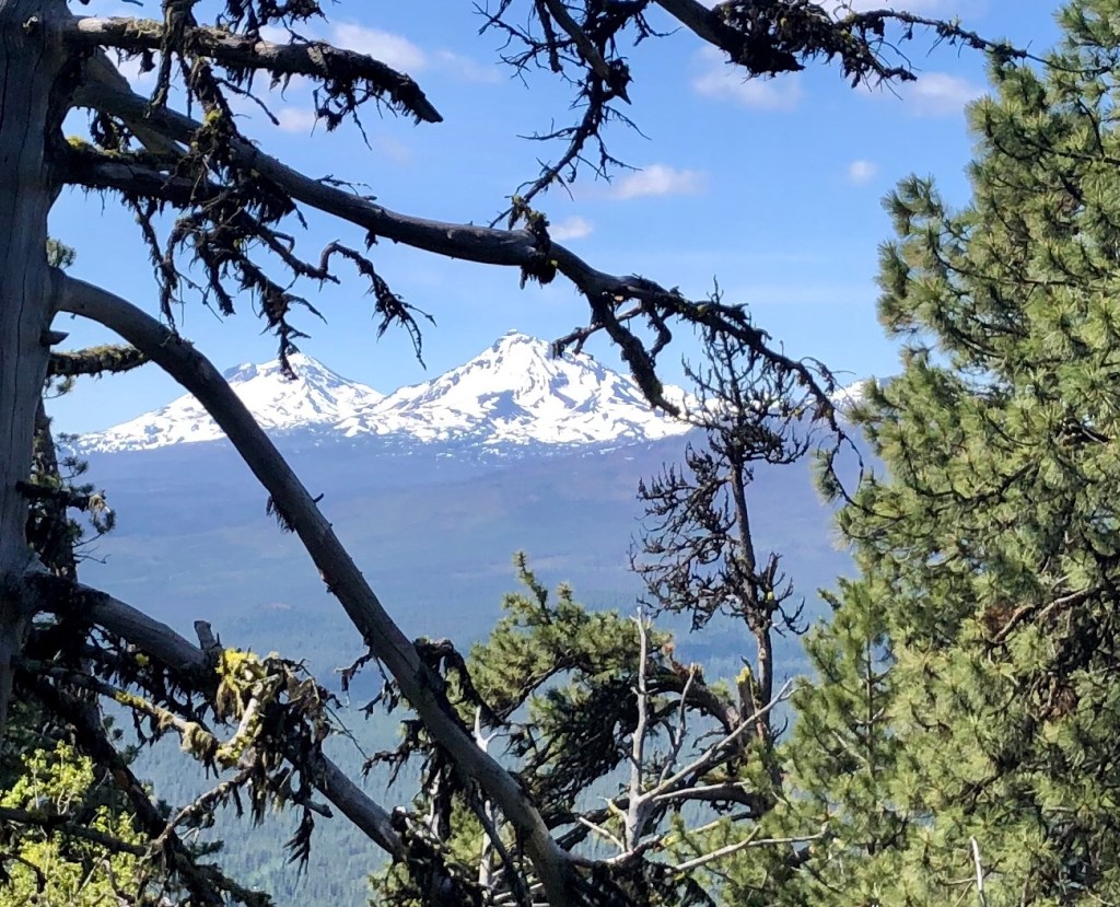
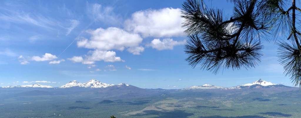
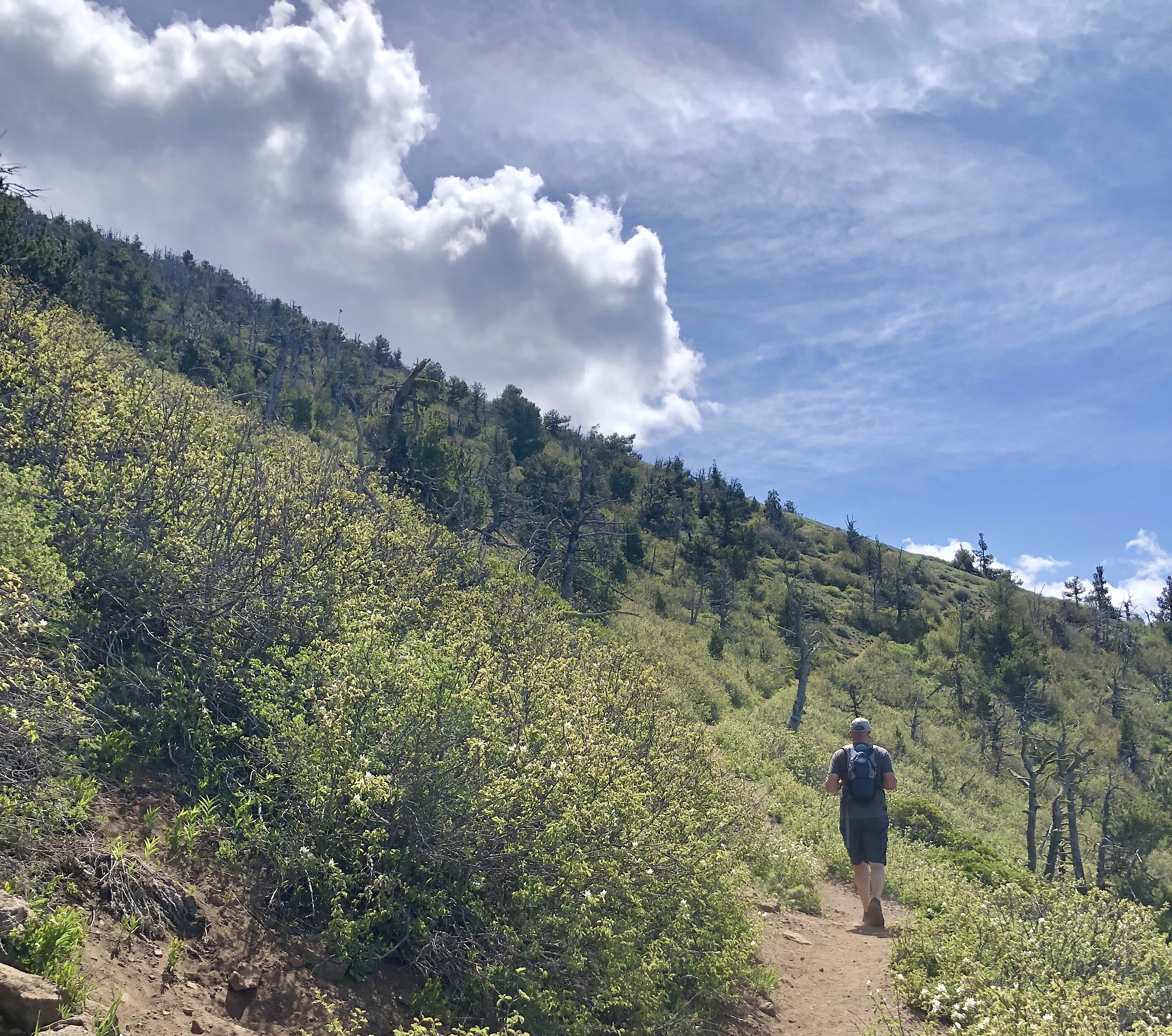
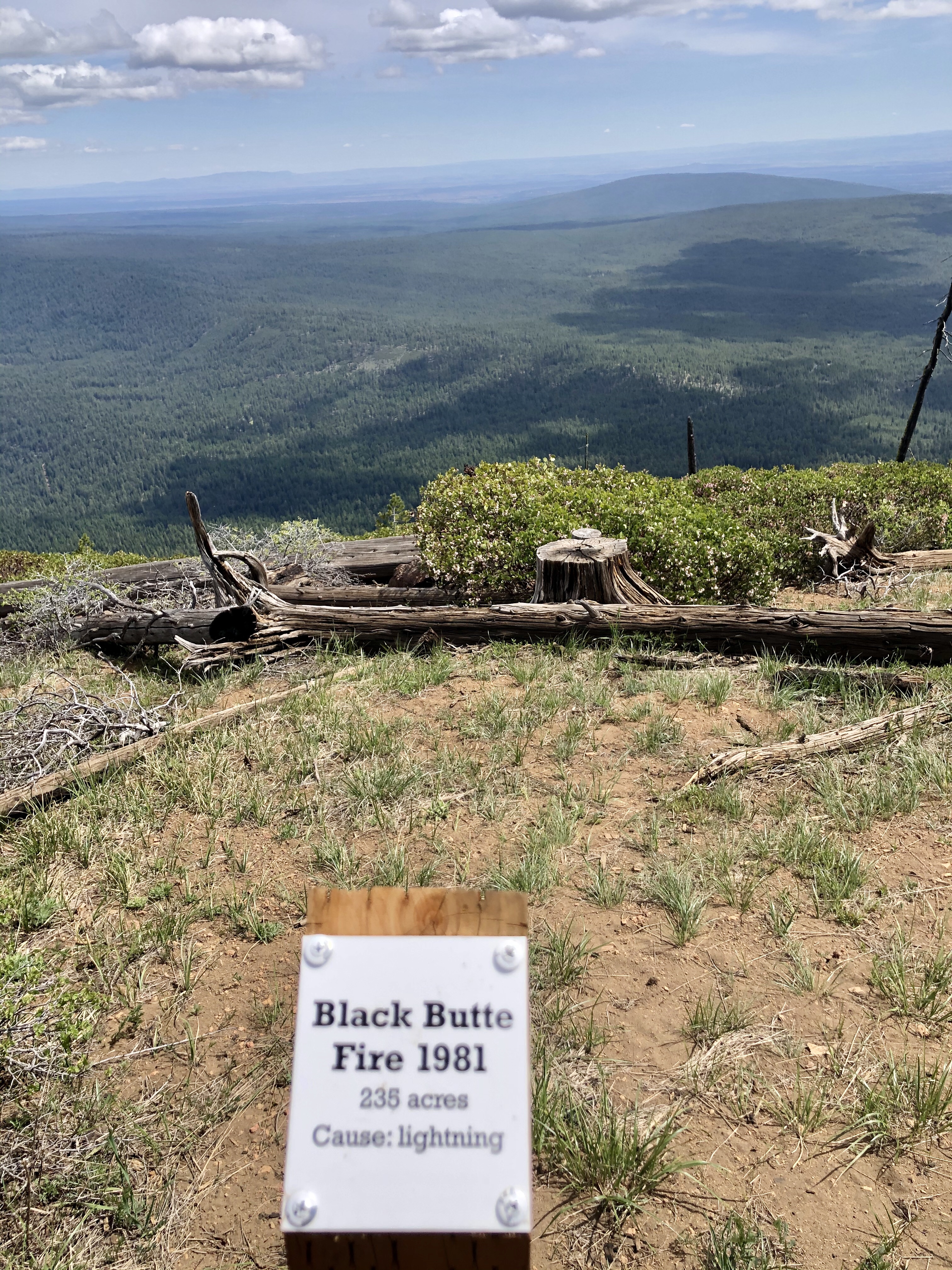
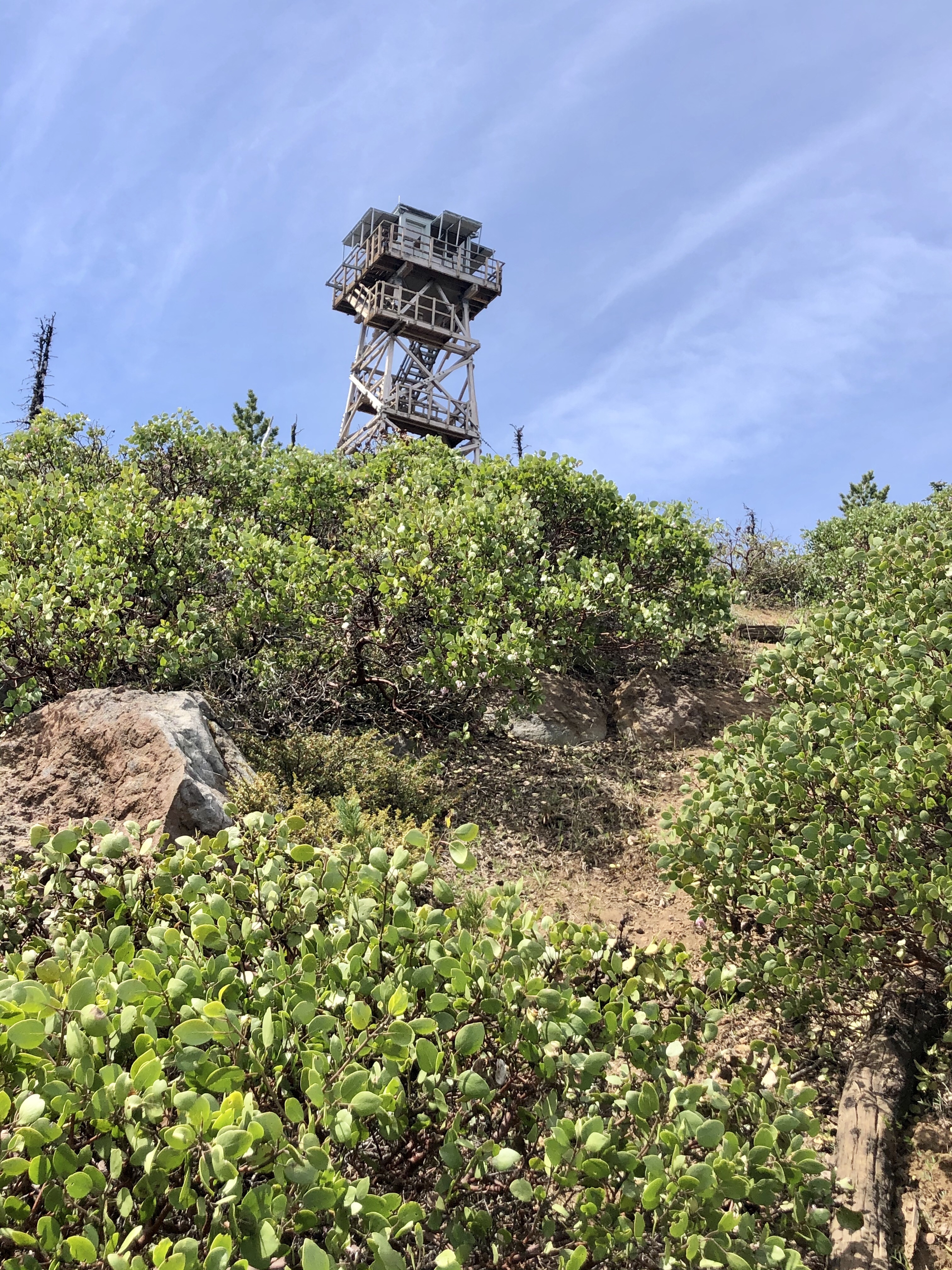
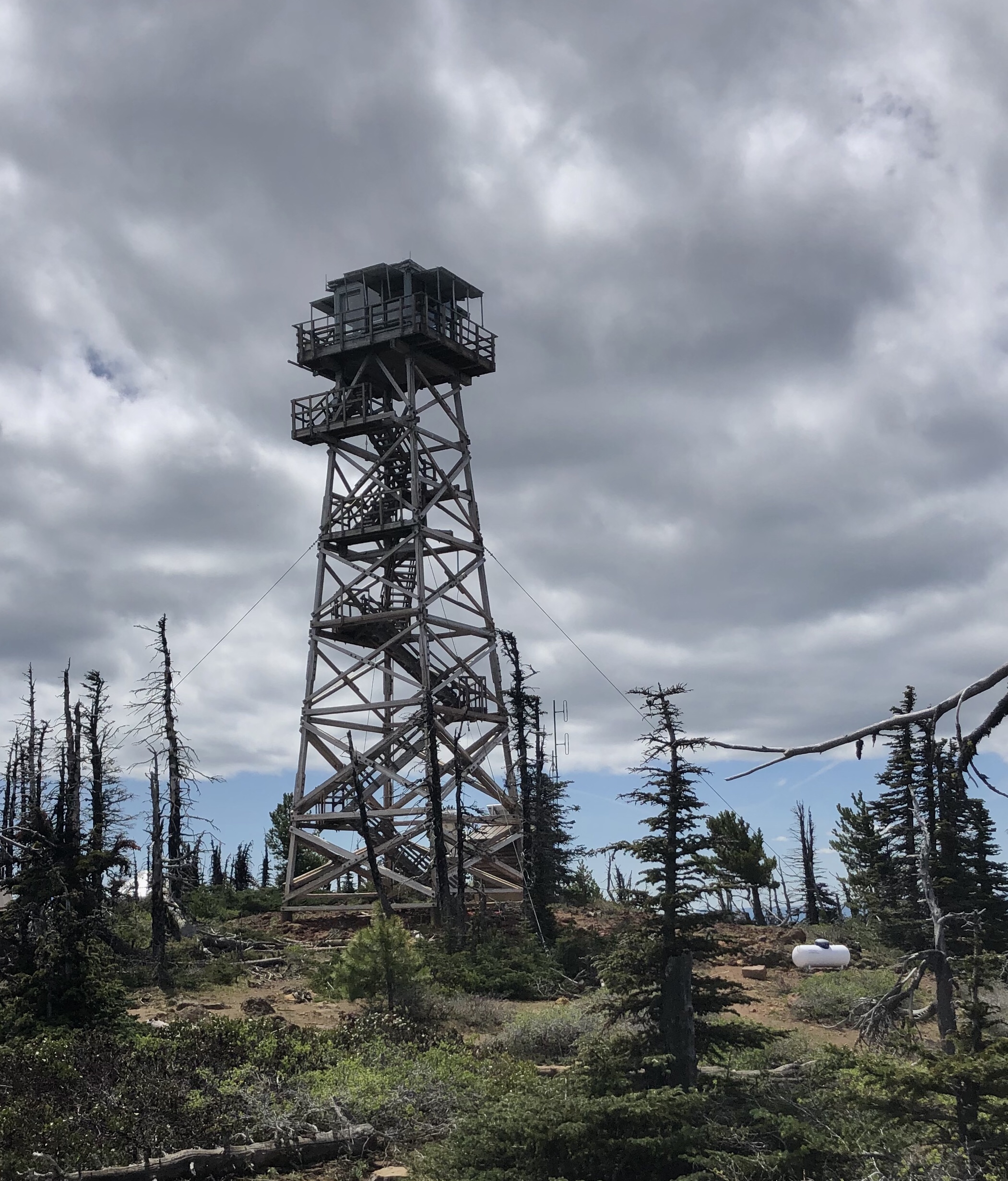
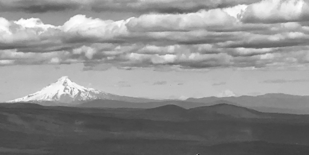
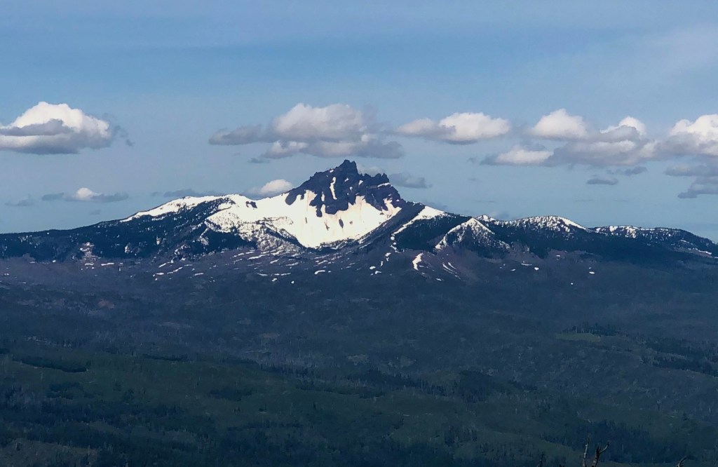
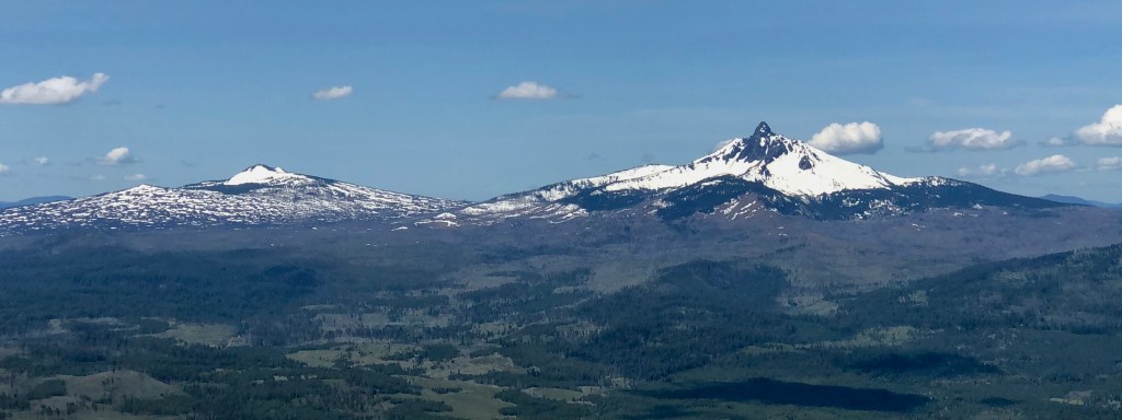
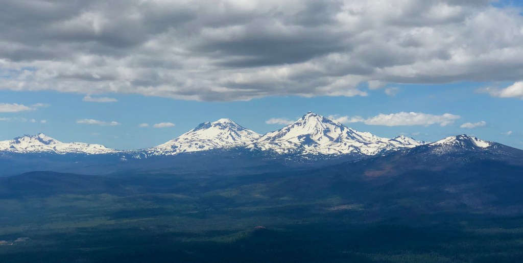
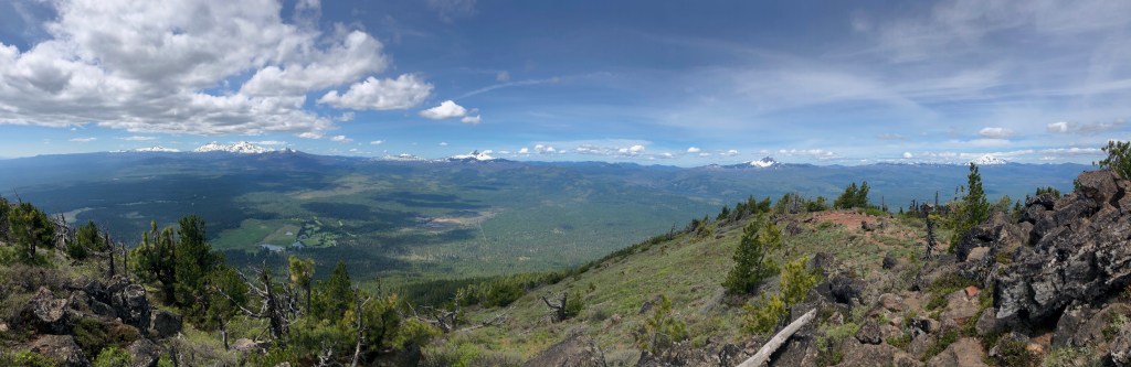
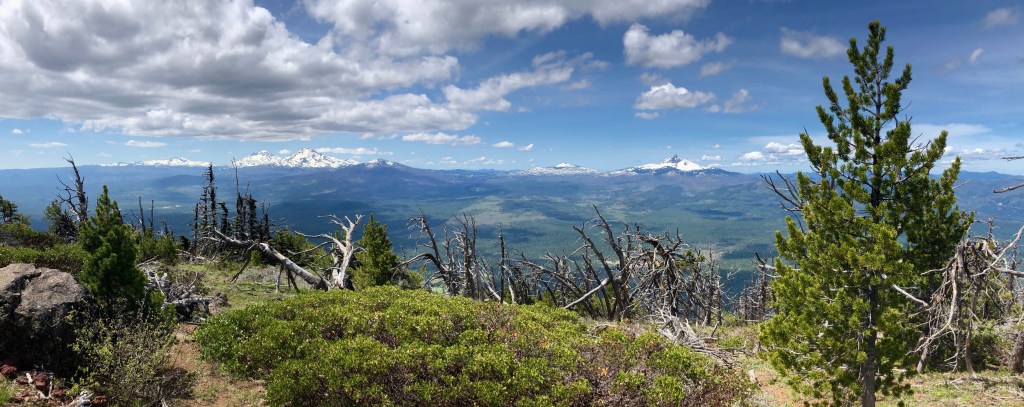
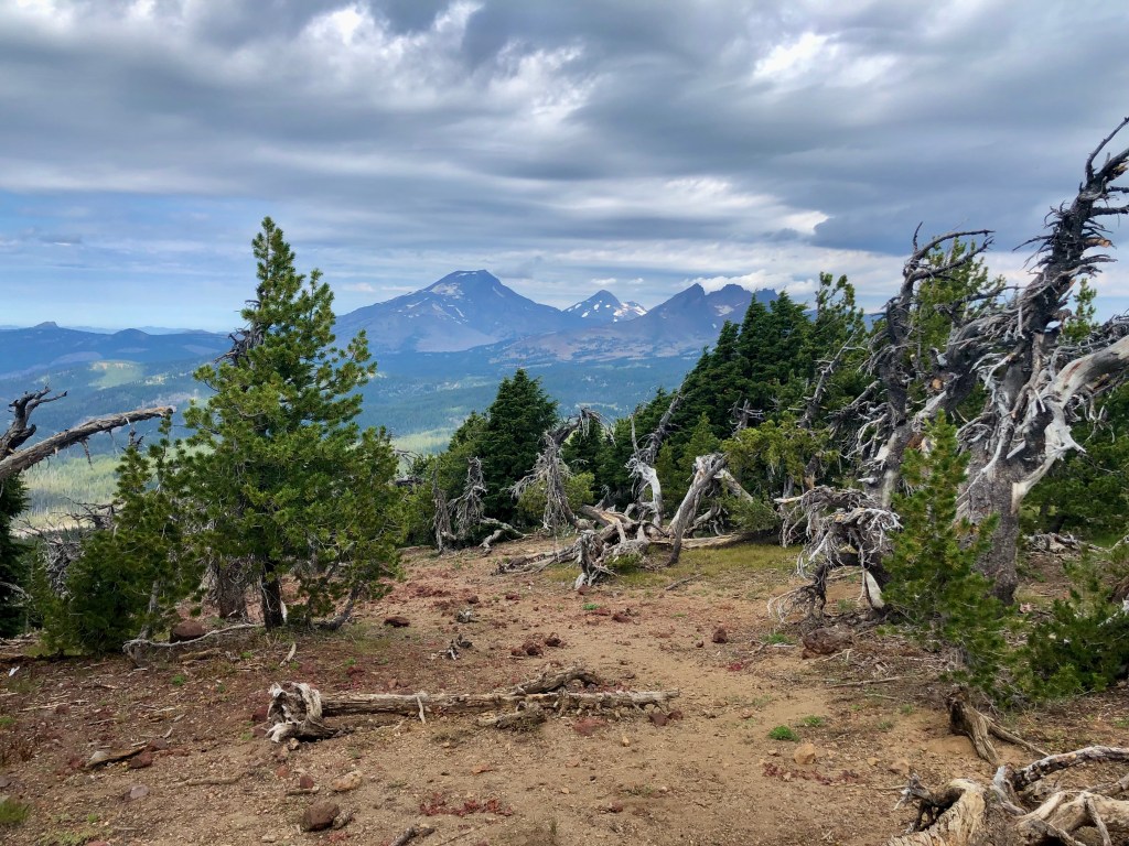
Black Butte Trail is a fun and popular hike in Central Oregon not far from Bend. The views along the way are worth the price of admission, which by the way you will need an America the Beautiful or other more local pass for parking. Like many of the mountains in the area Black Butte has volcanic origins. It is an extinct stratovolcano.
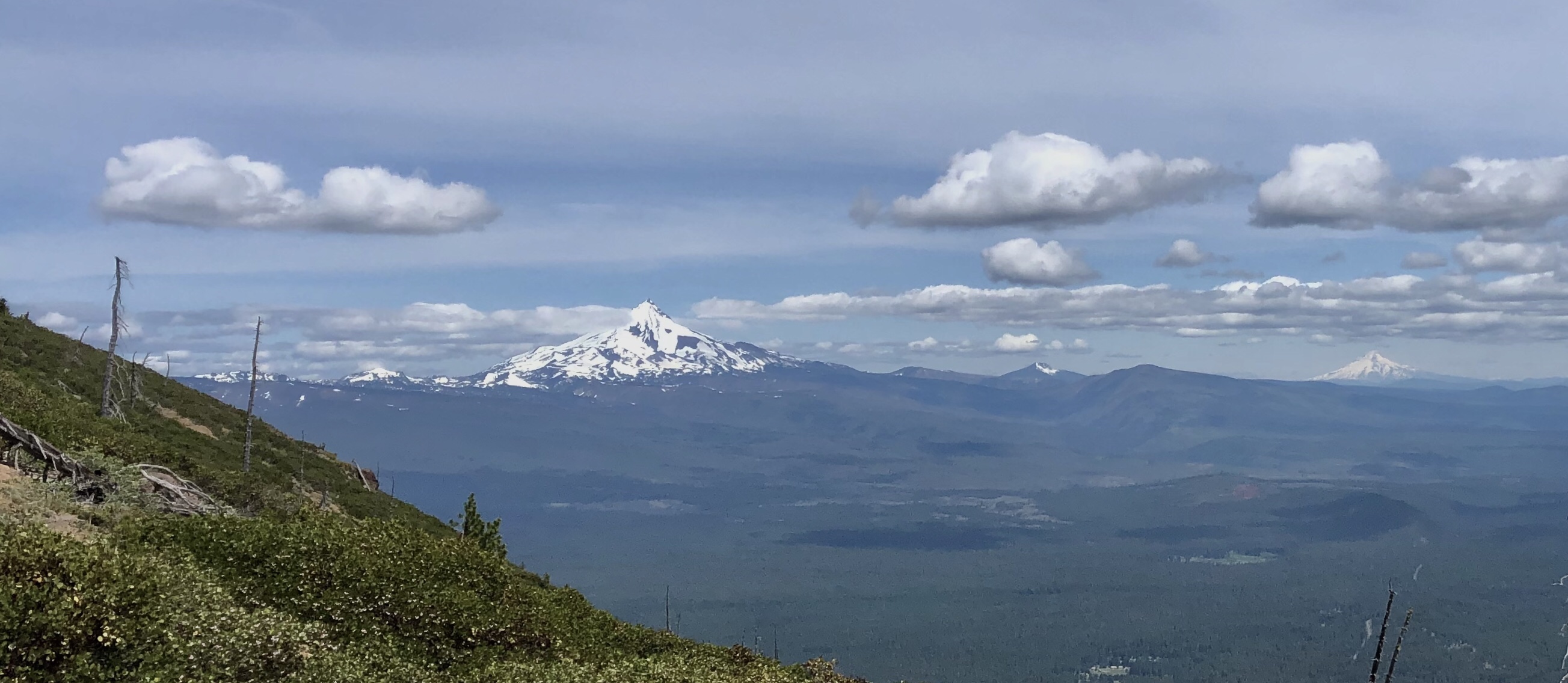
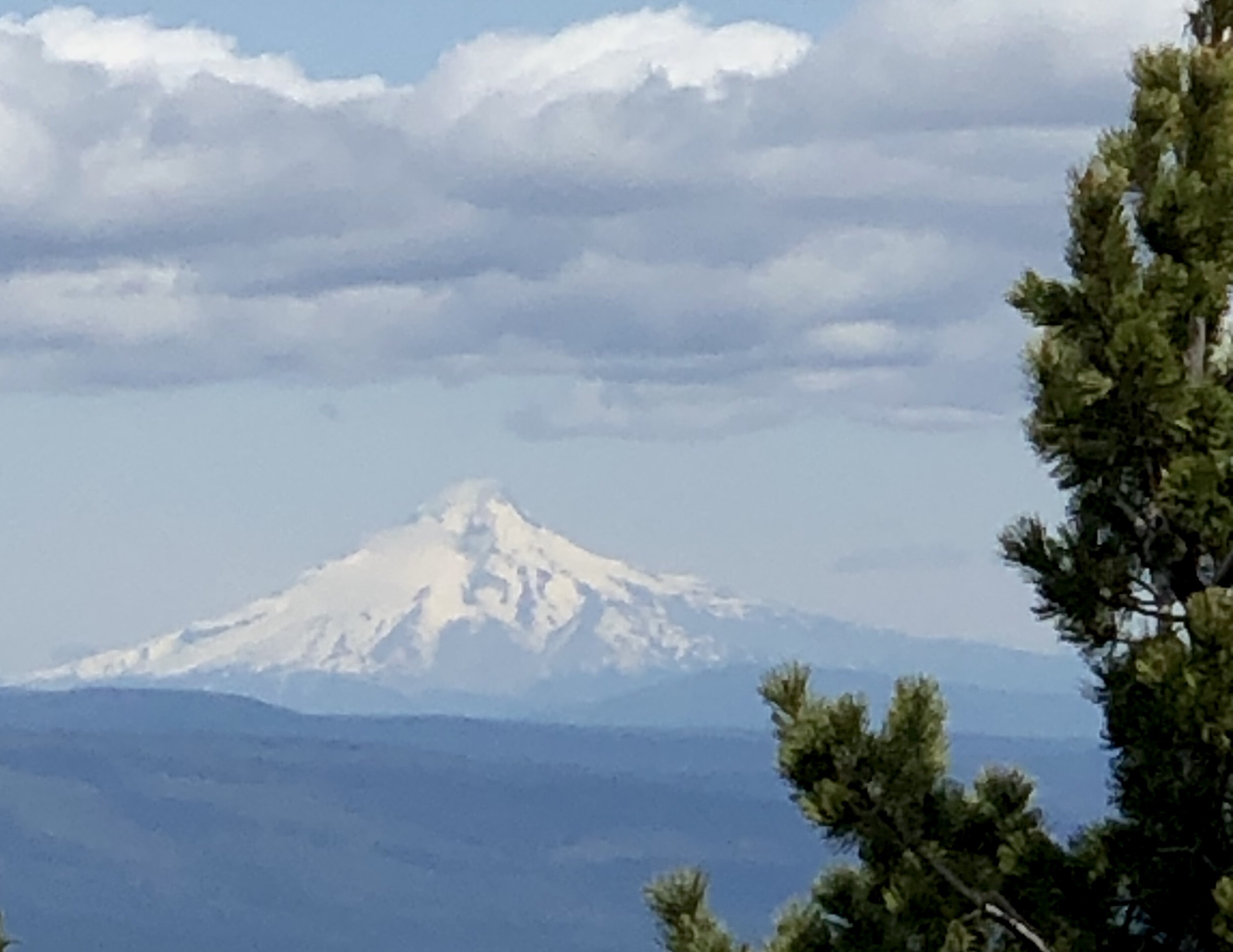
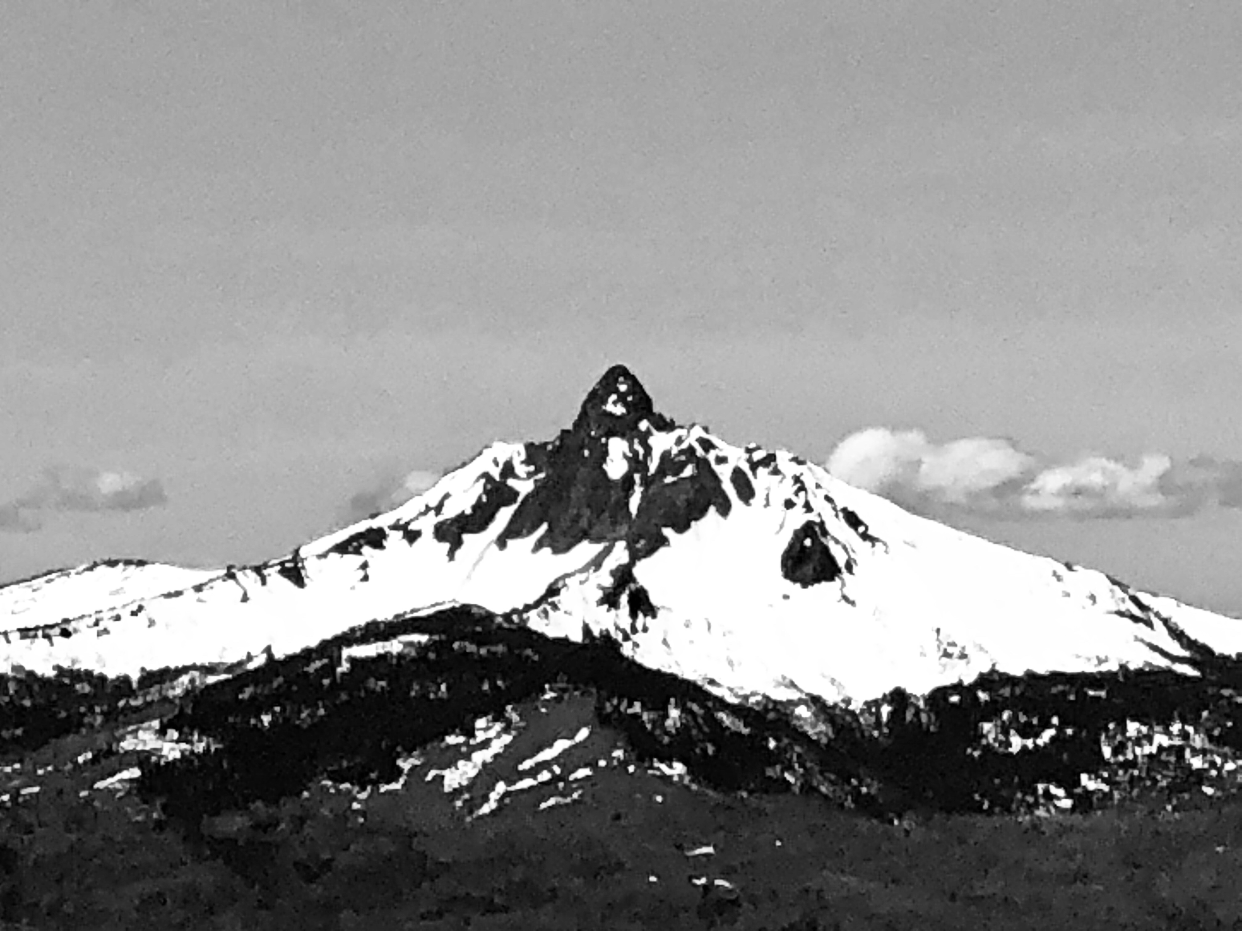
Your hike starts out in beautiful lush green forest. Enjoy the shade while you can as you will climb out of the forest and that will be the end of the shade. The views from Black Butte are utterly amazing along much of the hike. Even the forest provides peak-a-boo glimpses to spur you on along the trail. On top the Cascades come into full view and they are outstanding. Tam McArther Rim, Broken Top, the Sisters, Mount Washington, Three Fingered Jack, Mount Jefferson, Mount Hood, and Mount Adams all laid out before you like the most lavish banquet for the soul.
Mount Washington
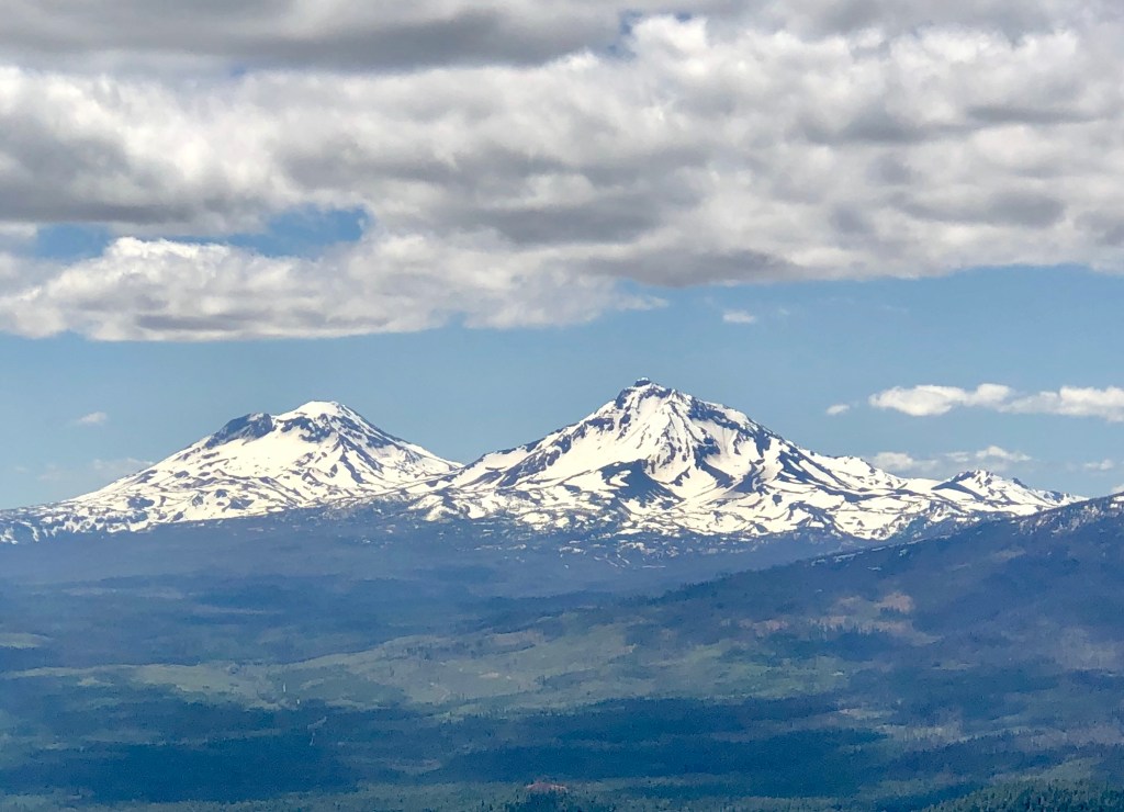
North Sister elevation 10, 090’
Sisters
Cascade Mountains
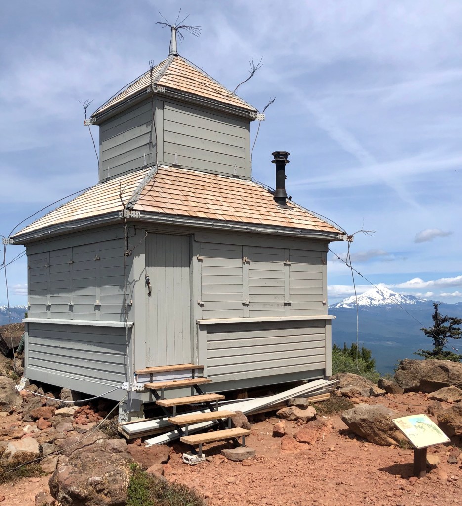
Cupola Building 1924 observation and living quarters.
Mount Jefferson elevation 10,497’
TFJ, Three Fingered Jack, elevation 7,844’
Mount Washington
Tam McArthur Rim, South and North Sister is blocking Middle Sister, and Belknap Crater
Sisters
Tam McArthur Rim, South and North Sister is blocking Middle Sister, and Belknap Crater
Mount Washington elevation 7,794’
Three Fingered Jack through the firs.
“There are moments when all anxiety and stated toil are becalmed in the infinite leisure and repose of nature.”-Henry David ThoreauBlack Butte
I appreciate you joining my good friend Bruce and I as we found ourselves drinking from the cup of replenishment ‘Pursuing Balance Through Adventure’ with the Cascade Mountains on display in all their splendor. To take in so much beauty all at once is almost staggering. Nature has a way of bringing that needle back into balance offsetting our hectic lives and that is exactly what PBTA is all about. There is much more to come. Be sure to COMMENT, FOLLOW, SHARE, and LIKE. Stop by SHOP APPAREL and gear up and then get your boots dusty. Need a place to go? Checkout the menu above each location is a separate website and thus needs to be FOLLOWED independently.
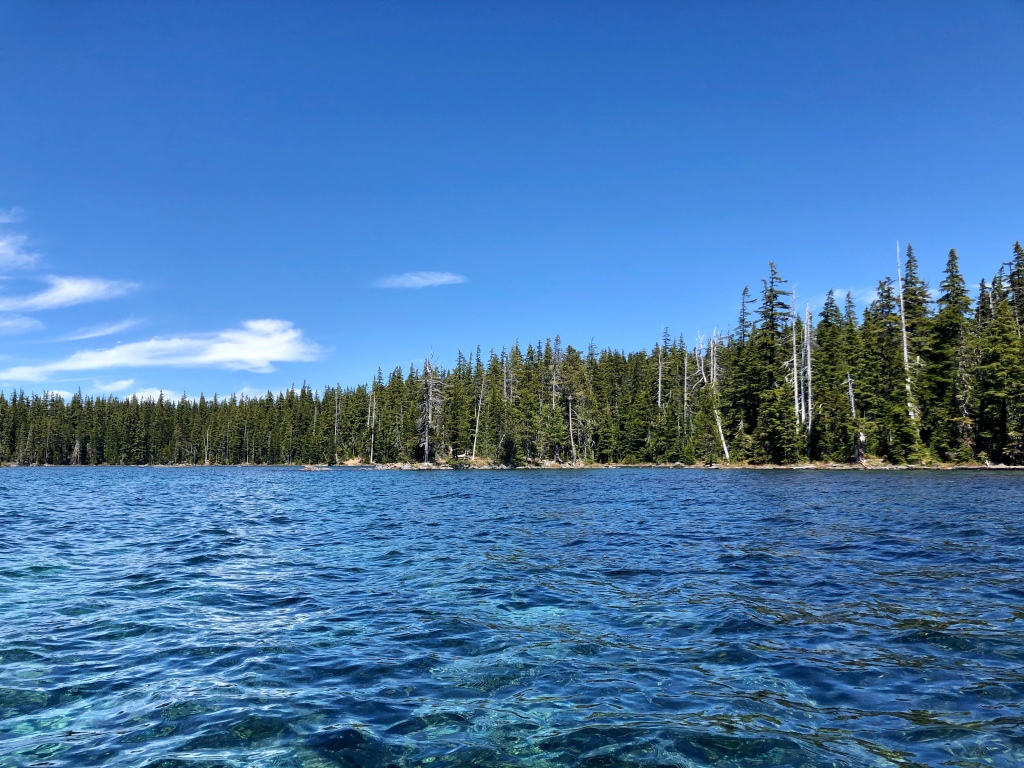
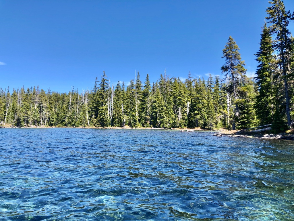
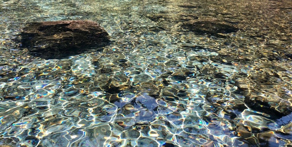
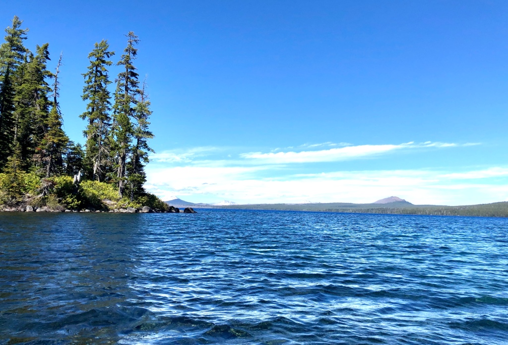
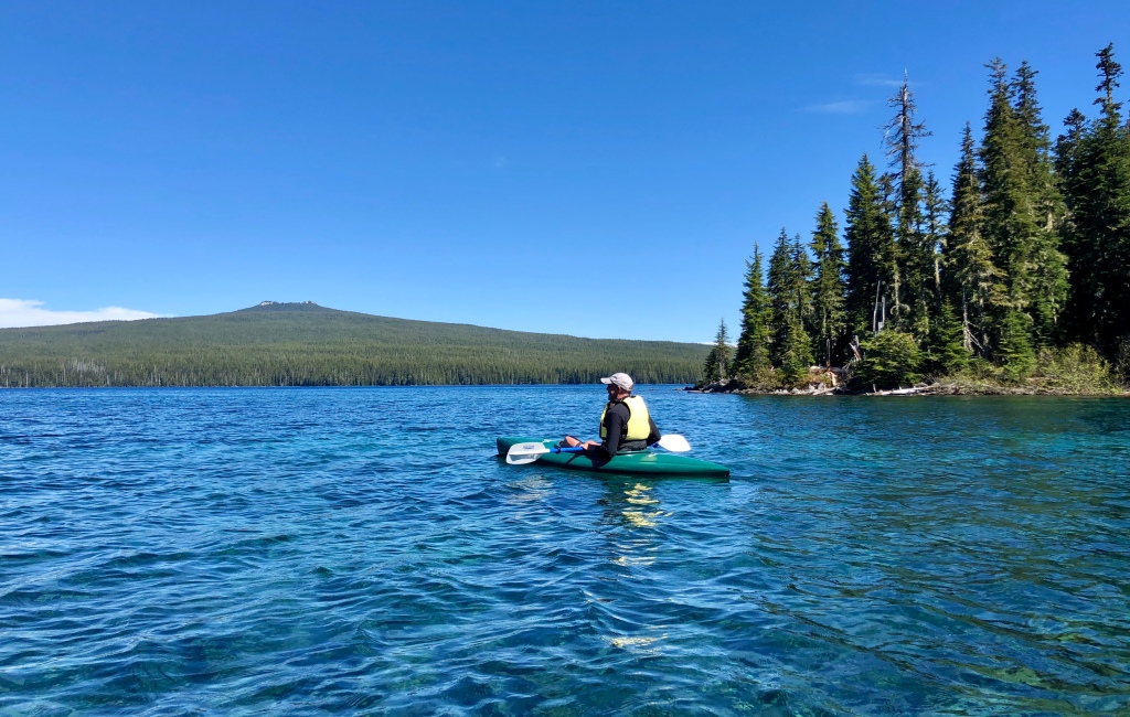
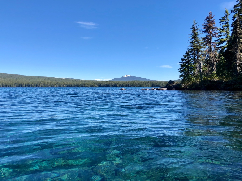
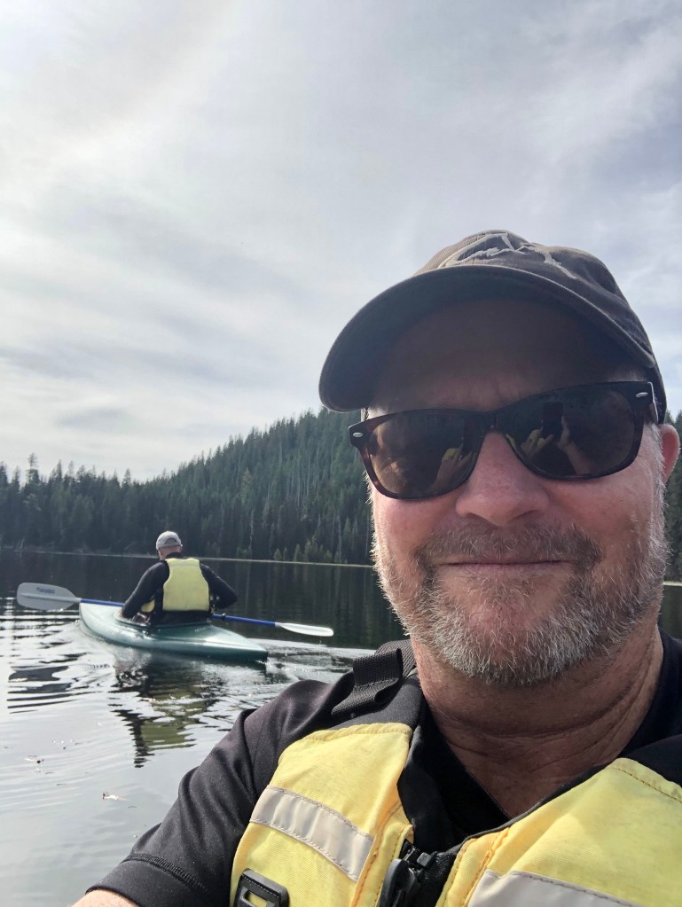
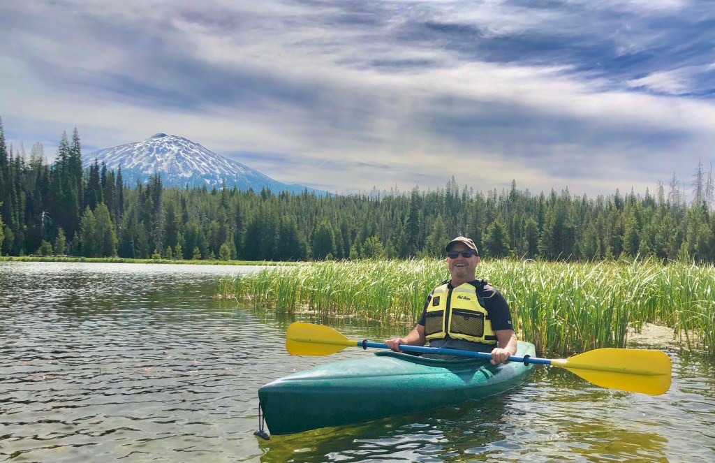
What a wonderful day to be experiencing Oregon at it’s best. I joined my good friend and Fraternity Brother Bruce for several days of journeying into incredible beauty, as he hosted these first days of Summer “Pursuing Balance Through Adventure“. Our days were filled with some of the bluest skies you’ll ever see, stunning views of the snow capped Cascade Mountains and on this day from a kayak, surrounded by deep sapphire blue water.
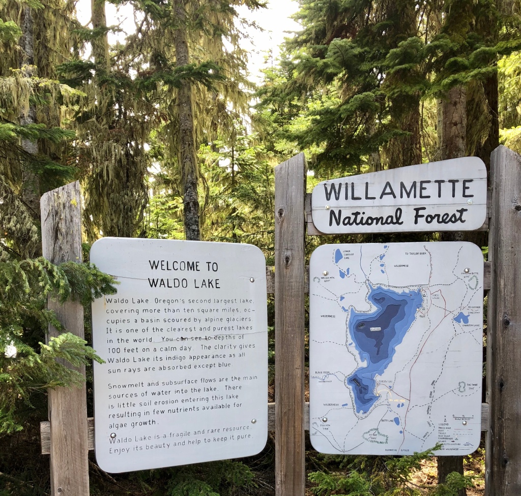
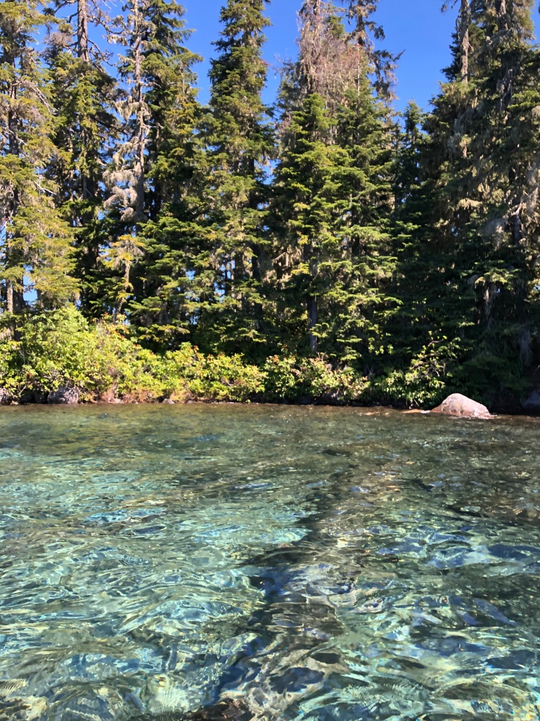
Waldo Lake is the second largest and second deepest natural lake in Oregon. It’s waters are some of the purest and cleanest on earth. On a calm day it is said that you can see over 100 feet deep. The lake is a little less than 6 miles long by 3 miles wide, and the nearest major city is Eugene about 70 miles south. Waldo Lake is surrounded by thick, green, lush forests of Douglas Firs and Western Hemlock, and it is a perfect spot for hiking, mountain biking, camping, swimming and kayaking.
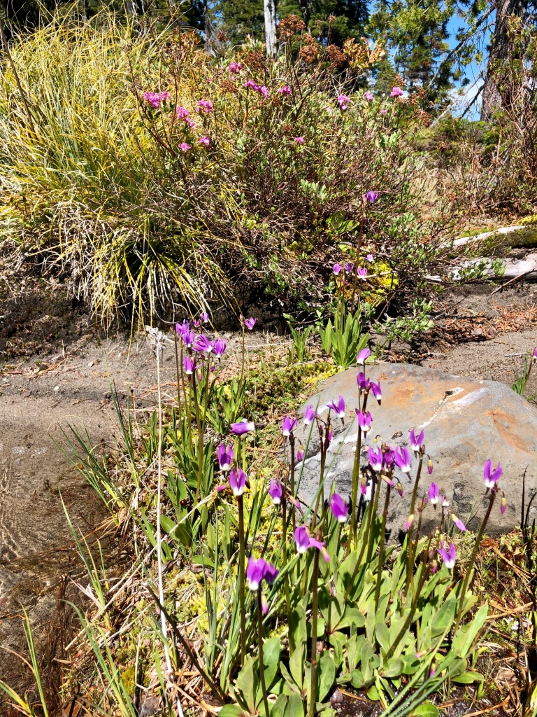
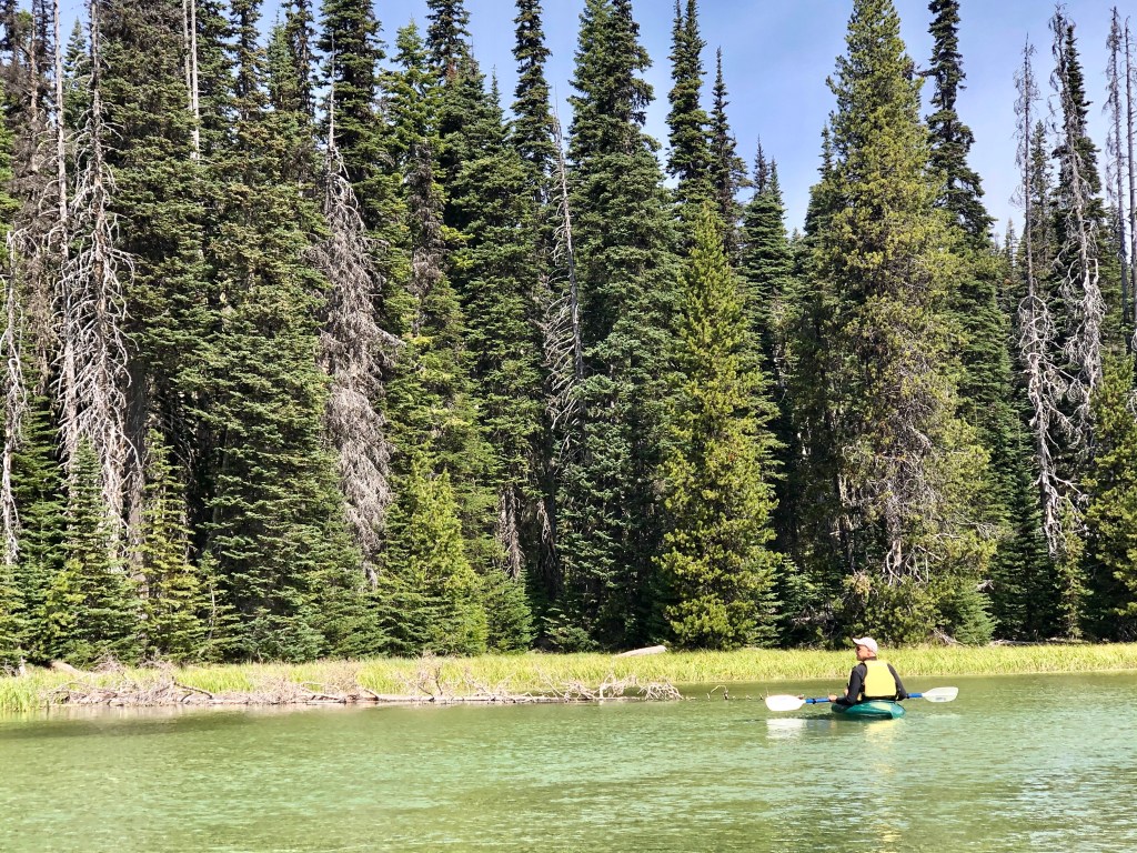
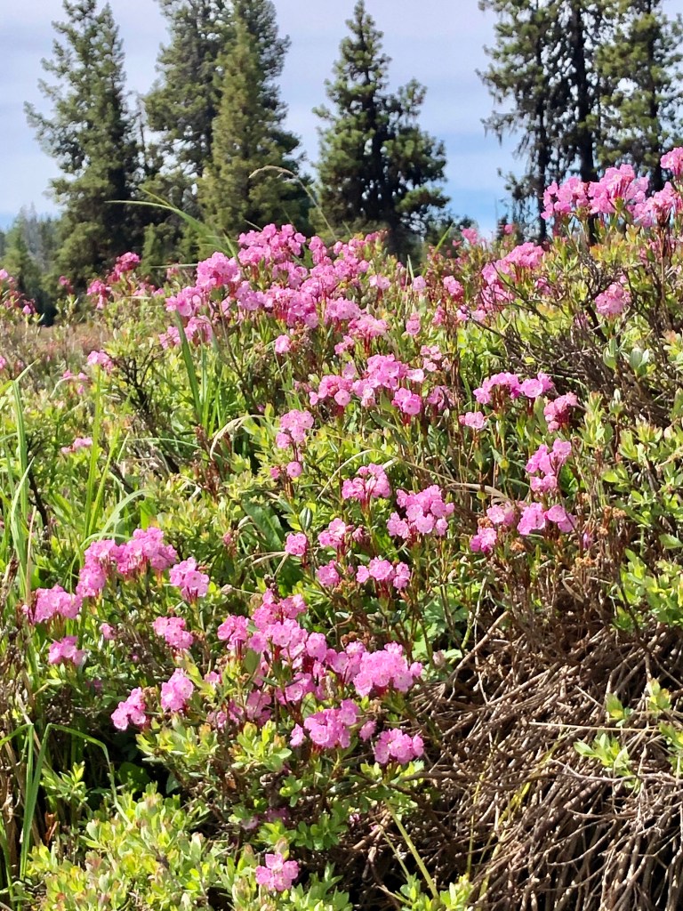
It was early in the season, as we did hit a few patches of snow driving along our route, but it was crazy that we had this big beautiful lake all to ourselves. We launched from Shadow Bay and we only saw a few other people- some hikers and a mountain biker. There was a light, but building breeze as we paddled through the indigo water, and took in views of the mountains to include Broken Top, South Sister and Middle Sister. We headed across the lake against the wind thinking if it really came up strong that it would be at our back for our return trip. We also figured that once we got to the other shore the forest would provide a wind break as well. We put in some miles as we struck out for Rhododendron Island which wasn’t in bloom, but full of natural beauty just the same. We circumnavigated the small island taking pictures and video to recreate Bruce’s daughter‘s perfect day, which the two experienced last year together.
If timing is everything then it sounds like we hit the nail on the head. Not only was the weather perfect, but it sounded like we dodged a bullet. We kayaked Hosmer Lake earlier in the morning, and met a Stand Up Paddle Boarder that told us his favorite lake was Waldo Lake because of it’s vast beauty and it’s deep blue water, but that he would never go there again due to the mosquitos. Well, we seemed to have escaped that issue. We experienced none of that, although we did bring the insecticide and head nets. The hikers we encountered in the parking lot, who make this an annual pilgrimage, said that this is the perfect time to come. It is all timing when everything just opens up with the snow melt and before the mosquitos are out in force.
The water was amazing, the scenery was stunning, the exercise was perfect, recanting our college days was awesome, what a great time! When can we do it again?
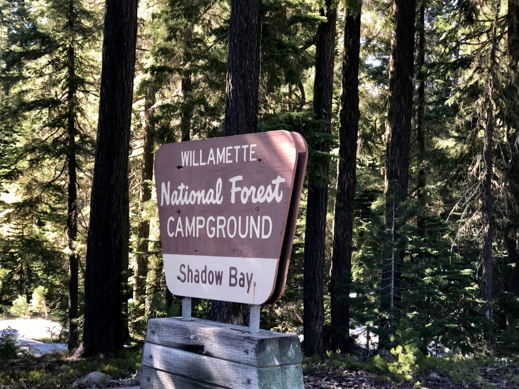
The pictures you always hear don’t do the experience justice, nor does video clips, but video is a little closer because of the moment of water. We launched into Waldo Lake out of Shadow Bay.Shadow Bay at Waldo LakeBruce lands his kayak on Rhododendron Island.Worry less, paddle more.
Thanks for joining Bruce and I as we paddled- “Pursuing Balance Through Adventure“, on this pristine and gorgeous lake in the Wilds of Central Oregon. It doesn’t matter the question a little wilderness is the answer. Good, friends, paddles, blue sky, blue water- “Ya’ Just Gotta Love It!“ Bruce and I still have adventures left to put to pen. So make sure that you COMMENT, LIKE, FOLLOW and SHARE– you don’t want to miss a single moment to be inspired by nature. Hopefully this will get you out there in the wilderness taking it all in. It’s good for the soul. Need a hat like my PBTA logo cap? The answer is yes you do, lol. SHOP APPAREL. Need adventure? Again same answer- yes you do, so go to the menu- there are suggestions for adventures all over the West. Each of the locations has a separate website and you should check them out. They all need to be FOLLOWED independently.
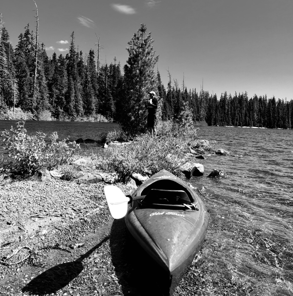
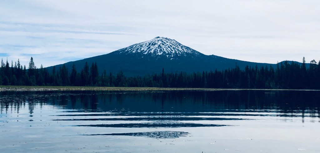
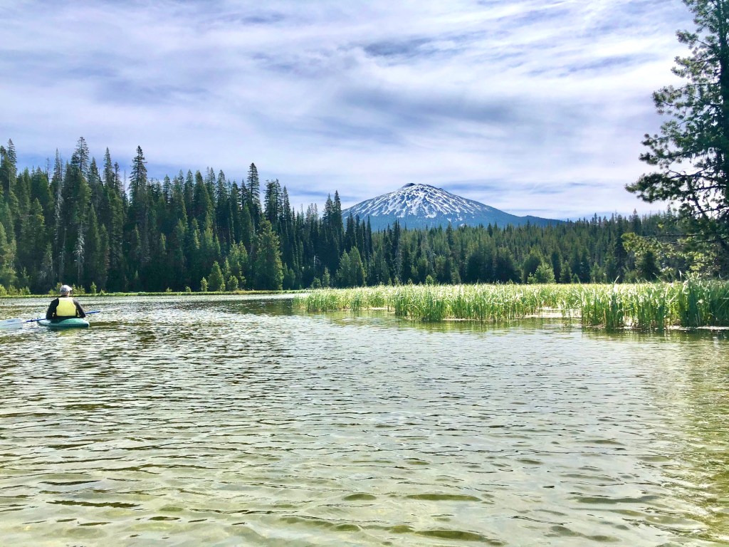
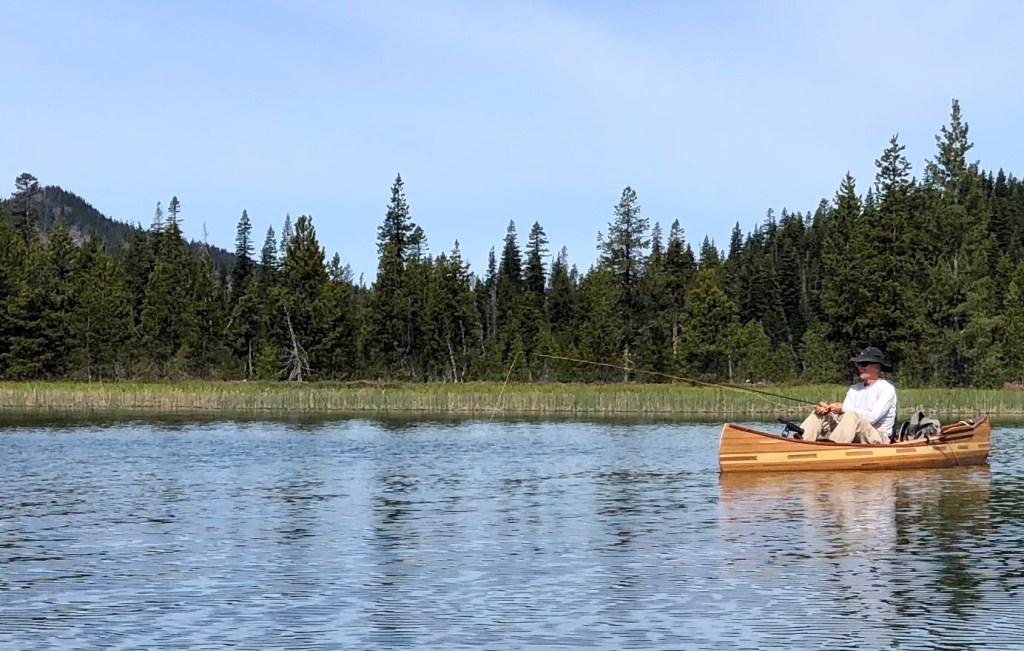
Hosmer Lake sits at about 5,000 feet above sea level and is 20 miles from Bend and what a magnificent body of water. The water is so clear that my friend Bruce was pointing out salmon, and trout like crazy. But we were there to take in some other sites, which were wondrous at every bend.
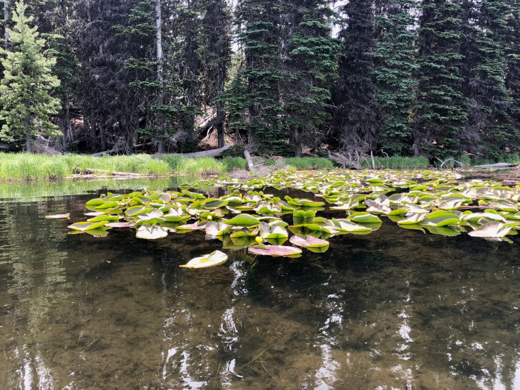
We were graced by the regal Mt Bachelor, the breathtaking South Sister, and the wild Broken Top all while paddling on beautiful blue water, surrounded by dark green forest, passing vibrant lily pads with bright yellow blossoms, shoreline adorned with fragrant flowers, under a crystal clear sky. It really was spectacular.
Just as Bruce was exclaiming how lucky we were to have this special scene without the crowd, people started arriving and by the time we left the small parking area was just about full. So, the ticket is like so many places arrive earlier paddle around the many twists and turns through marsh and lily pads to the other side of the lake and enjoy.
Apparently there is good fishing on Hosmer Lake.
“A lake is the landscape’s most beautiful and expressive feature. It is Earth’s eye; looking into which the beholder measures the depth of his own nature.” – Henry David Thorea
Thanks for joining Bruce and I as we paddled through superb natural surroundings with brilliant views of the Oregon Cascades while “Pursuing Balance Through Adventure“. We could have not asked for a more perfect day to take in these astounding views. What a nice way to step out of the chaos of deadlines, boardrooms, phone calls, sales quotas, and budgets, and into the realm of her majesty, Mother Nature, how calming, how peaceful, and tranquil. We need to embrace nature as much and as often as we can because that is a wonderful way to find that balance that we all seek. There is more balance ahead so please COMMENT, LIKE, FOLLOW, and by all means SHARE. Gear up at SHOP APPAREL. Checkout the menu above for a place to find adventure by the way, they are all independent sites from each other, divided by area, and need to be followed separately.
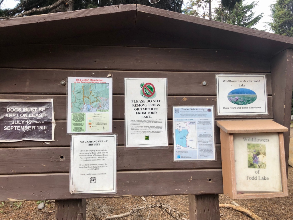
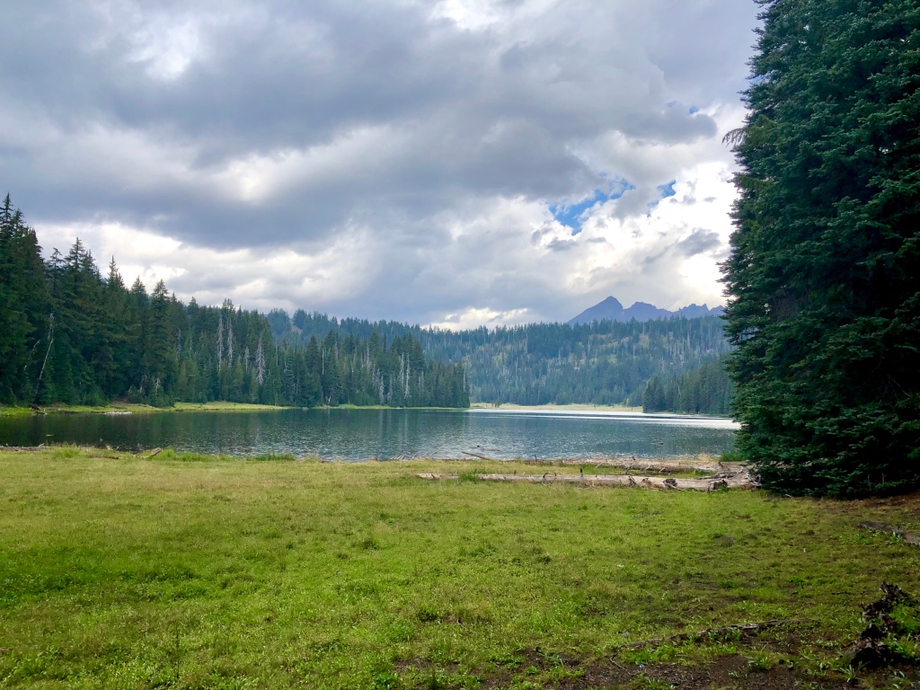
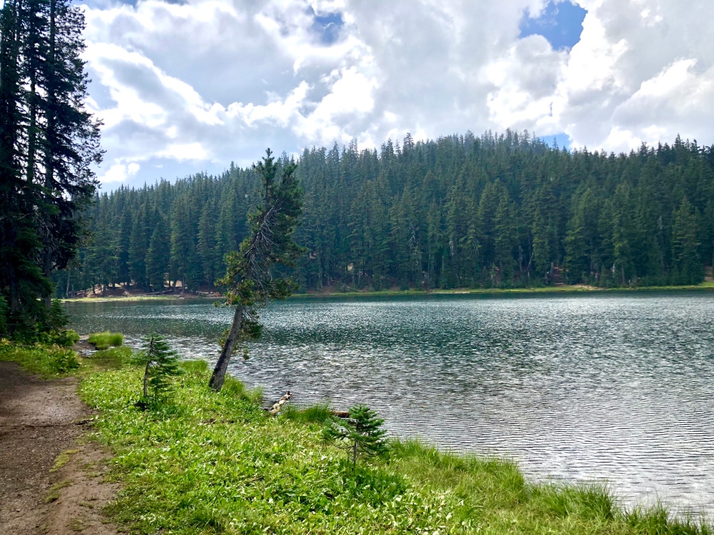
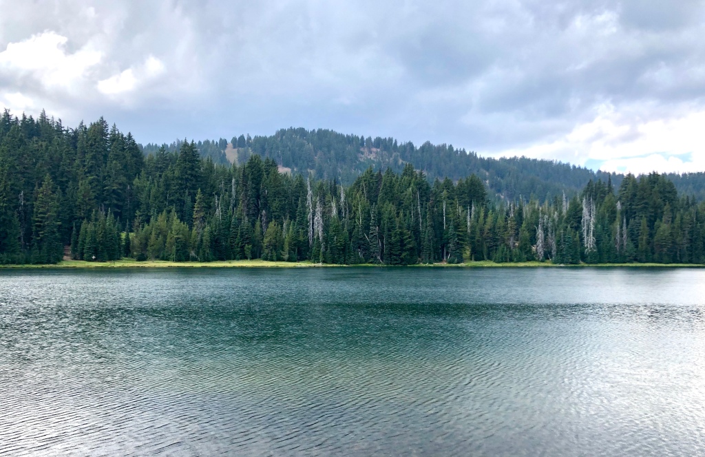
When I arrived at Todd Lake I knew there was a chance of afternoon thunderstorms. I thought that I could get in and out of this hike quickly before the storm. When I arrived there were nice views of the lake and the neighboring mountains Broken Top and Mount Bachelor. There was a little sun beaming through the clouds, but all of that was about to change. Quickly clouds rolled in masking the mountain views, a few claps of thunder, a flicker of lightening and then the heavens opened up and I got a pretty healthy down pour. I was prepared in my sailing foul weather gear jacket so there was nothing to do but enjoy Oregon’s “liquid sunshine” after all that is why everything is so plush and green.
Hearing the rain on the lake, seeing the puddles collect on the trail, feeling the damp air, the breeze through the firs, the scent of freshness mixed with a dank whiff of wet decaying wood really lets you experience the Oregon Wilderness.
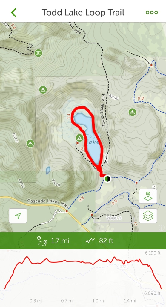
Trailhead parking is $5 unless you have a NW Forest Pass or other excepted annual passes. Todd Lake is a great little hike for the whole family. Very scenic even on a stormy day, so I can only imagine how beautiful it would be on one of the picture perfect Blue Bird Central Oregon days. The trail is delightfully forested, with views of the lake and mountains. On the far end is sort of a marsh meadow area. I found what I will call a little feeder stream filled with tadpoles. Fun little hike.
Todd Lake with Broken Top in the background
“Life is not about waiting for the storm to pass, but learning to dance in the rain.” -Vivian Greene
Todd Lake with Mount Bachelor in the background
Todd Lake, in the Deschutes National Forest, is a great place to be ‘Pursuing Balance Through Adventure’, won’t you join me next time for another journey? You can do so by FOLLOWING, SHARING, LIKING, and COMMENTING.
Happy Trails, Roger Jenkins, Pursuing Balance Through Adventure
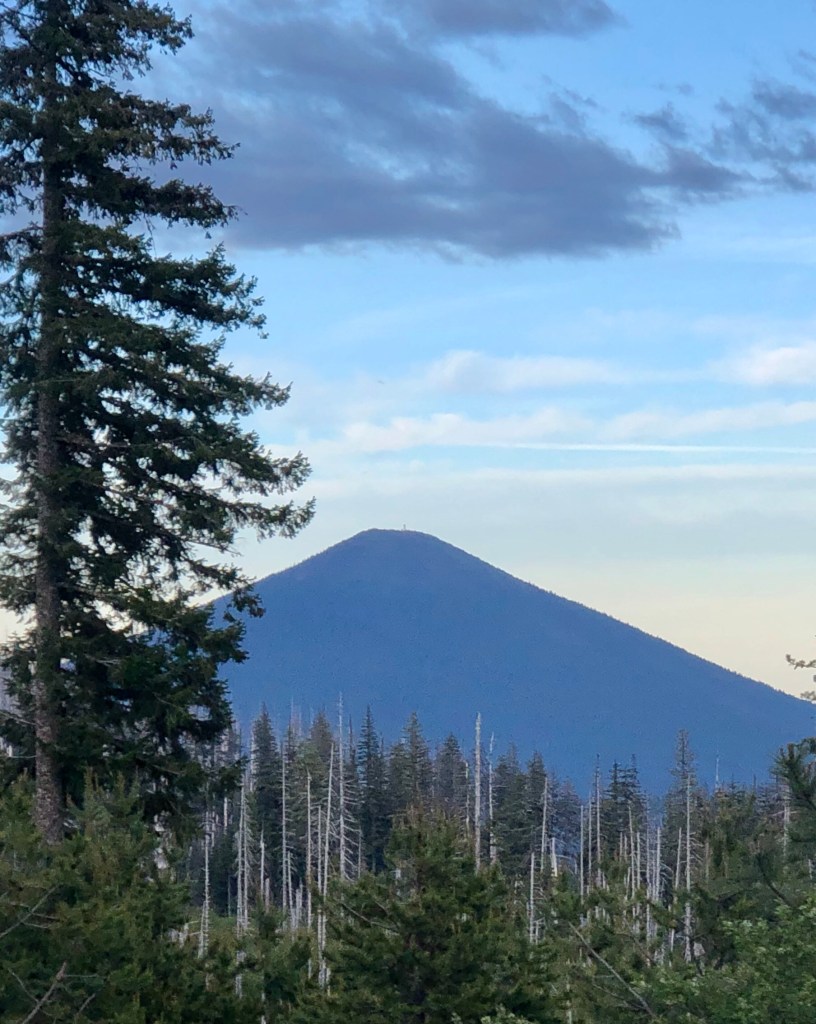
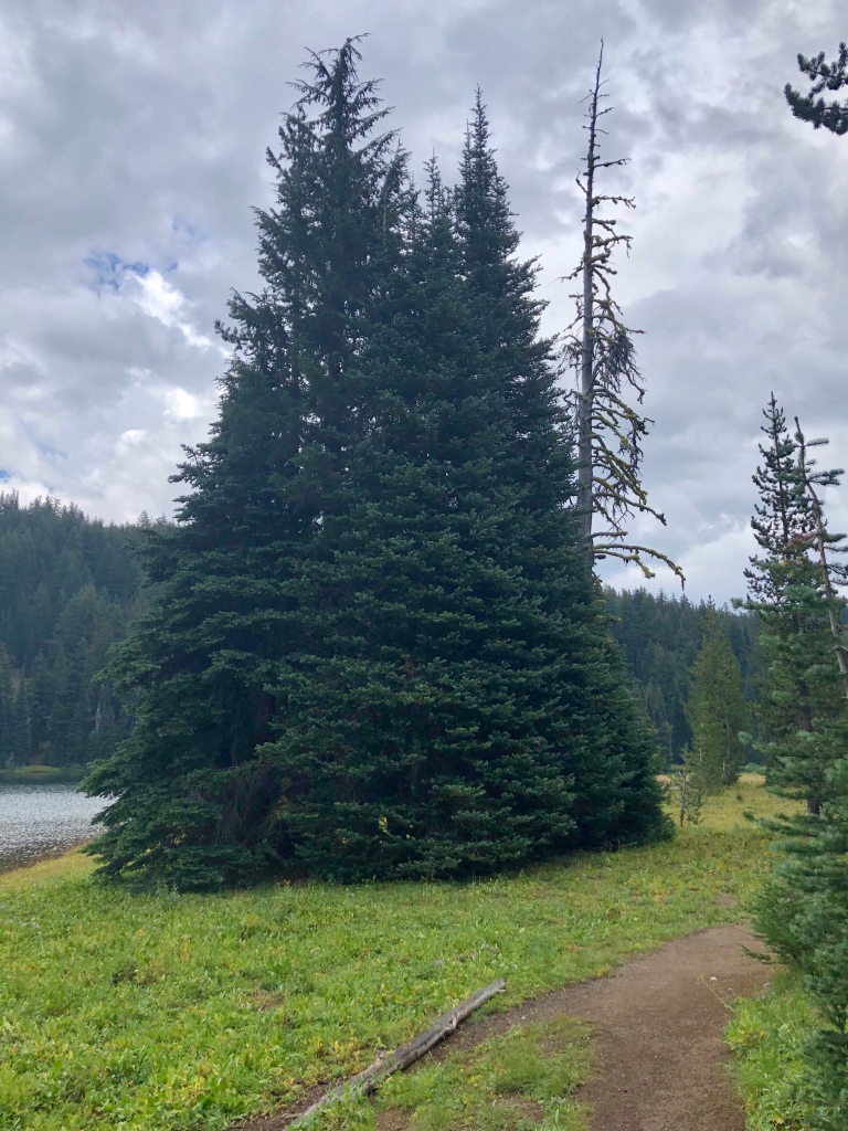
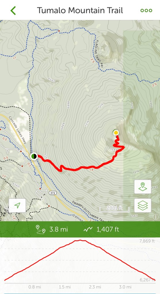
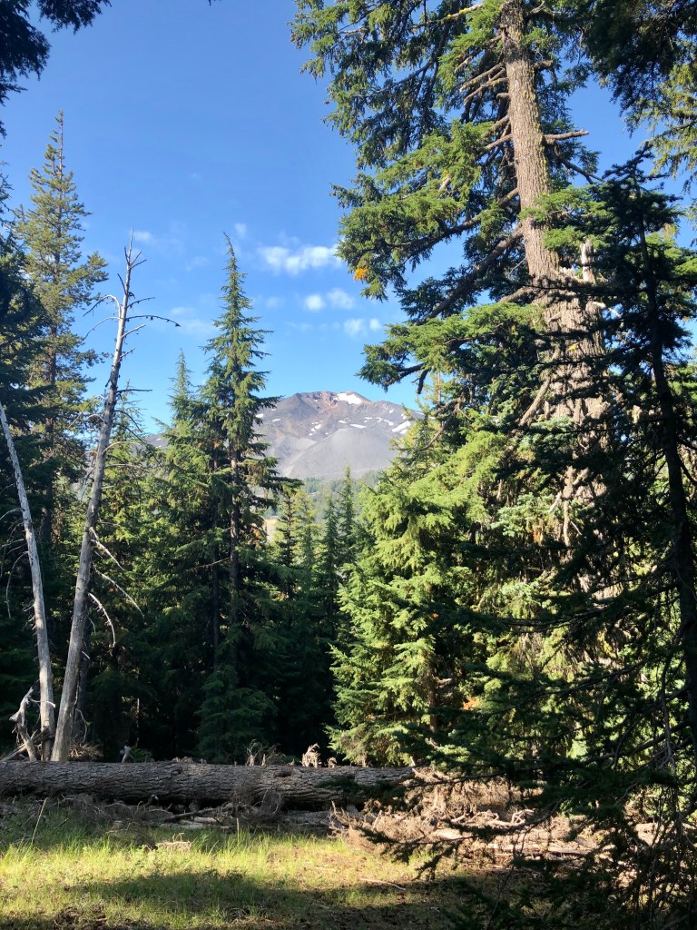
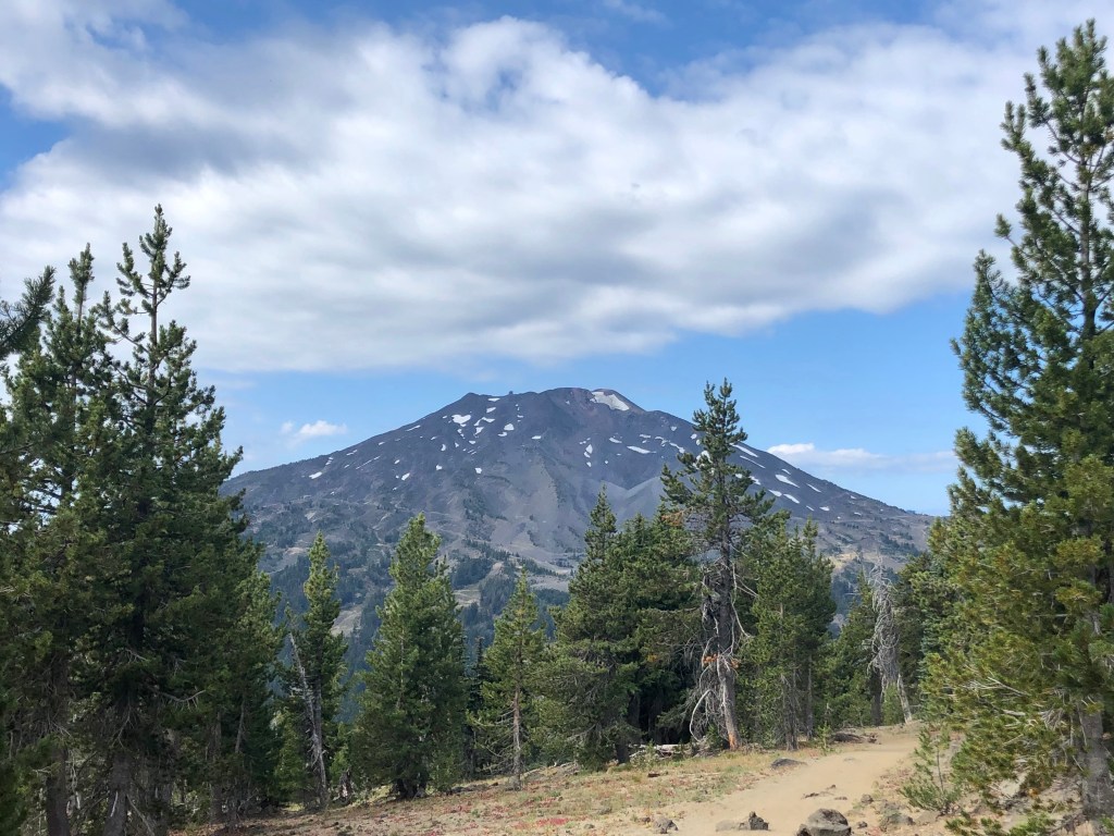
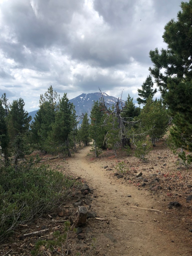
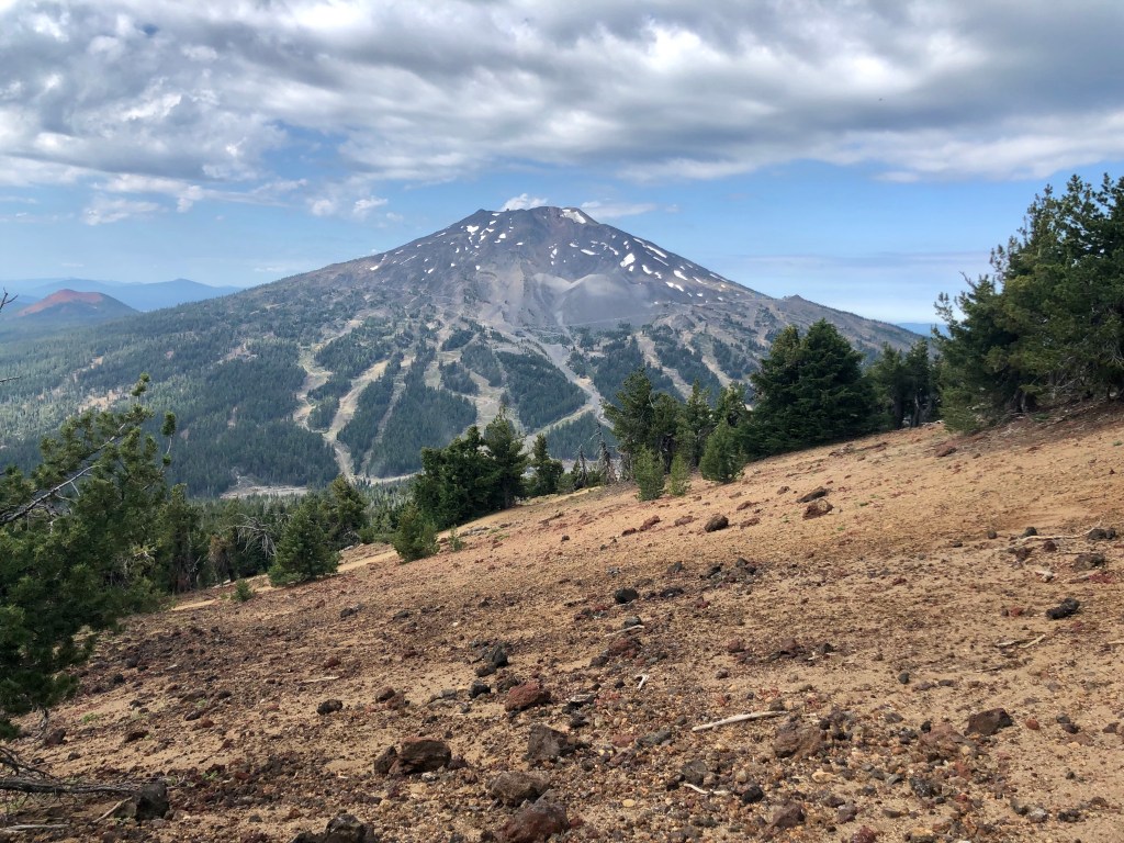
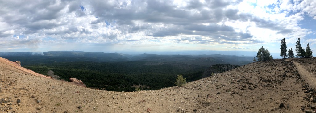
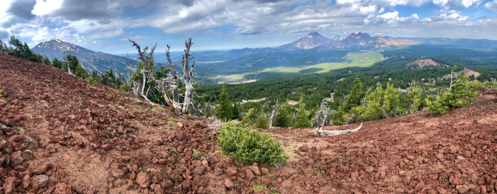
Tumalo Mountain, a shield volcano, sits adjacent to majestic Mountain Bachelor near Bend Oregon in the Deschutes National Forest. At over 7700’ it affords wonderful views of Mt Bachelor at 9000’. From the top Tumalo Mountain is optimally located for spanning views of the northwest. Splendidly on display are the Sister’s Mountains, Broken Top and in the other direction Tam McArthur Rim.
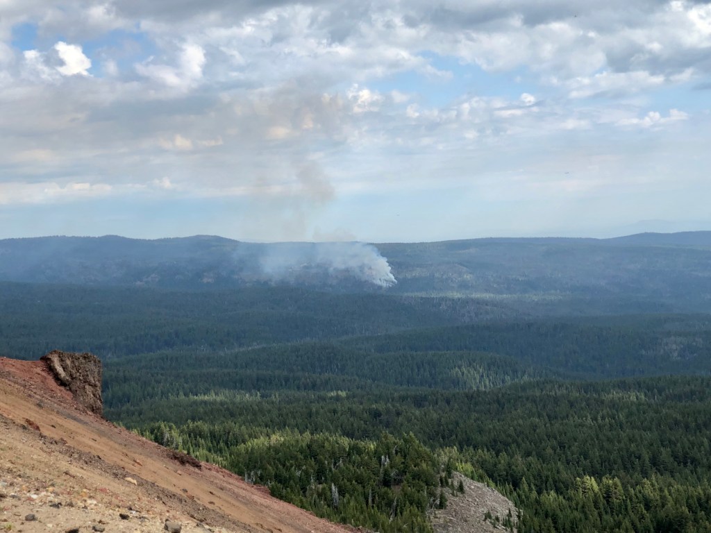
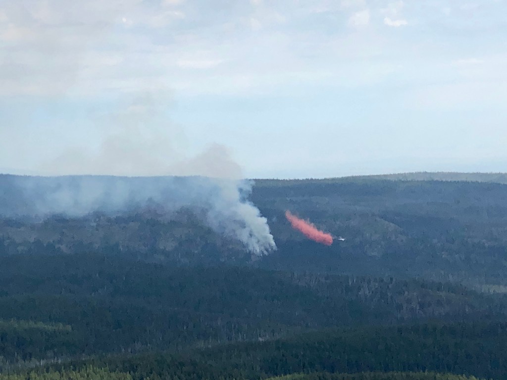
Something very special for me to observe was occurring while I was on top of Tumalo Mountain. Yesterday in the late afternoon I was hiking Tumalo Falls. During the hike there was a light rain and distant lightening and thunder. That lightening touched off small forest fires in the area and fire fighters were working hard to make sure they stayed small. From my vantage point atop Tumalo Mountain I could see the aerial attack on that fire and found it fascinating. Crews made drops over and over with orange fire retardant to halt the advancing fire. Thank you fire-fighters for your valiant efforts.
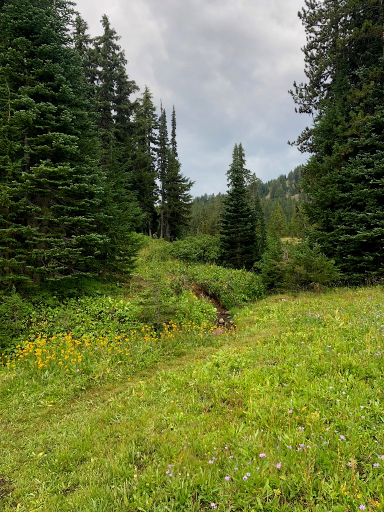
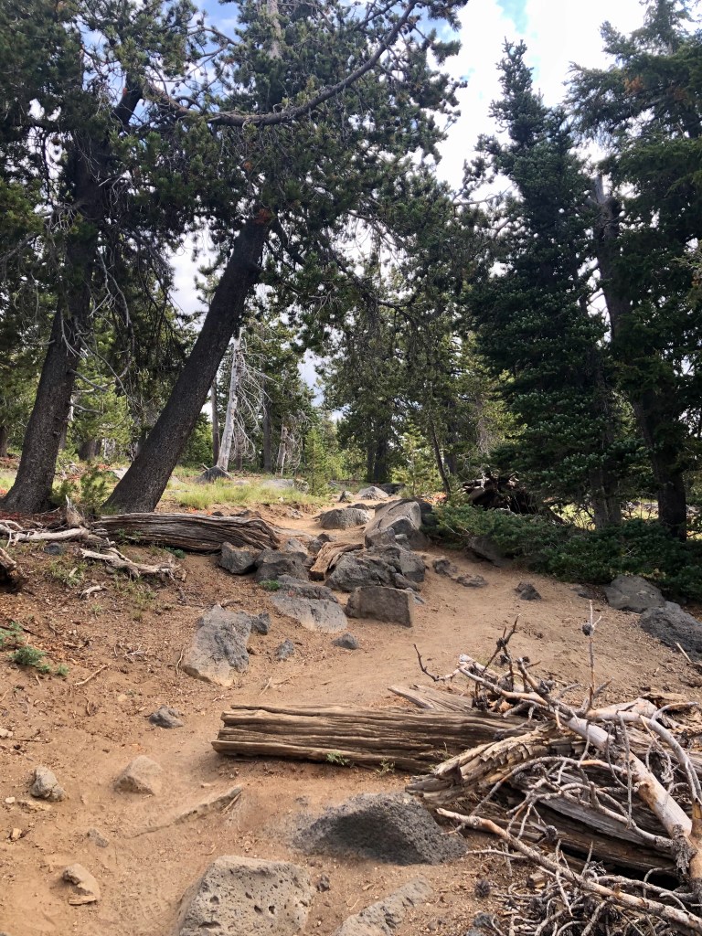
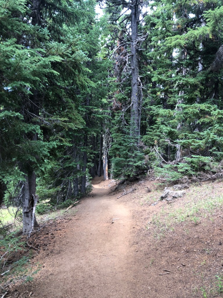
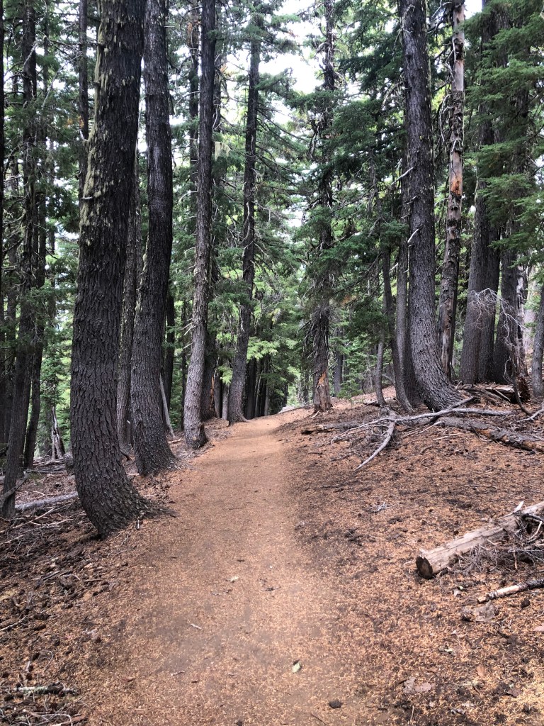
A Northwest Forest Pass is required, and during the winter, if you are snow shoeing, a Snow Pass is required for parking. The trail gains altitude from the get-go as you weave through a sparse evergreen forest, an alpine meadow, until you reach an open portion at the top adorned with twisted white bark pines, and craggy trees. The backside of Tumalo Mountain confirms it’s volcanic origins with a steep hillside of volcanic pumice scree.
I highly recommend this hike. I hike mostly during the week, so the fact that this is a popular hike, simply because it is a great hike with superb views, is close to Bend, and is easy to get to, doesn’t affect me as much, but be aware that if you are hiking prime time – prime season that you won’t be alone. You know that you must be spoiled, in this manner, when you are hiking on a Thursday, and you discover a very chatty group is coming up behind you. I pulled over and let them go by. I believe that they figured out the reason that I stopped, mentioning something along the lines and apologizing. I replied. “Good morning, there is plenty of mountain for everyone.”
Mt. Bachelor playing peak-a-boo through the trees.It is funny to think that in just a few short months Mt Bachelor will be packed with skiers and snow boarders, being one of the finest resorts in the country.
Fire Fighters drop fire repellent just in front of the fire to keep it from spreading.The backside of Tumalo Mountain is steep, made up of volcanic pumice scree. Background is Mt Bachelor, Sisters, and Broken Top. Foreground is volcanic pumice scree.
Home is where the mountains are.
Thanks for coming along on this journey of mine ‘Pursuing Balance Through Adventure’. It is my hope that my accounts will inspire you to seek your own counter balance to our busy work a day world through profound encounters with nature. Besides the stretching of the legs, and the breathing of mountain air, it is about setting the soul soaring to the mountain tops, the deserts, the oceans, rivers, lakes or canyons. If you are unable to take an adventure of this nature, for whatever reason, then do so vicariously through me and together we will experience freeing our souls through this medium. So please COMMENT, FOLLOW, LIKE, and SHARE.
Pursuing Balance Through Adventure Videos regarding the hike
Tumalo Mt in the Shadow of Mt Bachelor
Views of Sisters, Broken Top, and Mt Bachelor from Tumalo Mt.
Firefighters make aerial assault on Wildfire as seen from Tumalo Mt.