Category Archives: Peak Bagging

Mount McLoughlin

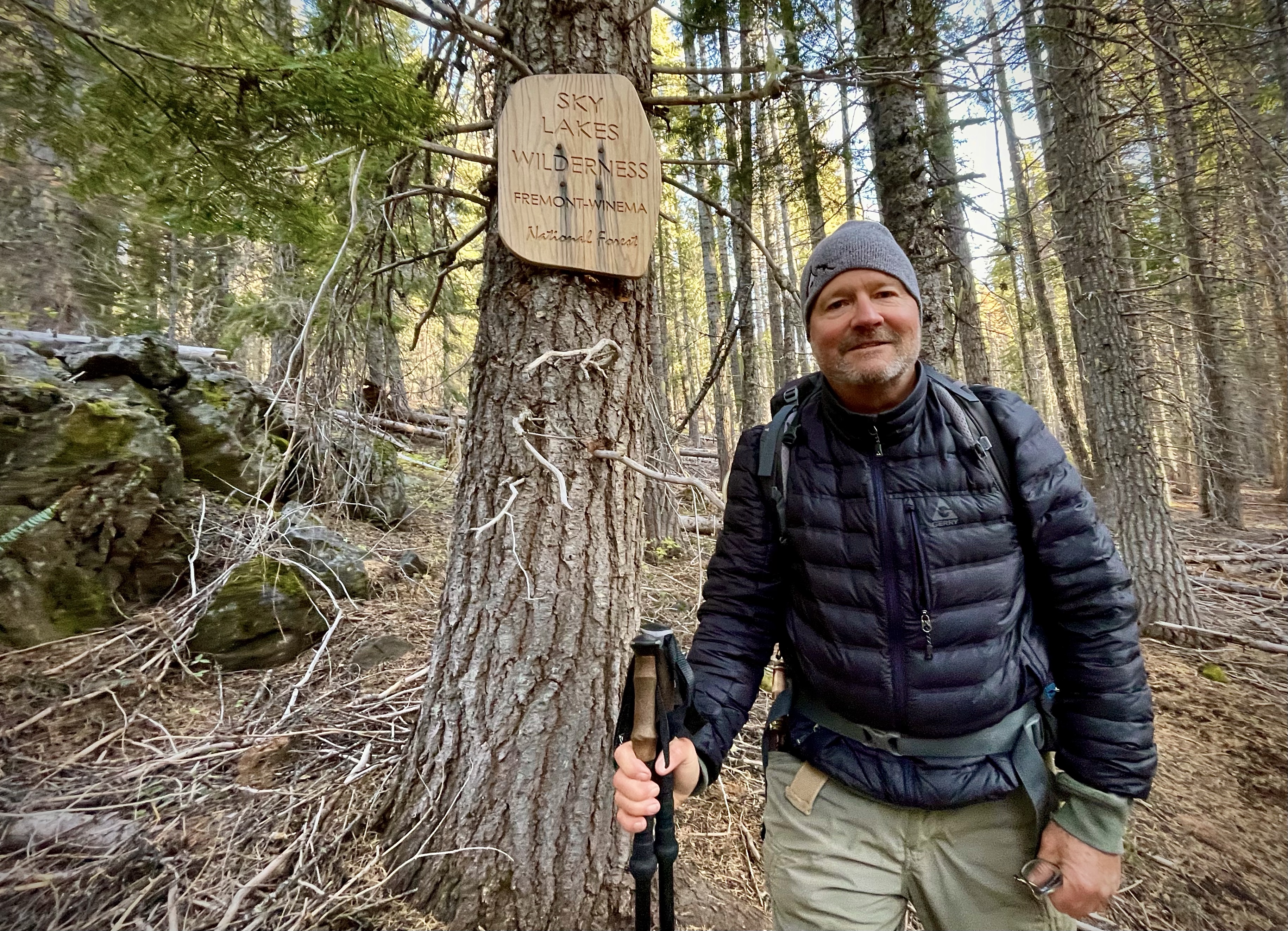
Winema National Forest / Sky Lakes Wilderness

Activity: Backpacking, Peak Bagging

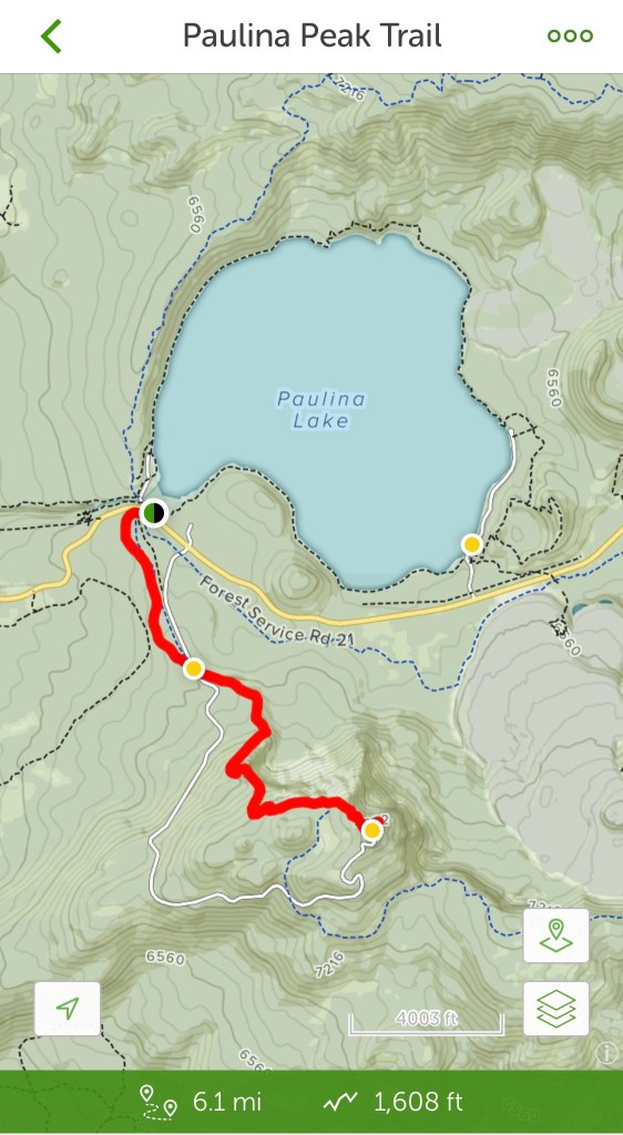
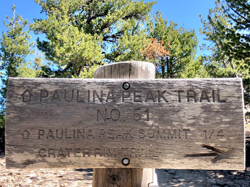
Fish Lake to Mount McLouglin Summit: 9,495’ elevation, Distance: approximately 17 miles, over 5,000’ elevation gain, 12 hour duration, rated VERY HARD

Date: 10/6-8/21

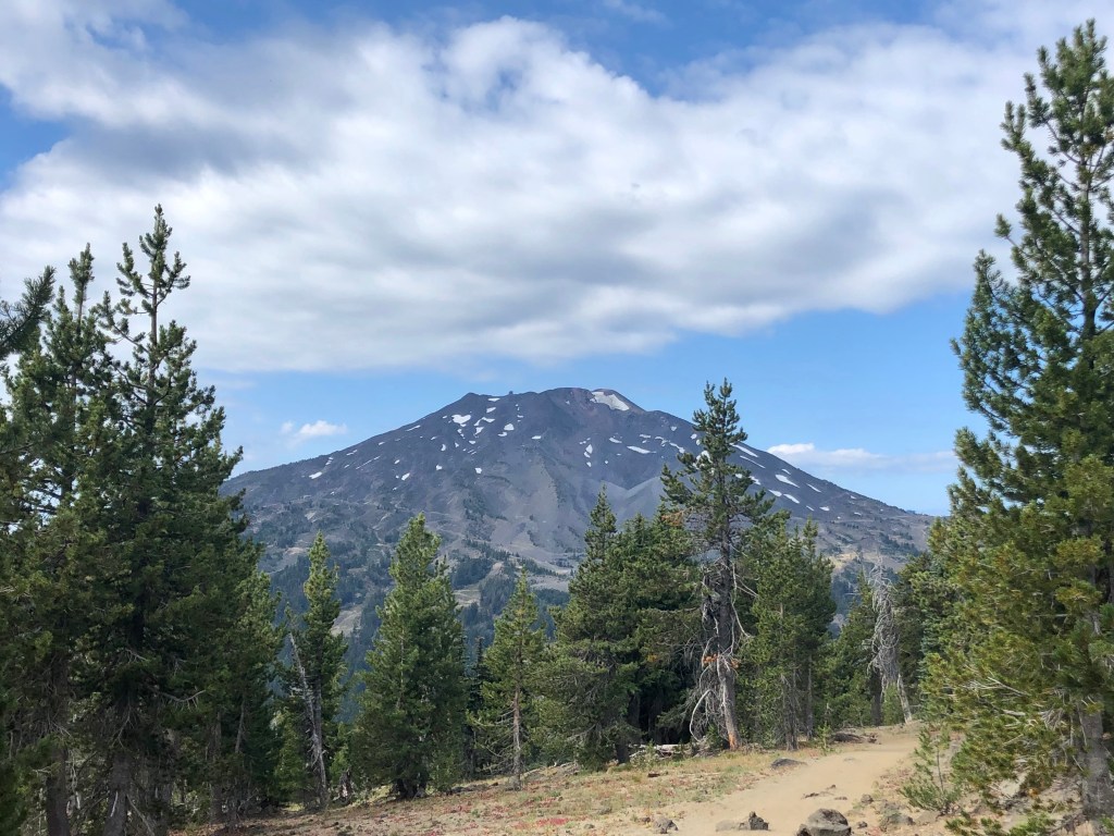
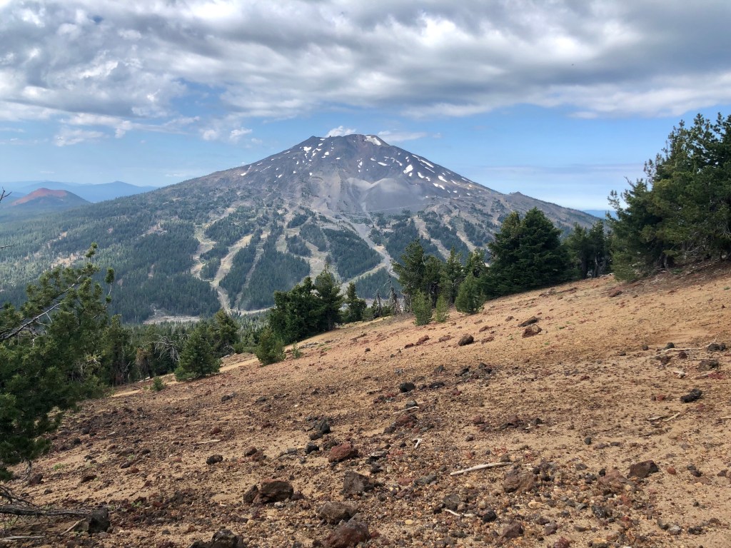
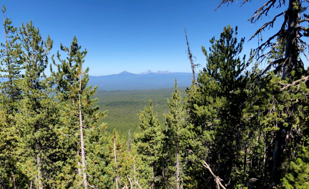
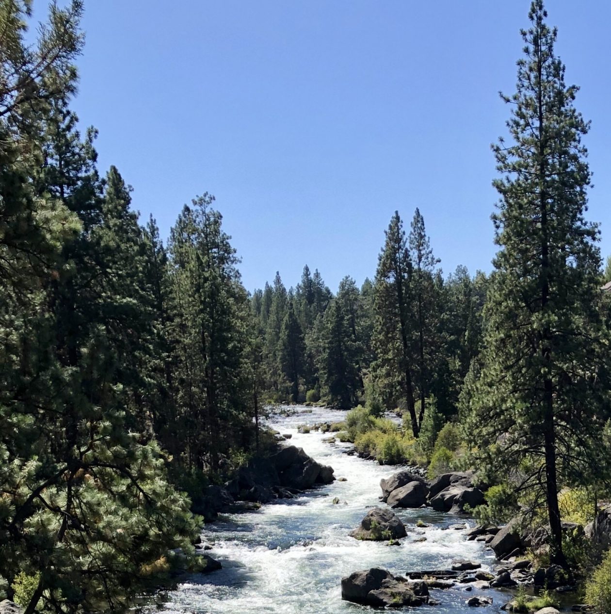
Mount McLoughlin is located in Southern Oregon. It lies south of Crater Lake and well North of Mount Shasta in Northern California which can easily be seen from the summit. Mount McLoughlin is a steep sided dormant volcano, part of the High Cascades Volcanic Arc and dominates the Medford Oregon horizon.

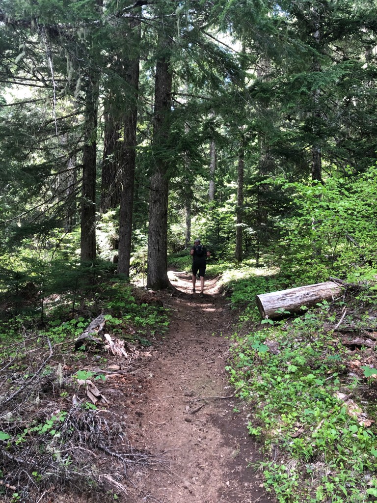
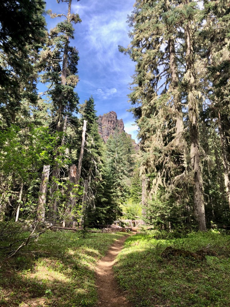
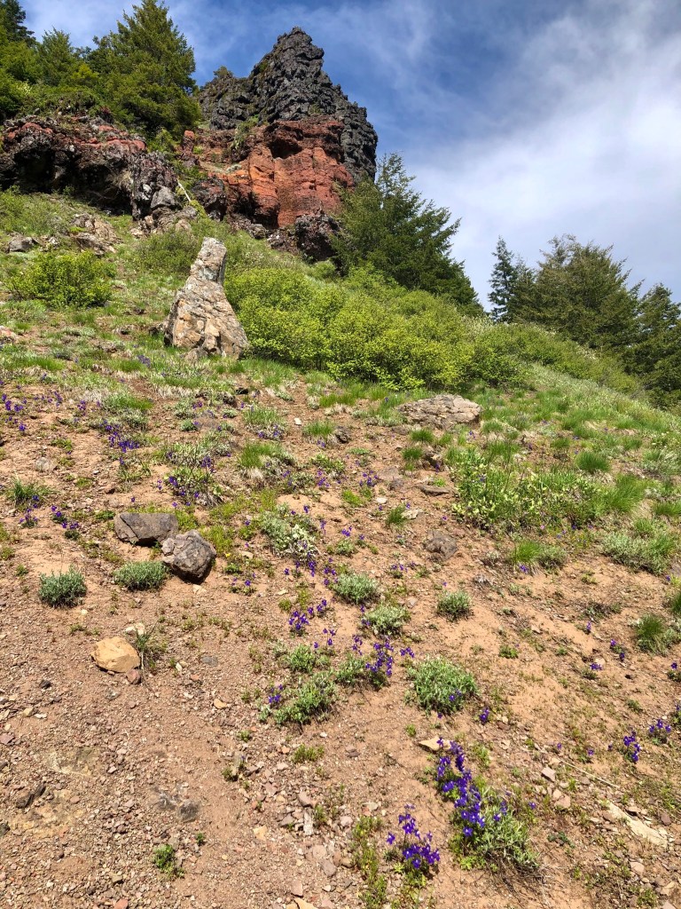
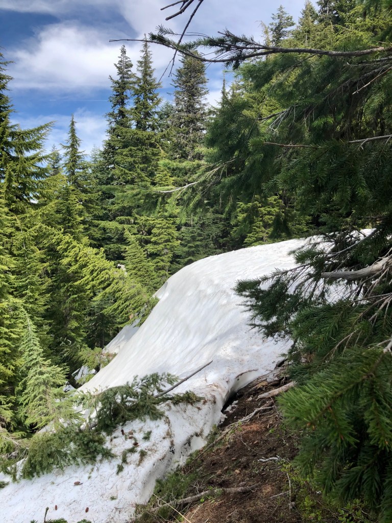
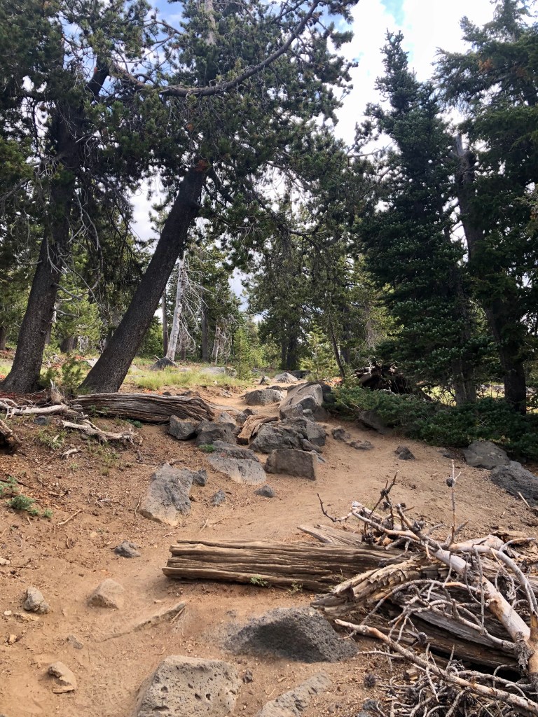
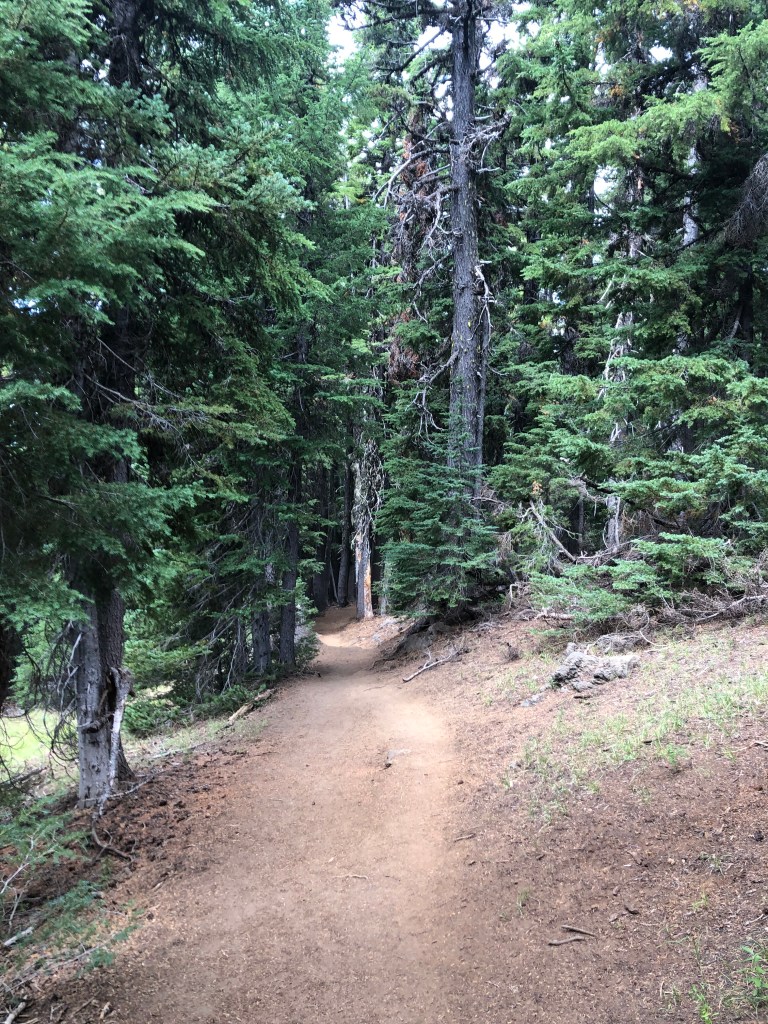
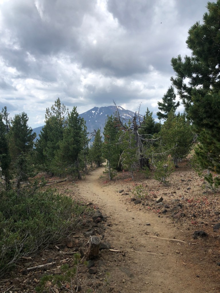
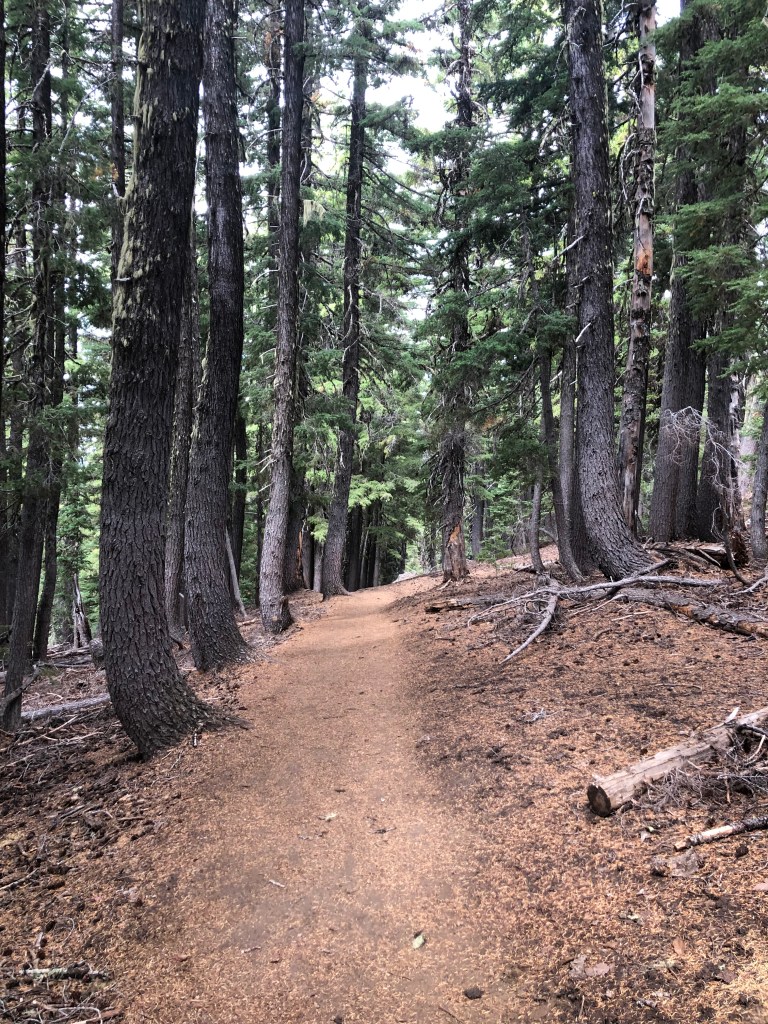
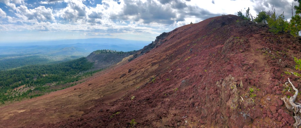
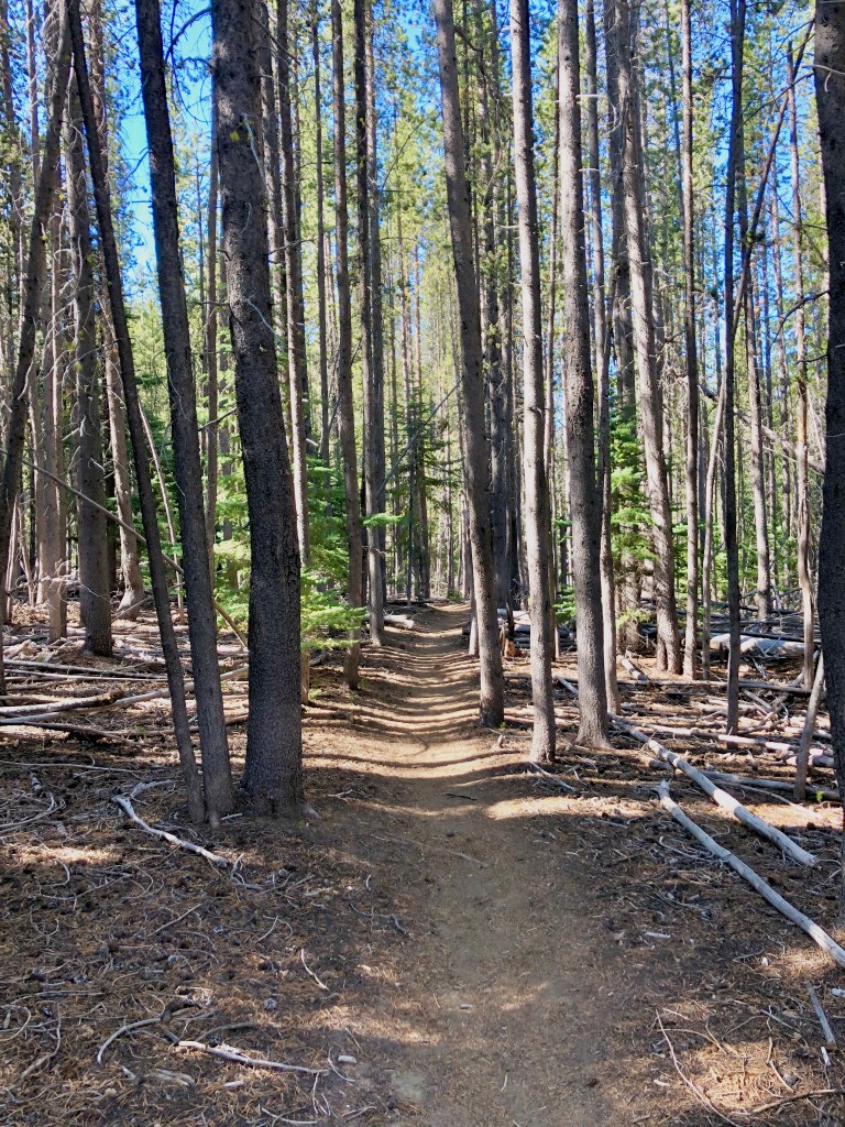
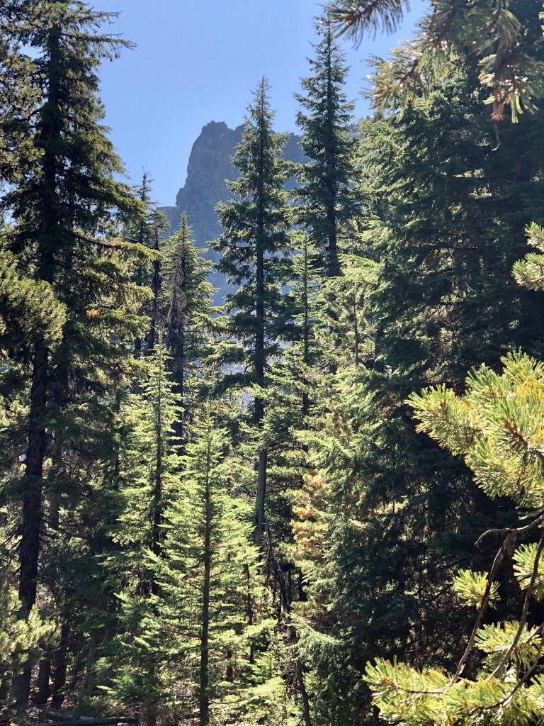
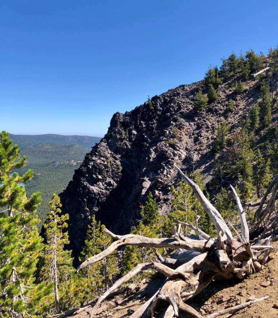
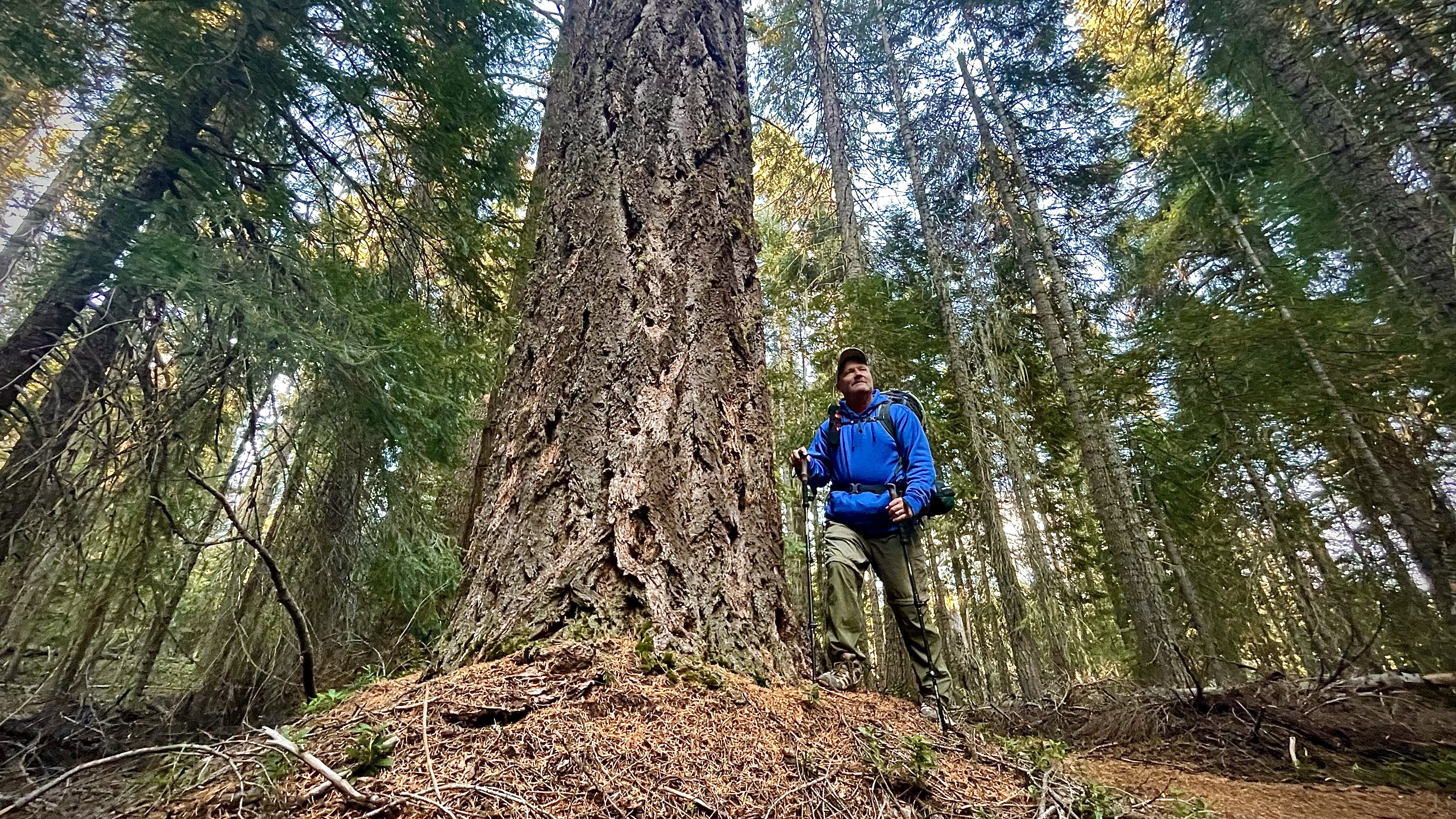
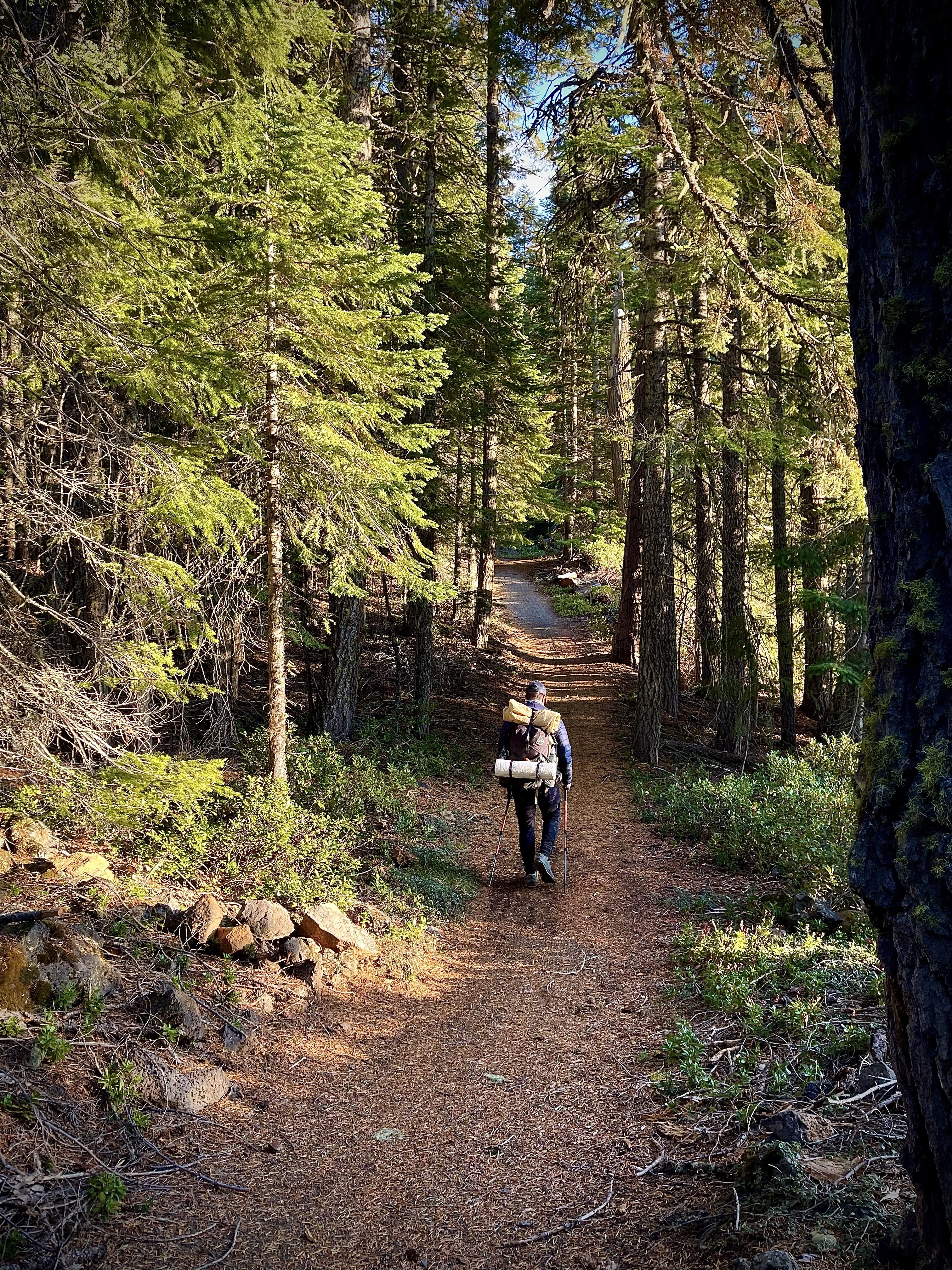
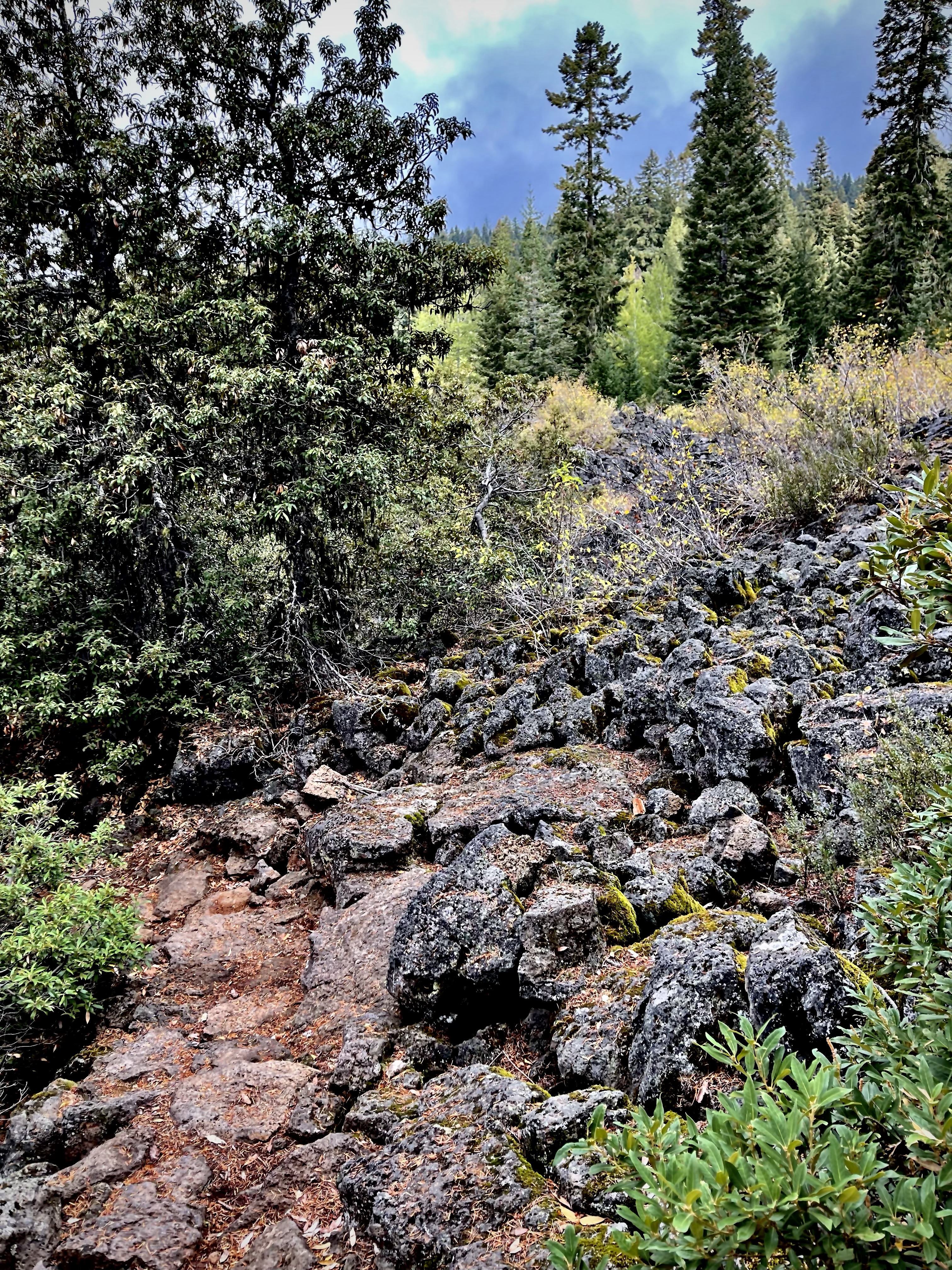
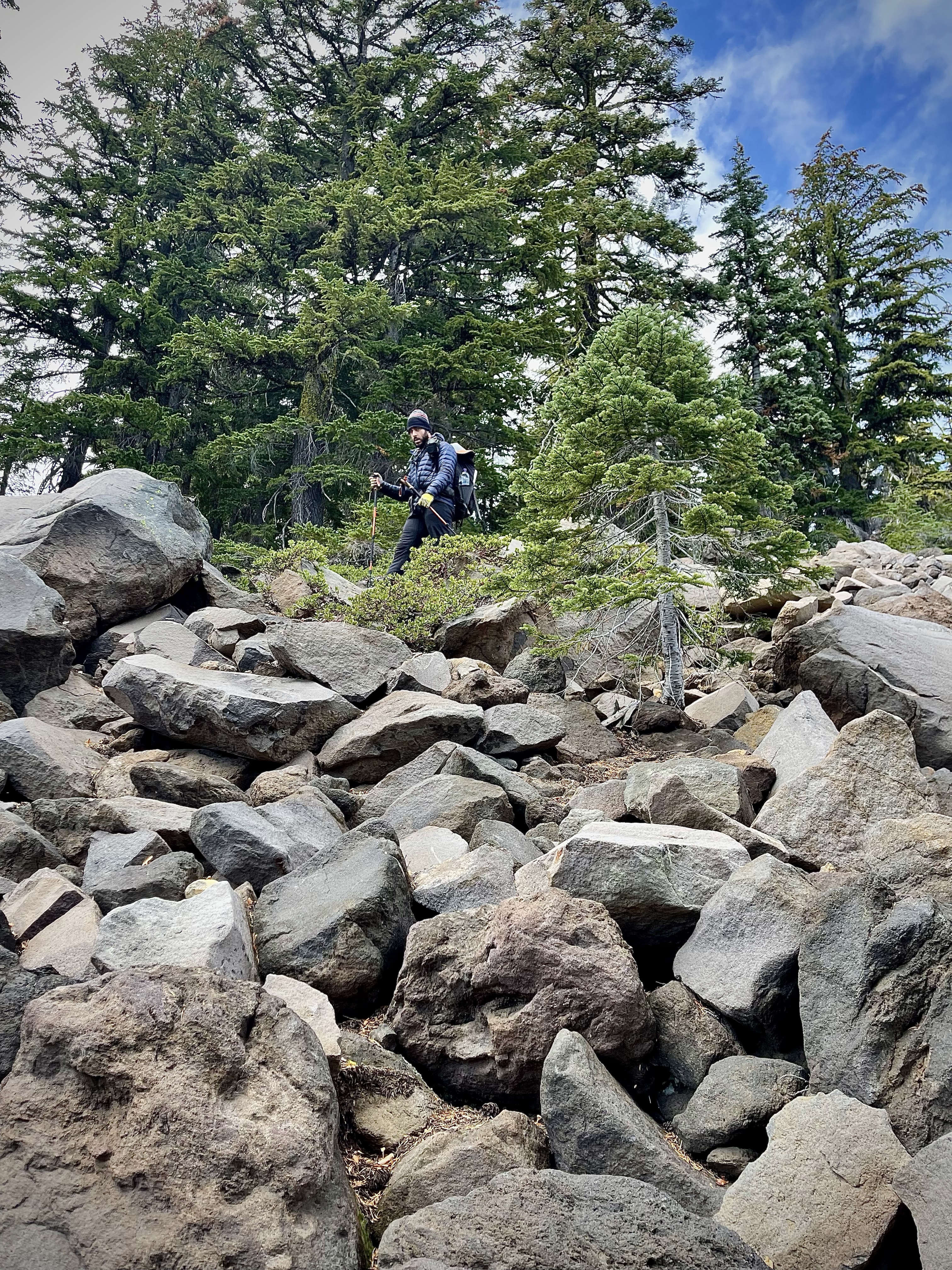
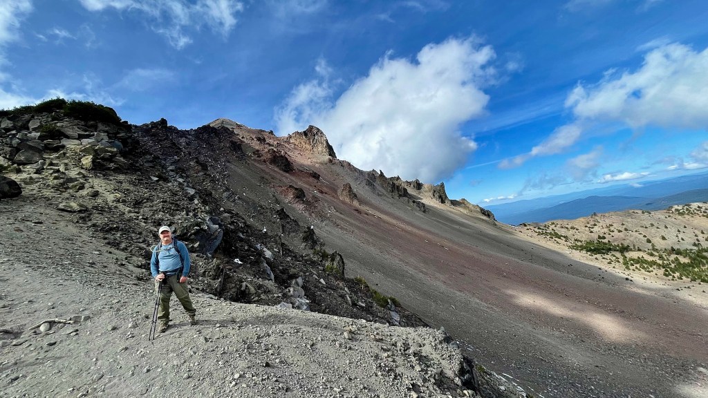
The area is heavily forested, and the journey along the well kept trail is absolutely gorgeous. It is a steady incline which becomes steeper and rockier about a third of the way in, but let me assure you that is only the beginning. The last 20% of this adventure is rock scrambling up talus broken boulders and at the very top portion of this trek add scree, which at least made the climb something different.

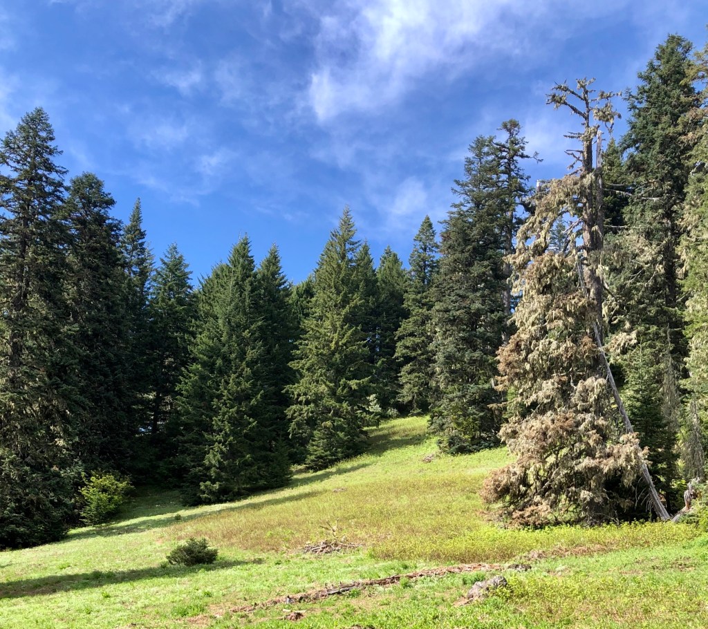
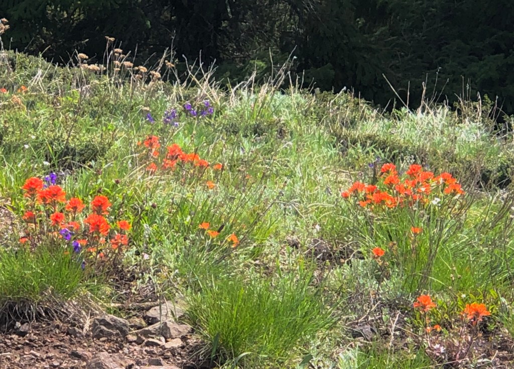
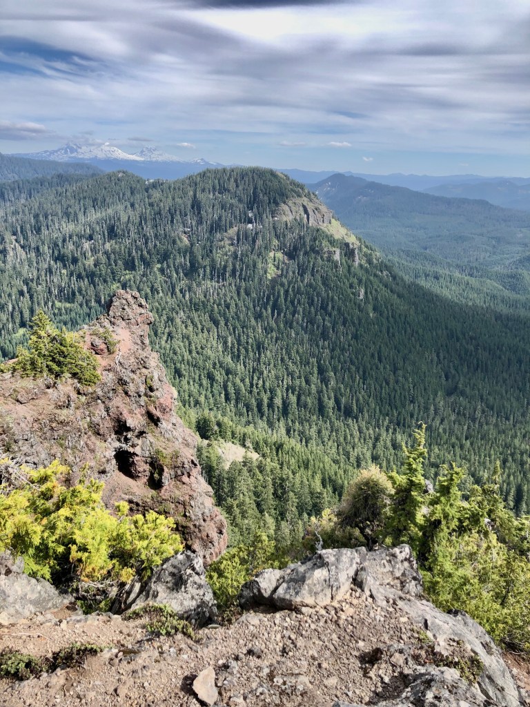
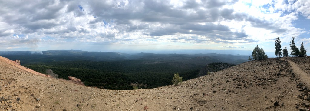
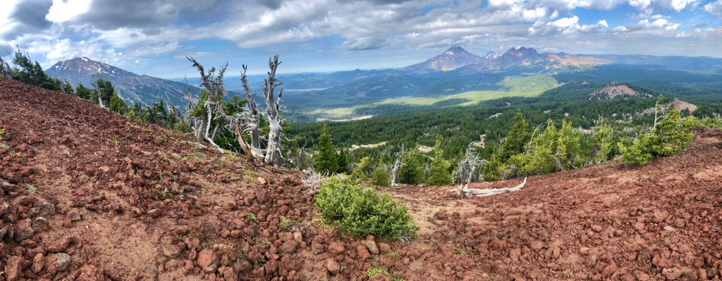
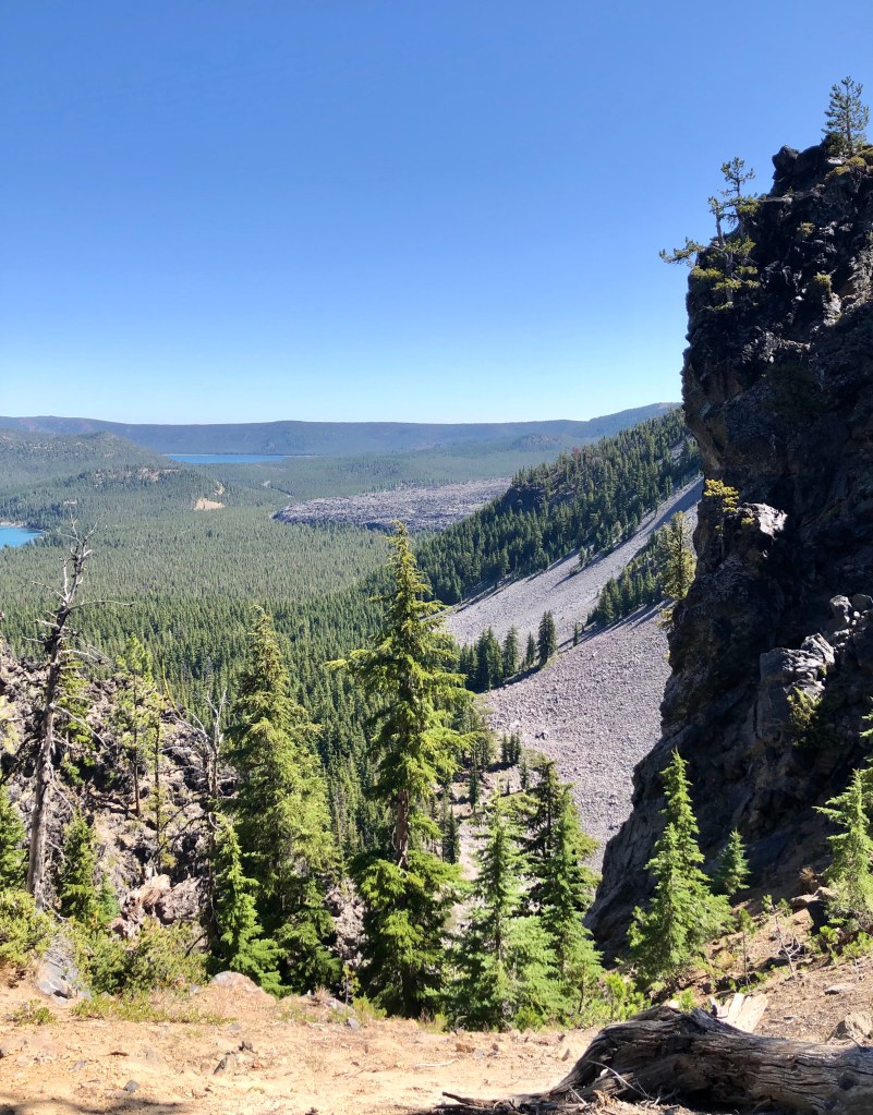
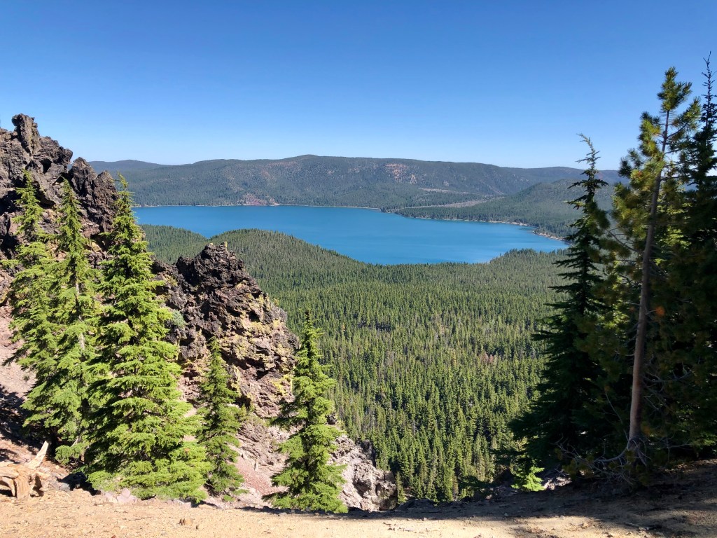
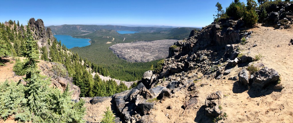
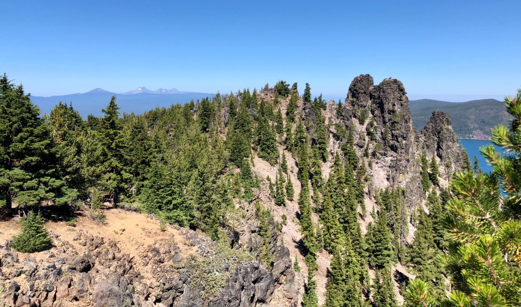
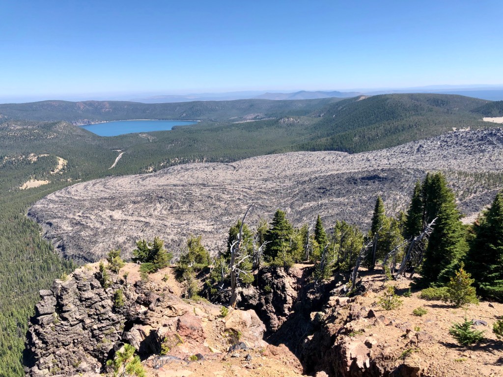
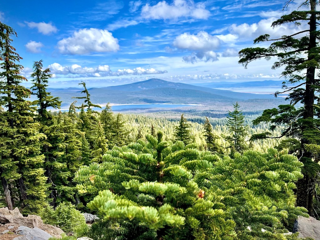
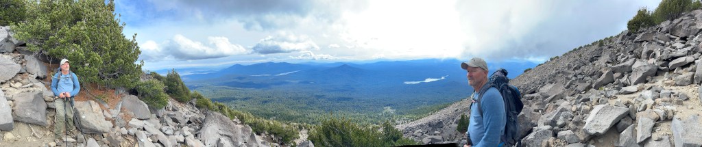
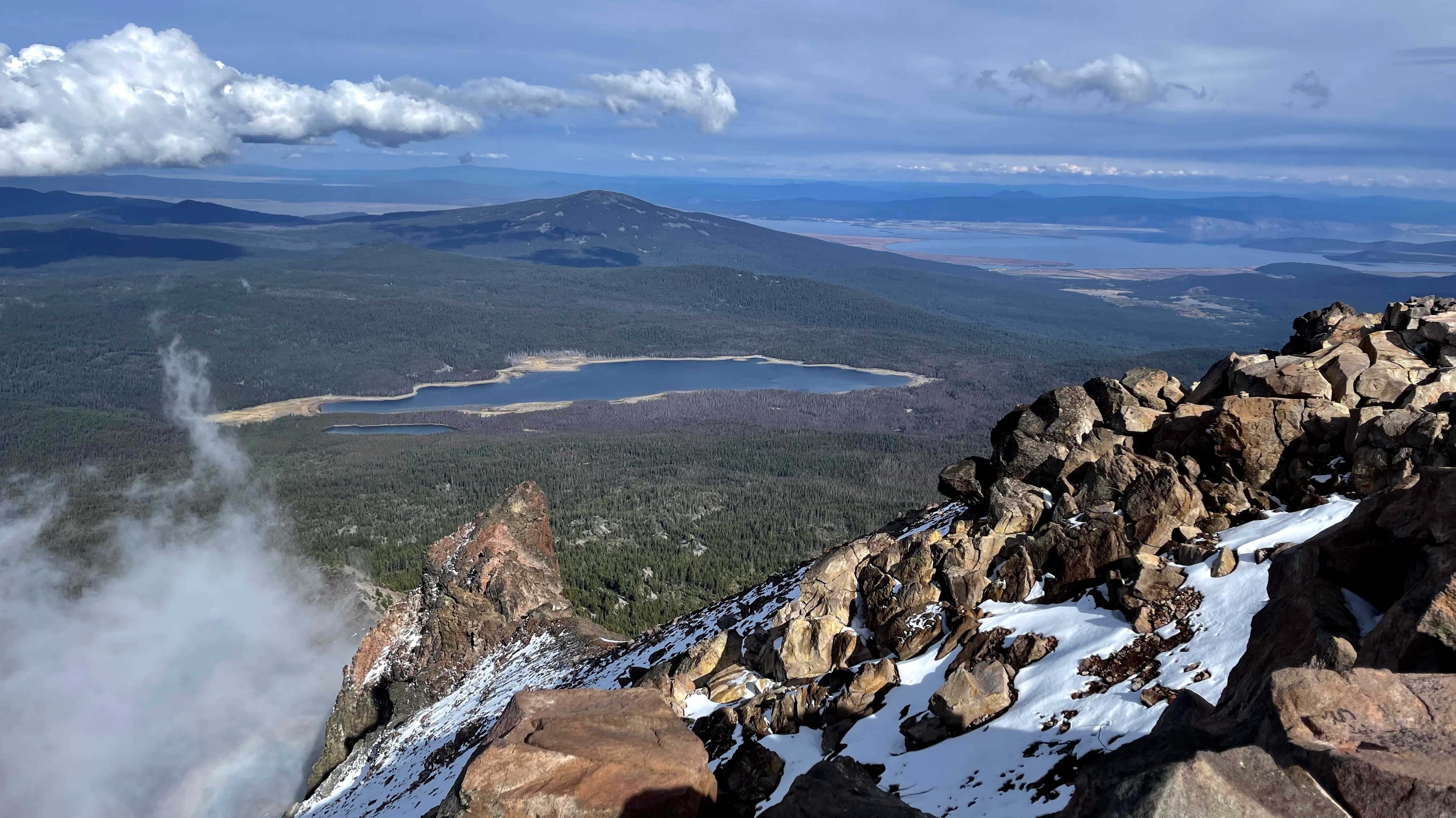
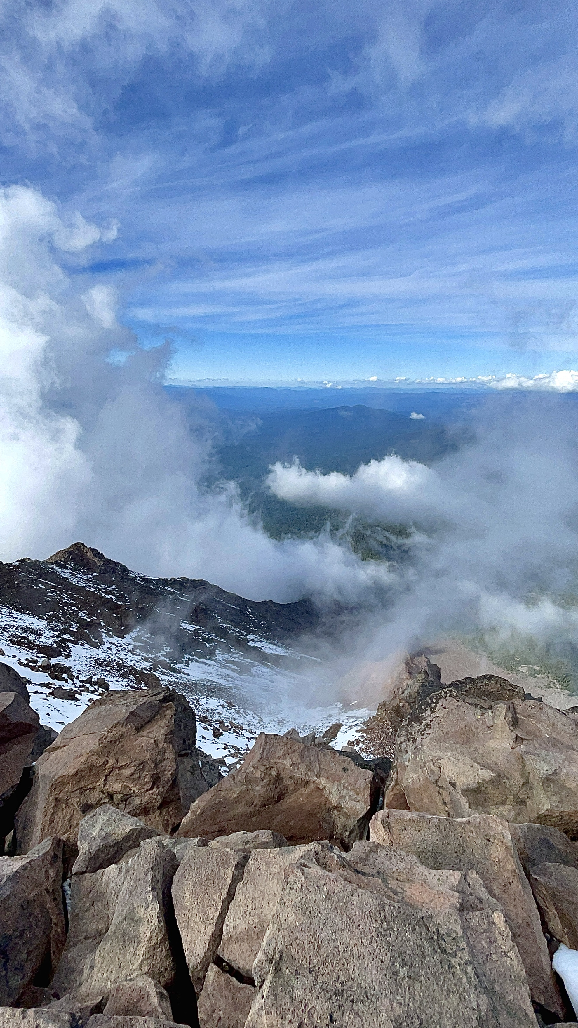
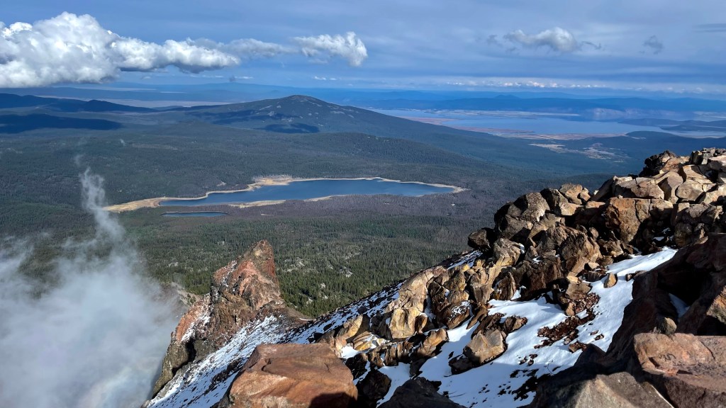
The altitude was beginning to affect me making it more difficult for me to catch my breath, and tiring me out quicker, making it necessary for me to take frequent breaks for a moment or so. However, this provided an excellent chance to enjoy the breathtaking views. (Breathtaking… notice my choice of words there?) Once above the tree line a blanket of green lay out before us with multiple blue lakes dotting the landscape.

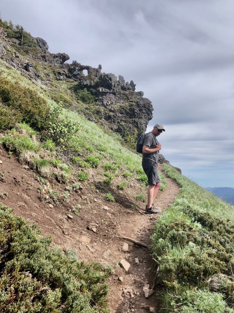
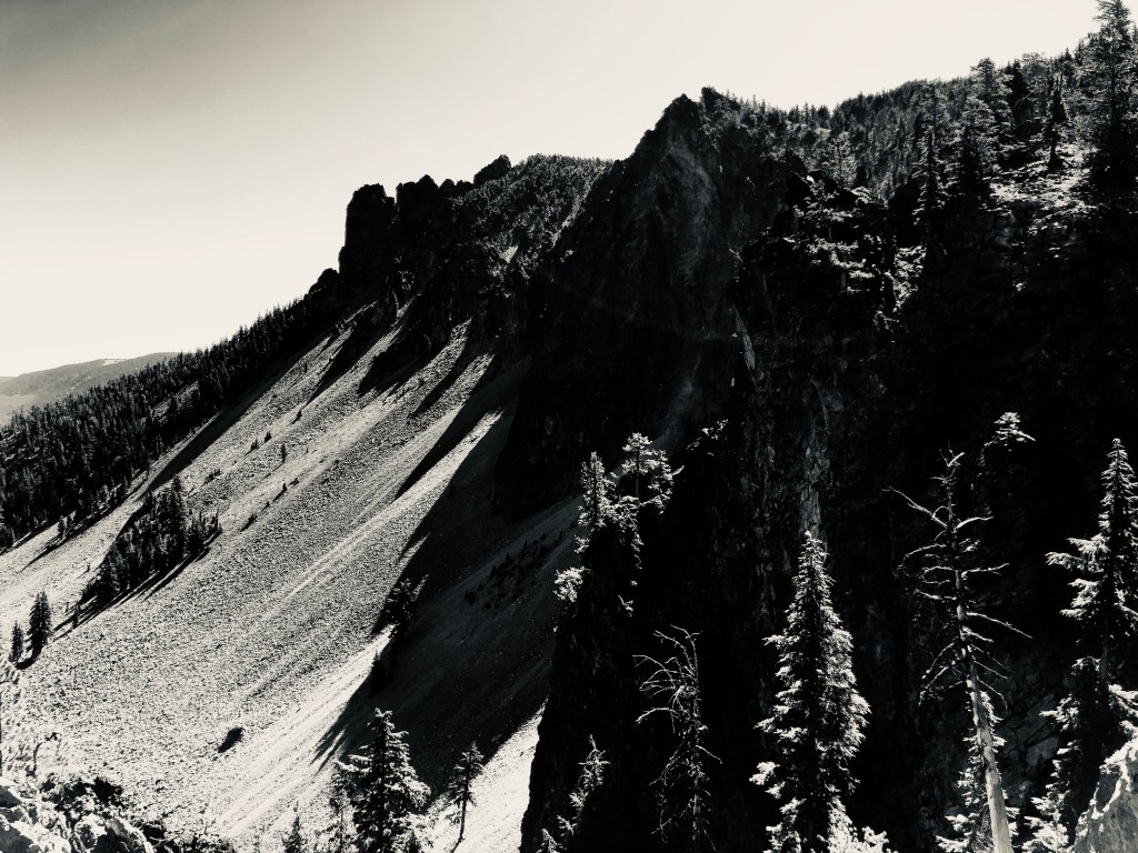
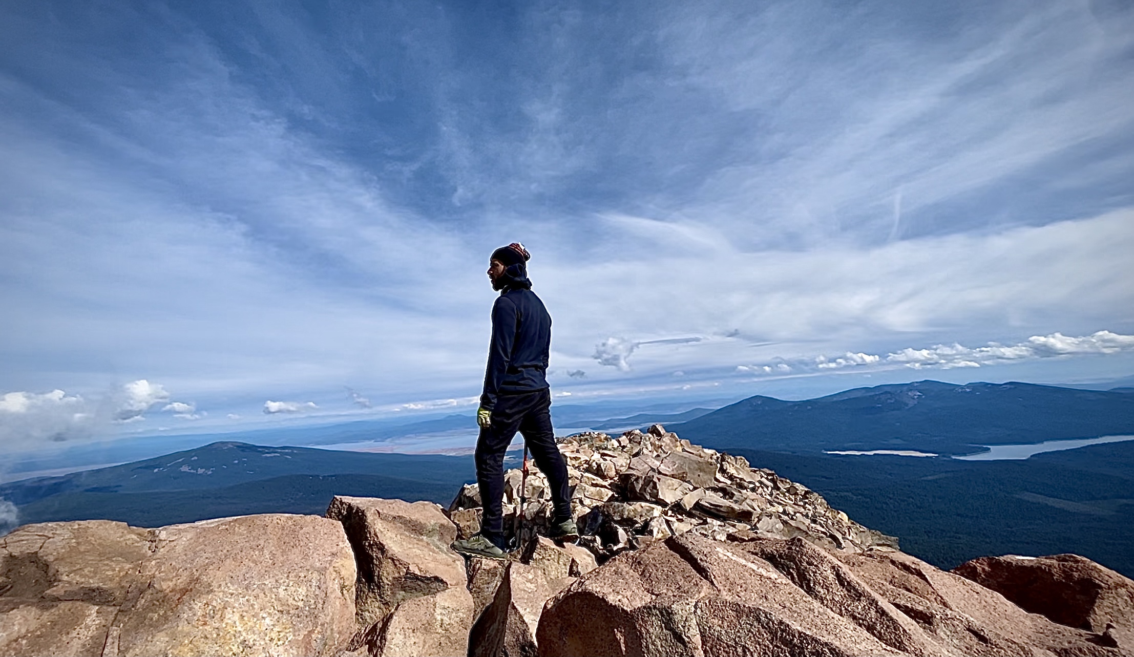
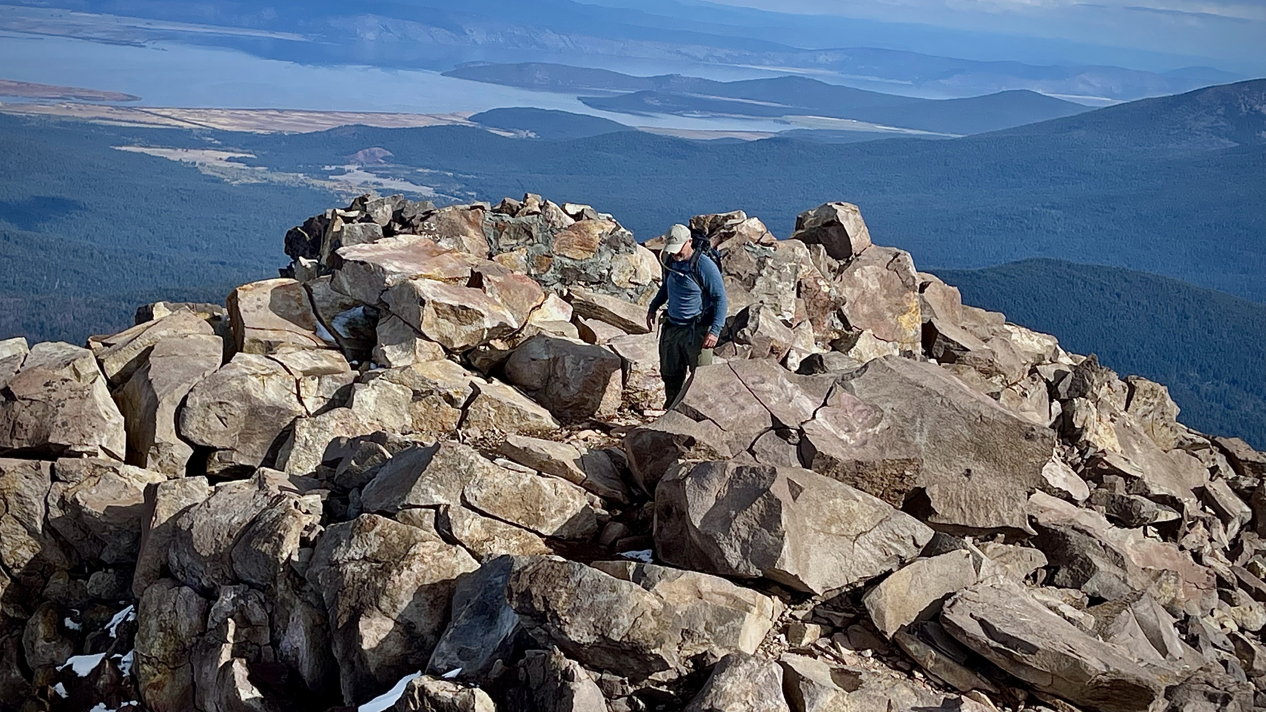
We made it to a view point that provided stunning views of wilderness far and near. We were filled with awe and delight of the bowl area with it’s hues of beige, tan, and brown. We then cast our eyes on high, above the bowl to the massive jagged peaks of Mount McLoughlin. At that point I found looking up at the lonely rugged peaks quite discouraging as it made it quite plain just how far we still had yet to go.

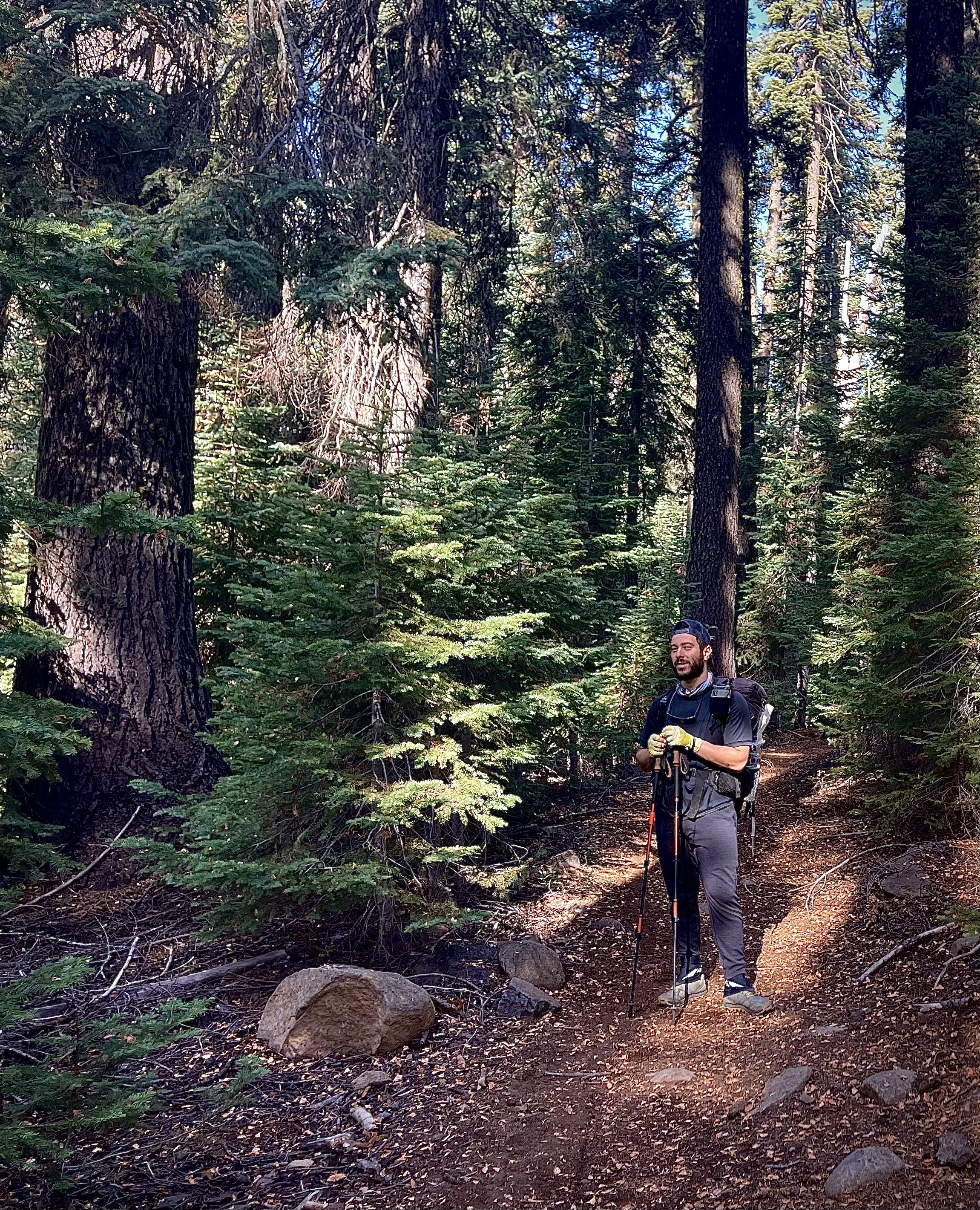
My Through Hiker buddy Ahmed fresh from a few weeks on the trail, plus much younger than I, was starting to realize that this pace was not what he was accustom to. I finally signaled him to just go on ahead, and take my iPhone mostly for picture opportunities, but also GPS Location and what normally would have been GPS Tracking.

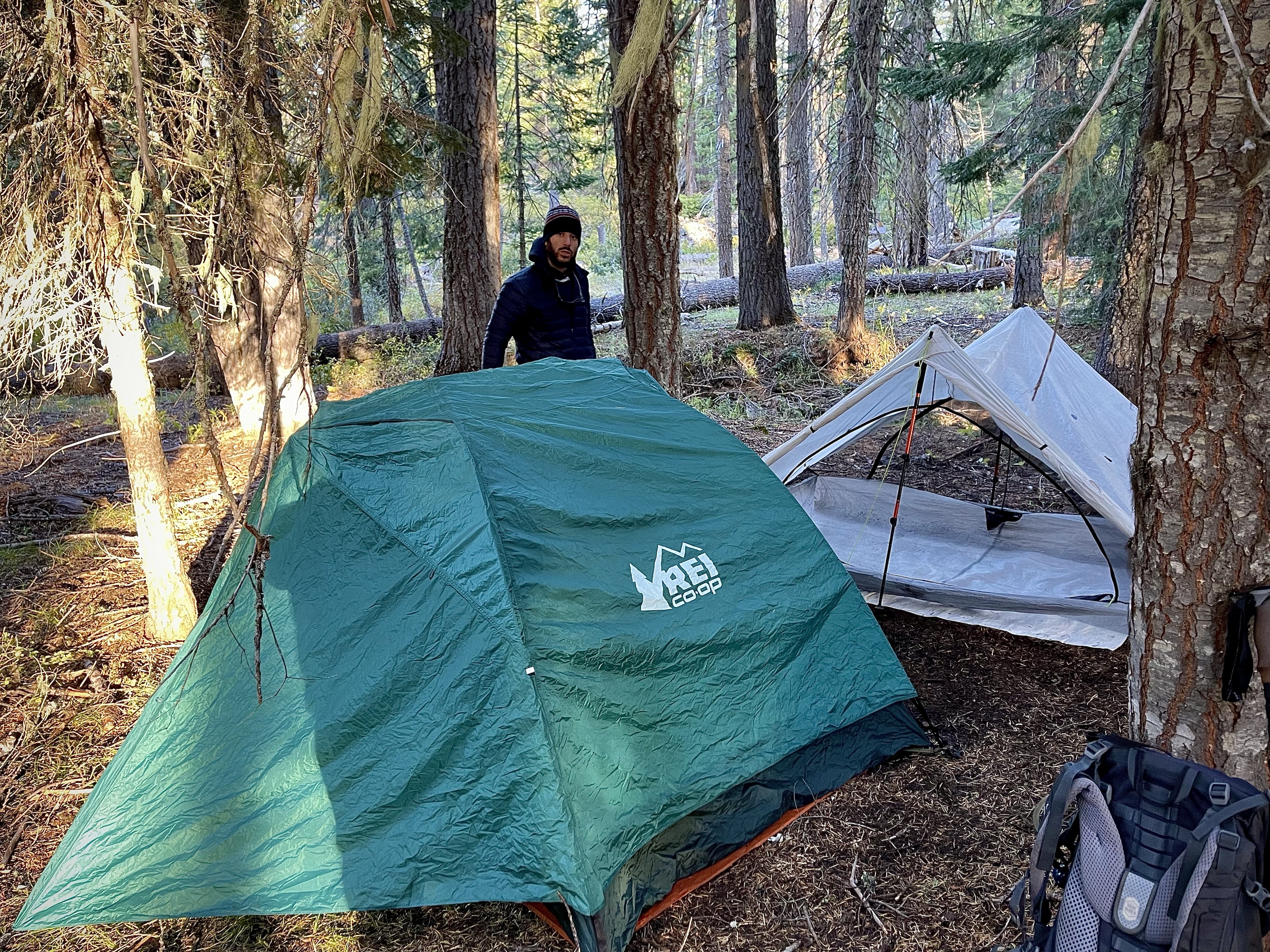
You see in an effort to introduce me to the ulta-lite world of a Through Hiker, all well intended I might add, costly errors were made. One such mistake was my two battery packs were shed from my pack. Ahmed’s iPhone died and he did not have his ultra light battery as it turned out, so we were rationing the usage of my iPhone only turning it on and checking my GPS APP occasionally. To see the other hardships emptying my pack put us in go to my ‘Pursuing Balance Through Adventure Hiking and Backpacking 101’ post ”When a Through Hiker Repacks Your Pack”.

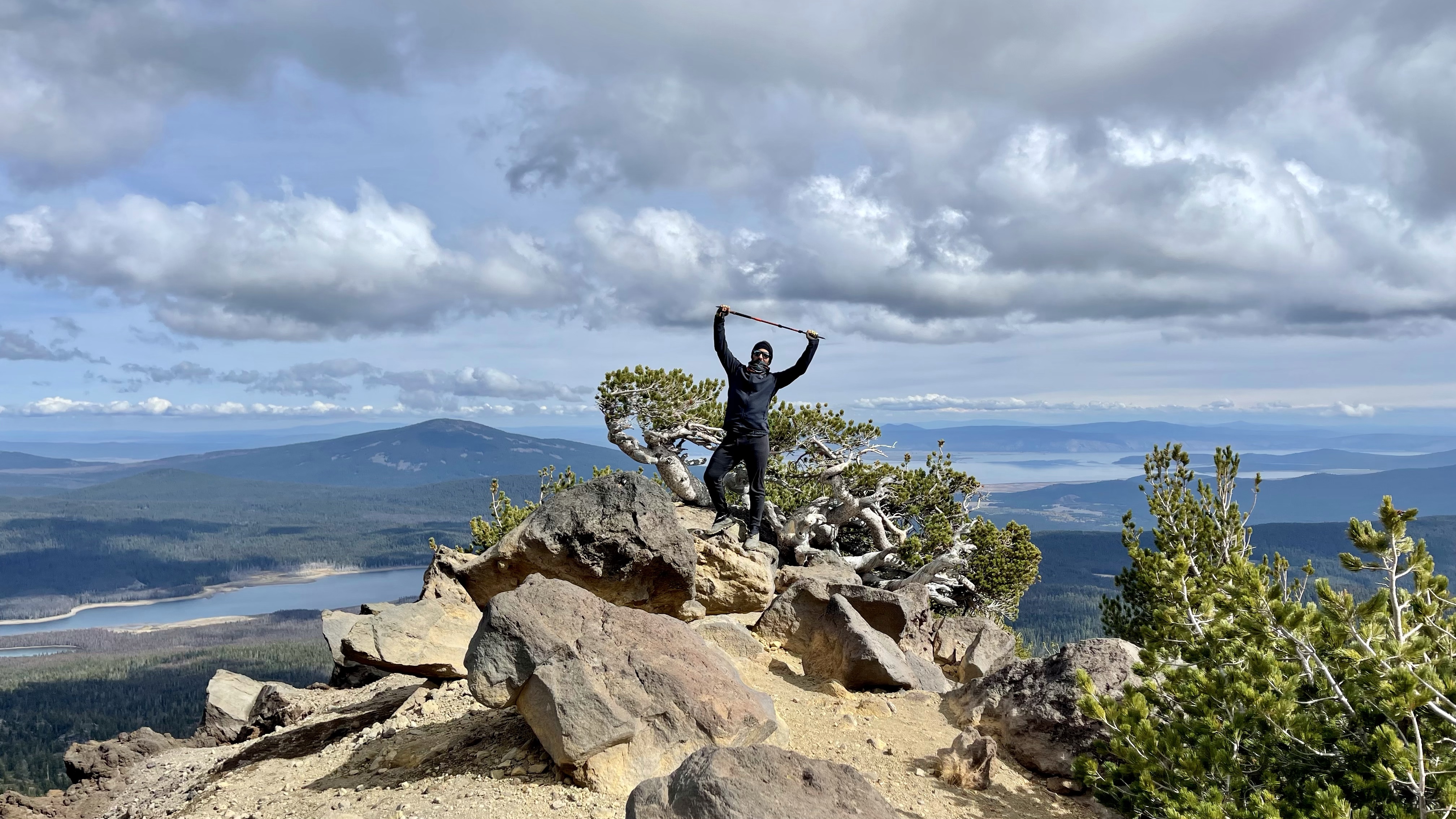
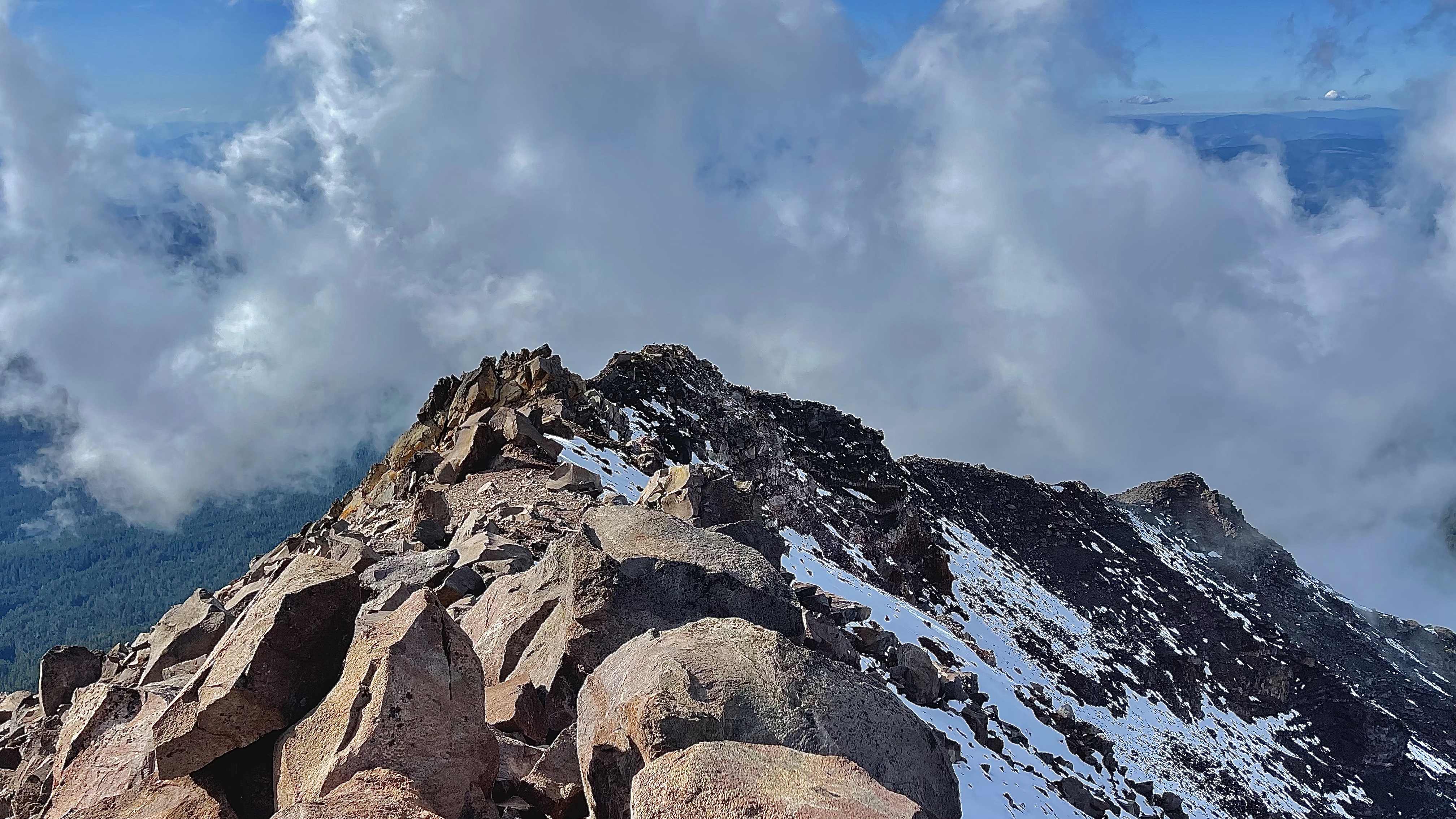
It seemed no matter how much climbing I did the peak was only getting further and further away. Disheartened I signaled Ahmed on the rocks up above that I was done. However… I hate quitting so I thought I might as well continue on at a more meager pace in the mean time as Ahmed kept climbing for the summit. After awhile I saw that the boulders changed to scree, while not optimal hiking it was different and I needed the break of at least different both mentally as well as physically.

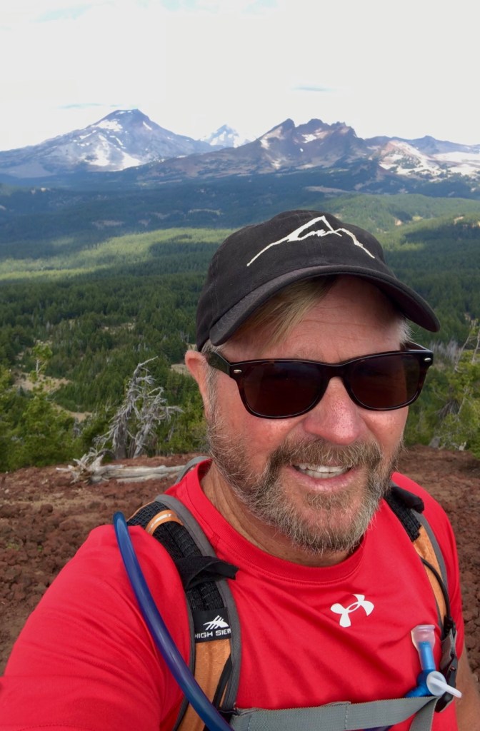
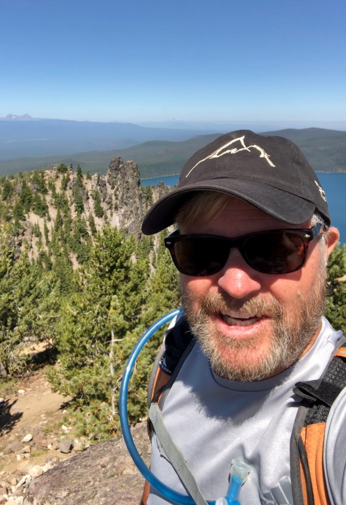
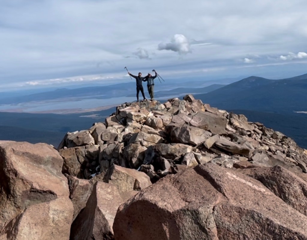
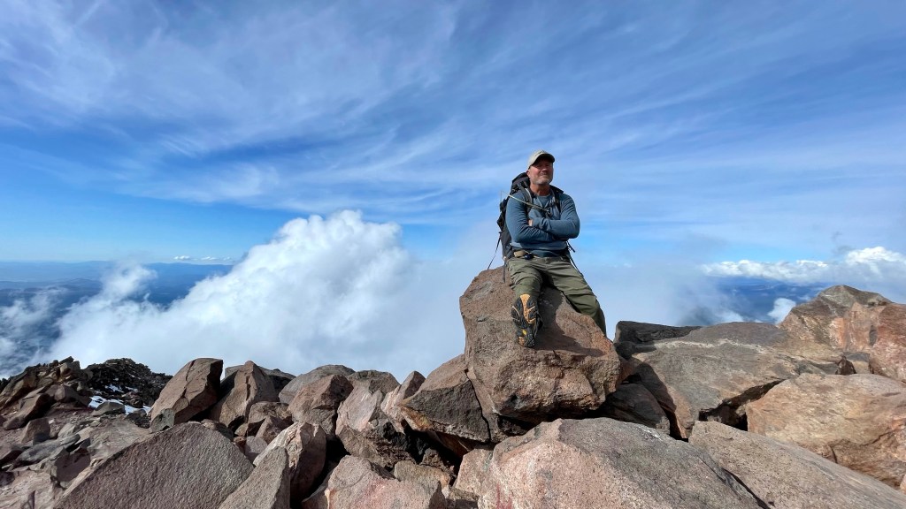
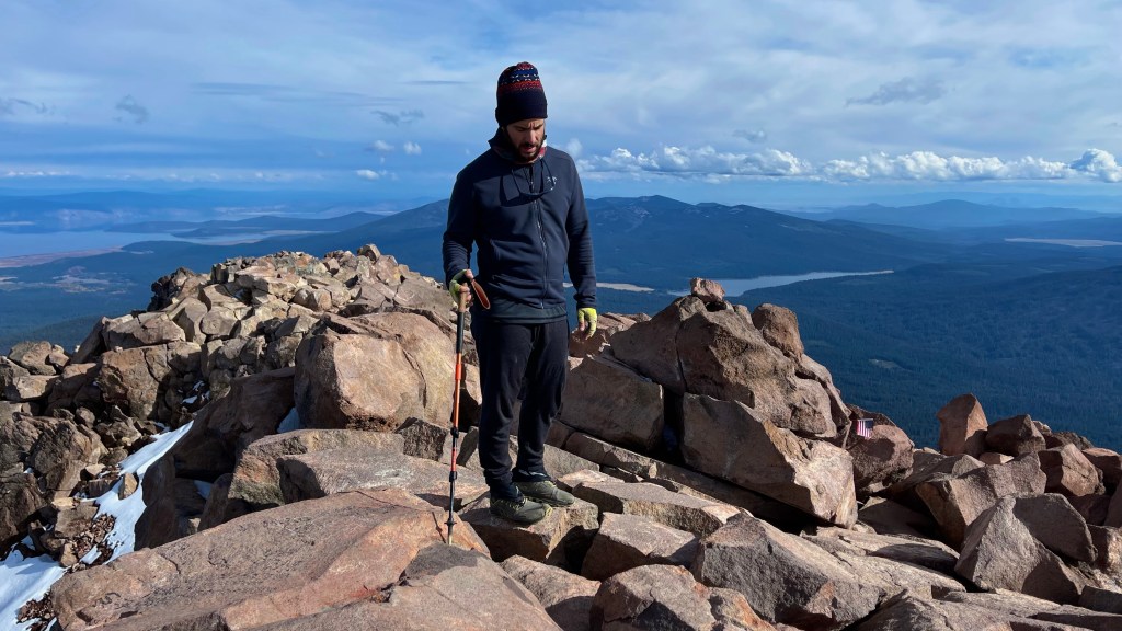
Finally I came up over a rise hoping this wasn’t another false top with still further to trudge, but there was Ahmed setting up a summit photo shoot. We celebrated that we had both accomplished the mountain top goal! He made a point that because it was hard it felt like we had done something special. Of course, we were only half done with the adventure and since the footing was treacherous going down it would still be slow going until the path leveled out far below. (For the rest of the story and the difficulty we placed ourselves in see: “When a Through Hiker Repacks Your Pack.”)

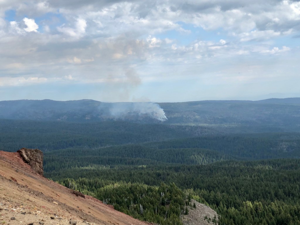
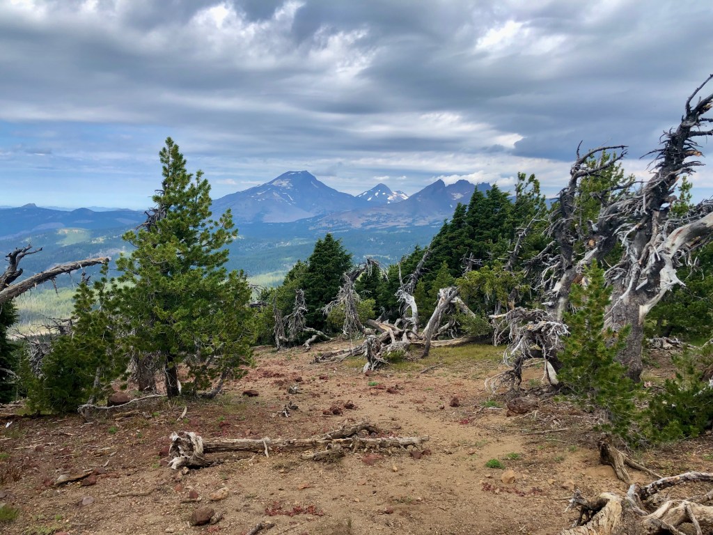
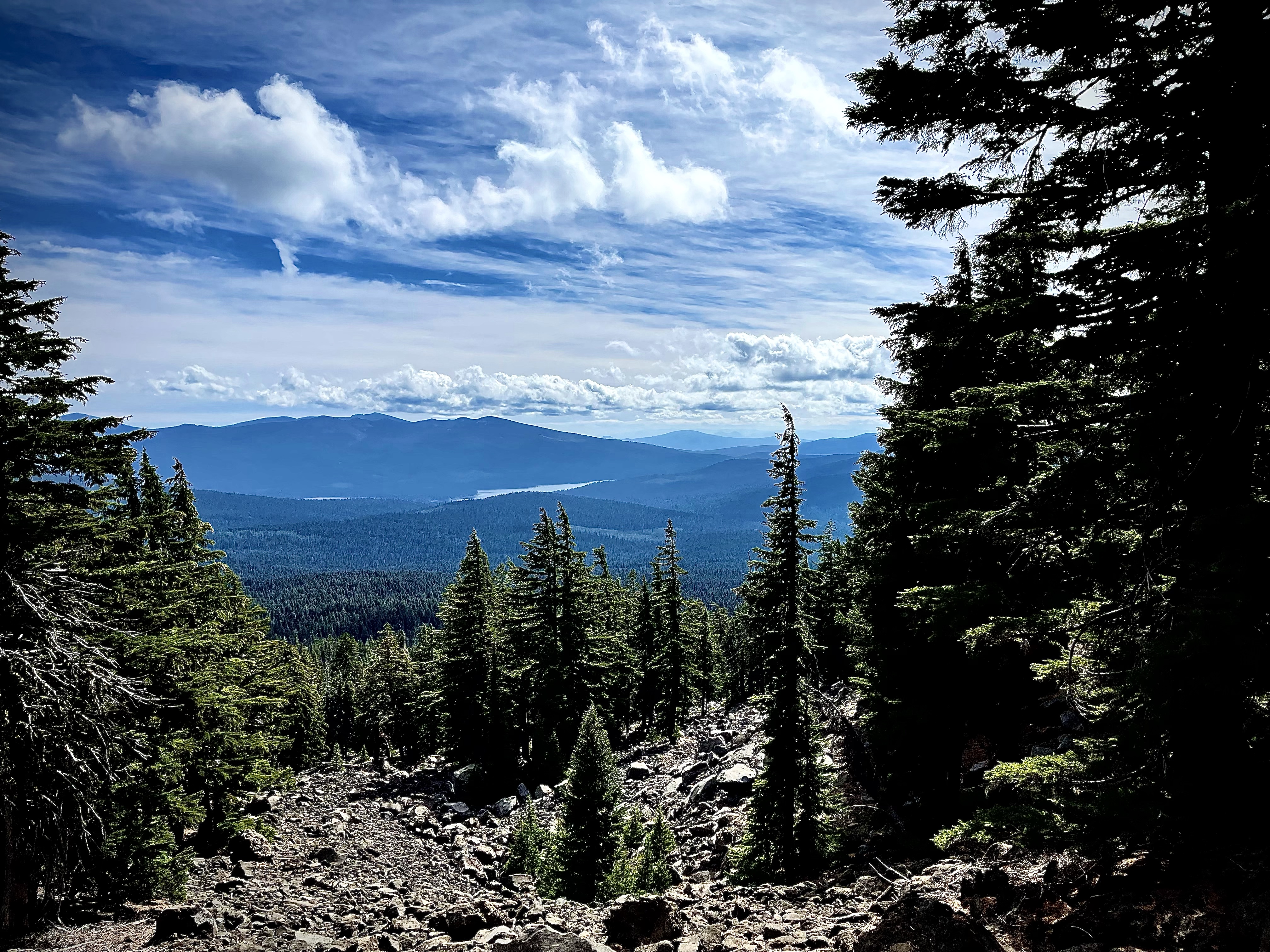
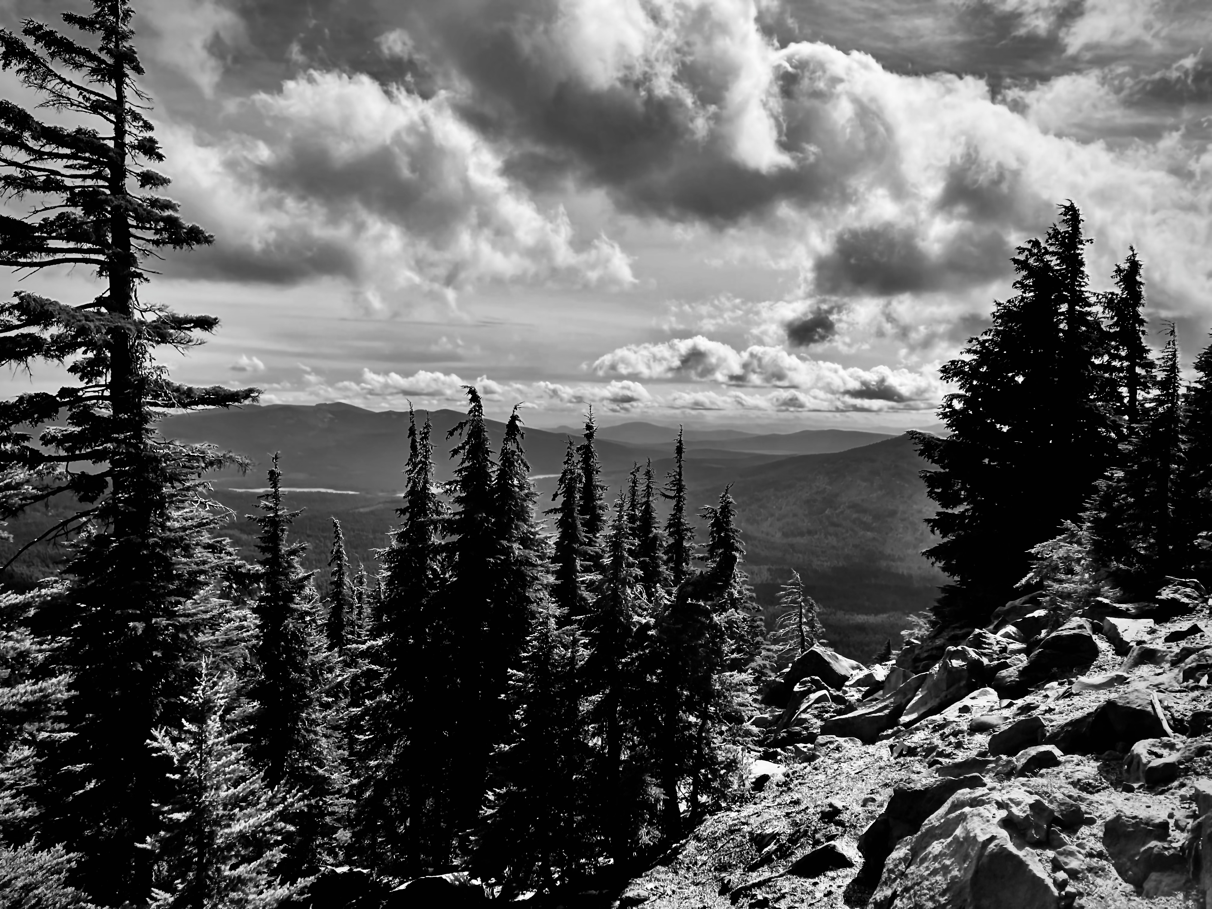
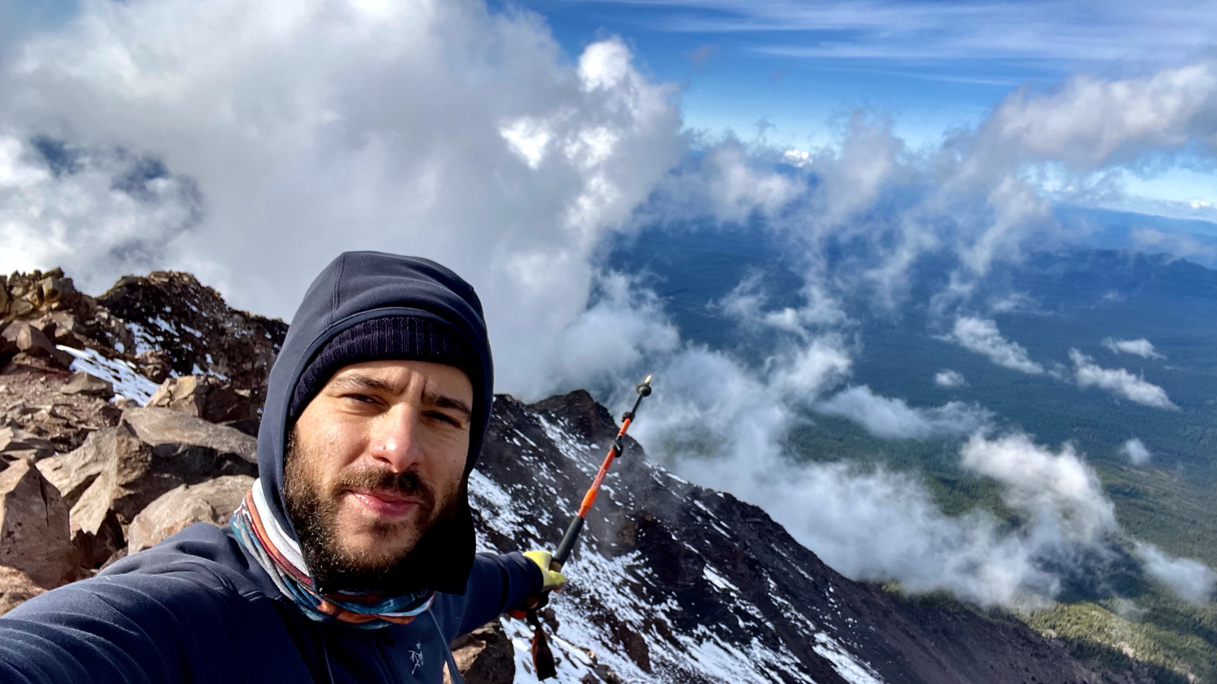
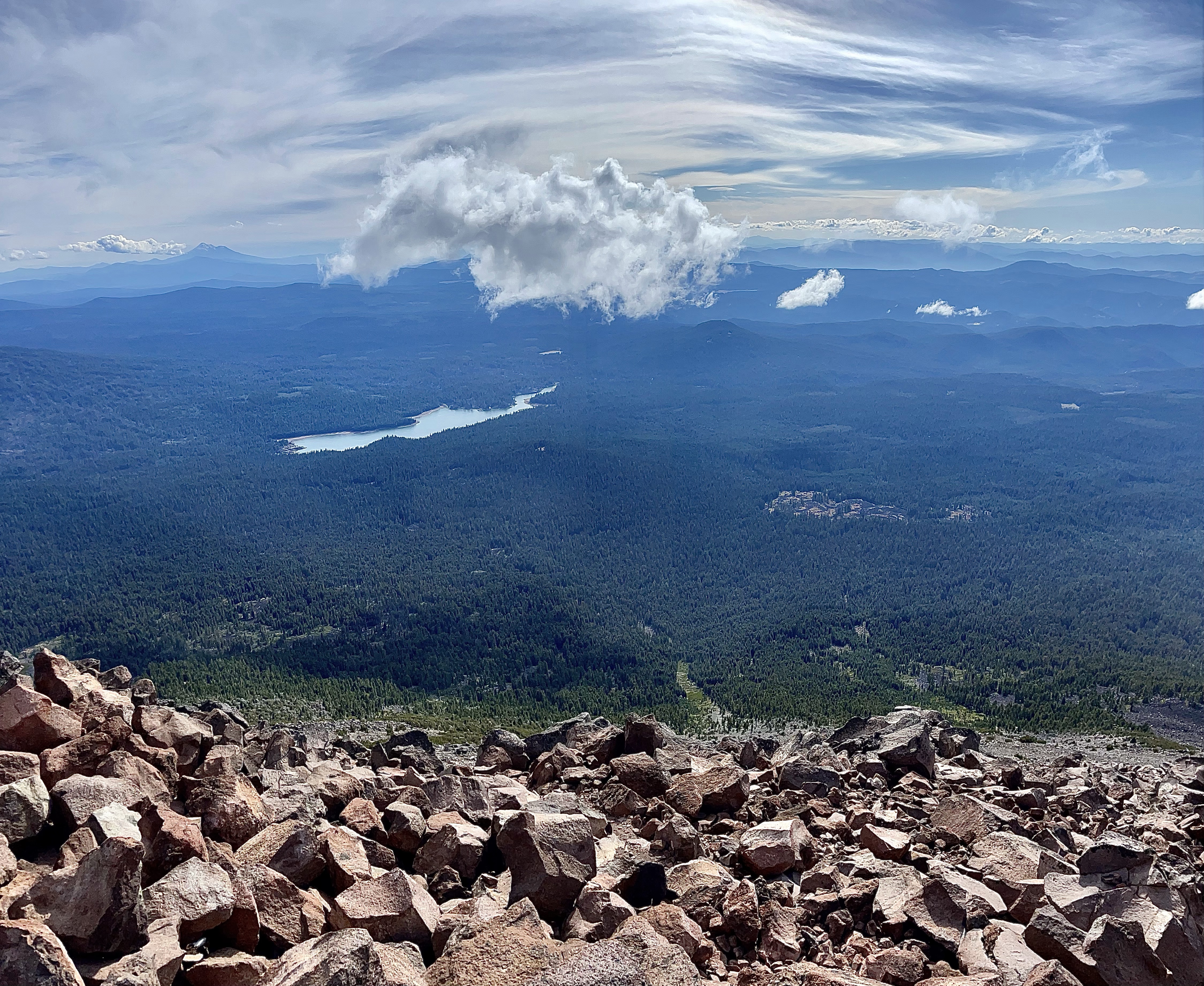
The views from the summit of this rugged mountain were superb, shadows of mountains in the distance including Mount Shasta, multiple blue lakes, and wonderful wilderness, as far as the eye could see, filled the senses. We had indeed done something special.

The bowl area of McLoughlin
Summit Celebration
“May your trails be crooked, winding, lonesome, dangerous, leading to the most amazing view. May your mountains rise into and above the clouds.” – Edward Abbey
Pursuing Balance Through Adventure YouTube Channel

Thanks for joining Ahmed and myself as we found ourselves ’Pursuing Balance Through Adventure’ atop Mount McLoughlin. Ahmed purposely made our trek more of an adventure adding miles on, but when that was coupled with a few unforeseen errors, (See “When a Through Hiker Repacks Your Pack”), it fell just short of an Ordeal. I discovered that the difference between Ordeal and Adventure is Attitude. As I struggled up the mountain I did not always have the best attitude, but I never gave up and because of this I found some of that needed balance that we seek when stepping out of the anxiety of our everyday existence and into a world of wonder that profound experiences in Nature provides. For more journeys into the wilderness, and thus journeys into ourselves stay tuned by doing these simple tasks: LIKE, COMMENT, FOLLOW and SHARE. For other locations that PBTA travels to please see the menu above. Each is location is a separate website and thus needs to be FOLLOWED independently. For high quality adventure wear please see the PBTA Store SHOP APPAREL.

Happy Trails-

Roger Jenkins

Pursuing Balance Through Adventure

Iron Mountain Trail

WILLAMETTE NATIONAL FOREST

CASCADIA, OREGON

Activity: Day Hike, Peak Bagging

Distance: 4.5 miles, elevation: 5,476’, 1,276’ elevation gain, >2 hours duration, rated Hard

Date: 6-4-20

“Iron Mountain is a large jagged rock, situated in very rough country,” was an early description of this adventure describing the perch over looking the Santiam portion of the Willamette National Forest. It would be used at different times over the years as a fire lookout and it would be destroyed more than once by heavy snow, high winds, and wildfire.

We were on Iron Mountain early Summer of 2020. There were a good amount of wildflowers decorating the landscape and to be sure this spot is well know for it’s flowers due to the rich soil. The biggest bloom, I understand, takes place in July, but even just after snow melt the flowers ’Spring’ to life and there are blooms through out the Summer.

The day that my college fraternity brother Bruce introduced me to this splendid hike was a warm Summer Oregon day with a mixture of blue skies and whimsical clouds. The hike found us ambling through quiet forests, thick with wondrous fir trees, as well as green meadows dotted with beautiful wildflowers. Then on to some switch backs, passed scraggy volcanic rock, a left over section of snow, and then out on the top with fabulous views of lush evergreens as far as the eye could see, with boundless layers of mountainous ridges, and snowy peaks far in the distance.

Sadly late in the Summer the area was besieged once again by wildfire, and as of this late posting, (Oct 2020), it is closed for that reason.

Oh worrisome thoughts of what has become of this tranquil place. The kind of place that one might find balance from an otherwise over worked, over stressed, over political world that – oh yeah just happens to be smack dab in a pandemic, with a side of firestorm to boot. Prayers for the firefighters, prayers for Mother Nature, prayers for us all.

Hey thanks for joining my fraternity bro Bruce and myself on this joyous journey in nature, while ‘Pursuing Balance Through Adventure’. Don’t forget to COMMENT, FOLLOW, LIKE and SHARE. There is still more coming up in regards to Beautiful, Fabulous, Wonderful Oregon and if you go to the menu above you will discover that PBTA goes to many spectacular locations to give you inspiration. You don’t need to thank me, that’s my job. Speaking of which, if you would like to support PBTA then I just got a big shipment of T-Shirts: (thinking that maybe you don’t need the best, top quality gear maybe you just want a darn T-Shirt, well then boom gotcha covered) SHOP APPAREL.

Checkout the Free Drawing for Free PBTA Merch which runs through 11-15-20.  

Happy Trails-

Roger Jenkins

Pursuing Balance Through Adventure

Tumalo Mountain Trail

DESCHUTES NATIONAL FOREST

NEAR BEND OREGON

Activity: Day Hike

Date: August 29, 2019

Distance 4 miles, 1,440’ elevation change, 3 hour duration, rated Moderate

Tumalo Mountain, a shield volcano, sits adjacent to majestic Mountain Bachelor near Bend Oregon in the Deschutes National Forest. At over 7700’ it affords wonderful views of Mt Bachelor at 9000’. From the top Tumalo Mountain is optimally located for spanning views of the northwest. Splendidly on display are the Sister’s Mountains, Broken Top and in the other direction Tam McArthur Rim.

Something very special for me to observe was occurring while I was on top of Tumalo Mountain. Yesterday in the late afternoon I was hiking Tumalo Falls. During the hike there was a light rain and distant lightening and thunder. That lightening touched off small forest fires in the area and fire fighters were working hard to make sure they stayed small. From my vantage point atop Tumalo Mountain I could see the aerial attack on that fire and found it fascinating. Crews made drops over and over with orange fire retardant to halt the advancing fire. Thank you fire-fighters for your valiant efforts.

A Northwest Forest Pass is required, and during the winter, if you are snow shoeing, a Snow Pass is required for parking. The trail gains altitude from the get-go as you weave through a sparse evergreen forest, an alpine meadow, until you reach an open portion at the top adorned with twisted white bark pines, and craggy trees. The backside of Tumalo Mountain confirms it’s volcanic origins with a steep hillside of volcanic pumice scree.

I highly recommend this hike. I hike mostly during the week, so the fact that this is a popular hike, simply because it is a great hike with superb views, is close to Bend, and is easy to get to, doesn’t affect me as much, but be aware that if you are hiking prime time – prime season that you won’t be alone. You know that you must be spoiled, in this manner, when you are hiking on a Thursday, and you discover a very chatty group is coming up behind you. I pulled over and let them go by. I believe that they figured out the reason that I stopped, mentioning something along the lines and apologizing. I replied. “Good morning, there is plenty of mountain for everyone.”

Fire Fighters drop fire repellent just in front of the fire to keep it from spreading.

Thanks for coming along on this journey of mine ‘Pursuing Balance Through Adventure’. It is my hope that my accounts will inspire you to seek your own counter balance to our busy work a day world through profound encounters with nature. Besides the stretching of the legs, and the breathing of mountain air, it is about setting the soul soaring to the mountain tops, the deserts, the oceans, rivers, lakes or canyons. If you are unable to take an adventure of this nature, for whatever reason, then do so vicariously through me and together we will experience freeing our souls through this medium. So please COMMENT, FOLLOW, LIKE, and SHARE.

Pursuing Balance Through Adventure Videos regarding the hike

Tumalo Mt in the Shadow of Mt Bachelor
Views of Sisters, Broken Top, and Mt Bachelor from Tumalo Mt.
Firefighters make aerial assault on Wildfire as seen from Tumalo Mt.

Paulina Peak Trail

DESCHUTES NATIONAL FOREST

NEAR LA PINE, OREGON

Activity: Day Hike

Date: August 27, 2019

Distance: 6 miles, 1,600’ elevation gain, 3.5 hours duration, rated Difficult

Paulina Peak Trail is a wonderful hike from lakeside at Paulina Lake, through a delightful forest. The first mile is easy, as you hike through thick forest, but progressively gets more difficult as it rises in elevation. The trees get larger and more spread out. By mile three you know it’s difficult when your heels don’t touch with each step and your breathing is accelerated. Pictures, of course, never show the incline. Finally the peak comes into view over the greenery of the forested land. As you rise even higher in altitude the White Pine becomes the predominant vegetation. There are some nice educational pieces regarding this species near the top. The scenic view of the blue lakes, both Paulina Lake and East Lake, along with the magnificent Cascade range in the distance takes you aback, it is a sensational experience.

Once on top, at an Elevation closing in on 8000’, the vista is amazing in every direction. In my title shot can be seen the Three Sisters, a bit of Broken Top, and Mt. Bachelor. Besides the sight of the exquisite Cascades from Mt. Adams all the way to Mt. McLoughlin, Paulina Lake and East Lake, you have a nice view peering down on the Obsidian Flow. Paulina Peak is the highest point of the Newberry National Volcanic Monument and dozens of small cinder cones can be seen rising from the volcanic plain surrounding the Newberry Crater.

This makes the Paulina Peak Trail a must do. The humorous thing is that I could have driven to see this spectacular view. I was disappointed that after hiking a strenuous trail to find at the peak there was a parking lot. So I good naturedly ribbed a guy and his young teen son’s about them driving while I hiked up a tough trail. He replied, “Good for your heart.” Which I thought was nice, but then he added, “You need it, you are not skinny.” Okay… I thought that might have been a step to far, lol. But everyone can certainly use more exercise and that is part of what Pursuing Balance Through Adventure is all about.

Life is like a mountain, hard to hike, but once you get to the top, the view is beautiful.

Thank you ever so much for joining me ‘Pursuing Balance Through Adventure’ to the top of Paulina Peak. Let’s meet up again and the way to do that is LIKE, FOLLOW, COMMENT, and SHARE.

Roger Jenkins, Pursuing Balance Through Adventure

Ya’ Just Gotta’ luv’ it!
Now this is what I am talking about.